Norley, Queensland
Norley is a locality in the Shire of Bulloo, Queensland, Australia.[1]
| Norley Queensland | |||||||||||||||
|---|---|---|---|---|---|---|---|---|---|---|---|---|---|---|---|
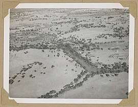 Aerial view of Norley Station, June 1946 | |||||||||||||||
 Norley | |||||||||||||||
| Coordinates | 27.6865°S 143.7523°E | ||||||||||||||
| Postcode(s) | 4492 | ||||||||||||||
| Area | 5,045.4 km2 (1,948.0 sq mi) | ||||||||||||||
| LGA(s) | Shire of Bulloo | ||||||||||||||
| State electorate(s) | Warrego | ||||||||||||||
| Federal Division(s) | Maranoa | ||||||||||||||
| |||||||||||||||
Geography
Norley is part of the Channel Country, a network of interconnecting creeks and rivers that are normally dry except during seasonal flooding. The land is used for low density cattle grazing.
The Bundeena Road enters the locality from the west and exits to the south to neighbouring Thargomindah. The Quilpie Thargomindah Road enters the locality from the north-east and exists to the south to Thargomindah.[2]
History
The locality of Norley takes its name from its county and parish of the same name. The county name takes its name in turn from the Norley pastoral station.[3]
References
- "Norley - locality in Shire of Bulloo (entry 42948)". Queensland Place Names. Queensland Government. Retrieved 1 August 2017.
- "Queensland Globe". State of Queensland. Retrieved 1 August 2017.
- "Norley - county (entry 24528)". Queensland Place Names. Queensland Government. Retrieved 1 August 2017.
This article is issued from Wikipedia. The text is licensed under Creative Commons - Attribution - Sharealike. Additional terms may apply for the media files.