Noblesville Township, Hamilton County, Indiana
Noblesville Township is one of nine townships in Hamilton County, Indiana, United States. As of the 2010 census, its population was 50,564 and it contained 20,122 housing units.[1]
Noblesville Township | |
|---|---|
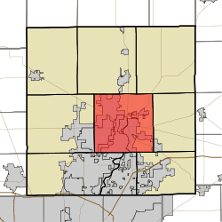 Location in Hamilton County | |
| Coordinates: 40°03′09″N 86°01′30″W | |
| Country | United States |
| State | Indiana |
| County | Hamilton |
| Government | |
| • Type | Indiana township |
| Area | |
| • Total | 49.12 sq mi (127.2 km2) |
| • Land | 46.82 sq mi (121.3 km2) |
| • Water | 2.29 sq mi (5.9 km2) 4.66% |
| Elevation | 791 ft (241 m) |
| Population (2010) | |
| • Total | 50,564 |
| • Density | 1,079.9/sq mi (417.0/km2) |
| GNIS feature ID | 0453676 |
History
Noblesville Township was organized in 1827.[2]
The Holliday Hydroelectric Powerhouse and Dam and Potter's Covered Bridge are listed on the National Register of Historic Places.[3]
Geography
According to the 2010 census, the township has a total area of 49.12 square miles (127.2 km2), of which 46.82 square miles (121.3 km2) (or 95.32%) is land and 2.29 square miles (5.9 km2) (or 4.66%) is water.[1] The streams of Cicero Creek, Dry Branch, East Fork Sly Run, Lily Vestal Drain, Hinkle Creek, Ingerman Ditch, Kirkendall Creek, Mallery Granger Ditch, Overdorff Branch, Stony Creek, and West Fork Sly Run run through this township.
Cities and towns
- Noblesville (vast majority)
Unincorporated communities
Adjacent townships
- Jackson Township (north)
- White River Township (northeast)
- Wayne Township (east)
- Fall Creek Township (southeast)
- Delaware Township (south)
- Clay Township (southwest)
- Washington Township (west)
Cemeteries
The township contains eight cemeteries: Crownland, Gascho-Trissel, Gray, Hurlock, Riverside, Thorp, Weaver and Zimmer.
Major highways
Airports and landing strips
- Roberts-Jacobi Restricted Airport
Education
Noblesville Township residents may obtain a free library card from the Hamilton East Public Library in Noblesville city.[4]
References
- "Population, Housing Units, Area, and Density: 2010 - County -- County Subdivision and Place -- 2010 Census Summary File 1". United States Census. Archived from the original on 2020-02-12. Retrieved 2013-05-10.
- Haines, John F. (1915). History of Hamilton County, Indiana: Her People, Industries And Institutions, Volume 1. B.F. Bowen & Co. p. 177.
- "National Register Information System". National Register of Historic Places. National Park Service. July 9, 2010.
- "How do I get a library card?". Hamilton East Public Library. Retrieved 7 March 2018.
External links
Municipalities and communities of Hamilton County, Indiana, United States | ||
|---|---|---|
| Cities | Map of Indiana highlighting Hamilton County | |
| Towns | ||
| Townships | ||
| Unincorporated communities | ||
| Footnotes | ‡This populated place also has portions in an adjacent county or counties | |