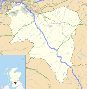
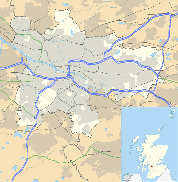
Newton, South Lanarkshire
Newton is a mainly residential district in the town of Cambuslang in Scotland. It is situated south of the River Clyde; the river directly borders the district to the north. Newton is within the Cambuslang East ward of the South Lanarkshire Council area.[1][2]
Newton
| |
|---|---|
.jpg) Aerial view of Newton looking east, March 2018 | |
| Country | Scotland |
| Sovereign state | United Kingdom |
| Post town | GLASGOW |
| Postcode district | G72 6 |
| Dialling code | 0141 |
| Police | Scotland |
| Fire | Scottish |
| Ambulance | Scottish |
| UK Parliament | |
| Scottish Parliament | |
The name is familiar to many in the Greater Glasgow area as a terminus on the suburban rail system (Newton railway station). The railway lines form the southern boundary of the area, while to the west Newton is separated from the neighbouring village of Westburn by the small Newton Burn, and to the east it is separated from farmland belonging to the town of Blantyre by the Rotten Calder river which flows into the Clyde.
History
Mining village
Originally lands owned by the Clan Hamilton, a hamlet called Newton appears on William Roy's military survey of Scotland (1750s),[3] and had earlier been labelled (as 'Neutoun') in Timothy Pont's map (1590s).[4] That settlement had all but disappeared by the time area was developed as a mining village in the late 19th century.[5] Rows of miners’ cottages were built along with local schools, churches and shops. There were several collieries in the vicinity and large bings rose on the landscape. The village reached its greatest extent around 1910.[6][7] The parish town of Cambuslang also became heavily industrialised and grew substantially in population.[8][9][10][11]
Since 1849 the area had been served by a train station, and when this was replaced in 1873 it coincided with the opening of the large Hallside steelworks.[5][12] However, unlike nearby districts also served by stations on the same lines such as Uddingston, Kirkhill and Burnside, Newton did not become a railway commuter suburb for Glasgow at that time.
The village and mines only occupied a small part of the district. The majority of land was occupied by the fields of Newton Farm bounded by the River Clyde to the north, as well as a small country estate centred around Newton House (this was approached by a bridge across Newton Burn and a tree-lined driveway, with the original mansion dating from the 1600s and the last version built in 1825),[5][13][14] and a smaller farm called Ridleywood/Redlawood.
Post-War Decline
In common with much of post-industrial Scotland, in the years after World War II the landscape of Newton changed considerably.
The mining industry declined and the pits closed, with the industrial areas becoming overgrown, and the miners' cottages were demolished in the 1960s; the remaining residents were rehoused in new developments on the other side of Cambuslang such as Cairns and Springhall. The Hallside Steelworks also closed down during the 1970s. Most of the civic amenities and shops closed their doors and the premises were knocked down, leaving derelict ‘gap sites’ which are still present today; however, St Charles' Primary School remained in operation.
Newton House was eventually abandoned and demolished around 1950, and Newton Farm ceased operations in the early 2000s, leaving its fields and buildings neglected. A small isolated group of modern houses were added on the footprint of the miners rows in the mid 1980s, with the streets named Redlawood after the neighbouring farm which had also been bulldozed.
The presence of an electricity generating station nearby resulted in the area being criss-crossed with large electricity pylons and wires, but other than that the land had almost reverted to its original unoccupied rural state after such changes during the previous decades.
Modern Suburb, Phase 1
In the early part of the 21st Century, plans were made to transform Newton into a Community Growth Area with 2100 new houses to be constructed over the following 20 years as well as a local retail centre and new education and community resources.[15]
The first phase of development began in 2006 near to the train station with housing (by Bellway and Taylor Wimpey). A replacement campus was built for St Charles' Primary School, opening in 2011,[16] and later further housing areas (by Taylor Wimpey, Persimmon and Miller Homes) concluded ‘Phase 1’ of the development in 2015 with about 600 homes constructed. The street names were themed on aspects of farming and rural life.
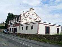
Around the same time the Newton Arms public house (originally dating from 1895) re-opened following a programme of refurbishment, providing a gathering point for the growing population which was otherwise lacking in the development.
Civic improvements were also made in ‘Newton Village’ - the small group of houses at Redlawood Road – including upgraded gym equipment at the local playpark and a small memorial garden reflecting the mining history of the area.
Modern Suburb, Phase 2
Newton Farm Phase 2[17] commenced in 2015. The first stage of construction included 600 houses and, at a cost of £13.4m,[18] a new nondenominational primary school with a 3G football pitch and nursery class (opened August 2017)[19][20] roughly where the buildings of Newton Farm itself previously stood. Barratt Developments,[21] Miller Homes[22] and Taylor Wimpey[23] are the house builders involved - the latter firm is also in overall control of the whole project.
Future development over the next 10 years, involving another 900 houses and two local parks,[24] encompasses land on the site of Newton House. The main road will complete a ‘loop’ back to the railway station. A retail zone for the district is also planned to be close to the station; however as of 2018 there was no confirmation as to when this commercial area would be built, what exact design it would have, or what businesses would be tenants. With development having moved north towards the Clyde by 2019, some residents there complained of regular and strong unpleasant smells emanating from the Daldowie area on the opposite side of the river, which contains a sewage treatment plant, waste-to-fuel facility, landfill site and crematorium.[25]
The secluded area around the footbridge to Westburn was a congregating point for local youths for many years, with antisocial behaviour often resulting - this continued after the surrounding land was dug up and fenced off for housebuilding, and after public gatherings were banned during the COVID-19 pandemic in Scotland.[26][27]
The area has much in common with many modern developments, with the houses often constructed by the same builders. A nearby example is Broomhouse, Glasgow, also a large suburban 'Community Growth Area' on green belt land, based around a small mining community with a few relic buildings including a pub, on the site of a demolished country house, traversed by pylons (on the same line), bounded by a minor river and a railway with a station, with few local amenities but close to established suburbs which provide these. Broomhouse is less than a mile north of Newton as the crow flies, with Daldowie between the two locations, however the communities are separated by the motorway and the river and have no direct transport links.
Amenities
Education
Until Newton Farm Primary School opened in 2017,[19] parents in the area who did not wish their children to receive a Catholic education at local St Charles' Primary had to utilise Cairns Primary in the Halfway district of Cambuslang, as the closer schools in the Drumsagard district (Hallside and Park View) were already at capacity due to the considerable amount of new housing in that area in recent years. Even after the school opened, many families opted to keep their children at Cairns to avoid disrupting their routines.
In 2018, it was announced that St Charles' (which opened its new buildings in 2011[16] and had already installed additional Portakabin classrooms in 2015)[28] would be extended further to accommodate five more new classrooms, with the local authority seemingly unprepared for the continued increase in pupil numbers despite the planned nature of the growth at Newton and the house builders aiming to attract families with young children.[29][30] In November 2019, it was confirmed that Newton Farm Primary would also require temporary classrooms costing £500,000 after the council's estimated pupil numbers fell far short of the reality.[31][32]

There are no secondary schools in Newton. Pupils who attend St Charles' Primary will transfer to Trinity High School while pupils at Newton Farm Primary will transfer to Uddingston Grammar School.[33] The situation has proven controversial, due to pupils from schools in Drumsagard being allocated to both Cathkin High School (nominally in Cambuslang but a considerable distance from both Drumsagard and Newton) and to Stonelaw High School in Rutherglen due to capacity issues - some parents felt this would cause splits in the community of Cambuslang.[34][35][36]
The Newton Farm Primary School project completed in 2017 also included a nursery provision for 3/4 year olds.[19] In addition to this, plans were presented to the local authority in August 2018 for the construction of a standalone nursery facility (on the vacant land at Newton Brae once occupied by St Charles Primary School) anticipated to be built over the following two years.[37] Construction on the facility, to be named Millburn Early Learning and Childcare Unit, began in October 2019.[38][39]
Commerce
Currently the only shop in Newton itself[24] is a small convenience store attached to the public house, plus a hairdresser and MOT garage. There is a licensed grocer and post office in Westburn and a neighbourhood retail zone at the south of Drumsagard, albeit these are both a considerable walking distance for many residents (e.g Westburn store is 1.2 miles (2 km) from Newton Farm Primary school, and Drumsagard shops 1.9 miles (3 km) from the same location). Halfway and Cambuslang Main Street have typical general shopping facilities, as well as the closest places of worship for various denominations. There is a modern industrial estate near Westburn.
Newton residents operating home businesses (as well as the many recreational users streaming television services etc) experienced problems with Broadband Internet access speeds, as the roadside cabinets which supplied the services became oversubscribed due to the number of new homes built in the previously rural location without any expansion of the relevant infrastructure. In 2017, the availability to existing streets was improved by the Openreach operator after the matter was highlighted in the UK Parliament by the sitting MP Margaret Ferrier.[40][41] However, the issue would become apparent again every time another cluster of homes was completed in the ongoing building work in the area, with little consideration given to future significant increases in broadband capacity requirements, requiring both Ferrier's successor Ged Killen and the local MSP Clare Haughey to give the matter their attention due to the volume of complaints received from constituents.[42][43]
Transport
Newton railway station is a busy stop for local services linking Glasgow and Lanarkshire on two different lines (Cathcart Circle Lines and Argyle Line). Additionally, high-speed trains on the West Coast Main Line pass Newton on separate lines which are also used by the suburban Shotts Line, meaning several trains of various types can be seen and heard each hour throughout the day.
The nearest connecting stations to Newton are Rutherglen and Cambuslang to the west and Blantyre to the east on the Argyle line, and Kirkhill on the westbound Cathcart Circle line - Newton is the east terminus for this line. Other nearby stations on different lines are Carmyle (common link at Rutherglen) and Uddingston (common link at Cambuslang).
Bus provision is fairly limited as of 2017. First Glasgow 7A service (to/from Summerston via Rutherglen and Glasgow City Centre) has its terminus near Newton Station, as does the 364 (to/from Parkhead), but the former is indirect and the latter an infrequent service.[44][45] A major First route to Lanarkshire which includes night runs, the 267, travels through Cambuslang and Halfway[46] but is a considerable walking distance from Newton at its closest point (e.g. 1.6 miles (3 km) from Newton Farm Primary School to Halfway Park bus stops).
The opening of the M74 Motorway extension between Cambuslang and Tradeston in Glasgow in 2011 introduced a quick route to and from the Newton area. Motorway connections heading south towards Hamilton and England, or towards northern (M73/M80) or eastern Scotland (M8) have been in place for some years. For visitors unfamiliar with the local road network, Junction 2A (Cambuslang/Tollcross) is the most suitable exit as it serves both north and southbound lanes. On suburban roads, generally drivers should follow signs for Cambuslang and then Halfway or Westburn – Newton itself is poorly signposted due to its small population until recently.
Recreation

There is little in the way of organised sport in Newton, other than bookings of the football pitches by casual groups and local amateur/youth teams[47][48] and fitness classes held in the school halls on evenings and weekends.[49] There are numerous participation and spectator sports organisations based in Cambuslang, and Westburn Hall is another community facility nearby.[50] The main recreational features of note in the area are:
- National Cycle Route 75 (Glasgow-Edinburgh) runs through Westburn as a standalone tarmac cycle path, then switches onto the main roads and runs parallel with the railway line past Newton and towards Uddingston.[51]
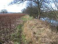
- The Clyde Walkway (Glasgow-Lanark) runs alongside the River Clyde to the north of Newton and passes houses under construction and woodland before joining the footpath down to the Rotten Calder and across a footbridge leading on to Uddingston.[52]
- A basic grass football field and goals in Newton Village, with an 'outdoor gym' and enclosed play area for young children
- Further play areas at Shepherds Way and Fallow Grove (the latter on the site of Redlawood Farm).
The areas of grassland and woods around Newton are home to various bird and animal species, including a herd of roe deer which are sighted on a regular basis in various locations by residents.
During World War II, an Anti-aircraft battery and associated camp for military personnel known as the 'Whins' or 'Blantyreferme' was set up on open land off the Blantyre Farm Road between Newton and Blantyre (1.3 miles (2 km) from Newton);[53] the camp was used as emergency accommodation after the conflict, but the huts were later demolished. However, some of the AA battery buildings survived into the 21st century (albeit heavily vandalised in some cases)[54] and were incorporated – along with a former clay quarry nearby – into the landscape of Redlees Urban Park developed by the local council.[55][56]
People From Newton
- Hugh McIver (soldier killed in World War I, recipient of Victoria Cross medal)
- Sheldon B. Govier (footballer, USA National Soccer Hall of Fame member)
- Donald McKinlay (footballer, Liverpool and Scotland)
- William McAulay (footballer, Aberdeen)
- Davie Wilson (footballer, Rangers and Scotland)[57]
See also
Notes and references
- "Map ward 14 - Cambuslang East" (PDF). South Lanarkshire Council. 4 May 2017. Retrieved 23 July 2018.
- "Cambuslang East". Police Service of Scotland. Retrieved 7 February 2018.
- "General Roy's military survey of Scotland (detail)". National Library of Scotland. Retrieved 20 August 2017.
- "Pont maps of Scotland (detail)". National Library of Scotland. Retrieved 20 August 2017.
- Buildings of Scotland: Glasgow (page 504), Elizabeth Williamson, Anne Riches, Malcolm Higgs, 1990, ISBN 9780140710694
- "Housing Conditions of Miners - Cambuslang (1910)". Scottish Mining Website. Retrieved 24 February 2016.
- "Newton Lanarkshire". Vision Of Britain (Ordnance Gazetteer of Scotland, Francis Groome, 1884). Retrieved 24 February 2016.
- "Ordnance Survey map of Cambuslang in 1859". Scotland's Places (National Library of Scotland). Retrieved 14 September 2016.
- "Ordnance Survey map of Cambuslang in 1896". Scotland's Places (National Library of Scotland). Retrieved 14 September 2016.
- "Ordnance Survey map of Cambuslang in 1910". Scotland's Places (National Library of Scotland). Retrieved 14 September 2016.
- "Ordnance Survey map of Cambuslang in 1934". Scotland's Places (National Library of Scotland). Retrieved 14 September 2016.
- "Hallside Steelworks 1873~1979". Clydebridge Steel Works History (Colin Findlay). Retrieved 24 February 2016.
- "Newton House". Old Country Houses Of the Old Glasgow Gentry (1878). Retrieved 24 February 2016.
- "Newton House". The Glasgow Story / Glasgow University Library. Retrieved 24 February 2016.
- "Projects: Newton Farm". Ashfield Land. Retrieved 25 September 2016.
- "About Us". St. Charles' Primary School - Newton. Retrieved 24 February 2016.
- "CR/14/0155 - Application for Newton Farm (Areas 2A 2B 2C 2D 2E) Cambuslang - Related Documents". South Lanarkshire Council Planning Department. Retrieved 24 February 2016.
- "Grass Pitch Block Booking Pack [page 3]" (PDF). South Lanarkshire Council. Retrieved 25 August 2017.
- "Newton Farm Primary School". South Lanarkshire Council. Retrieved 24 February 2016.
- "School information". Newton Farm Primary School and Nursery Clas. 1 May 2018. Retrieved 29 May 2018.
- "Barratt at Newton Farm". Barratt Developments. Retrieved 24 February 2016.
- "Newton Park". Miller Homes. Retrieved 25 March 2018.
- "Taylor Wimpey at Newton Farm". Taylor Wimpey. Retrieved 24 February 2016.
- "Greenlight for 100 houses in Newton as residents complain of poor services". Daily Record. 23 November 2017. Retrieved 11 July 2018.
- Newton residents work with firm to fight smell, Daily Record, 5 February 2020
- Teenagers gathering on Cambuslang street to drink, take drugs and have sex, Daily Record, 7 April 2017
- Police officer hit by rocks as she tried to split up gathering, STV News, 25 April 2020
- Local authorities urged to embrace off-site schools construction, Scottish Construction Now, 11 June 2015
- £3.7 million extension set for Cambuslang school just seven years after opening, Daily Record, 10 October 2018
- South Lanarkshire Council reported to ombudsman in row over school extension, Daily Record, 4 September 2019
- Mobile classrooms for Cambuslang school as South Lanarkshire Council admit they got pupil numbers wrong, Daily Record, 20 November 2019
- Cambuslang primary school in need of £4million expansion - despite only opening in 2017, Daily Record, 8 April 2020
- "Cambuslang East's £240,000 to be spent at Uddingston Grammar". Daily Record. 3 March 2017. Retrieved 11 July 2018.
- "Parents react angrily to new school plans". STV Group (Scotland). 25 November 2011. Retrieved 24 February 2016.
- "Two new primary schools to be built in Halfway and Newton". STV Group (Scotland). 8 March 2012. Retrieved 24 February 2016.
- "Newton primary to open a year later due to legal hold up". Daily Record/Rutherglen Reformer. 17 April 2015. Retrieved 24 February 2016.
- "Decision is due on new nursery for Cambuslang". Daily Record/Rutherglen Reformer. 14 August 2018. Retrieved 15 August 2018.
- on new Cambuslang nursery begins, Daily Record, 23 October 2019
- Minister visits Newton's new nursery project, South Lanarkshire View, 5 February 2020
- "Superfast web connection for Cambuslang's Newton Farm". Daily Record / Rutherglen Reformer. 21 April 2017. Retrieved 16 August 2016.
- "Ferrier welcomes Newton Farm broadband breakthrough". Margaret Ferrier MP website. 2 March 2017. Retrieved 16 August 2018.
- "Broadband Survey". Ged Killen MP website. 7 August 2018. Retrieved 16 August 2018.
- "MSP condemns Newton Farm broadband provision". Clare Haughey MSP website. 19 March 2018. Retrieved 16 August 2018.
- "Glasgow Network Map" (PDF). First Glasgow. 1 January 2018. Retrieved 29 May 2018.
- "Frequency Guide" (PDF). First Glasgow. 1 January 2018. Retrieved 29 May 2018.
- "Night Service Network Map" (PDF). First Glasgow. 1 January 2018. Retrieved 29 May 2018.
- "Football clubs in Rutherglen and Cambuslang call on local council for better sports facilities". Daily Record. 21 September 2017. Retrieved 11 July 2018.
- "About Us". Newton Vale A.F.C. Retrieved 19 August 2018.
- "Newton Farm Community Wing". South Lanarkshire Leisure & Culture. 12 October 2017. Retrieved 29 May 2018.
- "Westburn Community Hall". South Lanarkshire Council Leisure. Retrieved 21 September 2016.
- "National Cycle Route 75". Sustrans. Retrieved 24 February 2016.
- "Clyde Walkway (Newton is described in Section 2)". Walk Highlands. Retrieved 24 February 2016.
- "AA Battery Blantyreferme". Secret Scotland. 1 April 2013. Retrieved 11 July 2018.
- "Uddingston, Blantyre Farm Road". Canmore. 20 June 2012. Retrieved 11 July 2018.
- "Redlees Quarry due for £300,000 makeover". Daily Record. 25 February 2010. Retrieved 11 July 2018.
- "Redlees Urban Park". Woodland Trust. Retrieved 29 May 2018.
- "Tribute to one of Newton's favourite sons Davy Wilson". Daily Record. 19 July 2015. Retrieved 28 March 2016.
External links
| Wikimedia Commons has media related to Newton, South Lanarkshire. |