New Mexico State Road 122
State Road 122 (NM 122) is a 38.740-mile-long (62.346 km) state highway in the US state of New Mexico. NM 122's western terminus is at Interstate 40 (I-40) west of Thoreau, and the eastern terminus is at I-40 in Grants.
| ||||
|---|---|---|---|---|
| Route information | ||||
| Maintained by NMDOT | ||||
| Length | 38.740 mi[1] (62.346 km) | |||
| Major junctions | ||||
| West end | ||||
| East end | ||||
| Location | ||||
| Counties | Cibola, McKinley | |||
| Highway system | ||||
| ||||

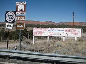
NM 122 westbound near Continental Divide.
History
NM 122 follows the routing of the former Historic U.S. Route 66. At the September 20, 2018 Transportation Commission meeting the bridge carrying NM 122 over I-40 was dedicated as "Sgt. Jackson Gibson Memorial Bridge" to honor Jackson Gibson for his service as a veteran, community leader and state transportation commissioner.[2]
Major intersections
| County | Location | mi[3] | km | Destinations | Notes |
|---|---|---|---|---|---|
| McKinley | Continental Divide | 0.000 | 0.000 | Western terminus; I-40 exit 47 | |
| Thoreau | 6.134 | 9.872 | |||
| Prewitt | 16.090 | 25.894 | Northern terminus of NM 412; to I-40 exit 63 | ||
| Cibola | | 24.989 | 40.216 | Northern terminus of NM 606; to I-40 exit 72 | |
| | 26.959 | 43.386 | Former NM 334 | ||
| | 29.799 | 47.957 | Northern terminus of NM 568 | ||
| Milan | 32.022 | 51.534 | Southern terminus of NM 605 | ||
| 32.211 | 51.839 | Eastern terminus of NM 615; to I-40 exit 79 | |||
| Grants | 34.652 | 55.767 | Eastern terminus of NM 53; to I-40 exit 81 | ||
| 36.003 | 57.941 | Southern terminus of NM 547 | |||
| 37.380 | 60.157 | Northern terminus of NM 117 | |||
| 38.455– 38.740 | 61.887– 62.346 | Eastern terminus; I-40 exit 85 | |||
| 1.000 mi = 1.609 km; 1.000 km = 0.621 mi | |||||
See also
- U.S. Route 66 in New Mexico

References
- "Posted Route: Legal Description" (PDF). New Mexico Department of Transportation. March 16, 2010. p. 91. Retrieved October 25, 2018.
- (PDF) http://dot.state.nm.us/content/dam/nmdot/Transportation_Commission/Regular_Meeting_Minutes_September_20_2018.pdf. Missing or empty
|title=(help) - "TIMS Road Segments by Posted Route/Point with AADT Info; NM, NMX-Routes" (PDF). New Mexico Department of Transportation. April 3, 2013. pp. 5–7. Retrieved October 20, 2018.
This article is issued from Wikipedia. The text is licensed under Creative Commons - Attribution - Sharealike. Additional terms may apply for the media files.