Nettleden
Nettleden is a village in Hertfordshire, England. It is in the Chiltern Hills, about four miles north-west of Hemel Hempstead, near Little Gaddesden, Great Gaddesden and Frithsden. Nettleden with Potten End is a civil parish in Dacorum District.
| Nettleden | |
|---|---|
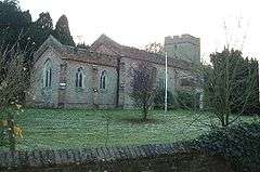 Nettleden Church | |
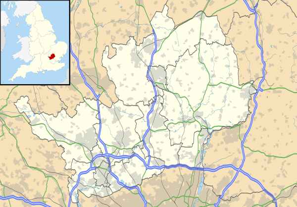 Nettleden Location within Hertfordshire | |
| Population | 1,546 (2011 Census)[1] |
| OS grid reference | TL0110 |
| Civil parish |
|
| District | |
| Shire county | |
| Region | |
| Country | England |
| Sovereign state | United Kingdom |
| Post town | Berkhamsted |
| Postcode district | HP1 |
| Dialling code | 01442 |
| Police | Hertfordshire |
| Fire | Hertfordshire |
| Ambulance | East of England |
| UK Parliament | |
Etymology
The village name of Nettleden is Anglo-Saxon in origin and means 'valley where nettles grow'. In manorial records of the late twelfth century the village was recorded as Neteleydene.
History
Anciently the village was a hamlet in the parish of Pitstone in Buckinghamshire, though the boundary of the hamlet was surrounded by the county of Hertfordshire. Nettleden was transferred from Buckinghamshire to Hertfordshire, and made a parish in its own right, in 1895. The church, St Lawrence, was first mentioned in 1285 when it became a part of the endowment of Ashridge Monastery. The church, except for the tower, was largely rebuilt in brick by John, Earl of Bridgewater, in 1811. Until 1895 it was a chapelry of Pitstone.
When Nettleden became a parish, the hamlet of St Margaret's, formerly belonging to Ivinghoe in Buckinghamshire, was connected to Nettleden. At this place Henry de Blois bishop of Winchester founded the nunnery St Margaret's de Bosco. After the Dissolution in 1539, St Margaret's came into private hands. During the Second World War the St Margaret's Camp was a London County Council Senior Boys School for evacuees – boys from London. The school closed one week after the end of the war in Europe when all the boys were returned to their homes in London. Since 1984 it has been the Amaravati Buddhist Monastery.
From Nettleden to Frithsden goes the Roman Road or Spooky Lane, named in reference to the ghost of an Ashridge monk. In the early 19th century the lane was dug deeper into the hill, with high revetted walls on both sides, and a bridge was built over the lane, in order that people using the driveway leading to Ashridge did not meet the villagers. Another feature of Nettleden is the steep Pipers Hill east of the village.
References
- "Civil Parish population 2011". Neighbourhood Statistics. Office for National Statistics. Retrieved 31 October 2016.
External links
| Wikimedia Commons has media related to Nettleden. |
- Nettleden (A Guide to Old Hertfordshire)
- Nettleden (British-History)
- Nettleden Conservation Area - Character Appraisal& Management Proposals