Nenjiang City
Nenjiang City (Chinese: 嫩江市; pinyin: Nènjiāng shì), formerly Nenjiang County, is a county-level city under the administration of Heihe prefecture-level city in northwestern Heilongjiang province, China. It is located on the river of the same name (Nen River), which also forms part of the provincial border with Inner Mongolia, more than 200 kilometres (120 mi) southwest of the urban area of Heihe. The city seat is Nenjiang Town. Land area 15,360 square kilometres (5,930 sq mi), population 500,000.
Nenjiang 嫩江市 Mergen; Nunkiang | |
|---|---|
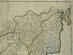 Nenjiang as shown on a 1734 French map | |
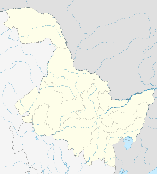 Nenjiang Location in Heilongjiang | |
| Coordinates: 49°11′N 125°13′E | |
| Country | People's Republic of China |
| Province | Heilongjiang |
| Prefecture-level city | Heihe |
| City seat | Nenjiang Town |
| Area | |
| • Total | 15,360 km2 (5,930 sq mi) |
| Elevation | 230 m (750 ft) |
| Population | |
| • Total | 500,000 |
| • Density | 33/km2 (84/sq mi) |
| Time zone | UTC+8 (China Standard) |
| Postal code | 161400 |
| Area code(s) | 0456 |
History
Nenjiang (also known as Mergen at the time) was the capital (seat of the Military Governor) of Heilongjiang Province in 1690–1699.[1]
Geography and climate
Nenjiang has a monsoon-influenced humid continental climate (Köppen Dwb), with long, harsh, but dry winters, and short, warm summers. The monthly 24-hour average temperature ranges from −23.3 °C (−9.9 °F) in January to 21.1 °C (70.0 °F) in July; the year averages out at only 0.85 °C (33.5 °F). Around 80% of the annual precipitation occurs from June to September. With monthly percent possible sunshine ranging from 53% in July to 74% in February, sunshine is generous year-round, totalling 2,726 hours annually.
| Climate data for Nenjiang County (1981−2010 normals) | |||||||||||||
|---|---|---|---|---|---|---|---|---|---|---|---|---|---|
| Month | Jan | Feb | Mar | Apr | May | Jun | Jul | Aug | Sep | Oct | Nov | Dec | Year |
| Average high °C (°F) | −16.7 (1.9) |
−10.5 (13.1) |
−0.8 (30.6) |
11.2 (52.2) |
19.9 (67.8) |
25.5 (77.9) |
26.6 (79.9) |
24.6 (76.3) |
18.8 (65.8) |
9.1 (48.4) |
−4.8 (23.4) |
−15.0 (5.0) |
7.3 (45.2) |
| Daily mean °C (°F) | −23.3 (−9.9) |
−18.4 (−1.1) |
−7.6 (18.3) |
4.5 (40.1) |
12.8 (55.0) |
19.1 (66.4) |
21.1 (70.0) |
18.8 (65.8) |
12.0 (53.6) |
2.8 (37.0) |
−10.7 (12.7) |
−20.9 (−5.6) |
0.9 (33.5) |
| Average low °C (°F) | −29.2 (−20.6) |
−25.6 (−14.1) |
−14.7 (5.5) |
−2.3 (27.9) |
5.2 (41.4) |
12.4 (54.3) |
15.9 (60.6) |
13.5 (56.3) |
5.9 (42.6) |
−3.1 (26.4) |
−16.4 (2.5) |
−26.5 (−15.7) |
−5.4 (22.3) |
| Average precipitation mm (inches) | 3.8 (0.15) |
2.4 (0.09) |
5.4 (0.21) |
21.9 (0.86) |
35.0 (1.38) |
76.4 (3.01) |
133.2 (5.24) |
115.0 (4.53) |
55.0 (2.17) |
22.0 (0.87) |
6.6 (0.26) |
5.6 (0.22) |
482.3 (18.99) |
| Average precipitation days (≥ 0.1 mm) | 6.4 | 4.1 | 4.6 | 7.5 | 8.3 | 13.2 | 14.3 | 13.1 | 9.8 | 6.8 | 5.5 | 7.3 | 100.9 |
| Average relative humidity (%) | 71 | 69 | 59 | 51 | 48 | 63 | 77 | 79 | 69 | 60 | 66 | 72 | 65 |
| Mean monthly sunshine hours | 179.3 | 209.1 | 257.5 | 239.4 | 281.9 | 279.0 | 258.6 | 257.5 | 225.2 | 208.1 | 175.0 | 155.3 | 2,725.9 |
| Percent possible sunshine | 67 | 74 | 70 | 59 | 60 | 58 | 53 | 58 | 60 | 62 | 64 | 61 | 62 |
| Source: China Meteorological Administration (precipitation days and sunshine 1971–2000)[2][3] | |||||||||||||
References
- Edmonds, Richard Louis (1985). Northern Frontiers of Qing China and Tokugawa Japan: A Comparative Study of Frontier Policy. University of Chicago, Department of Geography; Research Paper No. 213. pp. 115–117. ISBN 0-89065-118-3.
- 中国气象数据网 - WeatherBk Data (in Chinese). China Meteorological Administration. Retrieved 2020-04-15.
- 中国地面国际交换站气候标准值月值数据集(1971-2000年). China Meteorological Administration. Archived from the original on 2013-09-21. Retrieved 2010-05-25.