National Register of Historic Places listings in San Francisco
This is a list of the National Register of Historic Places listings in San Francisco, California.
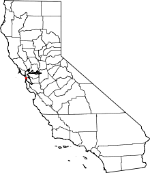
Location of San Francisco in California
This is intended to be a complete list of the properties and districts on the National Register of Historic Places in San Francisco, California, United States. Latitude and longitude coordinates are provided for many National Register properties and districts; these locations may be seen together in an online map.[1]
There are 194 properties and districts listed on the National Register in the city, including 18 National Historic Landmarks. Another two properties were once listed but have been removed.
- This National Park Service list is complete through NPS recent listings posted June 19, 2020.[2]
Current listings
| [3] | Name on the Register[4] | Image | Date listed[5] | Location | Neighborhood/Region | Description |
|---|---|---|---|---|---|---|
| 1 | Administration Building, Treasure Island | Administration Building, Treasure Island |
February 26, 2008 (#08000081) |
Southeast corner of Avenue of the Palms and California Ave. 37°49′02″N 122°22′16″W |
Treasure Island | Treasure Island Museum Association |
| 2 | Alcatraz | 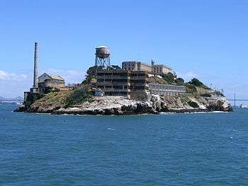 Alcatraz |
June 23, 1976 (#76000209) |
Alcatraz Island, San Francisco Bay 37°49′36″N 122°25′22″W |
San Francisco Bay | Former maximum security Federal prison, from which Frank Morris but few others escaped, now part of the Golden Gate National Recreation Area and visited by tourist ferries. |
| 3 | ALMA (Scow Schooner) | _2.JPG) ALMA (Scow Schooner) |
October 10, 1975 (#75000179) |
Hyde Street Pier, San Francisco Maritime National Historical Park, 2905 Hyde Street 37°48′37″N 122°25′22″W |
Fisherman's Wharf | Flat-bottomed scow schooner built in 1891 to haul goods on and around San Francisco Bay and river delta areas. |
| 4 | Apollo (Storeship) |  Apollo (Storeship) |
May 16, 1991 (#91000561) |
NW corner of Sacramento and Battery Sts. 37°47′39″N 122°24′02″W |
Financial District | San Francisco History: Buried Ships |
| 5 | Aquatic Park Historic District | 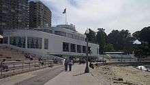 Aquatic Park Historic District |
January 26, 1984 (#84001183) |
Bounded by Van Ness Ave., Hyde and Polk Sts. 37°48′25″N 122°25′22″W |
Fisherman's Wharf | Streamline Moderne building built as a public bathhouse by the WPA in 1936. |
| 6 | Armour & Co. Building | 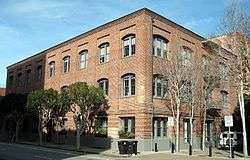 Armour & Co. Building |
December 22, 2009 (#09001117) |
1050 Battery St. 37°48′04″N 122°24′05″W |
Fisherman's Wharf | 1907 building by San Francisco architect Henry Geilfuss used as a meat packing plant and smokehouse by Armour and Company until 1934[6] |
| 7 | Atherton House | .JPG) Atherton House |
January 31, 1979 (#79000527) |
1990 California St. 37°47′24″N 122°25′38″W |
Lower Pacific Heights | NoeHill of San Francisco listing for Atherton House. |
| 8 | Audiffred Building | .JPG) Audiffred Building |
May 10, 1979 (#79000528) |
1–21 Mission St. 37°47′36″N 122°23′33″W |
South Beach | 1889 waterfront commercial building |
| 9 | Baker and Hamilton | Baker and Hamilton |
February 9, 2005 (#05000001) |
601 Townsend St. 37°46′17″N 122°24′07″W |
South of Market | |
| 10 | Balclutha | .JPG) Balclutha |
November 7, 1976 (#76000178) |
Pier 41 East 37°48′35″N 122°25′21″W |
Fisherman's Wharf | 1886 square rigged sailing ship |
| 11 | Bank of Italy | .JPG) Bank of Italy |
June 2, 1978 (#78000754) |
552 Montgomery St. 37°47′41″N 122°24′11″W |
Financial District | |
| 12 | Beach Chalet | Beach Chalet |
July 22, 1981 (#81000172) |
1000 Great Hwy. 37°46′10″N 122°30′37″W |
Ocean Beach | |
| 13 | C. A. Belden House | .JPG) C. A. Belden House |
August 11, 1983 (#83001229) |
2004-2010 Gough St. 37°47′32″N 122°25′33″W |
Pacific Heights | |
| 14 | Belt Railroad Engine House and Sandhouse | .JPG) Belt Railroad Engine House and Sandhouse |
February 13, 1986 (#86000207) |
Block bounded by Lombard, Sansome, and the Embarcadero 37°48′17″N 122°24′12″W |
Fisherman's Wharf | |
| 15 | Building at 1735-1737 Webster Street | 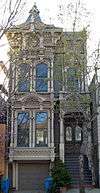 Building at 1735-1737 Webster Street |
March 8, 1973 (#73000444) |
1735—1737 Webster St. 37°47′13″N 122°25′55″W |
Lower Pacific Heights | |
| 16 | Building at 1813-1813B Sutter Street |  Building at 1813-1813B Sutter Street |
March 8, 1973 (#73000443) |
1813—1813B Sutter St. 37°47′11″N 122°25′50″W |
Japantown | The current address of this building is 1815 Sutter St.[7] |
| 17 | Building at 1840-1842 Eddy Street | _2.jpg) Building at 1840-1842 Eddy Street |
March 8, 1973 (#73000437) |
1840—1842 Eddy St. 37°46′51″N 122°26′20″W |
Western Addition | |
| 18 | Building at 33-35 Beideman Place | .jpg) Building at 33-35 Beideman Place |
March 8, 1973 (#73000435) |
33—35 Beideman Pl. 37°46′56″N 122°26′19″W |
Western Addition | |
| 19 | Building at 45-47 Beideman Place | .jpg) Building at 45-47 Beideman Place |
March 8, 1973 (#73000436) |
45—57 Beideman Pl. 37°46′56″N 122°26′19″W |
Western Addition | |
| 20 | Building at 465 Tenth St. | .JPG) Building at 465 Tenth St. |
June 4, 1999 (#99000581) |
465 Tenth St. 37°46′15″N 122°24′36″W |
South of Market | Rothschild Building |
| 21 | Building at 735 Market Street | .JPG) Building at 735 Market Street |
July 27, 2004 (#04000327) |
735 Market St. 37°47′12″N 122°24′15″W |
Financial District | |
| 22 | Burr House | 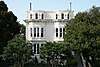 Burr House |
June 8, 2015 (#14000967) |
1772 Vallejo St. 37°47′47″N 122°25′35″W |
Pacific Heights | |
| 23 | Bush Street-Cottage Row Historic District | 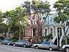 Bush Street-Cottage Row Historic District |
December 27, 1982 (#82000983) |
2101-2125 Bush St., 1-6 Cottage Row, and 1940-1948 Sutter St. 37°47′12″N 122°25′56″W |
Lower Pacific Heights | |
| 24 | C. A. Thayer |  C. A. Thayer |
November 13, 1966 (#66000229) |
San Francisco Maritime State Historic Park 37°48′33″N 122°25′18″W |
Fisherman's Wharf | 1895 schooner |
| 25 | Calvary Presbyterian Church | _3.JPG) Calvary Presbyterian Church |
May 3, 1978 (#78000755) |
2501—2515 Fillmore St. 37°47′34″N 122°26′05″W |
Pacific Heights | |
| 26 | Camera Obscura | .JPG) Camera Obscura |
May 23, 2001 (#01000522) |
1096 Point Lobos Ave. 37°46′42″N 122°30′51″W |
Richmond District | |
| 27 | Central Embarcadero Piers Historic District | 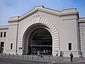 Central Embarcadero Piers Historic District |
November 20, 2002 (#02001390) |
Piers 1, 1½, 3 and 5, The Embarcadero 37°47′51″N 122°23′44″W |
Embarcadero | |
| 28 | Chambord Apartments | .JPG) Chambord Apartments |
September 20, 1984 (#84001184) |
1298 Sacramento St. 37°47′33″N 122°24′51″W |
Nob Hill | |
| 29 | City of Paris Building | .JPG) City of Paris Building |
January 23, 1975 (#75000471) |
181-199 Geary St. 37°47′15″N 122°24′23″W |
Downtown | Neiman Marcus now occupies the site of the former City of Paris Building |
| 30 | Coffin-Redington Building | .JPG) Coffin-Redington Building |
February 2, 2001 (#01000028) |
301 Folsom St. and 300 Beale St. 37°47′19″N 122°23′34″W |
Rincon Hill | |
| 31 | Coit Memorial Tower | 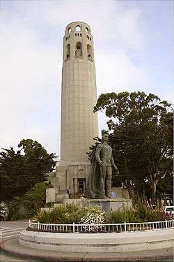 Coit Memorial Tower |
January 29, 2008 (#07001468) |
1 Telegraph Hill Blvd. 37°48′09″N 122°24′21″W |
Telegraph Hill | |
| 32 | Colombo Building | .JPG) Colombo Building |
January 31, 2008 (#07001469) |
1-21 Columbus Ave. 37°47′44″N 122°24′13″W |
Financial District | |
| 33 | USS Conestoga (shipwreck and remains) |  USS Conestoga (shipwreck and remains) |
June 10, 2016 (#16000358) |
Greater Farallones National Marine Sanctuary |
Gulf of the Farallones | |
| 34 | Dallam-Merritt House |  Dallam-Merritt House |
April 19, 1984 (#84001185) |
2355 Washington St. 37°47′30″N 122°25′56″W |
Pacific Heights | |
| 35 | Delano House | .JPG) Delano House |
October 29, 1982 (#82000984) |
70 Buena Vista Terr. 37°46′04″N 122°26′18″W |
Buena Vista | |
| 36 | Richard P. Doolan Residence and Storefronts |  Richard P. Doolan Residence and Storefronts |
May 11, 2011 (#09001201) |
557 Ashbury St./1500-1512 Haight St. 37°46′13″N 122°26′47″W |
Haight-Ashbury | |
| 37 | Drydock 4 Hunters Point Naval Shipyard |  Drydock 4 Hunters Point Naval Shipyard |
July 25, 2012 (#12000424) |
Southeast of the junction of Spear Ave. & Morrell St. 37°43′32″N 122°21′54″W |
Bayview-Hunters Point | |
| 38 | Frank G. Edwards House | .JPG) Frank G. Edwards House |
October 29, 1982 (#82000986) |
1366 Guerrero St. 37°44′57″N 122°25′22″W |
Noe Valley | |
| 39 | Engine House No. 31 | .JPG) Engine House No. 31 |
January 7, 1988 (#87002290) |
1088 Green St. 37°47′55″N 122°25′01″W |
Russian Hill | |
| 40 | Eureka | .JPG) Eureka |
April 24, 1973 (#73000229) |
Hyde Street Pier, San Francisco Maritime National Historical Park, 2905 Hyde Street 37°48′35″N 122°25′18″W |
Fisherman's Wharf | 1890 steam ferryboat |
| 41 | Fairmont Hotel | 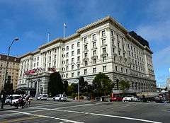 Fairmont Hotel |
April 17, 2002 (#02000373) |
950 Mason St. 37°47′33″N 122°24′38″W |
Nob Hill | |
| 42 | Farallon Islands |  Farallon Islands |
March 8, 1977 (#77000332) |
28 mi. W of San Francisco 37°41′57″N 123°00′10″W |
Gulf of the Farallones | |
| 43 | Federal Reserve Bank of San Francisco | .JPG) Federal Reserve Bank of San Francisco |
July 31, 1989 (#89000009) |
400 Sansome St. 37°47′39″N 122°24′04″W |
Financial District | |
| 44 | Ferry Station Post Office Building | Ferry Station Post Office Building |
December 1, 1978 (#78000756) |
Embarcadero at Mission St. 37°47′38″N 122°23′32″W |
Embarcadero | |
| 45 | Feusier Octagon House | .JPG) Feusier Octagon House |
March 24, 1974 (#74000554) |
1067 Green St. 37°47′54″N 122°25′00″W |
Russian Hill | |
| 46 | Fillmore-Pine Building | 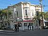 Fillmore-Pine Building |
January 11, 1982 (#82002247) |
1946 Fillmore Street 37°47′16″N 122°26′01″W |
Lower Pacific Heights | |
| 47 | Delia Fleishhacker Memorial Building | 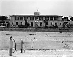 Delia Fleishhacker Memorial Building |
December 31, 1979 (#79000529) |
Zoo Rd. and Sloat Blvd. 37°44′01″N 122°30′23″W |
Parkside | destroyed by fire December 1, 2012[8] |
| 48 | James C. Flood Mansion | _4.JPG) James C. Flood Mansion |
November 13, 1966 (#66000230) |
California and Mason Sts. 37°47′31″N 122°24′41″W |
Nob Hill | |
| 49 | Folger Coffee Company Building | .JPG) Folger Coffee Company Building |
June 21, 1996 (#96000679) |
101 Howard St. 37°47′28″N 122°23′33″W |
South Beach | |
| 50 | Fort Mason Historic District | 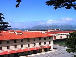 Fort Mason Historic District |
April 25, 1972 (#72000109) |
Portion of Fort Mason north and east of Franklin St. and McArthur Ave. • Boundary increase (listed April 23, 1979, refnum 79000530): Bounded by Van Ness Ave., Bay and Laguna Sts. 37°48′24″N 122°25′36″W |
Fort Mason | |
| 51 | Fort Miley Military Reservation | 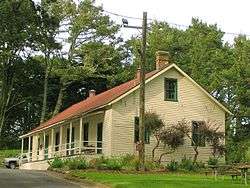 Fort Miley Military Reservation |
May 23, 1980 (#80000371) |
Off CA 1 37°46′58″N 122°30′32″W |
Richmond District | |
| 52 | Fort Point National Historic Site | 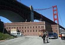 Fort Point National Historic Site |
October 16, 1970 (#70000146) |
N tip of San Francisco Peninsula on U.S. 101 37°48′39″N 122°28′37″W |
Presidio | |
| 53 | Four Fifty Sutter Building | 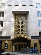 Four Fifty Sutter Building |
December 22, 2009 (#09001118) |
450 Sutter St. 37°47′22″N 122°24′28″W |
Union Square | |
| 54 | Frederick Griffing's (ship) | 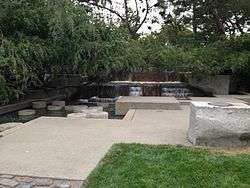 Frederick Griffing's (ship) |
February 1, 1982 (#82002248) |
Underneath Levi 37°48′11″N 122°24′08″W |
Fisherman's Wharf | Remains of buried ship at former wharf of Frederick Griffings discovered in 1978. Still buried under Levi Plaza fountain. |
| 55 | Fuller Company Glass Warehouse | Fuller Company Glass Warehouse |
October 11, 2001 (#01001101) |
50 Green St. 37°48′03″N 122°24′02″W |
Fisherman's Wharf | |
| 56 | Geary Theatre | .JPG) Geary Theatre |
May 27, 1975 (#75000472) |
415 Geary St. 37°47′13″N 122°24′37″W |
Downtown | |
| 57 | Henry Geilfuss House | .jpg) Henry Geilfuss House |
July 24, 2017 (#100001338) |
811 Treat Ave. 37°45′25″N 122°24′47″W |
Mission District | |
| 58 | Geneva Office Building and Power House | 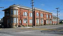 Geneva Office Building and Power House |
March 31, 2010 (#10000111) |
2301 San Jose Ave. 37°43′15″N 122°26′47″W |
Excelsior | |
| 59 | Daniel Gibb & Co. Warehouse | .JPG) Daniel Gibb & Co. Warehouse |
October 10, 1997 (#97001189) |
855 Front St., and 101 Vallejo St. 37°47′58″N 122°24′01″W |
Fisherman's Wharf | |
| 60 | Girls Club | .JPG) Girls Club |
November 6, 1979 (#79000531) |
362 Capp St. 37°45′40″N 122°25′06″W |
Mission District | |
| 61 | Glen Park BART Station |  Glen Park BART Station |
October 21, 2019 (#100004531) |
2901 Diamond St. 37°43′59″N 122°26′02″W |
||
| 62 | Golden Gate Park | 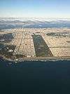 Golden Gate Park |
October 15, 2004 (#04001137) |
Bounded by Fulton St., Stanyan St., Fell St., Baker St., Oak St., Lincoln Way and The Great Highway 37°46′09″N 122°29′01″W |
Golden Gate Park | |
| 63 | Golden Gate Park Conservatory | 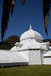 Golden Gate Park Conservatory |
October 14, 1971 (#71000184) |
Mount Link, N of John F. Kennedy Dr. at E end of Golden Gate Park 37°46′21″N 122°27′37″W |
Golden Gate Park | |
| 64 | Goodman Building | .JPG) Goodman Building |
June 18, 1975 (#75000473) |
1117 Geary Blvd. 37°47′08″N 122°25′20″W |
Western Addition | |
| 65 | Grabhorn Press Building | .JPG) Grabhorn Press Building |
May 2, 1997 (#97000349) |
1335 Sutter St. 37°47′15″N 122°25′21″W |
Lower Pacific Heights | |
| 66 | Federal Office Building | 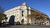 Federal Office Building |
June 5, 2017 (#100001018) |
50 United Nations Plaza 37°46′50″N 122°24′52″W |
Civic Center | |
| 67 | Haas Candy Factory | _2.JPG) Haas Candy Factory |
January 8, 2001 (#00001622) |
54 Mint St. 37°46′57″N 122°24′28″W |
South of Market | |
| 68 | Haas-Lilienthal House | _2.JPG) Haas-Lilienthal House |
July 2, 1973 (#73000438) |
2007 Franklin St. 37°47′36″N 122°25′29″W |
Pacific Heights | |
| 69 | Hale Brothers Department Store | .JPG) Hale Brothers Department Store |
December 18, 1986 (#86003492) |
901 Market St. • Boundary increase (listed May 10, 2001, refnum 01000490): 36 Fifth St., 423-27 and 429 Stevenson St. 37°47′01″N 122°24′29″W |
South of Market | |
| 70 | Hall of Transportation, Treasure Island | Hall of Transportation, Treasure Island |
February 26, 2008 (#08000082) |
SE Side of California Ave. between Avenue D and Avenue F 37°49′07″N 122°22′04″W |
Treasure Island | |
| 71 | Hallidie Building |  Hallidie Building |
November 19, 1971 (#71000185) |
130 Sutter St. 37°47′24″N 122°24′11″W |
Financial District | |
| 72 | Haslett Warehouse | Haslett Warehouse |
March 28, 1975 (#75000172) |
680 Beach St. 37°48′25″N 122°25′12″W |
Fisherman's Wharf | |
| 73 | Herald Hotel | .JPG) Herald Hotel |
October 29, 1982 (#82000985) |
308 Eddy St. 37°47′02″N 122°24′46″W |
Tenderloin | 1910 hotel by architect Alfred Henry Jacobs; contributing property to the Uptown Tenderloin Historic District;[9] now a low-income public senior housing facility |
| 74 | Hercules (tugboat) | .JPG) Hercules (tugboat) |
January 17, 1975 (#75000225) |
Hyde Street Pier, San Francisco Maritime National Historical Park, 2905 Hyde Street 37°48′36″N 122°25′20″W |
Fisherman's Wharf | 1907 steam tug boat |
| 75 | Hotel Californian | .JPG) Hotel Californian |
September 25, 1998 (#98001195) |
403 Taylor St. 37°47′11″N 122°24′41″W |
Tenderloin | 1923 hotel by architect Edward E. Young with 1929 addition by architect Alfred Henry Jacobs; contributing property to the Uptown Tenderloin Historic District;[9] now the Serrano Hotel |
| 76 | House at 1239-1245 Scott Street | .jpg) House at 1239-1245 Scott Street |
March 8, 1973 (#73000441) |
1239—1245 Scott St. 37°46′53″N 122°26′15″W |
Western Addition | |
| 77 | House at 1249-1251 Scott Street | .jpg) House at 1249-1251 Scott Street |
March 8, 1973 (#73000442) |
1249—1251 Scott St. 37°46′54″N 122°26′15″W |
Western Addition | |
| 78 | House at 1254-1256 Montgomery Street | .JPG) House at 1254-1256 Montgomery Street |
January 31, 1979 (#79000532) |
1254—1256 Montgomery St. 37°48′03″N 122°24′15″W |
Telegraph Hill | |
| 79 | House at 1321 Scott Street | .jpg) House at 1321 Scott Street |
March 8, 1973 (#73000439) |
1321 Scott St. 37°46′55″N 122°26′15″W |
Western Addition | |
| 80 | House at 1331-1335 Scott Street | _2.jpg) House at 1331-1335 Scott Street |
March 8, 1973 (#73000440) |
1331—1335 Scott St. 37°46′56″N 122°26′15″W |
Western Addition | |
| 81 | House at 584 Page Street | .JPG) House at 584 Page Street |
September 12, 1985 (#85002195) |
584 Page St. 37°46′24″N 122°25′49″W |
Hayes Valley | Daniel Einstein House |
| 82 | Hunter-Dulin Building | .jpg) Hunter-Dulin Building |
April 17, 1997 (#97000348) |
111 Sutter St. 37°47′24″N 122°24′09″W |
Financial District | |
| 83 | Hunters Point Commercial Drydock Historic District |  Hunters Point Commercial Drydock Historic District |
July 25, 2012 (#12000425) |
East of the junction of Fisher Ave. & Robinson Dr. 37°43′37″N 122°21′41″W |
Bayview-Hunters Point | |
| 84 | International Hotel | .JPG) International Hotel |
June 15, 1977 (#77000333) |
848 Kearny St. 37°47′46″N 122°24′18″W |
Chinatown | |
| 85 | Jackson Brewing Company | .JPG) Jackson Brewing Company |
April 8, 1993 (#93000284) |
1475—1489 Folsom St. and 319—351 11th St. 37°46′19″N 122°24′50″W |
South of Market | |
| 86 | Jackson Square Historic District |  Jackson Square Historic District |
November 18, 1971 (#71000186) |
Roughly bounded by Broadway on N, Sansome St. on E, Washington St. on S, and Columbus Ave. on W 37°47′49″N 122°24′12″W |
Financial District | |
| 87 | Japanese YWCA | January 10, 2020 (#100004868) |
1830 Sutter St. 37°47′11″N 122°25′50″W |
|||
| 88 | SS Jeremiah O'Brien National Historic Landmark | .JPG) SS Jeremiah O'Brien National Historic Landmark |
June 7, 1978 (#78003405) |
Pier 3, Fort Mason Center 37°48′40″N 122°25′05″W |
Fisherman's Wharf | |
| 89 | Jessie Street Substation | Jessie Street Substation |
September 6, 1974 (#74000555) |
222—226 Jessie St. 37°47′10″N 122°24′13″W |
South of Market | The building now houses the Contemporary Jewish Museum (opened June 2008) |
| 90 | San Francisco Juvenile Court and Detention Center | 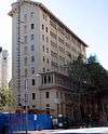 San Francisco Juvenile Court and Detention Center |
April 8, 2011 (#11000182) |
150 Otis St. 37°46′15″N 122°25′14″W |
South of Market | |
| 91 | King Philip (ship) and Reporter (schooner) Shipwreck Site | 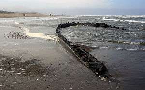 King Philip (ship) and Reporter (schooner) Shipwreck Site |
May 8, 1986 (#86001014) |
Address Restricted |
Ocean Beach | King Philip and Reporter shipwreck sites. |
| 92 | Koshland House |  Koshland House |
January 5, 1984 (#84001186) |
3800 Washington St. 37°47′20″N 122°27′21″W |
Presidio Heights | |
| 93 | Dr. Martin M. Krotoszyner Medical Offices and House | .JPG) Dr. Martin M. Krotoszyner Medical Offices and House |
August 15, 1985 (#85001784) |
995—999 Sutter St. 37°47′17″N 122°25′00″W |
Downtown | contributing property to the Lower Nob Hill Apartment Hotel District[10] |
| 94 | Don Lee Building | .JPG) Don Lee Building |
October 28, 2001 (#01001179) |
1000 Van Ness Ave. 37°47′06″N 122°25′16″W |
Western Addition | |
| 95 | Lewis Ark (Houseboat) | .JPG) Lewis Ark (Houseboat) |
November 8, 1979 (#79000256) |
Hyde Street Pier, San Francisco Maritime National Historical Park, 2905 Hyde Street 37°48′29″N 122°25′15″W |
Fisherman's Wharf | |
| 96 | Liberty Street Historic District | .JPG) Liberty Street Historic District |
September 15, 1983 (#83001230) |
Roughly 15-188 Liberty St. 37°45′27″N 122°25′25″W |
Eureka Valley | |
| 97 | Lotta Crabtree Fountain | .JPG) Lotta Crabtree Fountain |
June 20, 1975 (#75000475) |
Market, Geary, and Kearny Sts. 37°47′16″N 122°24′12″W |
Financial District | |
| 98 | Lower Nob Hill Apartment Hotel District |  Lower Nob Hill Apartment Hotel District |
July 31, 1991 (#91000957) |
Roughly, 590—1209 Bush, 680—1156 Sutter and 600—1099 Post Sts. and the intersecting cross streets 37°47′19″N 122°24′49″W |
Downtown/Union Square | |
| 99 | The Lydia |  The Lydia |
July 16, 1981 (#81000173) |
At the foot of King Street near Pier 42 37°46′51″N 122°23′18″W |
South of Market | Whaling bark |
| 100 | Market Street Theatre and Loft District |  Market Street Theatre and Loft District |
April 10, 1986 (#86000729) |
982—1112 Market, 973—1105 Market, 1 Jones, and 1—35 Taylor Sts. 37°46′55″N 122°24′39″W |
Tenderloin | |
| 101 | Matson Building and Annex | .jpg) Matson Building and Annex |
November 29, 1995 (#95001384) |
215 Market St. 37°47′34″N 122°23′48″W |
Financial District | |
| 102 | McElroy Octagon House | _2.JPG) McElroy Octagon House |
February 23, 1972 (#72000250) |
2645 Gough St. 37°47′52″N 122°25′39″W |
Cow Hollow | |
| 103 | John McMullen House | .JPG) John McMullen House |
September 15, 1983 (#83001231) |
827 Guerrero St. 37°45′28″N 122°25′24″W |
Eureka Valley | |
| 104 | Mills Building and Tower | .jpg) Mills Building and Tower |
April 13, 1977 (#77000334) |
220 Montgomery St. and 220 Bush St. 37°47′28″N 122°24′06″W |
Financial District | |
| 105 | Mish House | .JPG) Mish House |
May 21, 1979 (#79000534) |
1153 Oak St. 37°46′22″N 122°26′18″W |
Haight-Ashbury | |
| 106 | Mission Dolores |  Mission Dolores |
March 16, 1972 (#72000251) |
320 Dolores St. 37°45′51″N 122°25′36″W |
Mission District | |
| 107 | Moss Flats Building | .JPG) Moss Flats Building |
February 24, 1983 (#83001232) |
1626 Great Hwy. 37°45′22″N 122°30′31″W |
Sunset | |
| 108 | Mutual Savings Bank Building |  Mutual Savings Bank Building |
January 22, 2014 (#13001107) |
700 Market St. 37°47′16″N 122°24′14″W |
Financial District | |
| 109 | Myrtle Street Flats | .JPG) Myrtle Street Flats |
June 14, 1976 (#76000520) |
234—248 Myrtle St. 37°47′07″N 122°25′20″W |
Western Addition | |
| 110 | National Carbon Company Building | .jpg) National Carbon Company Building |
August 25, 1983 (#83001233) |
599 8th St. 37°46′17″N 122°24′19″W |
South of Market | |
| 111 | New Mission Theater | 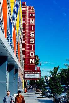 New Mission Theater |
November 9, 2001 (#01001206) |
2550 Mission St. 37°45′23″N 122°25′08″W |
Mission District | San Francisco's New Mission Theater Chronology at The Friends of 1800 website. |
| 112 | Niantic (Storeship) | .jpg) Niantic (Storeship) |
May 16, 1991 (#91000563) |
NW corner of Clay and Sansome Sts. 37°47′42″N 122°24′06″W |
Financial District | |
| 113 | Ohlandt Newlyweds House |  Ohlandt Newlyweds House |
August 19, 1994 (#94000995) |
1260 Potrero Ave. 37°45′08″N 122°24′23″W |
Mission District | |
| 114 | Old Ohio Street Houses | .JPG) Old Ohio Street Houses |
May 31, 1979 (#79000535) |
17—55 Osgood Pl. 37°47′53″N 122°24′11″W |
Financial District | |
| 115 | Old U.S. Mint | Old U.S. Mint |
October 15, 1966 (#66000231) |
5th and Mission Sts. 37°46′58″N 122°24′26″W |
South of Market | |
| 116 | One Lombard Street |  One Lombard Street |
February 3, 2010 (#09001300) |
1 Lombard St. 37°48′15″N 122°24′10″W |
Fisherman's Wharf | |
| 117 | Otis Elevator Company Building | Otis Elevator Company Building |
October 21, 1999 (#99001265) |
1 Beach St. 37°48′28″N 122°24′34″W |
Fisherman's Wharf | |
| 118 | Pacific Gas and Electric Company General Office Building and Annex | .jpg) Pacific Gas and Electric Company General Office Building and Annex |
November 29, 1995 (#95001385) |
245 Market St. 37°47′33″N 122°23′49″W |
Financial District | |
| 119 | Pacific Gas and Electric Company Substation J | .jpg) Pacific Gas and Electric Company Substation J |
December 29, 1986 (#86003514) |
565 Commercial and 568 Sacramento Sts. 37°47′38″N 122°24′08″W |
Financial District | |
| 120 | Paige Motor Car Co. Building | .JPG) Paige Motor Car Co. Building |
February 24, 1983 (#83001234) |
1699 Van Ness Ave. 37°47′28″N 122°25′22″W |
Civic Center | |
| 121 | Palace of Fine and Decorative Arts, Treasure Island | Palace of Fine and Decorative Arts, Treasure Island |
February 26, 2008 (#08000083) |
SE Side of California Ave. between Avenue F and Avenue I 37°49′11″N 122°21′58″W |
Treasure Island | "Regilded Gate", Time, 1939-09-04 |
| 122 | Palace of Fine Arts | Palace of Fine Arts |
December 5, 2005 (#04000659) |
3301 Lyon St. 37°48′10″N 122°26′54″W |
Marina District | |
| 123 | USS Pampanito (submarine) | .JPG) USS Pampanito (submarine) |
January 14, 1986 (#86000089) |
Fisherman's Wharf-Pier 45 37°48′36″N 122°24′59″W |
Fisherman's Wharf | |
| 124 | Park View Hotel | .JPG) Park View Hotel |
August 11, 1983 (#83001235) |
750 Stanyan St. 37°46′06″N 122°27′12″W |
Haight-Ashbury | |
| 125 | Theodore F. Payne House | .JPG) Theodore F. Payne House |
June 11, 1980 (#80000847) |
1409 Sutter St. 37°47′14″N 122°25′26″W |
Lower Pacific Heights | |
| 126 | Abner Phelps House | .JPG) Abner Phelps House |
May 23, 1979 (#71000187) |
1111 Oak St. 37°46′22″N 122°26′17″W |
Haight-Ashbury | |
| 127 | Pier One | Pier One |
January 5, 1999 (#98001551) |
Pier One, The Embarcadero (at Washington St.) 37°47′49″N 122°23′41″W |
Embarcadero | |
| 128 | Pioneer Trunk Factory-C. A. Malm & Co. | Pioneer Trunk Factory-C. A. Malm & Co. |
March 5, 1987 (#86003727) |
2185—2199 Folsom and 3180 18th Sts. 37°45′44″N 122°24′53″W |
Mission District | |
| 129 | Pioneer Woolen Mills and D. Ghirardelli Company |  Pioneer Woolen Mills and D. Ghirardelli Company |
April 29, 1982 (#82002249) |
900 N. Point St. 37°48′20″N 122°25′25″W |
Fisherman's Wharf | |
| 130 | Point Lobos Archaeological Sites | Point Lobos Archaeological Sites |
November 7, 1976 (#76000176) |
Address Restricted 37°46′48″N 122°30′50″W |
Richmond District | Sutro Baths |
| 131 | Port of San Francisco Embarcadero Historic District | 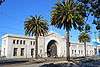 Port of San Francisco Embarcadero Historic District |
May 12, 2006 (#06000372) |
From Pier 45 to Pier 48, The Embarcadero 37°47′49″N 122°23′42″W |
Embarcadero | |
| 132 | Presidio |  Presidio |
October 15, 1966 (#66000232) |
Northern tip of San Francisco Peninsula on U.S. 101 37°47′47″N 122°27′55″W |
Presidio | |
| 133 | Pumping Station No. 2 San Francisco Fire Department Auxiliary Water Supply System | .JPG) Pumping Station No. 2 San Francisco Fire Department Auxiliary Water Supply System |
May 13, 1976 (#76000177) |
N end of Van Ness Ave 37°48′29″N 122°25′37″W |
Fisherman's Wharf | A crucial component of San Francisco's independent water supply system for fighting fires, separate from the domestic water system. |
| 134 | Quarters 1, Yerba Buena Island Naval Training Station |  Quarters 1, Yerba Buena Island Naval Training Station |
September 10, 1991 (#91001380) |
1 Whiting Way, Yerba Buena Island 37°48′46″N 122°21′49″W |
Yerba Buena Island | |
| 135 | Quarters 10 and Building 267, Yerba Buena Island | .JPG) Quarters 10 and Building 267, Yerba Buena Island |
February 26, 2008 (#08000084) |
Jct. Northgate & Macalla Rds., North Shore of Yerba Buena Island 37°48′43″N 122°21′51″W |
Yerba Buena Island | |
| 136 | Rialto Building | 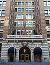 Rialto Building |
January 3, 2011 (#10001108) |
116 New Montgomery St. 37°47′14″N 122°24′01″W |
South of Market | |
| 137 | Rincon Annex | Rincon Annex |
November 16, 1979 (#79000537) |
101—199 Mission St. 37°47′34″N 122°23′36″W |
South Beach | |
| 138 | SS Rio de Janeiro Shipwreck | 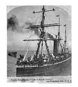 SS Rio de Janeiro Shipwreck |
November 3, 1988 (#88002394) |
Address Restricted |
Golden Gate | |
| 139 | Roos House | 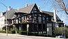 Roos House |
October 8, 2009 (#09000805) |
3500 Jackson St. 37°47′26″N 122°27′10″W |
Presidio Heights | |
| 140 | Russian Hill-Macondray Lane District | 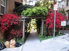 Russian Hill-Macondray Lane District |
January 7, 1988 (#87002286) |
Roughly 900—982 Green, 1918—1960 Jones, 15—84 Macondray & 1801—1809 Taylor 37°47′57″N 122°24′53″W |
Russian Hill | |
| 141 | Russian Hill-Paris Block Architectural District |  Russian Hill-Paris Block Architectural District |
January 7, 1988 (#87002288) |
Roughly 1017—1067 Green St. 37°47′54″N 122°24′59″W |
Russian Hill | |
| 142 | Russian Hill-Vallejo Street Crest District |  Russian Hill-Vallejo Street Crest District |
January 22, 1988 (#87002289) |
Roughly 1020-1032 Broadway, 1-49 Florence, 1728-1742 Jones, 1-7 Russian Hill Pl., 1629-1715 Taylor, & 1000-1085 Vallejo 37°47′52″N 122°24′52″W |
Russian Hill | |
| 143 | Sacred Heart Parish Complex | .jpg) Sacred Heart Parish Complex |
September 28, 2017 (#100001665) |
546 and 554 Fillmore, 735 Fell & 660 Oak Sts. 37°46′29″N 122°25′52″W |
||
| 144 | San Francisco Art Institute |  San Francisco Art Institute |
January 5, 2016 (#15000950) |
800 Chestnut St. 37°48′12″N 122°25′02″W |
Russian Hill | |
| 145 | San Francisco Cable Cars | 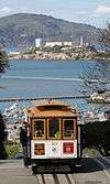 San Francisco Cable Cars |
October 15, 1966 (#66000233) |
1390 Washington St. 37°47′38″N 122°24′58″W |
Multiple neighborhoods | |
| 146 | San Francisco Central YMCA |  San Francisco Central YMCA |
April 9, 2018 (#100002287) |
220 Golden Gate Ave. 37°46′55″N 122°24′51″W |
||
| 147 | San Francisco Civic Center Historic District |  San Francisco Civic Center Historic District |
October 10, 1978 (#78000757) |
Roughly bounded by Golden Gate Ave., 7th, Franklin, Hayes, and Market Sts. 37°46′46″N 122°25′03″W |
Civic Center | |
| 148 | San Francisco Fire Department Engine Co. Number 2 |  San Francisco Fire Department Engine Co. Number 2 |
April 17, 2002 (#02000371) |
460 Bush St. 37°47′27″N 122°24′18″W |
Downtown | |
| 149 | San Francisco Maritime National Historic Park | San Francisco Maritime National Historic Park |
June 27, 1988 (#01000281) |
Fort Mason, Bld. 201 37°48′20″N 122°25′41″W |
Fort Mason | |
| 150 | San Francisco National Guard Armory and Arsenal | .jpg) San Francisco National Guard Armory and Arsenal |
November 14, 1978 (#78000758) |
1800 Mission St. 37°46′05″N 122°25′13″W |
Mission District | |
| 151 | San Francisco–Oakland Bay Bridge | 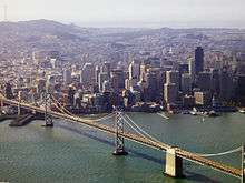 San Francisco–Oakland Bay Bridge |
August 13, 2001 (#00000525) |
I-80 37°48′02″N 122°22′31″W |
San Francisco Bay | |
| 152 | San Francisco Port of Embarkation, US Army |  San Francisco Port of Embarkation, US Army |
February 4, 1985 (#85002433) |
Ft. Mason 37°48′26″N 122°25′52″W |
Fort Mason | |
| 153 | San Francisco Public Library North Beach Branch |  San Francisco Public Library North Beach Branch |
August 8, 2011 (#11000501) |
2000 Mason St. 37°48′07″N 122°24′46″W |
North Beach | |
| 154 | San Francisco State Teacher's College |  San Francisco State Teacher's College |
January 7, 2008 (#07001391) |
55 Laguna St. 37°46′17″N 122°25′32″W |
Hayes Valley | |
| 155 | M.V. Santa Rosa | 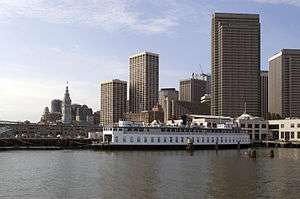 M.V. Santa Rosa |
May 29, 1979 (#79000469) |
Pier 3, San Francisco 37°47′54″N 122°23′43″W |
Embarcadero | Listed in the NRIS database as located Howard Terminal, Oakland. The vessel, now moored at Pier 3 in San Francisco, is owned by Hornblower Yachts and has been used as a concert venue.[11] |
| 156 | Schoenstein and Company Pipe Organ Factory | 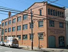 Schoenstein and Company Pipe Organ Factory |
November 14, 1978 (#78000759) |
3101 20th St. 37°45′32″N 122°24′42″W |
Mission District | |
| 157 | Irving Murray Scott School | .JPG) Irving Murray Scott School |
April 11, 1985 (#85000714) |
1060 Tennessee St. 37°45′31″N 122°23′22″W |
Potrero Hill | |
| 158 | Second and Howard Streets District |  Second and Howard Streets District |
July 28, 1999 (#99000894) |
121-198 2nd, 579-612 Howard, 116 Natoma, 111-163 New Montgomery 37°47′14″N 122°23′57″W |
South of Market | |
| 159 | Senior Officers Quarters Historic District, Yerba Buena Island |  Senior Officers Quarters Historic District, Yerba Buena Island |
February 26, 2008 (#08000085) |
Whiting Way at Northgate Rd., North shore of Yerba Buena Island 37°48′47″N 122°21′51″W |
Yerba Buena Island | Includes Quarters 1-7 and associated garages (Buildings 83, 205, and 230).[12] |
| 160 | Sinton House |  Sinton House |
December 22, 2011 (#11000944) |
1020 Francisco St. 37°48′13″N 122°25′19″W |
Russian Hill | |
| 161 | Six-Inch Rifled Gun No. 9 | 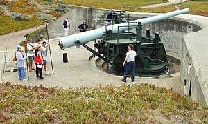 Six-Inch Rifled Gun No. 9 |
February 7, 1979 (#79000255) |
Baker Beach 37°47′37″N 122°28′58″W |
Presidio | |
| 162 | South San Francisco Opera House | 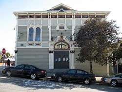 South San Francisco Opera House |
March 21, 2011 (#11000117) |
4701-4705 Third St. and 1601 Newcomb Ave. 37°44′06″N 122°23′25″W |
Bayview-Hunters Point | |
| 163 | Southern Pacific Company Hospital Historic District | Southern Pacific Company Hospital Historic District |
May 5, 1989 (#89000319) |
1400 Fell St. 37°46′25″N 122°26′27″W |
North Panhandle | |
| 164 | John Spencer House | .JPG) John Spencer House |
April 14, 2005 (#05000273) |
1080 Haight St. 37°46′16″N 122°26′25″W |
Haight-Ashbury | |
| 165 | Stadtmuller House | .JPG) Stadtmuller House |
July 19, 1976 (#76000523) |
819 Eddy St. 37°46′57″N 122°25′18″W |
Western Addition | |
| 166 | St. John's Presbyterian Church | _2.JPG) St. John's Presbyterian Church |
January 22, 1996 (#95001555) |
25 Lake St. and 201 Arguello Blvd. 37°47′12″N 122°27′34″W |
Presidio Heights | |
| 167 | St. Joseph's Church and Complex | .JPG) St. Joseph's Church and Complex |
January 15, 1982 (#82002250) |
1401—1415 Howard St. 37°46′25″N 122°24′52″W |
South of Market | |
| 168 | St. Joseph's Hospital | .JPG) St. Joseph's Hospital |
May 9, 1985 (#85001016) |
355 Buena Vista Ave. East 37°46′03″N 122°26′24″W |
Buena Vista | |
| 169 | St. Paulus Lutheran Church |  St. Paulus Lutheran Church |
February 11, 1982 (#82002251) |
999 Eddy St. 37°46′57″N 122°25′26″W |
Western Addition | Burned to the ground November 1995.[13] |
| 170 | Swedenborgian Church | .jpg) Swedenborgian Church |
August 18, 2004 (#04001154) |
3200 Washington St. 37°47′25″N 122°26′46″W |
Pacific Heights | |
| 171 | Swedish American Hall |  Swedish American Hall |
September 20, 2019 (#100004413) |
2168-2174 Market St. 37°46′00″N 122°25′49″W |
||
| 172 | Temple Sherith Israel |  Temple Sherith Israel |
March 31, 2010 (#10000114) |
2266 California St. 37°47′22″N 122°25′55″W |
Pacific Heights | |
| 173 | The Real Estate Associates (TREA) Houses | _House.JPG) The Real Estate Associates (TREA) Houses |
April 4, 1985 (#85000705) |
2503, 2524, 2530 and 2536 Clay Sts. 37°47′26″N 122°26′05″W |
Pacific Heights | |
| 174 | Tobin House | 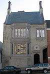 Tobin House |
October 5, 2009 (#09000806) |
1969 California St. 37°47′22″N 122°25′36″W |
Lower Pacific Heights | |
| 175 | Torpedo Storehouse-Torpedo (Mine) Assembly Building & Long Range Accuracy Storage Building | 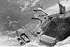 Torpedo Storehouse-Torpedo (Mine) Assembly Building & Long Range Accuracy Storage Building |
June 11, 2008 (#08000086) |
East Point; North Shore of Yerba Buena Island 37°48′53″N 122°21′33″W |
Yerba Buena Island | 1891 torpedo assembly building built for the US Army by architect Ernest Leslie Ransome[14] |
| 176 | Trinity Presbyterian Church | .JPG) Trinity Presbyterian Church |
March 2, 1982 (#82002252) |
3261 23rd St. 37°45′14″N 122°25′03″W |
Mission District | |
| 177 | Tubbs Cordage Company Office Building | .JPG) Tubbs Cordage Company Office Building |
November 6, 1979 (#79000254) |
Hyde Street Pier, San Francisco Maritime National Historical Park, 2905 Hyde Street 37°48′32″N 122°25′16″W |
Fisherman's Wharf | |
| 178 | Union Ferry Depot | .jpg) Union Ferry Depot |
December 1, 1978 (#78000760) |
Embarcadero at Market St. 37°47′43″N 122°23′37″W |
Embarcadero | |
| 179 | Union Iron Works Historic District | 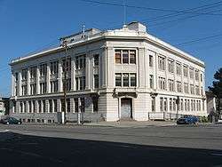 Union Iron Works Historic District |
April 17, 2014 (#14000150) |
E. of Illinois between 18th & 22nd Sts. 37°45′39″N 122°23′04″W |
Potrero Point | |
| 180 | Uptown Tenderloin Historic District | 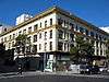 Uptown Tenderloin Historic District |
February 5, 2009 (#08001407) |
All or part of 33 blocks roughly bounded by Market, McAllister, Golden Gate, Larkin, Geary, Taylor, Ellis Sts. 37°47′02″N 122°24′51″W |
Tenderloin | |
| 181 | U.S. Appraisers Stores and Immigration Station |  U.S. Appraisers Stores and Immigration Station |
August 13, 2013 (#13000590) |
630 Sansome St. 37°47′47″N 122°24′06″W |
Financial District | |
| 182 | U.S. Customhouse | .JPG) U.S. Customhouse |
January 29, 1975 (#75000476) |
555 Battery St. 37°47′47″N 122°24′03″W |
Financial District | |
| 183 | U.S. Mint | .JPG) U.S. Mint |
February 18, 1988 (#88000026) |
155 Hermann St. 37°46′13″N 122°25′39″W |
Hayes Valley | |
| 184 | U.S. Post Office and Courthouse | .jpg) U.S. Post Office and Courthouse |
October 14, 1971 (#71000188) |
NE corner of 7th and Mission Sts. 37°46′46″N 122°24′40″W |
South of Market | National Historic Landmark designation October 16, 2012[15] |
| 185 | Veterans Affairs Medical Center-San Francisco, California |  Veterans Affairs Medical Center-San Francisco, California |
April 20, 2009 (#05001112) |
4150 Clement Street 37°46′56″N 122°30′16″W |
Sea Cliff | |
| 186 | Russell Warren House | .JPG) Russell Warren House |
December 12, 1983 (#83003594) |
465-467 Oak St. and 368 Lily St. 37°46′27″N 122°25′37″W |
Hayes Valley | |
| 187 | Julian Waybur House |  Julian Waybur House |
March 28, 2011 (#11000143) |
3232 Pacific Ave. 37°47′30″N 122°26′53″W |
Presidio Heights | |
| 188 | William Westerfeld House | .JPG) William Westerfeld House |
March 16, 1989 (#89000197) |
1198 Fulton St. 37°46′38″N 122°26′11″W |
Alamo Square | |
| 189 | Whittier Mansion | _2.JPG) Whittier Mansion |
April 26, 1976 (#76000524) |
2090 Jackson St. 37°47′36″N 122°25′46″W |
Pacific Heights | |
| 190 | Albert Wilford Houses | .jpg) Albert Wilford Houses |
August 29, 1985 (#85001914) |
2121 & 2127 Vallejo St. 37°47′43″N 122°25′56″W |
Pacific Heights | |
| 191 | Woman's Athletic Club of San Francisco | .JPG) Woman's Athletic Club of San Francisco |
September 10, 2004 (#04000955) |
640 Sutter St. 37°47′20″N 122°24′40″W |
Union Square | |
| 192 | The Women's Building |  The Women's Building |
April 30, 2018 (#100002359) |
3543 18th St. 37°45′42″N 122°25′21″W |
||
| 193 | Yerba Buena Island Lighthouse |  Yerba Buena Island Lighthouse |
September 3, 1991 (#91001096) |
Yerba Buena Island 37°48′26″N 122°21′44″W |
Yerba Buena Island | part of the Light Stations of California Multiple Property Submission |
| 194 | YMCA Hotel | .jpg) YMCA Hotel |
February 6, 1986 (#86000148) |
351 Turk St. 37°46′57″N 122°24′54″W |
Tenderloin | 1928 hotel by architect Frederick Meyer; contributing property to the Uptown Tenderloin Historic District[9] |
Former listings
| [3] | Name on the Register | Image | Date listed | Date removed | Location | City or town | Summary |
|---|---|---|---|---|---|---|---|
| 1 | Fitzhugh Building | January 20, 1976 (#76000519) | 384 Post St. |
San Francisco | |||
| 2 | Wapama | .jpg) Wapama |
April 24, 1973 (#73000228) | February 7, 2015 | Hyde Street Pier, San Francisco Maritime National Historical Park, 2905 Hyde Street 37°48′28″N 122°25′16″W |
Fisherman's Wharf | steam schooner; scrapped in 2013; moved to drydock at Richmond Shipyard #3; NHL and NRHP designations withdrawn in 2015[16] |
See also
| Wikimedia Commons has media related to National Register of Historic Places in San Francisco, California. |
References
- The latitude and longitude information provided in this table was derived originally from the National Register Information System, which has been found to be fairly accurate for about 99% of listings. Some locations in this table may have been corrected to current GPS standards.
- "National Register of Historic Places: Weekly List Actions". National Park Service, United States Department of the Interior. Retrieved on June 19, 2020.
- Numbers represent an ordering by significant words. Various colorings, defined here, differentiate National Historic Landmarks and historic districts from other NRHP buildings, structures, sites or objects.
- "National Register Information System". National Register of Historic Places. National Park Service. July 9, 2010.
- The eight-digit number below each date is the number assigned to each location in the National Register Information System database, which can be viewed by clicking the number.
- National Register of Historic Places Registration Form, Armour & Co. Buildings, San Francisco, California, National Register #09001117.
- National Register of Historic Places, Building at 1813-1813B Sutter Street, San Francisco, California, National Register #73000443.
- Kuruvila, Matthai (2012-12-02). "Fire at S.F. Zoo destroys old bathhouse". San Francisco Chronicle. Retrieved December 1, 2012.
- National Register of Historic Places Registration Form, Uptown Tenderloin Historic District, San Francisco, California, National Register #8001407
- National Register of Historic Places Registration Form, Lower Nob Hill Apartment Hotel District, San Francisco, California, National Register #85001784.
- LeBaron, Gaye (July 16, 2006). "Ferry Embarks on New Life as Floating Concert Hall". The Press Democrat. Santa Rosa, CA. p. B1. Retrieved April 29, 2009.
- Treasure Island Development Authority (2007-07-23). "Amended and Restated Economic Development Conveyance Application for Naval Station Treasure Island" (PDF). p. 15. Archived from the original (PDF) on 2008-04-21. Retrieved 2008-05-31.
- Snyder, George (November 6, 1995). "S.F. Landmark Burns". San Francisco Chronicle. p. A1.
- James, Scott (March 23, 2012). "Hold That Bridge! This Dilapidated Warehouse Is a Landmark". The New York Times. Retrieved March 23, 2012.
- "Weekly list of actions taken on properties: 10/22/12 through 10/27/12". National Park Service. November 2, 2012. Retrieved November 4, 2012.
- "Wapama (Designation Withdrawn)". 2015-04-15. Retrieved 2018-01-09.
External links
- List of San Francisco historic landmarks
- List of City of S.F., California, and Federal landmarks in San Francisco
- Early history of the California Coast: San Francisco - clickable map and descriptions.
- World War II in the San Francisco Bay Area - National Register travel itinerary
| Topics | |
|---|---|
| Lists by state |
|
| Lists by insular areas | |
| Lists by associated state | |
| Other areas | |
| Related | |
| |
| Downtown | .svg.png) | |
|---|---|---|
| North of Downtown | ||
| Outside Lands | ||
| Western Addition | ||
| Southern | ||
| ||
This article is issued from Wikipedia. The text is licensed under Creative Commons - Attribution - Sharealike. Additional terms may apply for the media files.