National Register of Historic Places listings in Coweta County, Georgia
This is a list of properties and districts in Coweta County, Georgia that are listed on the National Register of Historic Places (NRHP).
- This National Park Service list is complete through NPS recent listings posted June 19, 2020.[1]
Current listings
| [2] | Name on the Register | Image | Date listed[3] | Location | City or town | Description |
|---|---|---|---|---|---|---|
| 1 | W. A. Brannon Store-Moreland Knitting Mills | 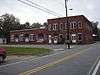 W. A. Brannon Store-Moreland Knitting Mills |
December 12, 1985 (#85003332) |
Main St. 33°17′07″N 84°46′11″W |
Moreland | |
| 2 | Cole Town District | 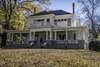 Cole Town District |
September 30, 1982 (#82002400) |
Roughly bounded by Washington, Thompson, and Davis Sts., and Hooligan Alley 33°22′22″N 84°47′39″W |
Newnan | |
| 3 | Coweta County Courthouse | 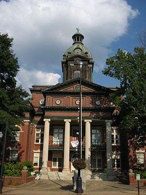 Coweta County Courthouse |
September 18, 1980 (#80001006) |
Courthouse Sq. 33°22′29″N 84°48′01″W |
Newnan | |
| 4 | William Leonard Crowder Home Place |  William Leonard Crowder Home Place |
March 17, 1986 (#86000455) |
1615 Handy Rd. 33°22′38″N 84°58′07″W |
Newnan | |
| 5 | Goodwyn-Bailey House | 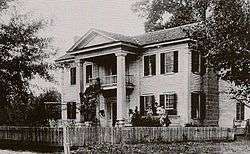 Goodwyn-Bailey House |
October 29, 1992 (#92001520) |
2295 Old Poplar Rd. 33°21′16″N 84°42′19″W |
Newnan | |
| 6 | Gordon-Banks House | 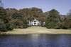 Gordon-Banks House |
January 20, 1972 (#72000383) |
South of Newnan on U.S. 29 33°20′28″N 84°47′01″W |
Newnan | |
| 7 | Grantville Historic District | 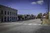 Grantville Historic District |
June 14, 1991 (#91000772) |
Bounded by US 29, LaGrange St., W. Grantville Rd. and the city cemetery 33°14′07″N 84°50′05″W |
Grantville | |
| 8 | Greenville Street-LaGrange Street Historic District | 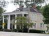 Greenville Street-LaGrange Street Historic District |
April 28, 1983 (#83000190) |
LaGrange, Nimmons, Greenville, Powell, Reese, Powell and Buchanan Sts. 33°21′57″N 84°48′02″W |
Newnan | |
| 9 | Henderson-Orr House |  Henderson-Orr House |
June 2, 2000 (#00000562) |
Junction of Thomas Powers Rd. and GA 34 33°20′15″N 84°58′51″W |
Stallings Crossing | |
| 10 | Hollberg Hotel | 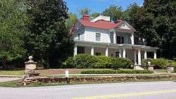 Hollberg Hotel |
March 10, 1980 (#80001007) |
Seavy and Barnes Sts. 33°18′04″N 84°33′11″W |
Senoia | |
| 11 | Newnan Commercial Historic District |  Newnan Commercial Historic District |
March 20, 1990 (#90000432) |
Roughly bounded by Lee, Perry, Salbide, Lagrange, W. Spring, Brown, Madison, and Jefferson 33°22′28″N 84°48′00″W |
Newnan | Coweta County Courthouse is a contributing property |
| 12 | Newnan Cotton Mill and Mill Village Historic District | 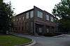 Newnan Cotton Mill and Mill Village Historic District |
April 11, 2002 (#02000339) |
Roughly bounded by E. Washington, Wilcoxen and Farmer Sts., and CSX RR. 33°22′39″N 84°47′38″W |
Newnan | |
| 13 | Northwest Newnan Residential Historic District | 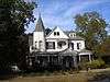 Northwest Newnan Residential Historic District |
May 28, 1982 (#82002401) |
Roughly bounded by railroad tracks, Jefferson, Cavender, Duncan, and Browns Sts. 33°22′40″N 84°48′12″W |
Newnan | |
| 14 | Oak Grove Plantation | 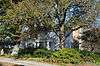 Oak Grove Plantation |
May 25, 2001 (#01000535) |
4537 N US 29 33°27′32″N 84°41′26″W |
Newnan | |
| 15 | Oak Hill Cemetery |  Oak Hill Cemetery |
January 27, 2012 (#11001054) |
96 Jefferson St. 33°23′09″N 84°47′52″W |
Newnan | |
| 16 | Platinum Point Historic District | 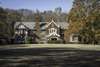 Platinum Point Historic District |
July 12, 1990 (#90000997) |
Along Jackson St., 0.5 miles (0.80 km) north of downtown Newnan 33°23′25″N 84°48′08″W |
Newnan | |
| 17 | Powell Chapel School | 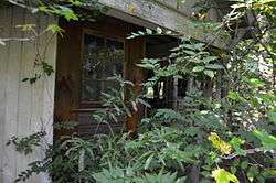 Powell Chapel School |
June 23, 2003 (#03000535) |
620 Old Atlanta Hwy. 33°24′56″N 84°47′06″W |
Newnan | |
| 18 | Mary Ray Memorial School | 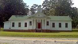 Mary Ray Memorial School |
July 23, 2013 (#13000531) |
771 Raymond Sheddan Ave. 33°20′09″N 84°43′02″W |
Raymond | |
| 19 | Roscoe-Dunaway Gardens Historic District | 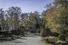 Roscoe-Dunaway Gardens Historic District |
December 6, 1996 (#96001414) |
Roughly bounded by the Chattahoochee R., Cedar Cr., Hood Branch, and White Oak Cr. 33°29′54″N 84°50′00″W |
Roscoe | |
| 20 | Sargent Historic District | 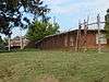 Sargent Historic District |
February 24, 2005 (#05000077) |
Roughly centered on the Arnall Mill Complex at the junction of Georgia State Route 16 and Old Carrolton Rd. 33°25′52″N 84°52′03″W |
Sargent | |
| 21 | Senoia Historic District | Senoia Historic District |
March 17, 1989 (#89000149) |
Roughly bounded by Couch St., CSX Transportation tracks, Georgia State Route 16, and Pylant St. 33°18′05″N 84°33′14″W |
Senoia | |
| 22 | George R. Sims House | 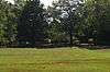 George R. Sims House |
September 27, 1990 (#90001435) |
1851 Collinsworth Rd. 33°29′31″N 84°37′08″W |
Palmetto | |
| 23 | Dr. Robert L. and Sarah Alberta Smith House | 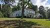 Dr. Robert L. and Sarah Alberta Smith House |
October 18, 1996 (#96001139) |
1262 Bob Smith Rd. 33°22′49″N 84°38′43″W |
Sharpsburg | |
| 24 | Tidwell-Amis-Haynes House | 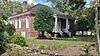 Tidwell-Amis-Haynes House |
September 11, 1997 (#97001124) |
1200 Sid Hunter Rd. 33°16′23″N 84°40′16″W |
Senoia | |
| 25 | Vinewood |  Vinewood |
May 11, 2011 (#11000263) |
1324 Roscoe Rd. 33°25′44″N 84°48′49″W |
Newnan | |
| 26 | Willcoxon-Arnold House |  Willcoxon-Arnold House |
May 20, 1991 (#91000559) |
One Bullsboro Dr. 33°22′55″N 84°47′35″W |
Newnan |
References
- "National Register of Historic Places: Weekly List Actions". National Park Service, United States Department of the Interior. Retrieved on June 19, 2020.
- Numbers represent an ordering by significant words. Various colorings, defined here, differentiate National Historic Landmarks and historic districts from other NRHP buildings, structures, sites or objects.
- The eight-digit number below each date is the number assigned to each location in the National Register Information System database, which can be viewed by clicking the number.
| Wikimedia Commons has media related to National Register of Historic Places in Coweta County, Georgia. |
This article is issued from Wikipedia. The text is licensed under Creative Commons - Attribution - Sharealike. Additional terms may apply for the media files.