Namcha Barwa
Namcha Barwa or Namchabarwa (Tibetan: གནམས་ལྕགས་འབར་བ།, Wylie: Gnams lcags 'bar ba, ZYPY: Namjagbarwa ; Chinese: 南迦巴瓦峰, Pinyin: Nánjiābāwǎ Fēng) is a mountain in the Tibetan Himalaya. The traditional definition of the Himalaya extending from the Indus River to the Brahmaputra would make it the eastern anchor of the entire mountain chain, and it is the highest peak of its own section as well as Earth's easternmost peak over 7,600 metres (24,900 ft).[2]
| Namcha Barwa | |
|---|---|
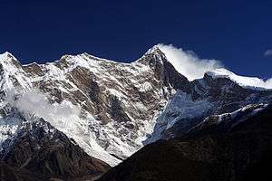 Namcha Barwa from the west, from Zhibai observation platform | |
| Highest point | |
| Elevation | 7,782 m (25,531 ft) [1] Ranked 28th |
| Prominence | 4,106 m (13,471 ft) [1] Ranked 19th |
| Isolation | 708 km (440 mi) |
| Listing | Ultra |
| Coordinates | 29°37′45″N 95°03′21″E [1] |
| Geography | |
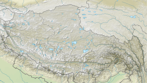 Namcha Barwa Location in eastern Tibet Autonomous Region | |
| Location | Tibet Autonomous Region Nyingchi Prefecture Mêdog County north of McMahon Line |
| Parent range | Himalayas Namcha Barwa Himal |
| Climbing | |
| First ascent | 1992, China–Japan expedition |
| Easiest route | SSW ridge on rock, snow and ice |
Location
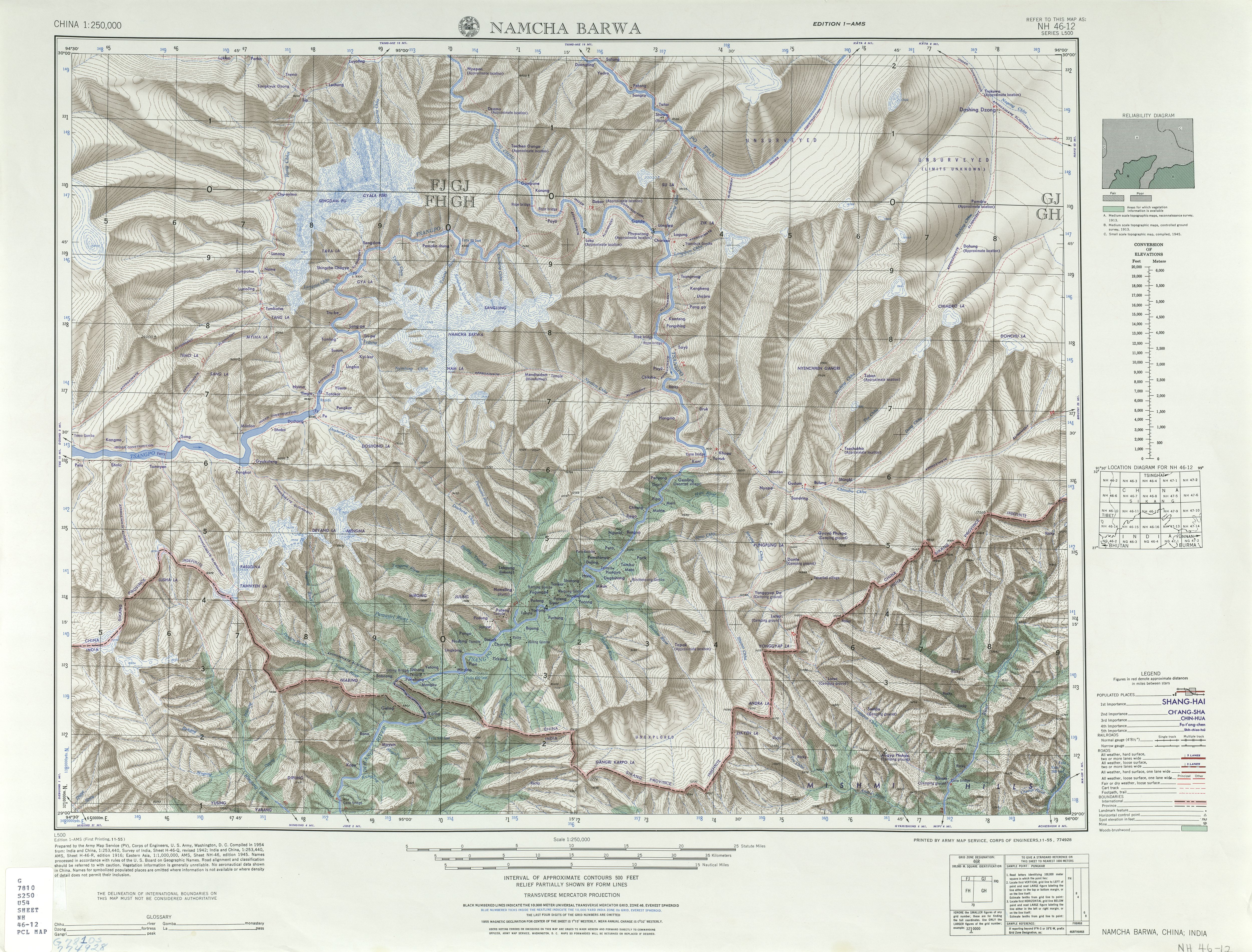
Namcha Barwa is in an isolated part of southeastern Tibet rarely visited by outsiders. It stands inside the Great Bend of the Yarlung Tsangpo River as the river enters its notable gorge across the Himalaya,[3] emerging as the Siang and becoming the Brahmaputra. Namcha Barwa's sister peak Gyala Peri at 7,294 metres (23,930 ft) rises across the gorge 22 kilometres (14 mi) to the NNW.
Notable features
Namcha rises 5,000–6,800 metres (16,400–22,300 ft) above the Yarlung Tsangpo.[4][5] After 7,795-metre (25,574 ft) Batura Sar in the Karakoram was climbed in 1976, Namcha Barwa became the highest unclimbed independent mountain in the world,[6] until it was finally climbed in 1992.
In addition to being one of the highest mountains in the world, Namcha Barwa is also the third most prominent peak in the Himalayas after Mount Everest and Nanga Parbat.[1][7]
Frank Kingdon-Ward described in the 1920s "a quaint prophecy among the Kongbo Tibetans that Namche Barwa will one day fall into the Tsangpo gorge and block the river, which will then turn aside and flow over the Doshong La [pass]. This is recorded in a book by some fabulous person whose image may be seen in the little gompa [monastery] at Payi, in Pome."(126-7)
Climbing history
Namcha Barwa was located in 1912 by British surveyors but the area remained virtually unvisited until Chinese alpinists began attempting the peak in the 1980s. Although they scouted multiple routes, they did not reach the summit.[8] In 1990 a Chinese-Japanese expedition reconnoitered the peak.[9] Another joint expedition reached 7,460 metres (24,480 ft) in 1991 but lost member Hiroshi Onishi in an avalanche.[10] The next year a third Chinese-Japanese expedition established six camps on the South Ridge over intermediate Nai Peng (7,043 metres or 23,107 feet) reaching the summit October 30.[11] Eleven climbers climbed to the summit. U.K. Alpine Club's Himalayan Index lists no further ascents.[12]
See also
- Geology of the Himalaya
- Geology of Nepal
- Zanskar is a subdistrict of the Kargil district, which lies in the Indian union territory of Ladakh
- Indus River - the erosion at Nanga Parbat is causing rapid uplifting of lower crustal rocks
- Mount Everest
- Sutlej River - similar small scale erosion to the Indus
- Tibetan Plateau to the North (also discussed in Geography of Tibet)
- Paleotethys
- Karakoram fault system - major active fault system within the Himalayas
References
- "High Asia II: Himalaya of Nepal, Bhutan, Sikkim and adjoining region of Tibet". Peaklist.org. Retrieved 2014-06-01.
- Neate, Jill (1990). High Asia: An Illustrated History of the 7,000 Metre Peaks. Seattle: Mountaineers Books. pp. 1–4, 14–15. ISBN 0-89886-238-8.
- "A river´s bend -- Trip to Yarlung Zangpo Canyon". CCTV-International. Retrieved 2013-10-19.
- Namjagbarwa Mountaineering Map (1:50,000), Chinese Research Institute of Surveying and Mapping, China Mountaineering Association, 1990, ISBN 7-5031-0538-0.
- High Asia digital elevation models
- American Alpine Journal 1993, pp. 279-280.
- "HIGH ASIA I: The Karakoram, Pakistan Himalaya and India Himalaya (north of Nepal)". Peaklist.org. Retrieved 2016-03-28.
- Neate, 1990, op. cit..
- "Namcha Barwa" (PDF). American Alpine Journal. Boulder, Colorado: American Alpine Club. 33 (65): 285. 1991. Retrieved May 19, 2011.
- Tsuneo Shigehiro. "China Japan joint expedition to Namcha Barwa 1992". Retrieved May 19, 2011.
- "Shigehiro, 1992, op. cit.".
- "Himalayan Index". London: Alpine Club. Retrieved May 18, 2011.
External links
- Chinese expedition in the 1980s
- Namcha Barwa, NH 46-12 (Map). 1:250,000. U.S. Army Map Service. 1955. Retrieved 2011-06-08.
- Virtual Aerial Tour Video
| Authority control |
|
|---|