Nam Som District
Nam Som (Thai: น้ำโสม, pronounced [náːm sǒːm]) is a district (amphoe) in the northwestern part of Udon Thani Province, northeastern Thailand.
Nam Som น้ำโสม | |
|---|---|
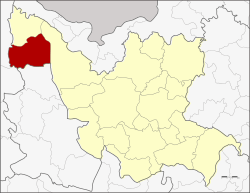 District location in Udon Thani Province | |
| Coordinates: 17°46′14″N 102°11′23″E | |
| Country | Thailand |
| Province | Udon Thani |
| Seat | Ban Yuak |
| Area | |
| • Total | 742.129 km2 (286.538 sq mi) |
| Population (2005) | |
| • Total | 55,622 |
| • Density | 74.9/km2 (194/sq mi) |
| Time zone | UTC+7 (ICT) |
| Postal code | 41210 |
| Geocode | 4118 |
Geography
Neighboring districts are (from the north clockwise) Na Yung, Ban Phue of Udon Thani Province, Suwannakhuha of Nong Bua Lamphu Province, and Pak Chom of Loei Province. Na Yung-Nam Som National Park lies within the district's boundaries.
History
The minor district (king amphoe) was created on 12 May 1969, when the two tambons Nam Som and Na Yung were split off from Ban Phue District.[1] The third tambon Nong Waeng was added on 4 July 1969.[2] The minor district was upgraded to a full district on 1 April 1974.[3]
Administration
The district is divided into seven sub-districts (tambons), which are further subdivided into 80 villages (mubans). There are two townships (thesaban tambons). Na Ngua covers parts of tambons Na Ngua and Si Samran; Nam Som cover parts of tambons Nam Som and Si Samran. There are a further seven tambon administrative organizations (TAO).
| No. | Name | Thai name | Villages | Pop. | |
|---|---|---|---|---|---|
| 1. | Na Ngua | นางัว | 10 | 8,848 | |
| 2. | Nam Som | น้ำโสม | 16 | 10,860 | |
| 5. | Nong Waeng | หนองแวง | 13 | 8,061 | |
| 6. | Ban Yuak | บ้านหยวก | 15 | 9,307 | |
| 7. | Som Yiam | โสมเยี่ยม | 6 | 4,215 | |
| 10. | Si Samran | ศรีสำราญ | 12 | 8,567 | |
| 12. | Samakkhi | สามัคคี | 8 | 5,764 |
Missing numbers are tambon which now form Na Yung District.
References
- ประกาศกระทรวงมหาดไทย เรื่อง แบ่งท้องที่ตั้งเป็นกิ่งอำเภอ (PDF). Royal Gazette (in Thai). 86 (44 ง): 1728. May 20, 1969.
- ประกาศกระทรวงมหาดไทย เรื่อง แก้ไขประกาศแบ่งท้องที่ตั้งเป็นกิ่งอำเภอ (PDF). Royal Gazette (in Thai). 86 (67 ง): 2277. July 22, 1969.
- พระราชกฤษฎีกาตั้งอำเภอเขาวง อำเภอเชียงม่วน อำเภอดอนตาล อำเภอชาติตระการ อำเภอภูเรือ อำเภอเคียนซา อำเภอน้ำโสม อำเภอหนองวัวซอ และอำเภอน้ำยืน พ.ศ. ๒๕๑๗ (PDF). Royal Gazette (in Thai). 91 (54 ก special issue): 30–33. March 28, 1974.