Myrtleford
Myrtleford is a town in northeast Victoria, Australia, 280 km (170 miles) northeast of Melbourne and 46 km (29 miles) southeast of Wangaratta. Myrtleford is part of the Alpine Shire local government area and in 2016 the town had a population of 3,193.[1]
| Myrtleford Victoria | |||||||||
|---|---|---|---|---|---|---|---|---|---|
 Myrtleford | |||||||||
 Myrtleford | |||||||||
| Coordinates | 36°33′0″S 146°43′0″E | ||||||||
| Population | 3,193 (2016 census)[1] | ||||||||
| Established | 1858 | ||||||||
| Postcode(s) | 3737 | ||||||||
| Elevation | 223 m (732 ft) | ||||||||
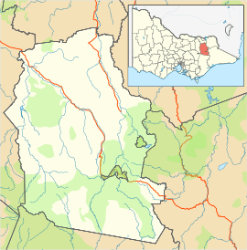
| Location |
| ||||||||
| LGA(s) | Alpine Shire | ||||||||
| State electorate(s) | Ovens Valley | ||||||||
| Federal Division(s) | Indi | ||||||||
| |||||||||
History
The post office opened on 26 July 1858 as Myrtle Creek and was renamed Myrtleford in 1871.[2] The road through Myrtleford was then called the Buckland Road, today it is known as the Great Alpine Road.
Sports
Myrtleford Football Club compete in the Ovens & Murray Football League.[3]
Myrtleford Savoy SC[4] is a soccer club who compete in the Albury Wodonga Football Association. They are based at Savoy Park.
Features
The rich soil of the region is known for its fresh local produce including vegetables, berries, nuts and olives. Myrtleford is also quite famous for its vineyards spread across the Alpine Valleys wine region which includes production of Italian Michelini Wines and Gapsted Wines. The area has abundant greenery in the form of parks such as the Jubilee Park and Rotary Park.[5]
Climate
Myrtleford has a temperate climate with more rain in winter than in summer and a high diurnal range throughout the year. Under the Köppen climate classification, the town has a subtropical highland (Cfb) climate.
| Climate data for Myrtleford | |||||||||||||
|---|---|---|---|---|---|---|---|---|---|---|---|---|---|
| Month | Jan | Feb | Mar | Apr | May | Jun | Jul | Aug | Sep | Oct | Nov | Dec | Year |
| Average high °C (°F) | 30.8 (87.4) |
30.0 (86.0) |
27.3 (81.1) |
21.8 (71.2) |
17.0 (62.6) |
13.5 (56.3) |
12.6 (54.7) |
14.5 (58.1) |
17.9 (64.2) |
20.9 (69.6) |
24.5 (76.1) |
28.5 (83.3) |
21.6 (70.9) |
| Average low °C (°F) | 11.7 (53.1) |
11.8 (53.2) |
9.3 (48.7) |
6.0 (42.8) |
4.1 (39.4) |
2.4 (36.3) |
2.1 (35.8) |
2.8 (37.0) |
3.8 (38.8) |
6.0 (42.8) |
8.0 (46.4) |
10.1 (50.2) |
6.5 (43.7) |
| Average precipitation mm (inches) | 44.8 (1.76) |
47.8 (1.88) |
60.1 (2.37) |
61.3 (2.41) |
84.3 (3.32) |
104.1 (4.10) |
106.5 (4.19) |
102.0 (4.02) |
83.2 (3.28) |
91.0 (3.58) |
59.6 (2.35) |
60.1 (2.37) |
905.2 (35.64) |
| Average precipitation days | 5.0 | 4.6 | 5.8 | 6.9 | 10.0 | 12.1 | 13.3 | 13.3 | 11.1 | 10.5 | 7.3 | 6.5 | 106.4 |
| Average relative humidity (%) | 32 | 37 | 42 | 48 | 62 | 68 | 68 | 59 | 54 | 51 | 44 | 35 | 50 |
| Source: [6] | |||||||||||||
Notable residents
- Gary Ablett Snr, Australian Rules footballer.
- Cris Bonacci, Musician, Producer
- Merv Hughes, Australian Cricketer.
- Sam Kekovich, Australian Rules footballer.
- Alby Lowerson, WWI Victoria Cross recipient.
- Steve Mautone, retired professional football association goalkeeper.[7]
- Chloe McConville, Australian racing cyclist and former cross-country skier.[8]
- Malcolm Milne, olympic skier.
- Ross Milne, olympic skier.
- Guy Rigoni, Australian Rules footballer.
- Jack Crisp, Australian rules footballer
References
- "2016 Census QuickStats Myrtleford". Australian Bureau of Statistics. Retrieved 12 January 2019.
- Premier Postal History, Post Office List, retrieved 11 April 2008
- Full Points Footy, Myrtleford, archived from the original on 6 April 2008, retrieved 25 July 2008
- https://www.facebook.com/myrtlefordsoccer/
- "General information". Travel Victoria.
- "Climate statistics for". Bureau of Meteorology. Retrieved 18 January 2014.
- Steve Mautone
- "High Performance > Rider Profiles > Female > Chloe McConville". Cycling Australia. Archived from the original on 20 June 2015. Retrieved 19 June 2015.
External links
![]()