Mylo, North Dakota
Mylo is a city in Rolette County, North Dakota, United States. The population was 20 at the 2010 census.[5]
Mylo, North Dakota | |
|---|---|
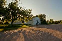 Post office in Mylo | |
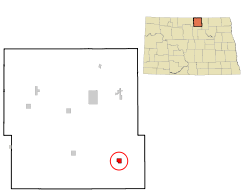 Location of Mylo, North Dakota | |
| Coordinates: 48°38′9″N 99°37′6″W | |
| Country | United States |
| State | North Dakota |
| County | Rolette |
| Area | |
| • Total | 0.91 sq mi (2.36 km2) |
| • Land | 0.91 sq mi (2.36 km2) |
| • Water | 0 sq mi (0 km2) |
| Elevation | 1,657 ft (505 m) |
| Population | |
| • Total | 20 |
| • Estimate (2018)[3] | 21 |
| • Density | 22/sq mi (8.5/km2) |
| Time zone | UTC-6 (Central (CST)) |
| • Summer (DST) | UTC-5 (CDT) |
| ZIP code | 58353 |
| Area code(s) | 701 |
| FIPS code | 38-55220 |
| GNIS feature ID | 1030349[4] |
Geography
Mylo is located at 48°38′9″N 99°37′6″W (48.635874, -99.618277).[8]
According to the United States Census Bureau, the city has a total area of 0.91 square miles (2.36 km2), all of it land.[1]
Demographics
| Historical population | |||
|---|---|---|---|
| Census | Pop. | %± | |
| 1910 | 98 | — | |
| 1920 | 140 | 42.9% | |
| 1930 | 134 | −4.3% | |
| 1940 | 89 | −33.6% | |
| 1950 | 110 | 23.6% | |
| 1960 | 103 | −6.4% | |
| 1970 | 51 | −50.5% | |
| 1980 | 31 | −39.2% | |
| 1990 | 20 | −35.5% | |
| 2000 | 19 | −5.0% | |
| 2010 | 20 | 5.3% | |
| Est. 2018 | 21 | [3] | 5.0% |
| U.S. Decennial Census[9] 2018 Estimate[10] | |||
2010 census
At the 2010 census there were 20 people in 9 households, including 4 families, in the city. The population density was 22.0 inhabitants per square mile (8.5/km2). There were 12 housing units at an average density of 13.2 per square mile (5.1/km2). The racial makeup of the city was 95.0% White and 5.0% Native American.[2] Of the 9 households 22.2% had children under the age of 18 living with them, 44.4% were married couples living together, and 55.6% were non-families. 44.4% of households were one person and 22.2% were one person aged 65 or older. The average household size was 2.22 and the average family size was 3.50.
The median age was 45.5 years. 30% of residents were under the age of 18; 0.0% were between the ages of 18 and 24; 20% were from 25 to 44; 40% were from 45 to 64; and 10% were 65 or older. The gender makeup of the city was 50.0% male and 50.0% female.
2000 census
At the 2000 census, there were 19 people in 10 households, including 7 families, in the city. The population density was 21.0 people per square mile (8.2/km²). There were 14 housing units at an average density of 15.5 per square mile (6.0/km²). The racial makeup of the city was 100% White.
Of the 10 households 10.0% had children under the age of 18 living with them, 70.0% were married couples living together, none had a female householder with no husband present, and 30.0% were non-families. 30.0% of households were one person and 30.0% were one person aged 65 or older. The average household size was 1.90 and the average family size was 2.29.
The age distribution was 10.5% under the age of 18, 5.3% from 18 to 24, 15.8% from 25 to 44, 31.6% from 45 to 64, and 36.8% 65 or older. The median age was 60 years. For every 100 females, there were 137.5 males. For every 100 females age 18 and over, there were 112.5 males.
The median household income was $28,750 and the median family income was $45,000. Males had a median income of $31,250 versus $28,750 for females. The per capita income for the city was $23,279. None of the families and 8.3% of the population were below the poverty line, including none of those under the age of 18 and 100.0% of those 65 and older.
References
- "US Gazetteer files 2010". United States Census Bureau. Archived from the original on February 20, 2011. Retrieved June 14, 2012.
- "U.S. Census website". United States Census Bureau. Retrieved June 14, 2012.
- "Population and Housing Unit Estimates". Retrieved September 30, 2019.
- "US Board on Geographic Names". United States Geological Survey. October 25, 2007. Retrieved January 31, 2008.
- "2010 Census Redistricting Data (Public Law 94-171) Summary File". American FactFinder. United States Census Bureau. Retrieved May 2, 2011.
- "Explain Origin of All County Towns". Turtle Mountain Star. September 5, 1940. p. 7. Retrieved May 2, 2015.
- "Rolette County". Jim Forte Postal History. Retrieved February 14, 2015.
- "US Gazetteer files: 2010, 2000, and 1990". United States Census Bureau. February 12, 2011. Retrieved April 23, 2011.
- United States Census Bureau. "Census of Population and Housing". Retrieved January 19, 2014.
- "Population Estimates". United States Census Bureau. Retrieved September 30, 2019.
Municipalities and communities of Rolette County, North Dakota, United States | ||
|---|---|---|
| Cities |  Map of North Dakota highlighting Rolette County | |
| Townships |
| |
| CDPs | ||
| Unorganized territories |
| |
| Unincorporated communities | ||
| Indian reservation | ||
| Footnotes | ‡This populated place also has portions in an adjacent county or counties | |
| Authority control |
|
|---|