Murayama, Yamagata
Murayama (村山市, Murayama-shi) is a city located in Yamagata Prefecture, Japan. As of 1 February 2020, the city had an estimated population of 23,643 in 8133 households,[1] and a population density of 120 persons per km². The total area of the city is 196.98 square kilometres (76 sq mi).is
Murayama 村山市 | |
|---|---|
 Murayama City Hall | |
 Flag  Seal | |
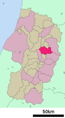 Location of Murayama in Yamagata Prefecture | |
 Murayama | |
| Coordinates: 38°29′N 140°23′E | |
| Country | Japan |
| Region | Tōhoku |
| Prefecture | Yamagata |
| Area | |
| • Total | 196.98 km2 (76.05 sq mi) |
| Population (October 2015) | |
| • Total | 23,643 |
| • Density | 120/km2 (310/sq mi) |
| Time zone | UTC+9 (Japan Standard Time) |
| - Tree | Japanese Red Pine |
| - Flower | Rose |
| Phone number | 0237-55-2111 |
| Address | 1-3-6 Chūō, Murayama-shi, Yamagata-ken 995-8666 |
| Website | Official website |
Geography
Murayama is located in northeast Yamagata Prefecture, in a river valley of the Mogami River, with branches of the Ōu Mountains to the east and west.
Demographics
Per Japanese census data,[2] the population of Murayama has gradually been decreasing over the past 50 years.
| Historical population | ||
|---|---|---|
| Year | Pop. | ±% |
| 1920 | 30,731 | — |
| 1930 | 34,761 | +13.1% |
| 1940 | 35,751 | +2.8% |
| 1950 | 41,950 | +17.3% |
| 1960 | 38,959 | −7.1% |
| 1970 | 34,130 | −12.4% |
| 1980 | 32,324 | −5.3% |
| 1990 | 31,589 | −2.3% |
| 2000 | 29,586 | −6.3% |
| 2010 | 26,820 | −9.3% |
Climate
Murayama has a Humid continental climate (Köppen climate classification Dfa) with large seasonal temperature differences, with warm to hot (and often humid) summers and cold (sometimes severely cold) winters. Precipitation is significant throughout the year, but is heaviest from August to October. The average annual temperature in Murayama is 11.4 °C. The average annual rainfall is 1546 mm with September as the wettest month. The temperatures are highest on average in August, at around 25.1 °C, and lowest in January, at around -1.2 °C.[3]
History
The area of present-day Murayama was part of ancient Dewa Province. After the start of the Meiji period, the area became part of Kitamurayama District, Yamagata Prefecture. The town of Tateoka was established with the establishment of the modern municipalities system on April 1, 1889. The city of Murayama was established on April 1, 1954 with the merger of Tateoka with the villages of Nishigo, Okura, Tozawa, Okubo and Fumoto.
Government
Higashine has a mayor-council form of government with a directly elected mayor and a unicameral city legislature of 16 members. The city contributes one member to the Yamagata Prefectural Assembly. In terms of national politics, the city is part of Yamagata District 2 of the lower house of the Diet of Japan.
Economy
The economy of Murayama is based on agriculture.
Education
Murayama has eight public elementary schools and two public middle schools operated by the city government and two public high schools operated by the Yamagata Prefectural Board of Education
Transportation
Highway
.png)


International relations
Noted people from Murayama
- Mogami Tokunai, Edo period samurai and explorer
- Tōru Murakawa, movie director
References
External links
![]()
- Official Website (in Japanese)
Yamagata (capital) | ||
| Core city | ||
| Cities | ||
| Districts | ||
| Authority control |
|
|---|