Munno Para West, South Australia
Munno Para West is a northern suburb of Adelaide, South Australia. It is within the City of Playford.
| Munno Para West Adelaide, South Australia | |||||||||||||||
|---|---|---|---|---|---|---|---|---|---|---|---|---|---|---|---|
 Munno Para West | |||||||||||||||
| Coordinates | 34.659°S 138.666°E | ||||||||||||||
| Population | 5,909 (2016 census)[1] | ||||||||||||||
| Postcode(s) | 5115 | ||||||||||||||
| LGA(s) | City of Playford | ||||||||||||||
| State electorate(s) | Light[2] | ||||||||||||||
| Federal Division(s) | Spence | ||||||||||||||
| |||||||||||||||
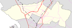
Munno Para west is bounded by Max Fatchen Expressway on the west, Curtis Road to the south, Stebonheath Road to the east and a line parallel to Fradd Road but north of the Almond Grove housing estate to the north. The boundaries were adjusted in June 2011 to ensure that the new expressway did not divide the suburb.[3]
References
- Australian Bureau of Statistics (27 June 2017). "Munno Para West". 2016 Census QuickStats. Retrieved 5 February 2018.

- "District of Napier Background Profile". Electoral Commission of South Australia, Government of South Australia. 29 April 2014. Retrieved 8 April 2016.
- "Placename Details: Munno Para West". Property Location Browser. Government of South Australia. 15 September 2011. SA0047832. Archived from the original on 12 October 2016. Retrieved 17 December 2015.
This article is issued from Wikipedia. The text is licensed under Creative Commons - Attribution - Sharealike. Additional terms may apply for the media files.