Mullaghduff, County Cavan
Mullaghduff (Irish: Mullach Dubh) is a townland in the Parish of Tomregan, Barony of Tullyhaw, County Cavan, Ireland.
Etymology
The townland name is an anglicisation of the Gaelic placename ‘Mullach Dubh’ which means "The Black Hilltop", which probably derives from the blackish soil which covers the hill. The 1609 Ulster Plantation map spells the name as Mulladuff.[1] A 1610 grant spells the name as Mullaghduffe. A 1630 Inquisition spells it as Mullaghduffe. The 1641 Rebellion Depositions as Mullaighduffe, the 1652 Commonwealth Survey as Mullaghduffe and the 1659 Down Survey map spells it as Mullaghduffe.[2] A 1666 grant spells it as Mullaghduffe. William Petty's 1685 map spells it as Mulladuf.[3]
Geography
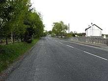
It is bounded on the north by Annagh and Corranierna townlands, on the west by Cullyleenan and Agharaskilly townlands, on the south by Cavanagh (townland) and on the east by Cranaghan townland. Its chief geographical features are Killywilly Lough on its eastern boundary and a central drumlin hill which rises to 309 feet above sea level. Mullaghduff is traversed by the N87 road (Ireland), the L1505 Yellow road, Murray's Lane and by the disused Cavan & Leitrim Railway. The townland covers 253 statute acres, including three acres of water.
History
In the Plantation of Ulster by grant dated 23 June 1610, along with other lands, King James VI and I granted two polls in Mullaghduffe to Hugh Culme, esquire, as part of the Manor of Calva.[4] Culme then surrendered his interest in Mullaghduff to Walter Talbot of Ballyconnell. Walter Talbot died on 26 June 1625 at Ballyconnell and his son James Talbot succeeded to the Mullaghduff lands aged just 10 years. An Inquisition held in Cavan Town on 20 September 1630 stated that Walter Talbot's lands included two polls in Mullaghduffe.[5] James Talbot married Helen Calvert, the daughter of George Calvert, 1st Baron Baltimore of Maryland, USA, in 1635 and had a son Colonel George Talbot who owned an estate in Cecil County, Maryland which he named Ballyconnell in honour of his native town in Cavan. George Talbot was appointed Surveyor-General of Maryland in 1683. In the aftermath of the Irish Rebellion of 1641, James Talbot's estate in Ballyconnell was confiscated in the Cromwellian Act for the Settlement of Ireland 1652 because he was a Catholic and he was granted an estate in 1655 at Castle Rubey, County Roscommon instead. He died in 1687.
By 1652 the Irish rebels in the Ballyconnell area had been defeated and the area was put under the control of the Cromwellian captain Thomas Gwyllym. He was a native of Glenavy, County Antrim where his father, Rev. Meredith Gwyllym, was vicar of the parishes of Glenavy, Camlin, Tullyrusk, Ballinderry & Magheragall from 1622 until sometime after 1634.[6] Gwyllym's name first appears in the area as the owner in the 1652 Commonwealth Survey, which lists the townland as belonging to Captain Gwilliams. Gwyllym was also a Cavan Commissioner in the 1660 Hearth Money Ordinances and in the 1664 Hearth Money Rolls he has five hearths in Ballyconnell. After the restoration of King Charles II to the throne in 1660, James Talbot tried to have the Ballyconnell estate restored to him but a final grant was made to Thomas Gwyllym in August 1666[7], which included 210 acres of profitable land and 10 acres-2 roods of unprofitable land in Mullaghduffe alias Cloghane alias Cormerin, so at that time it was merged with Corranierna townland. Thomas Gwyllym died in 1681 and his son Colonel Meredith Gwyllym inherited the Ballyconnell estate, including Mullaghduff.
The Gwyllym estate was sold for £8,000 in 1724 to Colonel Alexander Montgomery (1686–1729) of Convoy House, County Donegal, M.P. for Donegal Borough 1725 to 1727 & for Donegal County 1727 to 1729. He died in 1729 and left the Ballyconnell estate to his nephew George Leslie who then assumed the name George Leslie Montgomery. George Leslie Montgomery was M.P. for Strabane, County Tyrone from 1765 to 1768 and for County Cavan from 1770 to 1787, when he died and left the Ballyconnell estate to his son George Montgomery, whose estate was administered by the Court of Chancery as he was a lunatic.[8] and descended as part of the Ballyconnell estate since then. George Montgomery died in 1841 and his estate went to his Enery cousins of Bawnboy. In 1856 they sold the estate to take advantage of its increased value owing to the opening of the Woodford Canal through the town in the same year. The estate, including Mullaghduff, was split up among different purchasers and maps & details of previous leases of the sold parts are still available.[9]
Four deeds relating to land transactions in Mullaghduff in 1749 are now in the Farnham Papers[10] held in the National Library of Ireland (Collection List No. 95). They are described as-
Lease for one year from Robert King to William Lennox of Mullaghduff in the barony of Tullyhaw and Ardarragh and other lands in the barony of Tullyhunco. 1749 Mar. 5
Conveyance of mortgage from Robert King to William Lennox secured by Mullaghduff in the barony of Tullyhaw and Ardarragh and other lands in the barony of Tullyhunco. 1749 Mar. 6.
Lease for one year from Mrs. Mary Carmichael to Robert King of Mullaghduff in the barony of Tullyhaw and Ardarragh and other lands in the barony of Tullyhunco. 1749 May 1.
Mortgage between Mrs. Mary Carmichael and Robert King secured by Mullaghduff in the barony of Tullyhaw and Ardarragh and other lands in the barony of Tullyhunco in consideration of the sum of £400. 1749 May 2.
The Tithe Applotment Books for 1827 list the following tithepayers in the townland- Moore, Gallagher, Whitely, Sturdy, Sheridan, Taylor, Quinn, Reilly, Graham, Gerty, Watt, Baxter, Matthews, O'Brien.[11]
The Ordnance Survey Name Books for 1836 give the following description of the townland- Mullach Dubh which means Black Summit. This was in old times considered a part of Cavans & in patent called Cavan Mullaghduff. Property of Montgomery. Rent from 14 shillings to £1 per arable acre. Gravelly soil. Stone houses. Crops are oats, rye, flax and potatoes. Road in good repair. Inhabitants are comfortable.
The Mullaghduff Valuation Office books are available for 1840.[12][13]
Griffith's Valuation of 1857 lists the landlord of the townland as Netterfield and the tenants as Cochrane, Quinn, Fallon, Moore, Faris, McGinn, Reilly, Graham, Gallahar and Roe.[14]
Census
| Year | Population | Males | Females | Total Houses | Uninhabited |
|---|---|---|---|---|---|
| 1841 | 87 | 44 | 43 | 18 | 0 |
| 1851 | 54 | 26 | 28 | 9 | 0 |
| 1861 | 40 | 17 | 23 | 9 | 1 |
| 1871 | 27 | 15 | 12 | 7 | 0 |
| 1881 | 31 | 20 | 11 | 5 | 0 |
| 1891 | 22 | 12 | 10 | 4 | 0 |
In the 1901 census of Ireland, there are six families listed in the townland.[15]
In the 1911 census of Ireland, there were seven families in the townland.[16]
Antiquities
The only items of historical interest are the disused Cavan & Leitrim Railway and a sandpit.
References
- "The Baronie of Tollagh Aghe". 14 May 2018 – via Flickr.
- "Down Survey Maps | The Down Survey Project". downsurvey.tcd.ie.
- "Down Survey Maps | The Down Survey Project". downsurvey.tcd.ie.
- Chancery, Ireland (11 April 1800). "Calendar of the Patent Rolls of the Chancery of Ireland". A. Thom – via Google Books.
- "Inquisitionum in Officio Rotulorum Cancellariae Hiberniae Asservatarum Repertorium". command of his majesty King George IV. In pursuance of an address of the house of Commons of Great Britain (an Ireland). 11 April 1829 – via Google Books.
- "Glenavy History". Archived from the original on 16 October 2009.
- "Commissioners of Public Records in Ireland : fourteenth and fifteenth reports with appendix, 1824-25". HMSO. 11 April 1825 – via Internet Archive.
- The Pursuit of the Heiress: Aristocratic Marriage in Ireland 1740-1840 By A. P. W. Malcomson.
- Tithe Applotment Books 1827
- "Valuation Office Books". census.nationalarchives.ie.
- "Griffith's Valuation". www.askaboutireland.ie.
- Census of Ireland 1901
- Census of Ireland 1911
External links
Places in County Cavan | ||
|---|---|---|
| Towns |  | |
| Villages |
| |
| Townlands | ||
| ||