Corranierna
Corranierna is a townland in the Parish of Tomregan, Barony of Tullyhaw, County Cavan, Ireland. (Disambiguation see also- Corranierna (Corlough) townland, County Cavan, Republic of Ireland.)
Etymology
The townland name is an anglicisation of either (1) Cor an Iarna, meaning ‘The Hill of the Skein (of thread)’, which derived its name from the weavers who lived there. In the Dúchas Schools' Collection at [1] there is an account of a flax mill in Corranierna, or (2) The local pronunciation however is Corrnernyah which seems to indicate a different meaning Cor na nAirchinneach, meaning 'The Hill of the Erenagh'. On the 1609 Ulster Plantation map it is named Claghan (Gaelic ‘Clochán’ meaning a small beehive-shaped stone house).[2] A 1610 grant spells the name as Cloghane. A 1630 Inquisition spells it as Cloughan. In the Commonwealth Survey of 1652 it was named as Clioghan. By the Down Survey of 1655 it was merged into Mullaghduff townland where the combined townland was called ‘Mullaghduffe alias Cloghane alias Cornerin’. A 1666 grant spells it as Mullaghduffe alias Cloghane alias Cormerin. By 1687 Corranierna again existed as a separate townland.
Geography
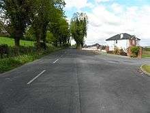
It is bounded on the north & west by Annagh townland, on the east by Killywilly townland and on the south by Mullaghduff townland. Its chief geographical features are Annagh Lough, Killywilly Lough, two chalybeate wells and some drumlin hills reaching an altitude of 234 feet (71 m) above sea-level. The townland is traversed by the L1505 Yellow Road, Killywilly Lane, some minor lanes and the disused Cavan and Leitrim Railway. Corranierna covers an area of 180 statute acres, including 26 acres (110,000 m2) of water.
History
In the Plantation of Ulster by grant dated 23 June 1610, along with other lands, King James VI and I granted one poll in Cloghane to Hugh Culme, esquire, as part of the Manor of Calva.[3] Culme then surrendered his interest in Corranierna to Walter Talbot of Ballyconnell. Walter Talbot died on 26 June 1625 at Ballyconnell and his son James Talbot succeeded to the Corranierna lands aged just 10 years. An Inquisition held in Cavan Town on 20 September 1630 stated that Walter Talbot's lands included one poll in Cloughan.[4] James Talbot married Helen Calvert, the daughter of George Calvert, 1st Baron Baltimore of Maryland, USA, in 1635 and had a son Colonel George Talbot who owned an estate in Cecil County, Maryland which he named Ballyconnell in honour of his native town in Cavan. George Talbot was appointed Surveyor-General of Maryland in 1683. In the aftermath of the Irish Rebellion of 1641, James Talbot's estate in Ballyconnell was confiscated in the Cromwellian Act for the Settlement of Ireland 1652 because he was a Catholic and he was granted an estate in 1655 at Castle Rubey, County Roscommon instead. He died in 1687.
By 1652 the Irish rebels in the Ballyconnell area had been defeated and the area was put under the control of the Cromwellian captain Thomas Gwyllym. He was a native of Glenavy, County Antrim where his father, Rev. Meredith Gwyllym, was vicar of the parishes of Glenavy, Camlin, Tullyrusk, Ballinderry & Magheragall from 1622 until sometime after 1634.[5] Gwyllym's name first appears in the area as the owner in the 1652 Commonwealth Survey, which lists the townland as belonging to Captain Gwilliams. Gwyllym was also a Cavan Commissioner in the 1660 Hearth Money Ordinances and in the 1664 Hearth Money Rolls he has five hearths in Ballyconnell. After the restoration of King Charles II to the throne in 1660, James Talbot tried to have the Ballyconnell estate restored to him but a final grant was made to Thomas Gwyllym in August 1666,[6] which included 210 acres of profitable land and 10 acres-2 roods of unprofitable land in Mullaghduffe alias Cloghane alias Cormerin, so at that time it was merged with Mullaghduff townland. Thomas Gwyllym died in 1681 and his son Colonel Meredith Gwyllym inherited the Ballyconnell estate, including Corranierna.
The Gwyllym estate was sold for £8,000 in 1724 to Colonel Alexander Montgomery (1686–1729) of Convoy House, County Donegal, M.P. for Donegal Borough 1725 to 1727 & for Donegal County 1727 to 1729. He died in 1729 and left the Ballyconnell estate to his nephew George Leslie who then assumed the name George Leslie Montgomery. George Leslie Montgomery was M.P. for Strabane, County Tyrone from 1765 to 1768 and for County Cavan from 1770 to 1787, when he died and left the Ballyconnell estate to his son George Montgomery, whose estate was administered by the Court of Chancery as he was a lunatic.[7] and descended as part of the Ballyconnell estate since then. George Montgomery died in 1841 and his estate went to his Enery cousins of Bawnboy. In 1856 they sold the estate to take advantage of its increased value owing to the opening of the Woodford Canal through the town in the same year. The estate, including Corranierna, was split up among different purchasers and maps & details of previous leases of the sold parts are still available.[8]
The Tithe Applotment Books for 1827 list the following tithepayers in the townland-Garvey, Fitzpatrick, Reilly, McCormick, Grimes.[9]
In 1829 a Sunday school was kept in the townland, funded by the Hibernian Sunday School Society.[10]
The 1836 Ordnance Survey Namebooks describe it as- Soil white gravelly clay of middling quality. About 45 acres of bog and 23 acres of water.
The Corranierna Valuation Office books are available for February 1840.[11][12]
Griffith's Valuation of 1857 lists the landlord of the townland as the Roe Estate & the tenants as Fitzpatrick, Roe, Reilly, Sheridan, Lomus, Cochrane, McGarvey, Smith, Kennedy, McCormack, Cassidy and Graham.[13]
Census
| Year | Population | Males | Females | Total Houses | Uninhabited |
|---|---|---|---|---|---|
| 1841 | 160 | 79 | 81 | 29 | 0 |
| 1851 | 113 | 58 | 55 | 23 | 0 |
| 1861 | 88 | 48 | 40 | 22 | 0 |
| 1871 | 86 | 49 | 37 | 21 | 0 |
| 1881 | 76 | 42 | 34 | 23 | 0 |
| 1891 | 70 | 36 | 34 | 20 | 0 |
A rare surviving page from the 1851 Census of Ireland lists the household of Michael Reilly of Corranierna.[14]
In the 1901 census of Ireland, there are sixteen families listed in the townland.[15]
In the 1911 census of Ireland, there are seventeen families listed in the townland.[16]
Antiquities
The only historic site in the townland is the disused Cavan and Leitrim Railway.
References
- "Ballyconnell (B.) | The Schools' Collection". dúchas.ie.
- "The Baronie of Tollagh Aghe". 14 May 2018 – via Flickr.
- Chancery, Ireland (11 April 1800). "Calendar of the Patent Rolls of the Chancery of Ireland". A. Thom – via Google Books.
- "Inquisitionum in Officio Rotulorum Cancellariae Hiberniae Asservatarum Repertorium". command of his majesty King George IV. In pursuance of an address of the house of Commons of Great Britain (an Ireland). 11 April 1829 – via Google Books.
- "Glenavy History". Archived from the original on 16 October 2009.
- "Commissioners of Public Records in Ireland : fourteenth and fifteenth reports with appendix, 1824-25". HMSO. 11 April 1825 – via Internet Archive.
- The Pursuit of the Heiress: Aristocratic Marriage in Ireland 1740-1840 By A. P. W. Malcomson.
- Tithe Applotment Books 1827
- society, Hibernian Sunday school (11 April 1818). "The report of the Hibernian Sunday school society for 1810 (-1837)" – via Google Books.
- Griffith’s Valuation 1857
- Census of Ireland 1901
- Census of Ireland 1911