Mull of Kintyre
The Mull of Kintyre is the southwesternmost tip of the Kintyre Peninsula (formerly Cantyre) in southwest Scotland. From here, the Antrim coast of Northern Ireland is visible on a calm and clear day, and an historic lighthouse, the second commissioned in Scotland, guides shipping in the intervening North Channel. The area has been immortalised in popular culture by the 1977 hit song "Mull of Kintyre" by Kintyre resident Paul McCartney's band of the time, Wings.
Mull of Kintyre
| |
|---|---|
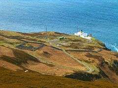 Mull of Kintyre Lighthouse | |
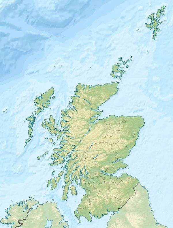
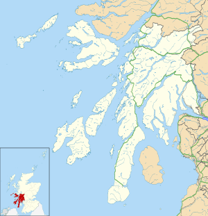 Mull of Kintyre Location within Argyll and Bute | |
| OS grid reference | NR5908 |
| Civil parish |
|
| Council area | |
| Lieutenancy area | |
| Country | Scotland |
| Sovereign state | United Kingdom |
| Post town | Campbeltown |
| Postcode district | PA28 |
| Dialling code | 01586 |
| Police | Scotland |
| Fire | Scottish |
| Ambulance | Scottish |
| UK Parliament | |
| Scottish Parliament | |
Etymology
The name is an anglicisation of the Gaelic Maol Chinn Tìre (Scottish Gaelic pronunciation: [mɯːl̪ˠ çiɲˈtʲʰiːɾʲə]), in English: "The rounded [or bare] headland of Kintyre", where chinn and tìre are the genitive forms of ceann head and tìr land, country respectively. The English variant Cantyre derives from the phrase ceann tìre [kʲʰaɲˈtʲʰiːɾʲə] "head land".
Mull as a geographical term is most commonly found in southwest Scotland, where it is often applied to headlands or promontories, and, often more specifically, for the tip of that promontory or peninsula.
The term mull derives from Scottish Gaelic: maol "bald, bare, baldness, bareness".[1][2] The geographical reference is to a land formation bare of trees, such as a rounded hill, summit, mountain, promontory or headland.
Geography
The Mull is at the extreme southwestern tip of the Kintyre peninsula, approximately 10 miles (16 kilometres) from Campbeltown in Argyll and Bute, Western Scotland. It is about 8 miles (13 kilometres) beyond the southernmost village of the peninsula, Southend with its tea room and beaches, and reached via a single-track road.[3]


Ailsa Craig and the County Antrim coast of Ulster and Rathlin Island are all clearly visible from the Mull. On clearer days it is also possible to make out Malin Head in Inishowen in County Donegal in the west of Ulster, and the Ayrshire coast on the other side of Ailsa Craig. Other islands in the Firth of Clyde are also visible when looking east, especially from further back along the single track road from Southend village. The Straits of Moyle (part of the North Channel) allow sea passage from the Irish Sea to the Atlantic Ocean. Notoriously strong currents plague the tip of the Kintyre Peninsula creating a hazard to unmotorised craft and virtually impossible for distance swimmers.[4][5] At its closest point, mainland Ulster is 12 mi (19 km) from the Mull. Owing to the low elevation of Rathlin Island and the high elevation of the Mull of Kintyre it is also possible to see over the top of Rathlin Island to the Antrim coastal town of Ballycastle. Individual houses on the Antrim coast and cars travelling along the coast road can sometimes be seen without the aid of binoculars, visibility conditions depending.
History
The Mull has been an important landbridge throughout history. It is thought that it was used by early humans in their travels from continental Europe to Ireland via Britain. In more recent times it was used again by the Scotti when they travelled from Ireland to establish the kingdom of Dál Riata in modern-day Argyll.
Air crashes
The steep cliffs and hills rising out of the sea on all sides, along with the frequent sea mists, have made the area a hazard to flight. It has been the site of numerous air crashes throughout aviation history, and the remains of some of those crashed aircraft still litter the area.[6][7][8]
A notable air disaster on the Mull was the RAF Chinook helicopter crash on 2 June 1994.
Nautical disaster
On 13 June 1858 the SS New York, a steamship converted to sail, was wrecked at the south end of the Mull of Kintyre.[9]
Lighthouse
 Mull of Kintyre Lighthouse | |
 Scotland | |

| |
| Location | Kintyre peninsula Argyll and Bute Scotland United Kingdom |
|---|---|
| Coordinates | 55.310421°N 5.803254°W |
| Year first constructed | 1788 |
| Year first lit | 1820 (rebuilt) |
| Automated | 1996 |
| Construction | brick tower |
| Tower shape | cylindrical tower with balcony and lantern |
| Markings / pattern | white tower, ochre balcony, black lantern |
| Tower height | 12 m (39 ft) |
| Focal height | 91 m (299 ft) |
| Range | 24 nmi (44 km) |
| Characteristic | Fl (2) W 20s. |
| Admiralty number | A4272 |
| NGA number | 4244 |
| ARLHS number | SCO-145 |
| Managing agent | National Trust for Scotland[10] [11] |
The Mull of Kintyre Lighthouse was the second lighthouse commissioned in Scotland by the Commissioners of the Northern Lights. It was designed and built by Thomas Smith and completed in 1788.[12] Smith had previously designed the light at Kinnaird Head, but Mull of Kintyre was a far more substantial project, in a far more remote location.
The lighthouse was rebuilt in the 1820s. The light was fixed until 1906, when it was converted to flashing, and its power increased from 8,000 to 281,000 candelas.[12] It was converted to electrical power in 1976, automated in 1996 and is now monitored from Edinburgh.
The former keeper's cottages are now run as holiday cottages by the National Trust for Scotland.[13]
See also
- List of lighthouses in Scotland
- List of Northern Lighthouse Board lighthouses
- The Mull of Kintyre test - an apocryphal unofficial test by British regulators for the propriety of images of naked men in film.
- British Isles fixed sea link connections - which details infrastructure proposals involving the mull.
References
- "Mull". Online Etymology Dictionary. Retrieved 17 January 2011.
- ""maol" in Gaelic-English Dictionary". Clan MacRae Society of Canada. Archived from the original on 4 December 2010. Retrieved 17 January 2011.
- "Kintyre Guide". Kintyre tourist information. Archived from the original on 19 March 2011. Retrieved 17 January 2011.
- "Wayne Soutter makes history with North Channel swim". BBC News. BBC. 27 August 2012. Retrieved 27 August 2012.
- Chris, Kilpatrick (28 August 2012). "Superman Wayne on crest of a wave after historic sea swim". Belfast Telegraph. Independent News & Media. Retrieved 28 August 2012.
- "Armstrong Whitworth Whitley Mk.V P5041 of No.502 Squadron, RAF, flew into high ground above the long abandoned settlement at Balmavicar on the Mull of Kintyre on the 23rd January 1941". Peak District Air Accident Research. Retrieved 19 October 2015.
- "Bristol Beaufort N1180". Air Crash Sites Scotland. Gordon Lyons. Retrieved 19 October 2015.
- "Lockheed Neptune WX545". Air Crash Sites Scotland. Gordon Lyons. Archived from the original on 9 March 2016. Retrieved 19 October 2015.
- "Wrecksite – New York Passenger/cargo Ship 1854–1858".
- Mull of Kintyre The Lighthouse Directory. University of North Carolina at Chapel Hill. Retrieved 11 May 2016
- Mull of Kintyre Northern Lighthouse Board. Retrieved 11 May 2016
- "Mull of Kintyre". Northern Lighthouse Board. Retrieved 17 January 2011.
- "Lighthouse Accommodation". National Trust for Scotland. Retrieved 17 January 2011.
External links
| Wikimedia Commons has media related to Mull of Kintyre. |
| Authority control |
|
|---|