Mueang Rayong District
Mueang Rayong (Thai: เมืองระยอง, pronounced [mɯ̄a̯ŋ rā.jɔ̄ːŋ]) is the capital district (amphoe mueang) of Rayong Province, Thailand. The provincial administration is in Tambon Map Ta Phut.
Mueang Rayong เมืองระยอง | |
|---|---|
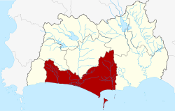 District location in Rayong Province | |
| Coordinates: 12°40′6″N 101°16′30″E | |
| Country | Thailand |
| Province | Rayong |
| Seat | Tha Pradu |
| Area | |
| • Total | 514.5 km2 (198.6 sq mi) |
| Population (2008) | |
| • Total | 229,657 |
| • Density | 410.3/km2 (1,063/sq mi) |
| Time zone | UTC+7 (ICT) |
| Postal code | 21000 |
| Geocode | 2101 |
Geography
Neighboring districts are (from the west clockwise) Ban Chang, Nikhom Phatthana, Ban Khai, Wang Chan, and Klaeng. To the south is the Gulf of Thailand.
The popular holiday island of Ko Samet, which is part of the Khao Laem Ya – Mu Ko Samet National Park, is in Mueang Rayong District.
Economy
The town of Map Ta Phut is in the western part of Mueang Rayong District. It is the site of the Map Ta Phut Industrial Estate, Thailand's largest petrochemical and heavy industry park.[1] It contributes to Rayong Province's economic output, but has also become known for scandals involving hazardous waste, industrial accidents, and pollution.
History
Originally named Mueang, the district was renamed after its central sub-district Tha Pradu (ท่าประดู่) in 1917. [2] In 1938 it was renamed "Mueang Rayong".[3]
Administration
The district is divided into 15 sub-districts (tambons), which are further subdivided into 86 villages (mubans). Rayong is a city (thesaban nakhon) which covers tambons Tha Pradu and Pak Nam and parts of tambons Choeng Noen and Noen Phra. The town (thesaban mueang) Map Ta Phut covers the whole tambon Map Ta Phut and Huai Pong, parts of Noen Phra and Thap Ma and also parts of tambon Mapkha of neighboring Nikhom Phatthana District. There are a further two sub-district municipalities (thesaban tambon). Klaeng Kachet covers parts of the tambon Klaeng and Kachet, and Ban Phe parts of tambon Phe. The remaining areas of the sub-districts Noen Phra and Thap Ma as well as the whole Nam Khok are also each a sub-district municipality. The other eight sub-districts each have a tambon administrative organization (TAO).
| No. | Name | Thai | Villages | Pop.[4] |
|---|---|---|---|---|
| 1. | Tha Pradu | ท่าประดู่ | - | 20,661 |
| 2. | Choeng Noen | เชิงเนิน | 7 | 41,429 |
| 3. | Taphong | ตะพง | 16 | 17,964 |
| 4. | Pak Nam | ปากน้ำ | - | 8,843 |
| 5. | Phe | เพ | 7 | 18,129 |
| 6. | Klaeng | แกลง | 7 | 11,094 |
| 7. | Ban Laeng | บ้านแลง | 7 | 6,676 |
| 8. | Na Ta Khwan | นาตาขวัญ | 6 | 6,293 |
| 9. | Noen Phra | เนินพระ | 7 | 29,659 |
| 10. | Kachet | กะเฉด | 10 | 7,056 |
| 11. | Thap Ma | ทับมา | 8 | 18,187 |
| 12. | Nam Khok | น้ำคอก | 4 | 4,450 |
| 13. | Huai Pong | ห้วยโป่ง | 1 | 14,280 |
| 14. | Map Ta Phut | มาบตาพุด | 1 | 19,746 |
| 15. | Samnak Thong | สำนักทอง | 5 | 5,190 |
See also
- Eastern Seaboard of Thailand
References
- "Map Ta Phut Port". Eastern Economic Corridor (EEC) Office. Retrieved 2 July 2019.
- ประกาศกระทรวงมหาดไทย เรื่อง เปลี่ยนชื่ออำเภอ (PDF). Royal Gazette (in Thai). 34 (0 ก): 40–68. 1917-04-29.
- พระราชกฤษฎีกาเปลี่ยนนามจังหวัด และอำเภอบางแห่ง พุทธศักราช ๒๔๘๑ (PDF). Royal Gazette (in Thai). 55 (0 ก): 658–666. 1938-11-14.
- "Population statistics 2008". Department of Provincial Administration. Archived from the original on 2009-05-30.