Moy, County Tyrone
The Moy (from Irish: an Maigh, meaning "the plain")[2][3] is a large village and townland in County Tyrone, Northern Ireland, United Kingdom about 5 miles (8 kilometres) southeast of Dungannon and beside the smaller village of Charlemont. Charlemont is on the east bank of the River Blackwater and Moy on the west; the two are joined by Charlemont Bridge. The river is also the boundary between County Tyrone and County Armagh. The 2011 Census recorded a population of 2,129.[4]
| The Moy | |
|---|---|
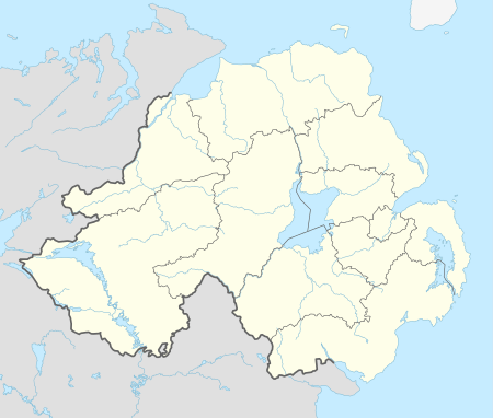 Location within Northern Ireland | |
| Population | 2,129 (2011 Census) |
| Irish grid reference | H7962 |
| District | |
| County | |
| Country | Northern Ireland |
| Sovereign state | United Kingdom |
| Post town | Dungannon |
| Postcode district | BT71 |
| Dialling code | 028 |
| UK Parliament | |
| NI Assembly | |
| Website | moyni.weebly.com |
History
Moy (mostly known by locals as "The Moy") was laid out in the 1760s for the Volunteer Earl – the patriot and aesthete James Caulfeild, 1st Earl of Charlemont (1728-1799) – opposite Charlemont Fort across the Blackwater. The formal rectangular market place, with lawns and horse-chestnut trees, was inspired by the square at Bosco Marengo in Lombardy, admired by the young earl during his grand tour of Europe. The houses lining the village square are mostly mid-18th century, though all four churches (Roman Catholic, Church of Ireland, Presbyterian and Methodist) are later. Moy used to hold a great horse fair, held once a month and lasting a whole week.
Moy had town commissioners under the Lighting of Towns (Ireland) Act, 1828 from 1844[5] until about 1865.[6]
The Troubles
Incidents in Moy during the Troubles resulting in two or more fatalities:
1973
- 5 August 1973 - Francis Mullen (59) and Bernadette Mullen (39), Catholic civilians, were found shot dead by the Ulster Volunteer Force at their farmhouse, near Moy.
1975
- 23 October 1975 - Peter McKearney (63) and Jane McKearney (58), both Catholic civilians, were shot dead by the Ulster Volunteer Force at their home, Listamlet, near Moy. A contemporary newspaper article reported that "[British] Army issue ammunition" had been used. The attack has been linked to the "Glenanne gang".[7]
1976
- 17 May 1976 - Robert Dobson (35) and Thomas Dobson (38), both Protestant civilians, were shot and killed by a non-specific republican group at their workplace, an egg packing factory in Dungannon Street, Moy.
1991
- December 1991 - Robin Farmer (19) Protestant civilian was murdered in his father's shop by republicans. He had returned home from university for Christmas.
1992
- 3 January 1992 - John McKearney (69) and Kevin McKearney (32), both Catholic civilians, were shot dead by the Ulster Volunteer Force at their butcher's shop, Moy. John McKearney died on 4 April 1992. They had been targeted because two of Kevin McKearney's brothers had been killed on IRA service and another was a former IRA hunger striker, serving time for his part in the murder of a UDR soldier.[8]
- 6 September 1992 - Charles Fox (63) and Teresa Fox (53), both Catholic civilians, were shot dead by the Ulster Volunteer Force at their home, Listamlet Road, near Moy. Their son, IRA volunteer Paddy Fox, was serving a 10-year prison sentence for possession of a bomb at the time.[9]
Former railway
The Portadown – Dungannon section of the Portadown, Dungannon and Omagh Junction Railway (PD&O) opened in 1858.[10] Its nearest station to Moy was optimistically called Trew and Moy, although it was at Trew Mount over 2 miles (3 kilometres) north of Moy. In 1876 the PD&O became part of the new Great Northern Railway.[11] The Ulster Transport Authority took over the line in 1958[12] and closed it in 1965.[13]
Places of interest
Moy features a cast-iron gate and screen set up in the 19th century to provide the grand entrance to the now-vanished Roxborough Castle. The richly modelled metalwork is thought by some to have been the work of the company of the celebrated Dublin iron-founder Richard Turner, best known for his conservatories in Dublin, Belfast and Kew Gardens. Turner designed a conservatory for the house c. 1850.[14]
Sport
Moy has a long history of horse riding and Gaelic games. Moy Tir Na nOg are current All Ireland Intermediate Club Champions 2018.
Schools
- Moy Regional Primary School
- St. John's Primary School, Moy
Demography
Moy is classified as a "Large Village" by the NI Statistics and Research Agency (NISRA) (i.e. with population between 2,000 and 5,000 people). On Census day 2011 there were 2,129 people living in Moy. Of these:
- 30.0% were aged under 18 years, with 23.0% aged 60 and over
- 51.0% of the population were male, with 49% female
- 82.0% were from a Catholic background, with 14.0% from a Protestant background
- 16% were from a foreign country
- 25.9% of people aged 18–75 were unemployed.
- 26% said their nationality was Northern Irish, 61% said their nationality was Irish, 6% said their nationality was British with 7% stating another nationality.
References
- "Ulstèr Merikay Fowk Pairk – Youngstèrs Wisin". National Museums Northern Ireland. Archived from the original on 11 October 2013. Retrieved 5 April 2017.
- "Placenames NI". Placenames NI. 20 January 2010. Archived from the original on 15 June 2012.
- "Placenames Database of Ireland". Logainm.ie. 13 December 2010. Retrieved 9 June 2012.
- Area Profile of Moy - Based on 2001 Census Retrieved 17 December 2011.
- Thom's Directory of Ireland. Alexander Thom. 1851. p. 193. Retrieved 24 August 2018.
- Listed in Statistics of the United Kingdom of Great Britain and Ireland. Reprinted, with additions, from Thom's Irish Almanac and Official Directory for 1865. Alexander Thom. 1866. p. 64. Retrieved 24 August 2018.; not listed in Returns of local taxation in Ireland for year 1865. www.dippam.ac.uk. Command papers. Cmd.4081 [HC 1867–1868 58 761]. Dublin: Alexander Thom. 1868. p. 18. Retrieved 24 August 2018.
- Cassell Report Archived 2011-06-10 at the Wayback Machine (2006), p.50
- The Irish War, Tony Geraghty, JHU Press 1998, p.232, ISBN 0801864569
- https://www.independent.co.uk/news/ira-dissident-is-seized-by-gang-1067957.html
- Hajducki, S. Maxwell (1974). A Railway Atlas of Ireland. Newton Abbott: David & Charles. map 8. ISBN 0-7153-5167-2.
- Hajducki, op. cit., page xii
- Hajducki, op. cit., page xiii
- Baker, Michael H.C. (1972). Irish Railways since 1916. London: Ian Allan. pp. 155, 209. ISBN 0 7110 0282 7.
- http://dia.ie/works/view/60610/building/CO.+TYRONE%2C+ROXBOROUGH+CASTLE
External links
| Wikimedia Commons has media related to Moy, County Tyrone. |