Moura, Portugal
Moura (Portuguese pronunciation: [ˈmowɾɐ] (![]()
Moura | |
|---|---|
 | |
 Flag  Coat of arms | |
 | |
| Coordinates: 38°08′N 7°27′W | |
| Country | |
| Region | Alentejo |
| Intermunic. comm. | Baixo Alentejo |
| District | Beja |
| Parishes | 8 |
| Government | |
| • President | Santiago Macias (CDU) |
| Area | |
| • Total | 958.46 km2 (370.06 sq mi) |
| Population (2011) | |
| • Total | 15,167 |
| • Density | 16/km2 (41/sq mi) |
| Time zone | UTC±00:00 (WET) |
| • Summer (DST) | UTC+01:00 (WEST) |
| Local holiday | Saint John June 24 |
| Website | http://www.cm-moura.pt |
The current Mayor is José Pós de Mina, elected by the Unitarian Democratic Coalition. The municipal holiday is 24 June.
It is home to Moura Photovoltaic Power Station, one of Europe's largest solar-power facilities.
Parishes
Administratively, the municipality is divided into 5 civil parishes (freguesias):[4]
- Amareleja
- Moura (Santo Agostinho e São João Baptista) e Santo Amador
- Póvoa de São Miguel
- Safara e Santo Aleixo da Restauração
- Sobral da Adiça
Town Twinning
.svg.png)
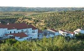
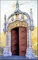
Gallery
 Moura, Portugal
 Moura, Portugal
 Moura, Portugal
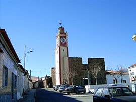 Moura, Portugal
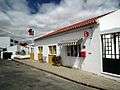 Moura, Portugal
See also
- Moura IPR
References
- Instituto Nacional de Estatística
- "Áreas das freguesias, concelhos, distritos e país". Archived from the original on 2018-11-05. Retrieved 2018-11-05.
- UMA POPULAÇÃO QUE SE URBANIZA, Uma avaliação recente - Cidades, 2004 Nuno Pires Soares, Instituto Geográfico Português (Geographic Institute of Portugal)
- Diário da República. "Law nr. 11-A/2013, page 552 79" (pdf) (in Portuguese). Retrieved 28 July 2014.
External links
| Authority control |
|
|---|
This article is issued from Wikipedia. The text is licensed under Creative Commons - Attribution - Sharealike. Additional terms may apply for the media files.