Moquino, New Mexico
Moquino is a census-designated place (CDP) in Cibola County, New Mexico, United States. The population was 37 at the 2010 census.[1]
Moquino, New Mexico | |
|---|---|
 Moquino | |
| Coordinates: 35°10′21″N 107°22′10″W | |
| Country | United States |
| State | New Mexico |
| County | Cibola |
| Area | |
| • Total | 2.32 sq mi (6.02 km2) |
| • Land | 2.32 sq mi (6.02 km2) |
| • Water | 0.0 sq mi (0.0 km2) |
| Elevation | 6,120 ft (1,870 m) |
| Population (2010) | |
| • Total | 37 |
| • Density | 16/sq mi (6.1/km2) |
| Time zone | UTC-7 (Mountain (MST)) |
| • Summer (DST) | UTC-6 (MDT) |
| Area code(s) | 505 |
| FIPS code | 35-50020 |
| GNIS feature ID | 0899803 |
Geography
Moquino is located in northeastern Cibola County at 35°10′21″N 107°22′10″W. It is bordered to the west by Bibo and to the northwest by Seboyeta. Interstate 40 in Laguna is 14 miles (23 km) to the south.
According to the United States Census Bureau, the Moquino CDP has a total area of 2.3 square miles (6.0 km2), all land.[1]
Education
All public schools in the county are operated by Grants/Cibola County Schools.
References
- "Geographic Identifiers: 2010 Demographic Profile Data (G001): Moquino CDP, New Mexico". U.S. Census Bureau, American Factfinder. Archived from the original on February 12, 2020. Retrieved October 20, 2014.
Municipalities and communities of Cibola County, New Mexico, United States | ||
|---|---|---|
| City | 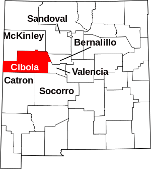 Map of New Mexico highlighting Cibola County | |
| Village | ||
| CDPs | ||
| Unincorporated communities | ||
| Indian reservations | ||
| Footnotes | ‡This populated place also has portions in an adjacent county or counties | |
This article is issued from Wikipedia. The text is licensed under Creative Commons - Attribution - Sharealike. Additional terms may apply for the media files.