Moore, Idaho
Moore is a city in Butte County, Idaho, United States. The population was 189 at the 2010 census.
Moore, Idaho | |
|---|---|
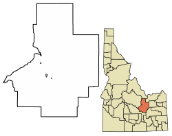 Location of Moore in Butte County, Idaho. | |
| Coordinates: 43°44′8″N 113°22′1″W | |
| Country | United States |
| State | Idaho |
| County | Butte |
| Area | |
| • Total | 0.28 sq mi (0.7 km2) |
| • Land | 0.28 sq mi (0.7 km2) |
| • Water | 0.00 sq mi (0.0 km2) |
| Elevation | 5,472 ft (1,668 m) |
| Population | |
| • Total | 189 |
| • Estimate (2018)[3] | 171 |
| • Density | 680/sq mi (260/km2) |
| Time zone | UTC-7 (Mountain (MST)) |
| • Summer (DST) | UTC-6 (MDT) |
| ZIP code | 83255 |
| Area code(s) | 208, 986 |
| FIPS code | 16-54100 |
| GNIS feature ID | 0396921 |
Geography
Moore is located at 43°44′8″N 113°22′1″W (43.735517, -113.366952).[4]
According to the United States Census Bureau, the city has a total area of 0.29 square miles (0.75 km2), all of it land.[5]
Demographics
| Historical population | |||
|---|---|---|---|
| Census | Pop. | %± | |
| 1950 | 256 | — | |
| 1960 | 358 | 39.8% | |
| 1970 | 156 | −56.4% | |
| 1980 | 210 | 34.6% | |
| 1990 | 190 | −9.5% | |
| 2000 | 196 | 3.2% | |
| 2010 | 189 | −3.6% | |
| Est. 2018 | 171 | [3] | −9.5% |
| U.S. Decennial Census[6] | |||
2010 census
As of the census[2] of 2010, there were 189 people, 79 households, and 50 families residing in the city. The population density was 651.7 inhabitants per square mile (251.6/km2). There were 90 housing units at an average density of 310.3 per square mile (119.8/km2). The racial makeup of the city was 100.0% White. Hispanic or Latino of any race were 3.2% of the population.
There were 79 households of which 30.4% had children under the age of 18 living with them, 54.4% were married couples living together, 5.1% had a female householder with no husband present, 3.8% had a male householder with no wife present, and 36.7% were non-families. 34.2% of all households were made up of individuals and 20.3% had someone living alone who was 65 years of age or older. The average household size was 2.39 and the average family size was 3.14.
The median age in the city was 37.2 years. 29.6% of residents were under the age of 18; 6.4% were between the ages of 18 and 24; 21.7% were from 25 to 44; 23.7% were from 45 to 64; and 18.5% were 65 years of age or older. The gender makeup of the city was 49.2% male and 50.8% female.
2000 census
As of the census[7] of 2000, there were 196 people, 81 households, and 57 families residing in the city. The population density was 686.3 people per square mile (261.0/km²). There were 93 housing units at an average density of 325.6 per square mile (123.8/km²). The racial makeup of the city was 97.96% White, 1.02% from other races, and 1.02% from two or more races. Hispanic or Latino of any race were 2.04% of the population.
There were 81 households out of which 25.9% had children under the age of 18 living with them, 63.0% were married couples living together, 7.4% had a female householder with no husband present, and 28.4% were non-families. 23.5% of all households were made up of individuals and 13.6% had someone living alone who was 65 years of age or older. The average household size was 2.42 and the average family size was 2.90.
In the city, the population was spread out with 25.0% under the age of 18, 3.6% from 18 to 24, 25.0% from 25 to 44, 25.0% from 45 to 64, and 21.4% who were 65 years of age or older. The median age was 43 years. For every 100 females, there were 79.8 males. For every 100 females age 18 and over, there were 83.8 males.
The median income for a household in the city was $28,984, and the median income for a family was $30,000. Males had a median income of $31,875 versus $15,208 for females. The per capita income for the city was $14,732. About 10.0% of families and 13.1% of the population were below the poverty line, including 32.6% of those under the age of eighteen and none of those sixty five or over.
See also
References
- "2016 U.S. Gazetteer Files". United States Census Bureau. Retrieved Jul 26, 2017.
- "U.S. Census website". United States Census Bureau. Retrieved 2012-12-18.
- "Population and Housing Unit Estimates". Retrieved March 16, 2020.
- "US Gazetteer files: 2010, 2000, and 1990". United States Census Bureau. 2011-02-12. Retrieved 2011-04-23.
- "US Gazetteer files 2010". United States Census Bureau. Archived from the original on 2012-07-02. Retrieved 2012-12-18.
- "Census of Population and Housing". Census.gov. Retrieved June 4, 2015.
- "U.S. Census website". United States Census Bureau. Retrieved 2008-01-31.
External links
![]()
Municipalities and communities of Butte County, Idaho, United States | ||
|---|---|---|
| Cities | Map of Idaho highlighting Butte County | |
| Unincorporated community | ||
| Authority control |
|
|---|