Montfort-sur-Risle
Montfort-sur-Risle is a commune in the Eure department in Normandy region in northern France.
Montfort-sur-Risle | |
|---|---|
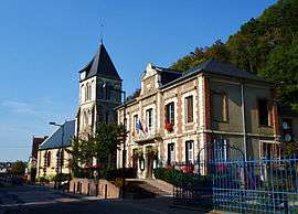 The town hall and church in Montfort-sur-Risle | |
.svg.png) Coat of arms | |
Location of Montfort-sur-Risle 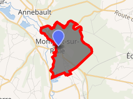
| |
 Montfort-sur-Risle  Montfort-sur-Risle | |
| Coordinates: 49°17′46″N 0°39′56″E | |
| Country | France |
| Region | Normandy |
| Department | Eure |
| Arrondissement | Bernay |
| Canton | Pont-Audemer |
| Intercommunality | Val de Risle |
| Government | |
| • Mayor (2008–204) | Jean-Luc Barre |
| Area 1 | 3.94 km2 (1.52 sq mi) |
| Population (2017-01-01)[1] | 761 |
| • Density | 190/km2 (500/sq mi) |
| Time zone | UTC+01:00 (CET) |
| • Summer (DST) | UTC+02:00 (CEST) |
| INSEE/Postal code | 27413 /27290 |
| Elevation | 27–102 m (89–335 ft) |
| 1 French Land Register data, which excludes lakes, ponds, glaciers > 1 km2 (0.386 sq mi or 247 acres) and river estuaries. | |
History
In Gallic times the river Risle delimited the territories of the tribes of Veliocasses and the Lexovii. Between 980 and 1204, when it passed into the hands of the King of France, Montfort-sur-Risle was a lordship. The most famous Lord of Montfort was Hugues II de Montfort (died 1083), who joined in the Norman conquest of England, for which he received 114 English manors.[2]
Population
| Historical population | ||
|---|---|---|
| Year | Pop. | ±% |
| 1962 | 754 | — |
| 1968 | 766 | +1.6% |
| 1975 | 867 | +13.2% |
| 1982 | 885 | +2.1% |
| 1990 | 913 | +3.2% |
| 1999 | 882 | −3.4% |
| 2009 | 824 | −6.6% |
See also
References
- "Populations légales 2017". INSEE. Retrieved 6 January 2020.
- "Préfecture of Eure". Archived from the original on 2016-03-03. Retrieved 2013-03-27.
| Wikimedia Commons has media related to Montfort-sur-Risle. |
| Authority control |
|
|---|
This article is issued from Wikipedia. The text is licensed under Creative Commons - Attribution - Sharealike. Additional terms may apply for the media files.