Ivry-la-Bataille
Ivry-la-Bataille is a commune in the Eure Department in the Normandy region in northern France. Ivry-la-Bataille was formerly known as Ivry.
Ivry-la-Bataille | |
|---|---|
 The village seen from the chateau | |
.svg.png) Coat of arms | |
Location of Ivry-la-Bataille 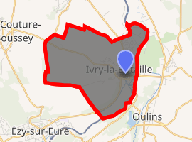
| |
 Ivry-la-Bataille  Ivry-la-Bataille | |
| Coordinates: 48°53′04″N 1°27′42″E | |
| Country | France |
| Region | Normandy |
| Department | Eure |
| Arrondissement | Évreux |
| Canton | Saint-André-de-l'Eure |
| Intercommunality | Val d'Eure et Vesgre |
| Government | |
| • Mayor (2008–2014) | Patrick Maison |
| Area 1 | 7.76 km2 (3.00 sq mi) |
| Population (2017-01-01)[1] | 2,724 |
| • Density | 350/km2 (910/sq mi) |
| Time zone | UTC+01:00 (CET) |
| • Summer (DST) | UTC+02:00 (CEST) |
| INSEE/Postal code | 27355 /27540 |
| Elevation | 55–137 m (180–449 ft) (avg. 64 m or 210 ft) |
| 1 French Land Register data, which excludes lakes, ponds, glaciers > 1 km2 (0.386 sq mi or 247 acres) and river estuaries. | |
History
The Battle of Ivry took place near Ivry on 14 March 1590. It was renamed Ivry-la-Bataille (Ivry-the-Battle) to commemorate the battle and to distinguish the town from Ivry-sur-Seine.
Geography
Ivry-la-Bataille is located on the Eure River in Normandy and about thirty miles (50 km) west of Paris, at the boundary between the Île-de-France and the Beauce regions.
Population
| Historical population | ||
|---|---|---|
| Year | Pop. | ±% |
| 1962 | 1,699 | — |
| 1968 | 2,183 | +28.5% |
| 1975 | 2,335 | +7.0% |
| 1982 | 2,065 | −11.6% |
| 1990 | 2,563 | +24.1% |
| 1999 | 2,639 | +3.0% |
| 2008 | 2,603 | −1.4% |
Sights
See also
External links
| Wikimedia Commons has media related to Ivry-la-Bataille. |
| Authority control |
|
|---|
This article is issued from Wikipedia. The text is licensed under Creative Commons - Attribution - Sharealike. Additional terms may apply for the media files.