Montfort, Wisconsin
Montfort is a village in Grant and Iowa Counties in the U.S. state of Wisconsin. The population was 718 at the 2010 census. Of this, 622 were in Grant County, and 96 were in Iowa County.
Montfort, Wisconsin | |
|---|---|
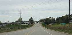 Looking west at Montfort | |
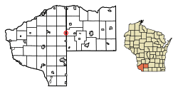 Location of Montfort in Grant County, Wisconsin. | |
| Coordinates: 42°58′17″N 90°25′59″W | |
| Country | |
| State | |
| Counties | Grant, Iowa |
| Area | |
| • Total | 0.54 sq mi (1.39 km2) |
| • Land | 0.54 sq mi (1.39 km2) |
| • Water | 0.00 sq mi (0.00 km2) |
| Elevation | 1,109 ft (338 m) |
| Population | |
| • Total | 718 |
| • Estimate (2018)[4] | 692 |
| • Density | 1,286.25/sq mi (496.64/km2) |
| Time zone | UTC-6 (Central (CST)) |
| • Summer (DST) | UTC-5 (CDT) |
| Area code(s) | 608 |
| FIPS code | 55-53950[5] |
| GNIS feature ID | 1569677[2] |
The Iowa County portion of Montfort is part of the Madison Metropolitan Statistical Area, while the Grant County portion is part of the Platteville Micropolitan Statistical Area.
History
Montfort was named from an old fort situated on a nearby hill.[6]
Geography
Montfort is located at 42°58′17″N 90°25′59″W (42.971399, -90.432937).[7]
According to the United States Census Bureau, the village has a total area of 0.54 square miles (1.40 km2), all of it land.[8]
Demographics
| Historical population | |||
|---|---|---|---|
| Census | Pop. | %± | |
| 1880 | 64 | — | |
| 1890 | 407 | 535.9% | |
| 1900 | 627 | 54.1% | |
| 1910 | 558 | −11.0% | |
| 1920 | 598 | 7.2% | |
| 1930 | 554 | −7.4% | |
| 1940 | 615 | 11.0% | |
| 1950 | 576 | −6.3% | |
| 1960 | 538 | −6.6% | |
| 1970 | 518 | −3.7% | |
| 1980 | 616 | 18.9% | |
| 1990 | 676 | 9.7% | |
| 2000 | 663 | −1.9% | |
| 2010 | 718 | 8.3% | |
| Est. 2018 | 692 | [4] | −3.6% |
| U.S. Decennial Census[9] | |||
2010 census
As of the census[3] of 2010, there were 718 people, 279 households, and 192 families living in the village. The population density was 1,329.6 inhabitants per square mile (513.4/km2). There were 298 housing units at an average density of 551.9 per square mile (213.1/km2). The racial makeup of the village was 98.6% White, 0.8% African American, and 0.6% from other races. Hispanic or Latino of any race were 1.3% of the population.
There were 279 households of which 34.1% had children under the age of 18 living with them, 53.8% were married couples living together, 10.0% had a female householder with no husband present, 5.0% had a male householder with no wife present, and 31.2% were non-families. 22.2% of all households were made up of individuals and 10% had someone living alone who was 65 years of age or older. The average household size was 2.56 and the average family size was 2.98.
The median age in the village was 35.9 years. 24.8% of residents were under the age of 18; 10.5% were between the ages of 18 and 24; 24.5% were from 25 to 44; 28.3% were from 45 to 64; and 11.8% were 65 years of age or older. The gender makeup of the village was 50.6% male and 49.4% female.
2000 census
At the 2000 census,[5] there were 663 people, 252 households and 179 families living in the village. The population density was 1,252.1 per square mile (483.0/km²). There were 273 housing units at an average density of 515.6 per square mile (198.9/km²). The racial makeup of the village was 99.25% White, 0.15% African American, and 0.60% from two or more races.
There were 252 households, of which 37.7% had children under the age of 18 living with them, 55.2% were married couples living together, 11.5% had a female householder with no husband present, and 28.6% were non-families. 23.0% of all households were individuals and 13.5% had someone living alone who was 65 years of age or older. The average household size was 2.63 and the average family size was 3.12.
In terms of age distribution, 30.3% were under the age of 18, 8.3% from 18 to 24, 26.2% from 25 to 44, 20.5% from 45 to 64, and 14.6% were 65 years of age or older. The median age was 36 years. For every 100 females, there were 95.6 males. For every 100 females age 18 and over, there were 87.0 males.
The median income for a household in the village was $37,500, and the median income for a family was $43,295. Males had a median income of $28,125 versus $21,442 for females. The per capita income for the village was $16,126. About 1.7% of families and 5.7% of the population were below the poverty line, including 4.7% of those under age 18 and 7.1% of those age 65 or over.
References
- "2018 U.S. Gazetteer Files". United States Census Bureau. Retrieved Feb 15, 2020.
- "US Board on Geographic Names". United States Geological Survey. 2007-10-25. Retrieved 2008-01-31.
- "U.S. Census website". United States Census Bureau. Retrieved 2012-11-18.
- "Population and Housing Unit Estimates". Retrieved June 4, 2019.
- "U.S. Census website". United States Census Bureau. Retrieved 2008-01-31.
- Chicago and North Western Railway Company (1908). A History of the Origin of the Place Names Connected with the Chicago & North Western and Chicago, St. Paul, Minneapolis & Omaha Railways. p. 104.
- "US Gazetteer files: 2010, 2000, and 1990". United States Census Bureau. 2011-02-12. Retrieved 2011-04-23.
- "US Gazetteer files 2010". United States Census Bureau. Archived from the original on 2012-07-14. Retrieved 2012-11-18.
- "Census of Population and Housing". Census.gov. Retrieved June 4, 2015.
External links
| Wikimedia Commons has media related to Montfort, Wisconsin. |
- Information about Montfort, Wisconsin
- Sanborn fire insurance maps: 1899 1905 1914
Municipalities and communities of Grant County, Wisconsin, United States | ||
|---|---|---|
| Cities | 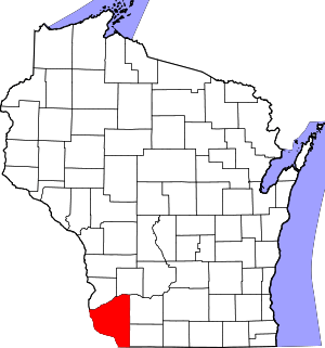 | |
| Villages | ||
| Towns |
| |
| CDPs | ||
| Unincorporated communities |
| |
| Ghost town/neighborhood | ||
| Footnotes | ‡This populated place also has portions in an adjacent county or counties | |
Municipalities and communities of Iowa County, Wisconsin, United States | ||
|---|---|---|
| Cities | 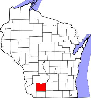 | |
| Villages | ||
| Towns | ||
| CDP | ||
| Unincorporated communities | ||
| Ghost towns |
| |
| Footnotes | ‡This populated place also has portions in an adjacent county or counties | |