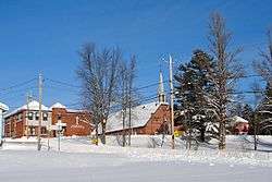
Mont-Saint-Michel, Quebec
Mont-Saint-Michel is a municipality in the Laurentides region of Quebec, Canada, part of the Antoine-Labelle Regional County Municipality.
Mont-Saint-Michel | |
|---|---|
Municipality | |
 | |
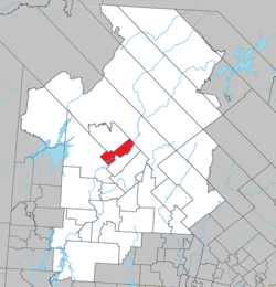 Location within Antoine-Labelle RCM | |
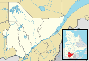 Mont-Saint-Michel Location in central Quebec | |
| Coordinates: 46°47′N 75°20′W[1] | |
| Country | |
| Province | |
| Region | Laurentides |
| RCM | Antoine-Labelle |
| Constituted | September 11, 1928 |
| Government | |
| • Mayor | André-Marcel Evéquoz |
| • Federal riding | Laurentides—Labelle |
| • Prov. riding | Labelle |
| Area | |
| • Total | 144.30 km2 (55.71 sq mi) |
| • Land | 138.75 km2 (53.57 sq mi) |
| Population (2011)[3] | |
| • Total | 633 |
| • Density | 4.6/km2 (12/sq mi) |
| • Pop 2006-2011 | |
| • Dwellings | 422 |
| Time zone | UTC−5 (EST) |
| • Summer (DST) | UTC−4 (EDT) |
| Postal code(s) | J0W 1P0 |
| Area code(s) | 819 |
| Highways | |
Demographics
Population trend:[4]
- Population in 2011: 633 (2006 to 2011 population change: 1.3%)
- Population in 2006: 625
- Population in 2001: 619
- Population in 1996: 616
- Population in 1991: 647
Private dwellings occupied by usual residents: 266 (total dwellings: 422)
Mother tongue:
- English as first language: 0%
- French as first language: 97.6%
- English and French as first language: 0%
- Other as first language: 2.4%
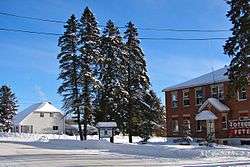
Mont-St-Michel municipal hall
See also
References
- Reference number 42206 of the Commission de toponymie du Québec (in French)
- Geographic code 79110 in the official Répertoire des municipalités (in French)
- Statistics Canada 2011 Census - Mont-Saint-Michel census profile
- Statistics Canada: 1996, 2001, 2006, 2011 census
External links

Adjacent Municipal Subdivisions | ||||||||||
|---|---|---|---|---|---|---|---|---|---|---|
| ||||||||||
| Cities/towns | |
|---|---|
| Municipalities |
|
| Villages | |
| Unorganized territories | |
| |
This article is issued from Wikipedia. The text is licensed under Creative Commons - Attribution - Sharealike. Additional terms may apply for the media files.