Montégut-Plantaurel
Montégut-Plantaurel is a commune in the Ariège department in southwestern France.
Montégut-Plantaurel | |
|---|---|
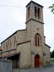 The church in Montégut-Plantaurel | |
Location of Montégut-Plantaurel 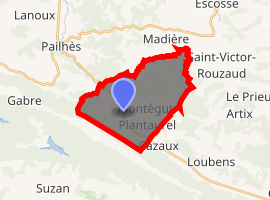
| |
 Montégut-Plantaurel  Montégut-Plantaurel | |
| Coordinates: 43°04′12″N 1°29′11″E | |
| Country | France |
| Region | Occitanie |
| Department | Ariège |
| Arrondissement | Foix |
| Canton | Val d'Ariège |
| Intercommunality | Canton of Varilhes |
| Government | |
| • Mayor (2008–2014) | Michel Carriere |
| Area 1 | 18.95 km2 (7.32 sq mi) |
| Population (2017-01-01)[1] | 335 |
| • Density | 18/km2 (46/sq mi) |
| Time zone | UTC+01:00 (CET) |
| • Summer (DST) | UTC+02:00 (CEST) |
| INSEE/Postal code | 09202 /09120 |
| Elevation | 307–630 m (1,007–2,067 ft) (avg. 325 m or 1,066 ft) |
| 1 French Land Register data, which excludes lakes, ponds, glaciers > 1 km2 (0.386 sq mi or 247 acres) and river estuaries. | |
Geography
The Lèze flows through the northwestern part of the commune.
History
The Chateau de La Hille, was home to Jewish refugee children during the early 1940s.[2]
Population
| Historical population | ||
|---|---|---|
| Year | Pop. | ±% |
| 1962 | 189 | — |
| 1968 | 210 | +11.1% |
| 1975 | 171 | −18.6% |
| 1982 | 179 | +4.7% |
| 1990 | 253 | +41.3% |
| 1999 | 267 | +5.5% |
| 2008 | 320 | +19.9% |
See also
References
- "Populations légales 2017". INSEE. Retrieved 6 January 2020.
- Les enfant du château de La Hille, Sebastian Steiger, Brunnen Verlag, Basel, ISBN 3765577219 (in French)
| Wikimedia Commons has media related to Montégut-Plantaurel. |
| Authority control |
|
|---|
This article is issued from Wikipedia. The text is licensed under Creative Commons - Attribution - Sharealike. Additional terms may apply for the media files.