Mérens-les-Vals
Mérens-les-Vals (Languedocien: Merens las Vals) is a commune in the Ariège department in southwestern France.
Mérens-les-Vals | |
|---|---|
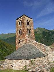 The church in Mérens-les-Vals | |
Location of Mérens-les-Vals 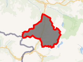
| |
 Mérens-les-Vals  Mérens-les-Vals | |
| Coordinates: 42°39′32″N 1°50′13″E | |
| Country | France |
| Region | Occitanie |
| Department | Ariège |
| Arrondissement | Foix |
| Canton | Haute-Ariège |
| Intercommunality | Vallées d'Ax |
| Government | |
| • Mayor (2008–2014) | Jean-Pierre Sicre |
| Area 1 | 80.12 km2 (30.93 sq mi) |
| Population (2017-01-01)[1] | 168 |
| • Density | 2.1/km2 (5.4/sq mi) |
| Time zone | UTC+01:00 (CET) |
| • Summer (DST) | UTC+02:00 (CEST) |
| INSEE/Postal code | 09189 /09110 |
| Elevation | 929–2,840 m (3,048–9,318 ft) (avg. 1,050 m or 3,440 ft) |
| 1 French Land Register data, which excludes lakes, ponds, glaciers > 1 km2 (0.386 sq mi or 247 acres) and river estuaries. | |
Geography
Mérens-les-Vals, as its name implies, has several valleys. The village is at the confluence of three valleys: Ariège, Nabre and Morgoulliou. The village has a train station (Gare de Mérens-les-Vals) on the Portet-Saint-Simon–Puigcerdà railway. The night train from Gare d'Austerlitz, Paris to Latour-de-Carol stops here. The journey taking about nine hours. There are six local trains a day to Toulouse, this journey takes 2 hours and 15 minutes.
Population
| Historical population | ||
|---|---|---|
| Year | Pop. | ±% |
| 1962 | 114 | — |
| 1968 | 195 | +71.1% |
| 1975 | 157 | −19.5% |
| 1982 | 143 | −8.9% |
| 1990 | 149 | +4.2% |
| 1999 | 180 | +20.8% |
| 2008 | 186 | +3.3% |
Inhabitants are called Mérengois.
References
- "Populations légales 2017". INSEE. Retrieved 6 January 2020.
| Wikimedia Commons has media related to Mérens-les-Vals. |
This article is issued from Wikipedia. The text is licensed under Creative Commons - Attribution - Sharealike. Additional terms may apply for the media files.