Monett, Missouri
Monett is a city in Barry and Lawrence counties in the U.S. state of Missouri. It is also the most-populous city in Barry and Lawrence counties. The city is located in the Ozarks, just south of Interstate 44 between Joplin and Springfield. The population was 8,873 at the 2010 census. The population was estimated to have been 9,124 in 2019.
Monett, Missouri | |
|---|---|
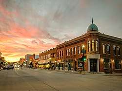 Monett Downtown facing west | |
| Motto(s): Pride & Progress | |
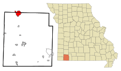 Location of Monett, Missouri | |
| Coordinates: 36.92082965 -93.91999632 | |
| Country | United States |
| State | Missouri |
| Counties | Barry, Lawrence |
| Township | Monett, Pierce |
| Founded | 1870 |
| Incorporated | 1887 |
| Government | |
| • Mayor | Mike Brownsberger[1] |
| Area | |
| • Total | 8.45 sq mi (21.89 km2) |
| • Land | 8.43 sq mi (21.83 km2) |
| • Water | 0.02 sq mi (0.05 km2) |
| Elevation | 1,378 ft (420 m) |
| Population | |
| • Total | 8,873 |
| • Estimate (2019) | 9,124 |
| • Density | 1,100/sq mi (410/km2) |
| Demonym(s) | Monettian |
| Time zone | UTC-6 (Central (CST)) |
| • Summer (DST) | UTC-5 (CDT) |
| ZIP code | 65708 |
| Area code(s) | 417 |
| Website | cityofmonett |
History
Settlement: 1870-1887
Monett was created as a railroad town by the St. Louis–San Francisco Railway ("Frisco Line") which came through in 1870 and would build branch going off the main line to Paris, Texas. Both lines are still in existence and operated by the BNSF Railway. During this time the area went through several names including Kings Prairie Depot, Plymouth, Plymouth Junction (when the southern branch was built in 1880), Gonten (named for the local postmaster because the Post Service said there were other Plymouths); and finally Monett in 1887 when the area was formally platted and the Monett name was applied to the post office.[3] It was named for Henry Monett who was a popular general station agent for various railroads including the New York, Chicago and St. Louis Railroad ("Nickel Plate Railroad") before becoming an agent for the New York Central Railroad shortly before his death at the age of 35 in 1888.[4][5][6][7]

The community was very much noted for being a rail town and had a Harvey House operating at the Frisco train station from 1896 until 1930.[8] The community in the Ozark Mountains also had a thriving fruit business and was nicknamed the "Strawberry Capital of the Midwest."[9] The Ozark Fruit Growers Association building (built in 1927) which is part of the Downtwon Monett Historic District is on the National Register of Historic Places.
The David W. Courdin House, Downtown Monett Historic District, and Waldensian Church and Cemetery of Stone Prairie are listed on the National Register of Historic Places.[10][11]
In 1894, a lynching and race riot in took place in Monett before the violence spread to Pierce City and other southwestern Missouri towns. Monett became a sundown town, banning African Americans from living or staying there after dark, with a sign across the main street saying: "Nigger, don't let the sun go down."[12][13] "Monett, Peirce City, Rogers, Ark., and several other towns around here have driven the negros out."[14]
20th century
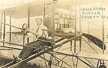
From about 1908 through 1911, Monett investors led by L. B. Durnil and U. S. Barnsley sought to build an airplane. Their most successful attempt was The DeChenne aeroplane. The DeChenne aeroplane gave its first public demonstration flight in Monett on July 4, 1911, flown by Monett pharmacist Logan McKee. It then made an exhibition tour in Oklahoma and Texas.[15]
The population had reached 4,177 by 1910,[16] due in large part to the railroad and its roundhouse. By 1937, a promotional pamphlet reported one out of eight people in Monett worked for the railroad.[17]
In a postwar industrialization effort, the Monett Industrial Development Corporation brought light industry to the town, further diversifying the local and broader economy.[17] This diversification nearly doubled the population during the century, to 7,396 by 2000.
21st century
Today, Monett is enjoying a renaissance, particularly in its historic downtown area. Through a combination of private investment and public resources, numerous restoration and revitalization projects have been undertaken in the historic downtown to restore its architectural quality, upgrade the infrastructure, drive local business success and improve the quality of life.
In 2018 Missouri Governor Eric Greitens and Senator Roy Blunt announced an "Opportunity Zone" in Monett, allocating state and federal tax incentives for businesses that invest in the areas designated.[18] In 2018, Monett adopted the Complete streets policy, the 39th city in Missouri to do so.[19]
Demographics
| Historical population | |||
|---|---|---|---|
| Census | Pop. | %± | |
| 1890 | 1,699 | — | |
| 1900 | 3,115 | 83.3% | |
| 1910 | 4,177 | 34.1% | |
| 1920 | 4,206 | 0.7% | |
| 1930 | 4,099 | −2.5% | |
| 1940 | 4,395 | 7.2% | |
| 1950 | 4,771 | 8.6% | |
| 1960 | 5,359 | 12.3% | |
| 1970 | 5,937 | 10.8% | |
| 1980 | 6,148 | 3.6% | |
| 1990 | 6,529 | 6.2% | |
| 2000 | 7,396 | 13.3% | |
| 2010 | 8,873 | 20.0% | |
| Est. 2019 | 9,124 | [20] | 2.8% |
| U.S. Decennial Census | |||
2010 census
As of the census[21] of 2010, there were 8,873 people, 3,405 households, and 2,282 families residing in the city. The population density was 1,052.6 inhabitants per square mile (406.4/km2). There were 3,828 housing units at an average density of 454.1 per square mile (175.3/km2). The racial makeup of the city was 86.8% White, 0.8% African American, 0.9% Native American, 1.0% Asian, 0.1% Pacific Islander, 8.5% from other races, and 1.9% from two or more races. Hispanic or Latino of any race were 19.0% of the population.
There were 3,405 households of which 36.8% had children under the age of 18 living with them, 48.8% were married couples living together, 12.7% had a female householder with no husband present, 5.6% had a male householder with no wife present, and 33.0% were non-families. 27.9% of all households were made up of individuals and 11.2% had someone living alone who was 65 years of age or older. The average household size was 2.57 and the average family size was 3.12.
The median age in the city was 34 years. 27.8% of residents were under the age of 18; 9% were between the ages of 18 and 24; 26.6% were from 25 to 44; 22.1% were from 45 to 64; and 14.5% were 65 years of age or older. The gender makeup of the city was 48.1% male and 51.9% female.
2000 census
As of the census[22] of 2000, there were 7,396 people, 2,904 households, and 1,916 families residing in the city. The population density was 1,136.2 people per square mile (438.6/km²). There were 3,130 housing units at an average density of 480.8/sq mi (185.6/km²). The racial makeup of the city was 89.45% White, 2.00% African American, 0.82% Native American, 0.62% Asian, 0.11% Pacific Islander, 7.82% from other races, and 0.96% from two or more races.
There were 2,904 households out of which 32.0% had children under the age of 18 living with them, 51.2% were married couples living together, 10.7% had a female householder with no husband present, and 34.0% were non-families. 29.4% of all households were made up of individuals and 15.1% had someone living alone who was 65 years of age or older. The average household size was 2.49 and the average family size was 3.08.
In the city the population was spread out with 26.5% under the age of 18, 9.7% from 18 to 24, 27.3% from 25 to 44, 18.9% from 45 to 64, and 17.6% who were 65 years of age or older. The median age was 35 years. For every 100 females, there were 91.1 males. For every 100 females age 18 and over, there were 86.8 males.
The median income for a household in the city was $30,764, and the median income for a family was $36,858. Males had a median income of $26,150 versus $18,211 for females. The per capita income for the city was $17,048. About 9.2% of families and 15.0% of the population were below the poverty line, including 25.4% of those under age 18 and 7.8% of those age 65 or over.
Economy
Monett's economy is based on manufacturing, financial services and software, retail and education. This community is driven primarily by its industrial sector. Several key businesses in town include Jack Henry & Associates, CoxHealth, Tyson Foods, Miracle Recreation Equipment Company, Hydro Aluminum, International Dehydrated Foods, Miracle, Architectural Systems Inc., EFCO, and WinTech.
The town has seen rapid growth over the last two decades. More recently, heavy investment into Monett's Historical Downtown has brought new life to many businesses, and the area's cultural scene.
Monett is a part of the Southwest Missouri Council of Governments (SMCOG), providing urban planning and economic development resources for the ten county region around the Springfield metropolitan area, Missouri.[23]
Transportation
Highways
Monett is at the crossroads of U.S. Route 60 and Missouri Route 37, connecting the town to Interstate 44 and the metropolitan areas of Joplin, Springfield and Northwest Arkansas.[24]
.jpg)
Airport
The Monett Municipal Airport (HFJ) is a public use airport, registering 18,100 aircraft operations annually in 2008. The Airport ranked 9th in the latest economic impact study conducted by the Missouri Department of Transportation, with a total output of 13.1 million dollars annually.[25]
Railroads
Monett was once an important depot used by the St. Louis–San Francisco Railway, but today is served by The BNSF Railway and Arkansas and Missouri Railroad.
Education
Public
Monett is part of the Monett R-1 School District. The district has the following schools:
- Monett High School
- Scott Regional Technology Center
- Monett Middle School
- Monett Intermediate School
- Central Park Elementary
- Monett Elementary
Missouri Schools for the Severely Disabled (MSSD) is a state operated program serving Missouri students with severe disabilities in the greater Monett area at:
- Oakview State School K-12 [26]
Private
The private schools in Monett include Berean Christian Academy and St. Lawrence Catholic Elementary.[27]
Higher education
Downtown Monett is home to a satellite campus of Drury University.
Library
Monett has a public library, a branch of the Barry-Lawrence Regional Library.[28]
Culture
Southwest Missouri is a close collection of cities, towns, and communities in the heart of the Ozarks between the metropolitan areas of Joplin and Springfield and the Fayetteville-Springdale-Rogers area.
Entertainment and performing arts
- Performing Arts Center (Also known as the PAC) hosts performances by the Community Theatre.
- Starting in 2018, on the first Friday of each month from May to August, the town holds the "First on Front" on Front Street and Broadway, a festival with live music, food trucks, and a locally brewed beer garden.
Sports
- From 1936–1939, the Monett Red Birds played in the Arkansas-Missouri League, a minor league for the St. Louis Cardinals.
- Monett High School plays within the Big 8 Conference on Kenley Richardson Field at Burl Fowler Stadium
- As a program, in 2018, the Monett High School Football team was inducted into the Missouri Sports Hall of Fame, for being one of the most successful football programs in state history from 1927 to the present day. The program has won three state championships, 1971, 1977, and 2016, along with 12 conference championships and 13 district titles since the state implemented a structured post-season.
Media
Newspapers
Radio
- KKBL, 95.9 FM - Adult Contemporary/News
Magazines
- "Connection"- A magazine dedicated to Southwest Missourians
Hospitals
Cox Monett Hospital, part of CoxHealth, was built in 1953. Construction of a new $42 million hospital building began in Spring 2019.[29]
Notable people
- Ginny Duenkel, known by her married name Ginny Fuldner; 1964 Olympic gold medalist and former Olympic record-holding swimmer
- Jack Henry, founder of Jack Henry & Associates, S&P 500 financial services company headquartered in Monett
- Phil Mulkey, track and field athlete
- Sally Shelton-Colby, U.S. Ambassador to Barbados, Grenada and Dominica
- Howard F. Stone, lieutenant general in the U.S. Army
- Titanic Thompson (Alvin Clarence Thomas), gambler, golfer and hustler
Geography
Monett is located at 36°55′25″N 93°55′20″W (36.923725, -93.922332).[30]
According to the United States Census Bureau, the city has a total area of 8.45 square miles (21.89 km2), of which 8.43 square miles (21.83 km2) is land and 0.02 square miles (0.05 km2) is water.[31]
Climate
Climate is characterized by relatively high temperatures and evenly distributed precipitation throughout the year. The Köppen Climate Classification subtype for this climate is "Cfa" (Humid Subtropical Climate).[32]
| Climate data for Monett, Missouri | |||||||||||||
|---|---|---|---|---|---|---|---|---|---|---|---|---|---|
| Month | Jan | Feb | Mar | Apr | May | Jun | Jul | Aug | Sep | Oct | Nov | Dec | Year |
| Average high °C (°F) | 8 (46) |
10 (50) |
14 (57) |
22 (71) |
26 (78) |
30 (86) |
32 (90) |
32 (90) |
28 (83) |
23 (73) |
15 (59) |
9 (49) |
21 (69) |
| Average low °C (°F) | −5 (23) |
−3 (26) |
0 (32) |
7 (45) |
13 (55) |
17 (63) |
20 (68) |
18 (65) |
14 (58) |
8 (47) |
2 (35) |
−3 (27) |
7 (45) |
| Average precipitation mm (inches) | 38 (1.5) |
56 (2.2) |
81 (3.2) |
110 (4.2) |
120 (4.9) |
120 (4.7) |
91 (3.6) |
71 (2.8) |
110 (4.2) |
76 (3) |
66 (2.6) |
66 (2.6) |
1,000 (39.4) |
| Average precipitation days | 5 | 6 | 8 | 9 | 9 | 8 | 7 | 7 | 6 | 6 | 7 | 6 | 84 |
| Source: Weatherbase [33] | |||||||||||||
References
- "Mayor & Council". Welcome to the City of Monett. City of Monett. Retrieved 6 February 2016.
- "Population and Housing Unit Estimates". Retrieved June 9, 2017.
- "Monett, Missouri History, A Town with Five Names".
- "Charles Monett Obituary Oct 10, 1888". Democrat and Chronicle.
- "Barry County Place Names, 1928-1945 (archived)". The State Historical Society of Missouri. Archived from the original on 24 June 2016. Retrieved 30 August 2016.CS1 maint: BOT: original-url status unknown (link)
- Eaton, David Wolfe (1916). How Missouri Counties, Towns and Streams Were Named. The State Historical Society of Missouri. pp. 206.
- "Post Offices". Jim Forte Postal History. Retrieved 30 August 2016.
- "Missouri Harvey Houses".
- "Monett Chamber of Commerce". www.monett-mo.com.
- "National Register Information System". National Register of Historic Places. National Park Service. July 9, 2010.
- "National Register of Historic Places Listings". Weekly List of Actions Taken on Properties: 6/16/14 through 6/27/14. National Park Service. 2014-07-03.
- Rucker, Walter; Upton, James Nathaniel, eds. (2007). "Southwest Missouri Riots (1894–1906)". Encyclopedia of American Race Riots. 2. Westport, Connecticut: Greenwood Press. pp. 603–607. ISBN 978-0-313-33302-6 – via Google Books.
- "Negroes Killed or Driven Away". Chicago Daily Tribune. Chicago. August 21, 1901. p. 1 – via Newspapers.com.
Most of the refugees are making through the woods to Joplin, as Monett, the nearest town, has for years refused to permit a negro to reside there. Across the main street of Monett for years there has been a sign reading: 'Nigger, don't let the sun go down,' and no negro has been permitted to remain inside the corporation after dark.
- "Negroes Lynched". Sedalia Weekly Democrat (Sedalia, Missouri). April 20, 1906. p. 9 – via newspapers.com.
- "Bill Caldwell: Logan McKee, Ed DeChenne pioneered aviation in Southwest Missouri".
- "Monett, MO population".
- Bishoff, Murray (November 18, 2014). "Monett Historic Preservation District gets final approval". Monett Times.
- "Opportunity Zones | Department of Economic Development".
- "Monett becomes 39th Missouri community with a Complete Streets policy".
- "Population and Housing Unit Estimates". Retrieved August 18, 2019.
- "U.S. Census website". United States Census Bureau. Retrieved 2012-07-08.
- "U.S. Census website". United States Census Bureau. Retrieved 2008-01-31.
- Springfield metropolitan area, Missouri
- "Monett, MO - Monett, Missouri Map & Directions - MapQuest". www.mapquest.com. Retrieved 30 March 2019.
- "Missouri Statewide Airports Economic Impact Study | Missouri Department of Transportation".
- https://dese.mo.gov/special-education/missouri-schools-severely-disabled
- "Top Monett, MO Private Schools (2018-19)". www.privateschoolreview.com. Retrieved 30 March 2019.
- "Locations". Barry-Lawrence Regional Library. Retrieved 17 March 2018.
- https://www.news-leader.com/story/news/business/2019/05/04/coxhealth-breaks-ground-new-hospital-monett/3659259002/
- "US Gazetteer files: 2010, 2000, and 1990". United States Census Bureau. 2011-02-12. Retrieved 2011-04-23.
- "US Gazetteer files 2010". United States Census Bureau. Archived from the original on 2012-01-25. Retrieved 2012-07-08.
- "Monett, Missouri Köppen Climate Classification (Weatherbase)". Weatherbase.
- "Weatherbase.com". Weatherbase. 2013. Retrieved on August 16, 2013.
External links
- City of Monett official website
- Online Edition of City Paper
- Monett Chamber of Commerce
- Historic maps of Monett in the Sanborn Maps of Missouri Collection at the University of Missouri
Municipalities and communities of Barry County, Missouri, United States | ||
|---|---|---|
| Cities | 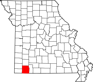 Map of Missouri highlighting Barry County | |
| Villages | ||
| Townships | ||
| CDPs | ||
| Unincorporated communities | ||
| Ghost towns | ||
| Footnotes | ‡This populated place also has portions in an adjacent county or counties | |
Municipalities and communities of Lawrence County, Missouri, United States | ||
|---|---|---|
| Cities |  Map of Missouri highlighting Lawrence County | |
| Villages | ||
| Townships | ||
| Other unincorporated communities | ||
| Ghost town | ||
| Footnotes | ‡This populated place also has portions in an adjacent county or counties | |