Middle Franconia
Middle Franconia (German: Mittelfranken) is one of the three administrative regions of Franconia in Bavaria, Germany.[2] It is located in the west of Bavaria and borders the state of Baden-Württemberg. The administrative seat is Ansbach; however, the most populous city is Nuremberg.[3]
Not to be confused with, Middle Francia.
Middle Franconia Mittelfranken | |
|---|---|
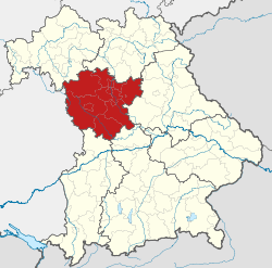 Map of Bavaria highlighting Middle Franconia (district) | |
| Country | Germany |
| State | Bavaria |
| Region seat | Ansbach |
| Area | |
| • Total | 7,245.70 km2 (2,797.58 sq mi) |
| Population (31 December 2018)[1] | |
| • Total | 1,770,401 |
| • Density | 240/km2 (630/sq mi) |
| Website | regierung.mittelfranken.bayern.de |
Subdivisions
The region is divided into seven districts ('Landkreise') and five independent cities ('Kreisfreie Städte').[4]
History
After the founding of the Kingdom of Bavaria the state was totally reorganised and, in 1808, divided into 15 administrative government regions (German: Regierungsbezirke (singular Regierungsbezirk)), in Bavaria called Kreise (singular: Kreis). They were created in the fashion of the French departements, quite even in size and population, and named after their main rivers.
In the following years, due to territorial changes (e. g. loss of Tyrol, addition of the Palatinate), the number of Kreise was reduced to 8. One of these was the Rezatkreis (Rezat District). In 1837 king Ludwig I of Bavaria renamed the Kreise after historical territorial names and tribes of the area. This also involved some border changes or territorial swaps. Thus the district name of Rezatkreis changed to Middle Franconia.
Main sights
Next to the major city Nuremberg, the capital Ansbach and the former residence city Erlangen, the towns of the Romantic Road Rothenburg ob der Tauber and Dinkelsbühl belong to the major tourist attractions. The Lichtenau Fortress, Rothenberg Fortress, Hohenstein and Cadolzburg belong to the most important castles of Middle Franconia. The Franconian Jura and the northern valley of the River Altmühl are among the scenic attractions.
Coat of arms

The coat of arms displays:
|
Population
| Year | Inhabitants |
|---|---|
| 1900 | 815,895 |
| 1910 | 930,868 |
| 1939 | 1,065,122 |
| 1950 | 1,273,030 |
| 1961 | 1,371,144 |
| 1970 | 1,486,389 |
| 1987 | 1,521,484 |
| 2002 | 1,703,869 |
| 2005 | 1,712,275 |
| 2006 | 1,712,622 |
| 2008 | 1,714,453 |
| 2010 | 1,710,876 |
Economy
The Gross domestic product (GDP) of the region was 78.6 billion € in 2018, accounting for 2.4% of German economic output. GDP per capita adjusted for purchasing power was 40,900 € or 136% of the EU27 average in the same year. The GDP per employee was 105% of the EU average.[8]
See also
- Upper Franconia (Oberfranken)
- Lower Franconia (Unterfranken)
References
- "Fortschreibung des Bevölkerungsstandes". Bayerisches Landesamt für Statistik und Datenverarbeitung (in German). July 2019.
- Berg-Schlosser, Dirk (1993). Political Culture in Germany. p. 102. ISBN 978-1-349-22767-9.
- "Allgerman.com - Middle Franconia (Mittelfranken)". allgerman.com. 2018-10-27.
- Pressestelle, Regierung von Mittelfranken. "Regierung von Mittelfranken". www.regierung.mittelfranken.bayern.de (in German). Retrieved 2018-10-27.
- County of Hohenzollern
- Franconia
- File:Wappen Deutscher Bund.svg
- "Regional GDP per capita ranged from 30% to 263% of the EU average in 2018". Eurostat.
External links
Administrative regions (Regierungsbezirk) of Bavaria | |||
|---|---|---|---|
| Regions | |||
| Former region |
| ||
| Authority control |
|
|---|