Mill Village, Pennsylvania
Mill Village is a borough in Erie County, Pennsylvania, United States. The population was 412 at the 2010 census,[4] unchanged from the 2000 census. It is part of the Erie Metropolitan Statistical Area.
Mill Village, Pennsylvania | |
|---|---|
 Location in Erie County and the U.S. state of Pennsylvania. | |
| Coordinates: 41°52′34″N 79°58′21″W | |
| Country | United States |
| State | Pennsylvania |
| County | Erie |
| Government | |
| • Mayor | Joseph Sam |
| Area | |
| • Total | 0.92 sq mi (2.38 km2) |
| • Land | 0.92 sq mi (2.38 km2) |
| • Water | 0.00 sq mi (0.00 km2) |
| Elevation [2] (Borough benchmark) | 1,206 ft (368 m) |
| Highest elevation [2] (south borough boundary) | 1,320 ft (400 m) |
| Lowest elevation | 1,160 ft (350 m) |
| Population (2010) | |
| • Total | 412 |
| • Estimate (2018)[3] | 387 |
| • Density | 427.64/sq mi (165.19/km2) |
| Time zone | UTC-4 (EST) |
| • Summer (DST) | UTC-5 (EDT) |
| ZIP code | 16427 |
| Area code(s) | 814 |
| Website | millvillageboro |
Geography
Mill Village is located in southern Erie County at 41°52′34″N 79°58′21″W (41.876050, -79.972607).[5] It is surrounded by LeBoeuf Township. U.S. Route 6 passes through the borough, leading east 7 miles (11 km) to Union City and southwest 8 miles (13 km) to Cambridge Springs. Erie is 19 miles (31 km) to the north.
According to the United States Census Bureau, Mill Village has a total area of 0.93 square miles (2.4 km2), all of it land.[4] It sits on the eastern edge of the valley of French Creek, part of the Allegheny River watershed.
Demographics
| Historical population | |||
|---|---|---|---|
| Census | Pop. | %± | |
| 1880 | 388 | — | |
| 1890 | 320 | −17.5% | |
| 1900 | 321 | 0.3% | |
| 1910 | 290 | −9.7% | |
| 1920 | 247 | −14.8% | |
| 1930 | 233 | −5.7% | |
| 1940 | 259 | 11.2% | |
| 1950 | 324 | 25.1% | |
| 1960 | 336 | 3.7% | |
| 1970 | 372 | 10.7% | |
| 1980 | 427 | 14.8% | |
| 1990 | 429 | 0.5% | |
| 2000 | 412 | −4.0% | |
| 2010 | 412 | 0.0% | |
| Est. 2018 | 387 | [3] | −6.1% |
| Sources:[6][7][8] | |||
As of the census[7] of 2000, there were 412 people, 149 households, and 116 families residing in the borough. The population density was 452.6 people per square mile (174.8/km²). There were 162 housing units at an average density of 177.9 per square mile (68.7/km²). The racial makeup of the borough was 98.30% White, 0.24% African American, 0.97% from other races, and 0.49% from two or more races.
There were 149 households, out of which 38.3% had children under the age of 18 living with them, 66.4% were married couples living together, 5.4% had a female householder with no husband present, and 21.5% were non-families. 17.4% of all households were made up of individuals, and 8.7% had someone living alone who was 65 years of age or older. The average household size was 2.77 and the average family size was 3.11.
In the borough the population was spread out, with 29.9% under the age of 18, 6.8% from 18 to 24, 27.9% from 25 to 44, 23.5% from 45 to 64, and 11.9% who were 65 years of age or older. The median age was 37 years. For every 100 females there were 104.0 males. For every 100 females age 18 and over, there were 100.7 males.
The median income for a household in the borough was $34,375, and the median income for a family was $35,156. Males had a median income of $24,444 versus $20,625 for females. The per capita income for the borough was $12,529. About 7.2% of families and 9.4% of the population were below the poverty line, including 9.9% of those under age 18 and 12.2% of those age 65 or over.
References
- "2017 U.S. Gazetteer Files". United States Census Bureau. Retrieved Mar 24, 2019.
- "New Ireland Topo Map, Erie County PA (Waterford Area)". TopoZone. Locality, LLC. Retrieved 2 September 2019.
- "Population and Housing Unit Estimates". Retrieved March 24, 2020.
- "Geographic Identifiers: 2010 Demographic Profile Data (G001): Mill Village borough, Pennsylvania". American Factfinder. U.S. Census Bureau. Archived from the original on February 13, 2020. Retrieved March 15, 2016.
- "US Gazetteer files: 2010, 2000, and 1990". United States Census Bureau. 2011-02-12. Retrieved 2011-04-23.
- "Census of Population and Housing". U.S. Census Bureau. Retrieved 11 December 2013.
- "U.S. Census website". United States Census Bureau. Retrieved 2008-01-31.
- "Incorporated Places and Minor Civil Divisions Datasets: Subcounty Resident Population Estimates: April 1, 2010 to July 1, 2012". Population Estimates. U.S. Census Bureau. Archived from the original on 11 June 2013. Retrieved 11 December 2013.
External links
Municipalities and communities of Erie County, Pennsylvania, United States | ||
|---|---|---|
| Cities | 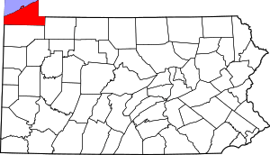 | |
| Boroughs | ||
| Townships | ||
| CDPs |
| |
| Unincorporated communities | ||
| Authority control |
|
|---|