Mattoon Township, Coles County, Illinois
Mattoon Township is one of twelve townships in Coles County, Illinois, USA. As of the 2010 census, its population was 15,817 and it contained 7,536 housing units.[2]
Mattoon Township | |
|---|---|
 Location in Coles County | |
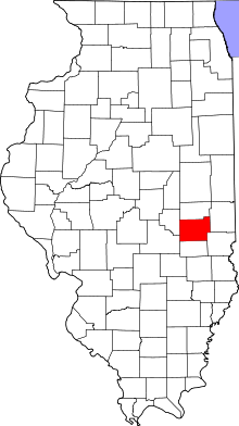 Coles County's location in Illinois | |
| Coordinates: 39°29′N 88°25′W | |
| Country | United States |
| State | Illinois |
| County | Coles |
| Established | November 8, 1859 |
| Area | |
| • Total | 36.17 sq mi (93.7 km2) |
| • Land | 36.17 sq mi (93.7 km2) |
| • Water | 0 sq mi (0 km2) 0% |
| Elevation | 715 ft (218 m) |
| Population (2010) | |
| • Estimate (2016)[1] | 15,362 |
| • Density | 437.3/sq mi (168.8/km2) |
| Time zone | UTC-6 (CST) |
| • Summer (DST) | UTC-5 (CDT) |
| ZIP codes | 61928, 61938 |
| FIPS code | 17-029-47566 |
Geography
According to the 2010 census, the township has a total area of 36.17 square miles (93.7 km2), all land.[2]
Cities, towns, villages
- Mattoon (west half)
Extinct towns
- Lane Acres
- Lipsey
- Magnet
- Wabash Point
Cemeteries
The township contains two cemeteries: Calvary and Dodge Grove.
Major highways


School districts
Political districts
- Illinois' 15th congressional district
- State House District 110
- State Senate District 55
References
- "Mattoon Township, Coles County, Illinois". Geographic Names Information System. United States Geological Survey. Retrieved 2010-01-10.
- United States Census Bureau 2007 TIGER/Line Shapefiles
- United States National Atlas
- "Population and Housing Unit Estimates". Retrieved June 9, 2017.
- "Population, Housing Units, Area, and Density: 2010 - County -- County Subdivision and Place -- 2010 Census Summary File 1". United States Census. Archived from the original on 2020-02-12. Retrieved 2013-05-28.
- "Census of Population and Housing". Census.gov. Retrieved June 4, 2016.
External links
Adjacent townships
Places adjacent to Mattoon Township, Coles County, Illinois | |
|---|---|
Municipalities and communities of Coles County, Illinois, United States | ||
|---|---|---|
| Cities | Map of Illinois highlighting Coles County | |
| Villages | ||
| Townships | ||
| Unincorporated communities | ||
| Extinct communities |
| |
| Footnotes | ‡This populated place also has portions in an adjacent county or counties | |
This article is issued from Wikipedia. The text is licensed under Creative Commons - Attribution - Sharealike. Additional terms may apply for the media files.