Mary's Harbour
Mary's Harbour is a town in the Canadian province of Newfoundland and Labrador. The town had a population of 341 in the Canada 2016 Census, down from 383 in the Canada 2011 Census, and 474 in the Canada 2006 Census. It is serviced by Mary's Harbour Airport. Mary's Harbour surrounds the St. Mary's River. St. Mary's River was the site of a salmon fishery as early as the 1780s. However Mary's Harbour was not a permanent settlement until after a fire at Battle Harbour in 1930. The International Grenfell Association decided to relocate its hospital and boarding school, destroyed by the fire, from Battle Harbour to Mary's Harbour. Mary's Harbour has always depended on the fishery for its livelihood. Since the Collapse of the Atlantic northwest cod fishery the community has thrived on the crab fishery. The Labrador Fishermen's Union Shrimp Company employs over 120 people at the local crab processing facility. It is also the gateway to the National Historic District of Battle Harbour.
Mary's Harbour | |
|---|---|
Town | |
 Mary's Harbour | |
| Nickname(s): Mary's Harbour | |
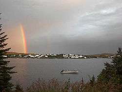
 Mary's Harbour Location of Mary's Harbour in Newfoundland  Mary's Harbour Mary's Harbour (Canada) | |
| Coordinates: 52°18′55″N 55°50′01″W | |
| Country | |
| Province | |
| Government | |
| • Type | Town Council |
| • Mayor | Alton Rumbolt |
| • MHA | Lisa Dempster |
| • MP | Yvonne Jones |
| Population (2016) | |
| • Total | 341 |
| Time zone | GMT -03:30 |
| Postal code | A0K 3P0 |
| Area code(s) | 709 |
| Highways | |
Notable residents
- Yvonne Jones, Member of Parliament for Labrador; former Leader of the Liberal Party of Newfoundland and Labrador
Climate
Mary's Harbour has a subarctic climate (Koppen: Dfc) with very cold winters in spite of its marine position, courtesy of the cold waters of the Labrador Current. Being located on the same latitude around 3,000 kilometres (1,900 mi) from almost frost-free areas of Ireland, the difference between the two Atlantic coastlines is rather extreme. As typical of eastern Canada, Mary's Harbour receives plenty of snowfall each winter. Unusual for such a climate, it has a pronounced seasonal lag, especially in the summer. A more typical subarctic climate, like Oymyakon, Russia has a temperature lag of only about 15 days.
| Climate data for Mary's Harbour | |||||||||||||
|---|---|---|---|---|---|---|---|---|---|---|---|---|---|
| Month | Jan | Feb | Mar | Apr | May | Jun | Jul | Aug | Sep | Oct | Nov | Dec | Year |
| Record high °C (°F) | 5.2 (41.4) |
5.0 (41.0) |
9.4 (48.9) |
14.7 (58.5) |
26.5 (79.7) |
35.6 (96.1) |
31 (88) |
32.6 (90.7) |
27.6 (81.7) |
19.0 (66.2) |
13.7 (56.7) |
9.2 (48.6) |
35.6 (96.1) |
| Average high °C (°F) | −9.0 (15.8) |
−8.4 (16.9) |
−3.4 (25.9) |
1.7 (35.1) |
7.6 (45.7) |
13.1 (55.6) |
17.6 (63.7) |
18.2 (64.8) |
13.7 (56.7) |
7.2 (45.0) |
0.9 (33.6) |
−5.3 (22.5) |
4.5 (40.1) |
| Daily mean °C (°F) | −14.4 (6.1) |
−13.8 (7.2) |
−8.7 (16.3) |
−2.2 (28.0) |
3.2 (37.8) |
8.1 (46.6) |
12.4 (54.3) |
13.1 (55.6) |
9.0 (48.2) |
3.4 (38.1) |
−2.7 (27.1) |
−10 (14) |
−0.2 (31.6) |
| Average low °C (°F) | −19.8 (−3.6) |
−19.1 (−2.4) |
−13.9 (7.0) |
−6.1 (21.0) |
−1.3 (29.7) |
3.3 (37.9) |
7.1 (44.8) |
8.0 (46.4) |
4.3 (39.7) |
−0.4 (31.3) |
−6.3 (20.7) |
−14.6 (5.7) |
−4.9 (23.2) |
| Record low °C (°F) | −33.0 (−27.4) |
−33.8 (−28.8) |
−33.2 (−27.8) |
−24.5 (−12.1) |
−11.4 (11.5) |
−3.3 (26.1) |
0 (32) |
0.2 (32.4) |
−4.0 (24.8) |
−11.4 (11.5) |
−21.2 (−6.2) |
−31.2 (−24.2) |
−33.8 (−28.8) |
| Average precipitation mm (inches) | 69.3 (2.73) |
81.0 (3.19) |
67.0 (2.64) |
51.0 (2.01) |
73.2 (2.88) |
95.4 (3.76) |
86.0 (3.39) |
89.2 (3.51) |
68.5 (2.70) |
92.9 (3.66) |
83.8 (3.30) |
86.7 (3.41) |
944 (37.18) |
| Source: weatherbase.com[1] | |||||||||||||
Demographics
| Canada 2016 Census | Population | % of Total Population | |
|---|---|---|---|
| Visible minority group Source:[2] | South Asian | 0 | 0.0 |
| Chinese | 0 | 0.0 | |
| Black | 0 | 0.0 | |
| Filipino | 0 | 0 .0 | |
| Latin American | 0 | 0.0 | |
| Southeast Asian | 0 | 0.0 | |
| Other visible minority | 0 | 0.0 | |
| Total visible minority population | 0 | 0.0 | |
| Aboriginal group Source:[2] | First Nations | 20 | 6.2 |
| Métis | 155 | 47.7 | |
| Inuit | 60 | 18.4 | |
| Total Aboriginal population | 200 | 61.5 | |
| White | 125 | 38.4 | |
| Total population | 325 | 100.0 | |
See also
- List of cities and towns in Newfoundland and Labrador
References
- http://www.weatherbase.com/weather/weather.php3?s=595348
- "Census Profile, 2016 Census: Division No. 10, Census division [Census division], Newfoundland and Labrador". Statistics Canada. Retrieved October 13, 2019.