Mangkalihat Peninsula
The Mangkalihat Peninsula, also known as the Sangkulirang-Mangkalihat Peninsula, is a peninsula in eastern Borneo. It is located in the Indonesian province of East Kalimantan, in the regencies of Berau and East Kutai.
 Mangkalihat Peninsula | |
| Geography | |
|---|---|
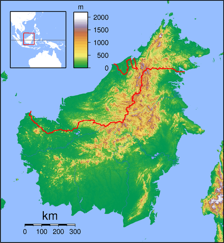
| Location | South East Asia |
| Coordinates | 1°15′00″N 118°15′00″E |
| Administration | |
| Province | |
The peninsula, as part of the Sangkulirang-Mangkalihat Karst, is notable for its rock art, dating to between 35,000 and 40,000 years ago.[1]
Geography
The Mangkalihat Peninsula separates the Celebes Sea in the north from the Makassar Strait in the south. It lies north of the Kutai Basin, and is separated from it by the Karangan River. The town of Sangkulirang lies at the base of the peninsula, and the northeastern Makassar Strait forms the Sangkulirang bay in its south.
This article is issued from Wikipedia. The text is licensed under Creative Commons - Attribution - Sharealike. Additional terms may apply for the media files.