Mandi Bahauddin
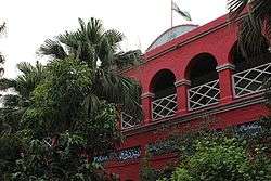
Mandi Bahauddin (Punjabi and Urdu: منڈی بہاءالدین) is a city in central Punjab, Pakistan. It is also the capital of Mandi Bahauddin District. Mandi Bahauddin is the 41th largest city of Pakistan by population according to the 2017 census.. The city is some 220 metres above sea level and is located in central Punjab, between the rivers Jhelum (north 12 km) and Chenab (south 39 km).
Mandi Bahauddin منڈی بہاءالدین M.B.Din | |
|---|---|
City | |
| Mandi Bahauddin | |
   .jpeg) | |
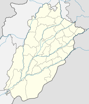 Mandi Bahauddin Location within Pakistan  Mandi Bahauddin Mandi Bahauddin (Pakistan) | |
| Coordinates: 32°34′47″N 73°28′53″E | |
| Country | |
| Province | |
| Division | Gujranwala |
| District | Mandi Bahauddin |
| Established | 1506 AD |
| NA/PP | 2/5 N.A (85,86) P.P(65,66,67,68) |
| No. of Towns | |
| Government | |
| • Type | Municipal Committee[1] |
| • Union Councils | 27 |
| Area | |
| • Total | 2,673 km2 (1,032 sq mi) |
| Elevation | 204 m (669 ft) |
| Population | |
| • Total | 198,609 |
| • Rank | 41st, Pakistan |
| • Density | 74/km2 (190/sq mi) |
| Demonym(s) | Mandi Wala |
| Time zone | UTC+5 (PST) |
| Postal code | 50400 |
| Dialling code | 0546 |
History
Early history
Mandi Bahauddin is also known as city of lions due to the brave people , The recorded history of Mandi Bahauddin goes back to the era before Common Era, connecting the region with the historic figure of Alexander the Great. Some 8 km northwest of the modern-day Mandi Bahauddin town, village Mong on the southern bank of Jhelum River (Greek Hydaspes), the battle Battle of the Hydaspes River was fought between Raja Porus (Sanskrit Paurava) and Alexander. This historic battle of Hydaspes River, which Indian sources refer to as the "Battle of Jhelum", took place in 326 BCE.[4] The kingdom of Raja Porus was situated in the northern Punjab of modern Pakistan. This battle proved the last major fight of Alexander's career, for the Macedonians, after being put up a fierce resistance by Porus' soldiery and having heard of a massive 4,000 elephant force mustered by eastern kingdoms, refused to march further east i.e. Ganges Plains.[5]The Sadar Gate built during the British era in 1933 is present here.
Administration
Mandi Bahauddin, the capital of the district, is also the Tehsil headquarters. Mandi Bahauddin was raised to the level of Municipal Committee in 1941. After the implementation of Punjab Local Government Ordinance 2001, it was given the status of Municipal Committee.[6] Municipal Committee of Mandi Bahauddin Tehsil has 27 Union Councils.[7]
Demographics
As per the 1998 Census of Pakistan, the population of city was recorded as 99,496 while according to the 2017 Census of Pakistan, the population of city was risen to 198,609 with an increase of over 99.62% in 19 years.[8] The population of Mandi Bahauddin District was recorded as 1,593,292 according to the Census of 2017.[9]
Education
Following are the some of notable educational institutes in the city:
- University of Gujrat, Mandi Bahauddin Campus
- The Superior College[10]
- Punjab College of Science[11]
- Beaconhouse School System[12]
References
- http://mcmandibahauddin.lgpunjab.org.pk
- https://www.census.gov.pk/PUNJAB/MANDI%20BAHAUDDIN.htm
- "Ten major cities' population up by 74pc". Retrieved 6 September 2017.
- Kaushik Roy, India's historic battles: from Alexander the great to Kargil, Delhi: Permanent Black, 2004, p.11
- Ruth Sheppard, Alexander the Great at War: His Army – His Battles – His Enemies, Oxford: Osprey Publishing, 2008, p.206
- http://mcmandibahauddin.lgpunjab.org.pk
- Tehsils & Unions in the District of Mandi Bahauddin – Government of Pakistan Archived 22 September 2008 at the Wayback Machine
- "Ten major cities' population up by 74pc". Retrieved 6 September 2017.
- "DISTRICT WISE CENSUS RESULTS CENSUS 2017" (PDF). www.pbscensus.gov.pk. Archived from the original (PDF) on 29 August 2017. Retrieved 3 September 2017.
- https://superiorcolleges.edu.pk/superior-college-mandi-bahauddin/
- https://www.pgc.edu/campus-network
- https://www.beaconhouse.net
Neighbourhoods of Mandi Bahauddin | ||
|---|---|---|
Administration: Mandi Bahauddin District | ||
| Tehsils |
|  |
| Cities |
| |
| Union Councils of Phalia |
| |
| Union Councils of Malakwal |
| |
| Union Councils of Mandi Bahauddin |
| |
Website: [Mandi Bahauddin District at NRB | ||