Manchester, Monterey County, California
Manchester (sometimes known as Mansfield) was a mining town in the southern Big Sur region of Monterey County, California from about 1875 to 1895. The town was reached by a 45 miles (72 km) road and 14 miles (23 km) rough, steep trail from King City via a very rough stage road and about 4 miles (6.4 km) east of Cape San Martin. Prospecting began in the area in the 1850s. In the spring of 1887, William Dugay Cruikshank discovered lode gold at the head of Alder Creek. He opened the Last Chance Mine, later known as the Buclimo Mine.[3]
Manchester Mansfield | |
|---|---|
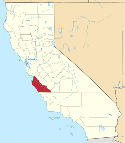
 Manchester Location in California | |
| Coordinates: 35°52′52″N 121°23′33″W | |
| Country | United States |
| State | California |
| County | Monterey County |
| Elevation | 135 ft (41 m) |
| ZIP code | 93920[2] |
| FIPS code | 06-44427 |
History
The Los Burros Mining District was organized in 1875. It comprised about 8 square miles (21 km2). It was defined as:
Commencing at the Mouth of the San Kapoko [Carpforo creek] following the Pacific Ocean Northerly to Premits [Prewitts] Trail. Thence following said trail to McKerns. Thence following the Nassimienta [Naciemiento] to the mouth of the Los Burros Creek. Thence to the place of beginning.
During the first year, 63 claims were recorded. Eventually around 500 claims existed. Cruikshank worked the Last Chance Mine until he sold it to the Krinkle family. Manchester was built downhill from the mine. At its height, several hundred miners lived and worked there. The town had three stamp mills, four stores, five saloons, a dance hall, restaurant, hotel, a barber shop, post office, blacksmith, a small one roomed school, mess halls, bunkhouses, a few cabins, a cemetery, and a dance hall.[4][5]
Manchester was served by the Mansfield post office from 1889 to 1897. A fire destroyed the town in 1882. By 1895 the boom had begun to fade. Additional fires destroyed all traces of the town.[6] William T. Cruikshank disappeared on the rugged trail to King City to catch the train to San Francisco and was never found.[7]
Another flurry of activity in the early 1900s followed placer gold discoveries in the various forks of Willow Creek. Intermittent small-scale prospecting and development work have continued in the district until the present time. There was a recorded production of several hundred dollars worth of gold in 1953 and again in 1963. It is believed that 2000 or more claims have been located in the district. About 350 people lived in the town at the height of its popularity.[8]
Geology
Dark sandstone is most abundant and is also the chief host rock of the gold-bearing deposits. Also present are chert, shale, serpentine, and volcanic rocks. Most of the gold has been recovered from small lenticular ore shoots in oxidized zones near the surface. The sulfides, which consist of fine-grained pyrite and small amounts of chalcopyrite and arsenopyrite generally, are low in gold content. Most of the placer gold has come from Willow Creek, and much of it was concentrated as coarse ragged fragments. Very small amounts have been found in Alder, Plaskett, and Salmon Creeks.[8]
Mineral production
The mining occurred in three nearly parallel quartz veinlets, parallel to a layer of sandstone. The gold was removed via open cuts, shafts, and drift tunnels. The Last Chance reached a maximum depth of 160 feet (49 m). In 1902, large gold nuggets were found on Spruce Creek and placer gold was found in Willow Creek.[3]:326
Ancona, Buclimo $62,000; Bushnell, Gorda, Grizzly, Mariposa, Melville, New York, Plaskett (placer) $18,000; Spruce (placer) $22,000. The value of the total output is estimated to be about $150,000.
References
- "Big Sur". Geographic Names Information System. United States Geological Survey. Retrieved April 16, 2020.
- "ZIP Code(tm) Lookup". United States Postal Service. Retrieved April 16, 2020.
- Hill, James (1923). "Los Burrows District, Monterey County, California" (PDF). Department of the Interior, U.S. Geological Survey. Retrieved 17 April 2020.
- "Lucia, California Big Sur Coast". www.seecalifornia.com. Retrieved 17 April 2020.
- Henson, Paul; Usner, Donald J. (1996). The Natural History of Big Sur. University of California Press. p. 389. ISBN 978-0-520-20510-9.
- "Manchester - Big Sur - CA - US". Historical Marker Project. Retrieved 17 April 2020.
- Thornton, Stuart. "A dirty journey to the lost city of the Santa Lucias". Monterey County Weekly. Retrieved 17 April 2020.
- "Manchester of the Los Burros - Hobbit Mine". sites.google.com. Retrieved 17 April 2020.