Malborn
Malborn is an Ortsgemeinde – a municipality belonging to a Verbandsgemeinde, a kind of collective municipality – in the Bernkastel-Wittlich district in Rhineland-Palatinate, Germany.
Malborn | |
|---|---|
 Coat of arms | |
Location of Malborn within Bernkastel-Wittlich district 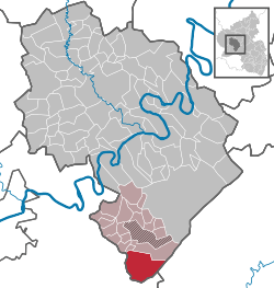 | |
 Malborn  Malborn | |
| Coordinates: 49°42′59″N 6°59′16″E | |
| Country | Germany |
| State | Rhineland-Palatinate |
| District | Bernkastel-Wittlich |
| Municipal assoc. | Thalfang am Erbeskopf |
| Government | |
| • Mayor | Gabriele Neurohr |
| Area | |
| • Total | 26.31 km2 (10.16 sq mi) |
| Elevation | 500 m (1,600 ft) |
| Population (2018-12-31)[1] | |
| • Total | 1,343 |
| • Density | 51/km2 (130/sq mi) |
| Time zone | CET/CEST (UTC+1/+2) |
| Postal codes | 54426 |
| Dialling codes | 06503, 06504 |
| Vehicle registration | WIL |
| Website | www.malborn-thiergarten.de |
Geography
Location
The municipality lies in the Hunsrück. The municipal area covers 26.3 km², of which 18.4 km² is wooded. Malborn lies at the foot of the Steinkopf (683 m above sea level), on which stands a lookout tower
Near Malborn rises the river Prims, which is dammed up in the Primstalsperre (reservoir), and which empties into the Saar near Dillingen.
Malborn belongs to the Verbandsgemeinde of Thalfang am Erbeskopf, whose seat is in the municipality of Thalfang.
Constituent communities
Malborn's Ortsteile are the main centre, also called Malborn, and the outlying centre of Thiergarten.
History
In 981, Malborn had its first documentary mention. As a result of the turmoil of the French Revolution, Malborn lay under French rule beginning about 1800. In 1814 it was assigned to the Kingdom of Prussia at the Congress of Vienna. Since 1947, it has been part of the then newly founded state of Rhineland-Palatinate.
Politics
Municipal council
The council is made up of 16 council members, who were elected by proportional representation at the municipal election held on 7 June 2009, and the honorary mayor as chairwoman. The municipal election held on 7 June 2009 yielded the following results:[2]
| CDU | WG Lauer | Total | |
| 2009 | 10 | 6 | 16 seats |
| 2004 | 9 | 7 | 16 seats |
Coat of arms
The municipality's arms might be described thus: Tierced in mantle, dexter vert three fir trees Or, sinister vert three ears of wheat banded in base and couped of the second, and the base chequy argent and gules, in a chief of the third a cross of the last.
The tinctures argent and gules (silver and red) recall two of the municipality's historical allegiances: the cross in the chief is a reference to the villages’ former allegiance to the Electorate of Trier, while the “chequy” pattern refers to the Counts of Sponheim. The fields in the tinctures vert and Or (green and gold) refer to the municipality's historical livelihood in forestry, with its considerable woodlands symbolized on the dexter (armsbearer's right, viewer's left) side by the three stylized trees, and agriculture, symbolized on the sinister (armsbearer's left, viewer's right) side by the three ears of wheat.[3]
Further reading
- Willi Schmitt: Ortskunde von Malborn Thiergarten. veröffentlicht 1973.
- Willi Schmitt (Teil 1) und Kurt Bach (Teil 2): Malborn - ein Hochwaldort und seine Geschichte. herausgegeben von der Ortsgemeinde zur 1000-Jahrfeier 1981.
- Bernd Kimmling: Die Einwohner von Malborn-Thiergarten mit den dazugehörigen Mühlen und Höfen und dem Weiler Röderbach 1708 - 1908. herausgegeben von der Ortsgemeinde 2001.
References
- "Bevölkerungsstand 2018 - Gemeindeebene". Statistisches Landesamt Rheinland-Pfalz (in German). 2019.
- Kommunalwahl Rheinland-Pfalz 2009, Gemeinderat
- Description and explanation of Malborn’s arms Archived 2011-02-13 at the Wayback Machine
External links
| Wikimedia Commons has media related to Malborn. |
- Official website

- Cultural heritage and sightseeing (in German)
| Authority control |
|
|---|