Maize, Kansas
Maize is a city in Sedgwick County, Kansas, United States, and a suburb of Wichita.[6] As of the 2010 census, the city population was 3,420.[7] Maize, derived from a Native American word for "corn", was so named because it is located within the Corn Belt.[8]
Maize, Kansas | |
|---|---|
 Location within Sedgwick County and Kansas | |
 KDOT map of Sedgwick County (legend) | |
| Coordinates: 37°46′45″N 97°28′2″W | |
| Country | United States |
| State | Kansas |
| County | Sedgwick |
| Founded | 1886 |
| Incorporated | 1915 |
| Named for | Maize |
| Area | |
| • Total | 8.84 sq mi (22.90 km2) |
| • Land | 8.84 sq mi (22.90 km2) |
| • Water | 0 sq mi (0 km2) |
| Elevation | 1,348 ft (411 m) |
| Population | |
| • Total | 3,420 |
| • Estimate (2018)[3] | 4,662 |
| • Density | 390/sq mi (150/km2) |
| Time zone | UTC-6 (Central (CST)) |
| • Summer (DST) | UTC-5 (CDT) |
| ZIP code | 67101 |
| Area code | 316 |
| FIPS code | 20-44200 [4] |
| GNIS feature ID | 0473821 [5] |
| Website | cityofmaize.org |
History
The Maize Town Company, led by N. F. Neiderlander, founded Maize in 1886 at the first stop outside of Wichita on the Wichita and Colorado Railway. The post office opened that same year as did the town's first church, having relocated from nearby. Maize's first school opened in 1887; its first newspaper opened in 1895. Maize State Bank, the town's first financial institution, opened in 1901, and, by 1908, a business community had emerged. In 1915, the Maize Town Company dissolved, and Maize was incorporated as a city.[9]
Several natural disasters struck Maize in the 1930s and 1940s, including the Dust Bowl in 1934–35, a plague of grasshoppers in 1936, and a flood in 1944.[9]
Maize began to grow rapidly in 1950, more than doubling in size by 1956.[9] This growth has continued, accelerating in recent years as Wichita has expanded to the northwest, and transformed Maize into a suburb.[6]
Geography
Maize is located at 37°46′45″N 97°28′2″W (37.779178, -97.467267)[10] at an elevation of 1,348 feet (411 m).[5] It lies on the west side of Big Slough Creek roughly 3 miles (4.8 km) southwest of the Arkansas River in the Wellington-McPherson Lowlands region of the Great Plains. Located in south-central Kansas, Maize is on K-96 immediately northwest of Wichita.
According to the United States Census Bureau, the city has a total area of 8.84 square miles (22.90 km2), all of it land.[1]
Demographics
| Historical population | |||
|---|---|---|---|
| Census | Pop. | %± | |
| 1920 | 189 | — | |
| 1930 | 229 | 21.2% | |
| 1940 | 198 | −13.5% | |
| 1950 | 266 | 34.3% | |
| 1960 | 623 | 134.2% | |
| 1970 | 785 | 26.0% | |
| 1980 | 1,294 | 64.8% | |
| 1990 | 1,520 | 17.5% | |
| 2000 | 1,868 | 22.9% | |
| 2010 | 3,420 | 83.1% | |
| Est. 2018 | 4,662 | [3] | 36.3% |
| U.S. Decennial Census[11] | |||
Maize is part of the Wichita, KS Metropolitan Statistical Area.
2010 census
As of the census[2] of 2010, there were 3,420 people, 1,172 households, and 942 families living in the city. The population density was 386.9 inhabitants per square mile (149.4/km2). There were 1,284 housing units at an average density of 145.2 per square mile (56.1/km2). The racial makeup of the city was 91.3% White, 1.5% African American, 1.1% Native American, 1.1% Asian, 0.1% Pacific Islander, 1.3% from other races, and 3.6% from two or more races. Hispanic or Latino of any race were 7.4% of the population.
There were 1,172 households of which 49.4% had children under the age of 18 living with them, 59.4% were married couples living together, 15.2% had a female householder with no husband present, 5.8% had a male householder with no wife present, and 19.6% were non-families. 17.2% of all households were made up of individuals and 7.4% had someone living alone who was 65 years of age or older. The average household size was 2.92 and the average family size was 3.28.
The median age in the city was 30.7 years. 34.1% of residents were under the age of 18; 7.6% were between the ages of 18 and 24; 27.7% were from 25 to 44; 21.8% were from 45 to 64; and 8.8% were 65 years of age or older. The gender makeup of the city was 48.6% male and 51.4% female.
2000 census
As of the census[4] of 2000, there were 1,868 people, 632 households, and 523 families living in the city. The population density was 2,274.9 people per square mile (879.6/km²). There were 668 housing units at an average density of 813.5 per square mile (314.5/km²). The racial makeup of the city was 93.47% White, 0.96% African American, 1.23% Native American, 0.32% Asian, 0.91% from other races, and 3.10% from two or more races. Hispanic or Latino of any race were 2.62% of the population.
There were 632 households out of which 49.4% had children under the age of 18 living with them, 66.6% were married couples living together, 11.4% had a female householder with no husband present, and 17.2% were non-families. 15.7% of all households were made up of individuals and 6.0% had someone living alone who was 65 years of age or older. The average household size was 2.96 and the average family size was 3.28.
In the city, the population was spread out with 34.4% under the age of 18, 8.0% from 18 to 24, 30.7% from 25 to 44, 19.9% from 45 to 64, and 7.1% who were 65 years of age or older. The median age was 30 years. For every 100 females, there were 100.4 males. For every 100 females age 18 and over, there were 97.1 males.
The median income for a household in the city was $51,845, and the median income for a family was $53,365. Males had a median income of $41,653 versus $25,817 for females. The per capita income for the city was $18,803. About 1.9% of families and 3.0% of the population were below the poverty line, including 4.4% of those under age 18 and 1.4% of those age 65 or over.
Government
Maize has a mayor-council-administrator form of government. The city council consists of the mayor and five members who serve part-time. The mayor is elected to a four-year term while terms for council members are staggered such that two members are up for election every two years.[12]
Education
Primary and secondary education
Maize USD 266 operates twelve schools in and around the city:[13]
- Early Childhood Center (Grades Pre-K)
- Maize Central Elementary School (K-5)
- Maize Elementary School (K-1)
- Maize South Elementary School (2-5)
- Pray-Woodman Elementary School (2-5)
- Vermillion Elementary School
- Maize Middle School (6-8)
- Maize South Middle School (6-8)
- Maize High School (9-12)
- Maize Career Academy (9-12)
- Maize South High School (9-12)
- Complete High School Maize (9-12), alternative school
Infrastructure
Transportation
K-96 runs southeast–northwest along the northeast side of the city.
The Hutchinson line of the Kansas and Oklahoma Railroad runs southeast–northwest through Maize.
Maize Airport is a privately owned, public-use airport located two nautical miles (2.3 mi, 3.7 km) southeast of the central business district of Maize.
Notable people
Notable individuals who were born in and/or have lived in Maize include:
- Nancy Kassebaum (1932- ), U.S. Senator from Kansas[14]
- Richard Kassebaum (1960-2008), documentary filmmaker[14]
- Miles Ukaoma (1992-), Olympian
References
- "US Gazetteer files 2010". United States Census Bureau. Archived from the original on January 12, 2012. Retrieved July 6, 2012.
- "U.S. Census website". United States Census Bureau. Retrieved July 6, 2012.
- "Population and Housing Unit Estimates". Retrieved November 16, 2019.
- "U.S. Census website". United States Census Bureau. Retrieved January 31, 2008.
- "US Board on Geographic Names". United States Geological Survey. October 25, 2007. Retrieved January 31, 2008.
- "Community". Maize Area Chamber of Commerce. 2008. Archived from the original on April 26, 2010. Retrieved August 16, 2010.
- "2010 City Population and Housing Occupancy Status". U.S. Census Bureau. Retrieved March 6, 2011.
- Bentley, Orsemus Hills (1910). History of Wichita and Sedgwick County, Kansas: Past and Present. Windmill Publications. p. 634.
- "History". City of Maize. 1986. Retrieved August 16, 2010.
- "US Gazetteer files: 2010, 2000, and 1990". United States Census Bureau. February 12, 2011. Retrieved April 23, 2011.
- "U.S. Decennial Census". Census.gov. Retrieved August 21, 2014.
- "City Government". City of Maize. Archived from the original on January 4, 2010. Retrieved August 17, 2010.
- "Schools". Maize Unified SD 266. Archived from the original on July 17, 2011. Retrieved August 15, 2010.
- "Kassebaum, Nancy Landon (1932- )". U.S. House of Representatives. Retrieved April 6, 2016.
Further reading
External links
| Wikimedia Commons has media related to Maize, Kansas. |
- City
- Historical
- Moxi Junction - Creating A 'Life' For Special Needs Young Adults on YouTube, from Hatteberg's People on KAKE TV news
- Maps
- Maize City Map, KDOT
Municipalities and communities of Sedgwick County, Kansas, United States | ||
|---|---|---|
| Cities | 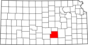 Map of Kansas highlighting Sedgwick County | |
| Unincorporated CDPs | ||
| Unincorporated communities | ||
| Townships | ||
| Footnotes | ‡This populated place also has portions in an adjacent county or counties | |
| Authority control |
|---|