Magangué
Magangué is a municipality of Colombia in the Department of Bolivar. The town is located in the Magdalena River; 20 km north of the mouth of the Cauca River, the Magdalena River. According to projections, the city has a population of over 198,000 inhabitants, becoming the twenty-seventh largest city in Colombia, with about 800,000 inhabitants in the Association Sabana Metropolitan, making it the eighth largest metropolitan area in Colombia. It is the second largest city of the Department, and the ninth largest of the Caribbean Region. Magangué was home to the country's largest port, now badly damaged by the problems of political corruption. It has been shown that the city has great national potential, due to its strategic location.
Magangué | |
|---|---|
.svg.png) Flag  Seal | |
| Nickname(s): City of the Rivers, Cosmopolitan City | |
| Motto(s): "Wealth And Prosperity" / "Riqueza y Prosperidad" | |
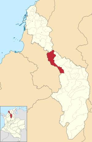 Location of the municipality and town of Magangué in the Bolívar Department of Colombia. | |
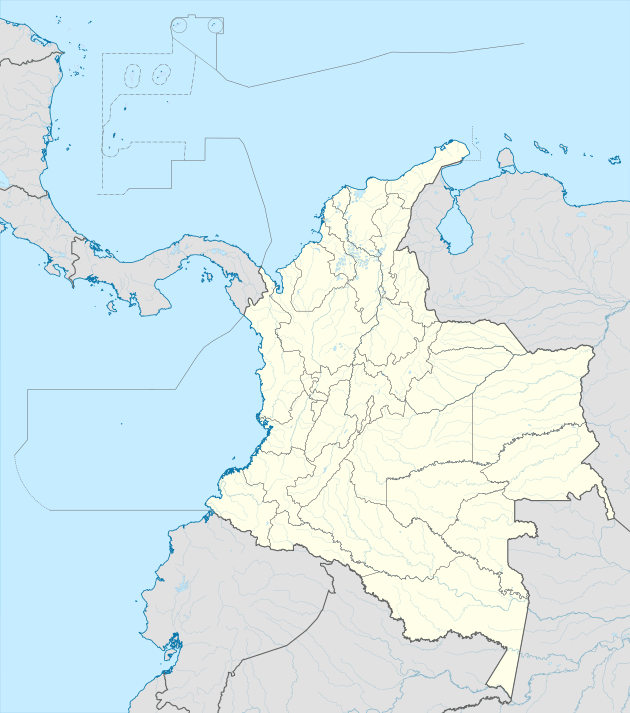 Magangué Location in Colombia | |
| Coordinates: 9°15′N 74°46′W | |
| Country | Colombia |
| Department | Bolívar Department |
| Region | Caribbean |
| Founded | April 10, 1610 |
| Erection | February 13, 1813 |
| Government | |
| • Type | Mayor and Secretary-General |
| • Mayor | Carlos Emil Cabrales Isaac |
| Area | |
| • Total | 1,568 km2 (605 sq mi) |
| • Land | 1,043 km2 (403 sq mi) |
| • Water | 525 km2 (203 sq mi) 33.48% |
| Elevation | 49 m (161 ft) |
| Population (2019 est.[1]) | |
| • Total | 123,982 |
| • Density | 79/km2 (200/sq mi) |
| • Demonym | Magangueleño(a) or Magueño(a) |
| Time zone | UTC-5 (Colombia Standard Time) |
History
Studies and research are still in their infancy, there are only approaches and assumptions based on interpretations of the records left by some writers and settlers who came from Spain. Most of them assert that original population were indigenous belonging to the family Chimilas Carib language that inhabited the extensive river and lake region of Bolivar, Sucre, Magdalena and Cesar departments. The highest regional authority was the Chimilas Mompox and her chiefdoms: Maguey, Yati, or Simacoa Tacaloa, etc. Guazo. Indigenous had an average height of 1.65 meters, were more or less heavyset, had black hair, short legs, dark skin and short prominent nose. Despite speaking a language related to that of the Carib people, who were warlike and resisted the Spaniards, the Maguey were peaceful and docile. They mainly engaged in the farming of cassava and corn and were also experts in fishing and hunting. Both men and women engaged in these tasks.
Administrative divisions
The urban area is divided into an average of 50 to 70 neighborhoods, including:
- Florida
- Camilo Torres
- Olaya Herrera
- El Sur
- San Pablo
- San José
- El Prado
- San Mateo
- Pastrana
- El Recreo
The rural area is organized in 43 districts.
The major townships are:
- Ceibal
- Juan Árias
- San Sebastián de Madrid
- La Pascuala
- Yatí
- Cascajal
- Henequén
- El Cuatro
- Betania
- Retiro
- Barbosa
- Coyongal
- San Antonio
References
- "Estimaciones de Población 1985 - 2005 y Proyecciones de Población 2005 - 2020 Total Municipal por Área (estimate)". DANE. Retrieved 20 June 2019.
| Authority control |
|
|---|