El Carmen de Bolívar
El Carmen de Bolivar is a municipality in the department of Bolivar, Colombia, 114 km southeast of Cartagena, in the mountain system of the Serrania de San Jacinto, near the Colombian Caribbean coast.
El Carmen de Bolívar | |
|---|---|
Municipality and town | |
.svg.png) Flag  Seal | |
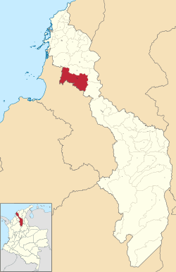 Location of the municipality and town of El Carmen de Bolívar in the Bolívar Department of Colombia | |
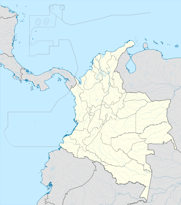 El Carmen de Bolívar Location in Colombia | |
| Coordinates: 9°43′N 75°08′W | |
| Country | |
| Department | |
| Founded | 1776 |
| Area | |
| • Municipality and town | 954 km2 (368 sq mi) |
| Elevation | 197 m (646 ft) |
| Population (2015) | |
| • Municipality and town | 159,987 |
| • Density | 170/km2 (430/sq mi) |
| • Urban | 143,039 |
| Demonym(s) | Carmero |
| Area code(s) | 57 + 5 |
| Website | Official website (in Spanish) |
History
This area was initially inhabited by the Native American tribes of Malibúes, Farotos and Piletas, and was later conquered and colonized by the Spanish naming it sitio de Nuestra Señora del Carmen or "Our Lady of El Carmen site" in 1776 by a Spanish officer named Antonio de La Torre y Miranda, under the orders of Juan de Torrezal Díaz de Pimienta, Governor of Cartagena of Indies.
Geography
The municipality of El Carmen de Bolivar is located south of the municipality of San Jacinto, north of the municipality of Ovejas, Sucre, west of the municipalities of Zambrano and Córdoba, and east of the municipality of San Onofre, Sucre, covering a total area of 954 km².
Political Division
Corregimientos
- Caracolí Grande: subdivided into the veredas and caseríos of La Cansona, Ojo Seco, El Ojito, Camaroncito, El Coco, La Zarza, Hondible, El Algodón and Lazaro.
- Macayepos: Subdivided into the caseríos and veredas of Limón, Joján, Jojancito, La sierra, El Cielo, El Orejero, Venado, Berruga, Centro Alegre, Berruguita and El Aguacate.
- Bajo Grande: formed by the caseríos and veredas of Santa Lucía, Raizal, La Pita, Pozo Oscuro, La Florida and Carocolicito.
- San Carlos: formed by the caseríos and veredas of El Bajito, Buenavista, Tierra Grata, La Victoria, El Alférez, Guamito and El Sapo.
- El Hobo: formed by the caseríos and veredas of Guaimito, Mazingá, Turquía, Sabaneta and La Puente.
- El Salado: formed by the caseríos and veredas of Jacinto, Tacaloa, El Varguero, Arenas del Sur, Mata caballo, El Reforma, El Umbral and La Estrella.
- San Isidro: formed by the caseríos and veredas of Guamanga, Mamón de María, Romualdo, Pasa Corriendo, Camarón, Caña Salada, Arroyo lejo, Las Lajas and Las Lajitas.
- Jesús del Monte: formed by the caseríos and veredas of Hato Nuevo, Mandatú, El Bongal, Apure, Piedras Blancas, Las vacas, Motaperro, Calsoncito, El Bledo, Piedra Azul, La Cesta, El Ceibal, La Negra, San Martín, El Encanto, Rebulicio and Los Andes.
References
- (in Spanish) El Carmen de Bolivar official website
- http://whynationsfail.com/blog/2012/3/26/whos-afraid-of-development-the-colombian-version.html