Machupicchu District
Machupicchu (from Quechua Machu Pikchu,[1] "old peak")[2] is one of seven districts of the Urubamba Province in Peru.[3] Its seat is the village of Machupicchu.[4]
Machupicchu Machu Pikchu | |
|---|---|
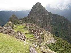 The archaeological site of Machu Pikchu in the Machupicchu District | |
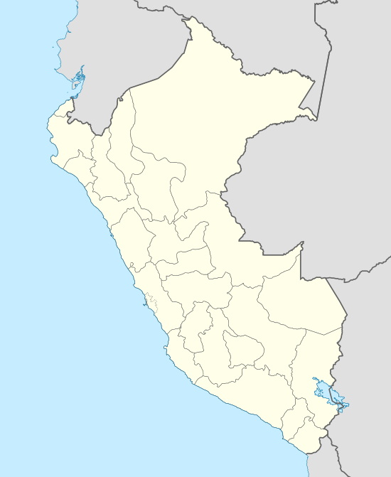 Machupicchu Location of Machupicchu in the Urubamba province | |
| Coordinates: | |
| Country | |
| Region | Cusco |
| Province | Urubamba |
| Founded | October 1, 1941 |
| Capital | Machupicchu |
| Government | |
| • Mayor | Darwin Baca León (2019-2022) |
| Area | |
| • Total | 271.44 km2 (104.80 sq mi) |
| Elevation | 2,060 m (6,760 ft) |
| Population (2017) | |
| • Total | 5,347 |
| • Density | 20/km2 (51/sq mi) |
| Time zone | UTC-5 (PET) |
| UBIGEO | 081304 |
Geography
The Urupampa and Willkapampa mountain ranges traverse the district. Some of the highest mountains of the district are listed below:[5]
- K'urkur Urqu
- Phutuq K'usi
- P'allqay
- Sallqantay
- Tunki Urqu
- Wayna Pikchu
See also
- Kusichaka River
- Machu Pikchu
- Machu Q'inti
- Pakaymayu
- Patallaqta
- Runkuraqay
- Warmi Wañusqa
- Wayna Q'inti
References
- Nonato Rufino Chuquimamani Valer, Carmen Gladis Alosilla Morales, Victoria Choque Valer: Qullaw Qichwapa Simi Qullqan. Lima, 2014 p. 70
- Teofilo Laime Acopa, Diccionario Bilingüe, Iskay simipi yuyay k'ancha, Quechua – Castellano, Castellano – Quechua.
- (in Spanish) Instituto Nacional de Estadística e Informática. Banco de Información Distrital Archived 2008-04-23 at the Wayback Machine. Retrieved April 11, 2008.
- spij.minjus.gob.pe Ley 9396 (Law 9396 of October 1, 1941) (in Spanish): "... El nuevo distrito que se crea por la presente ley se denominará Machupicchu y tendrá por capital la población de este nombre que se ha formado alrededor de la actual Estación de Machupicchu. ..."
- escale.minedu.gob.pe - UGEL map of the La Convención Province 1 (Cusco Region)
| |
|---|---|
| Acomayo | |
| Anta | |
| Calca | |
| Canas | |
| Canchis | |
| Chumbivilcas | |
| Cusco | |
| Espinar | |
| La Convención | |
| Paruro | |
| Paucartambo | |
| Quispicanchi | |
| Urubamba | |
This article is issued from Wikipedia. The text is licensed under Creative Commons - Attribution - Sharealike. Additional terms may apply for the media files.