Lyantonde
Lyantonde is a town in the southern part of the Central Region of Uganda. It is the main municipal, administrative, and commercial center of Lyantonde District.
Lyantonde | |
|---|---|
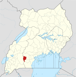
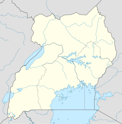 Lyantonde Map of Uganda showing the location of Lyantonde. | |
| Coordinates: | |
| Region | Central Region of Uganda |
| District | Lyantonde District |
| Population (2014 census) | |
| • Total | 13,586[1] |
| Time zone | UTC+3 (EAT) |
Location
Lyantonde is approximately 74 kilometres (46 mi), by road, west of Masaka, the nearest large city, on the all-weather highway between Masaka and Mbarara.[2] This is approximately 204 kilometres (127 mi), by road, south-west of Kampala, the capital and largest city of Uganda.[3] The coordinates of the town are 00 24 25S, 31 09 27E (Latitude: -0.4070; Longitude:31.1575).[4]
Population
In 2002, the national population census estimated the population of the town to be 7,500. In 2010, the Uganda Bureau of Statistics (UBOS) estimated the population at 8,700. In 2011, UBOS estimated the mid-year population at 8,900.[5] During the national census and household survey of 27 and 28 August 2014, the Uganda Bureau of Statistics (UBOS), enumerated the population of Lyantonde Town at 13,586 people.[1]
Overview
The town lies along the Masaka-Mbarara Road which connects to Kampala, Uganda's capital to the east and Kigali, the capital city of Rwanda to the southwest. Lyantonde serves as a stop-over for long-distance truck drivers plying this route. Although prostitution is illegal in Uganda, prostitutes are readily available in Lyantonde town.[6]
Points of interest
The following points of interest lie within the town limits or near the town edges: (a) The headquarters of Lyantonde District Administration (b) Lyantonde General Hospital, a 100-bed public hospital administered by the Uganda Ministry of Health (c) Offices of Lyantonde Town Council (d) Lyantonde central market (e) Masaka-Mbarara Road, which passes through the middle of town in a general east/west direction (f) Salaama Vocational Education Centre (SVEC).[7]
See also
References
- UBOS (November 2014). "National Population and Housing Census 2014: Provisional Results: Appendix 3 - Households and Population by Subcounty/ Town Council/Urban Division and Sex, 2014" (PDF). Kampala: Uganda Bureau of Statistics (UBOS). Archived from the original (PDF) on 10 January 2017. Retrieved 31 July 2017.
- GFC (31 July 2017). "Distance between Masaka, Central Region, Uganda and Lyantonde, Central Region, Uganda". Globefeed.com (GFC). Retrieved 31 July 2017.
- GFC (31 July 2017). "Distance between Uganda Post Office, Kampala Road, Kampala, Uganda and Lyantonde, Central Region, Uganda". Globefeed.com (GFC). Retrieved 27 May 2014.
- Google (16 July 2015). "Location of Lyantonde at Google Maps" (Map). Google Maps. Google. Retrieved 16 July 2015.
- UBOS (31 July 2017). "Estimated Population of Lyantonde In 2002, 2010 & 2011" (PDF). Kampala: Uganda Bureau of Statistics (UBOS). Retrieved 31 July 2017.
- Mednick, Sam (8 April 2014). "Prostitutes of Uganda's HIV Capital". Vice.com. Retrieved 31 July 2017.
- Ssali, Michael (7 January 2015). "Lyantonde's Response to the AIDS Scourge". Daily Monitor. Kampala. Retrieved 25 June 2016.
External links
Capital: Lyantonde | ||
| Counties and sub-counties |
|  |
| Towns and villages |
| |
| Banking | ||
| Notable landmarks | ||
| Notable people |
| |