Lowestoft
Lowestoft (/ˈloʊ(ɪ)stɒft, ˈloʊstəf/) is an English North Sea coast town and civil parish in the county of Suffolk.[3] On the edge of The Broads, it is the most easterly UK settlement, 110 miles (177 km) north-east of London, 38 miles (61 km) north-east of Ipswich and 22 miles (35 km) south-east of Norwich. As the main town in the district of East Suffolk, it had an estimated 73,775 inhabitants in 2018.[1][1] A port town, it developed out of the fishing industry and as a seaside resort with wide, sandy beaches. As its fisheries declined, oil and gas exploitation in the southern North Sea in the 1960s added to its development, alongside nearby Great Yarmouth. These roles have declined, but it is developing as a regional centre of the renewable energy industry.
| Lowestoft | |
|---|---|
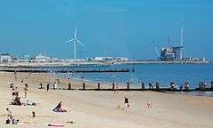 Lowestoft beach and outer harbour | |
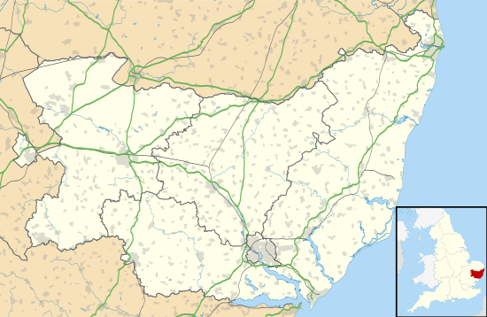 Lowestoft Location within Suffolk | |
| Population | 71,010 [1][2] |
| OS grid reference | TM548933 |
| • London | 110 mi (180 km) South-west |
| Civil parish |
|
| District |
|
| Shire county | |
| Region | |
| Country | England |
| Sovereign state | United Kingdom |
| Post town | Lowestoft |
| Postcode district | NR32, NR33 |
| Dialling code | 01502 |
| Police | Suffolk |
| Fire | Suffolk |
| Ambulance | East of England |
| UK Parliament | |
| Website | http://Eastangliatoday.com |
History
Some of the earliest evidence of settlement in Britain was found here. The discovery of flint tools in the cliffs at Pakefield in south Lowestoft in 2005 means that human habitation of the Lowestoft area can be traced back 700,000 years.[4]
The area was inhabited in the Neolithic, Bronze and Iron ages and in the Roman and Saxon periods. Several finds have been made at a Saxon cemetery at Bloodmoor Hill in south Lowestoft.[5][6] The place name derives from a Viking personal name, Hlothver, and toft,[7] a Viking word for homestead. It has been variously spelt as Lothnwistoft, Lothuwistoft, Lestoffe, Laistoe, Loystoft and Laystoft.
The 1086 Domesday Book gives Lothuwistoft village a population of some 16 households in three families, with ten smallholders and three slaves.[8][9] The manor formed part of the king's holding in the Hundred of Lothingland, worth about four geld in tax income.[9][10] Roger Bigod was the tenant in chief.[10] The lost village of Akethorpe may have lain close by.[11]
In the Middle Ages, Lowestoft became an increasingly important fishing town that grew to challenge its neighbour, Great Yarmouth.[12][13] The trade, particularly for herring, continued as the town's main identity into the 20th century.
The naval Battle of Lowestoft in June 1665 was the first of the Second Anglo-Dutch War. Held 40 miles (64 km) off the coast, it was a clear victory for the English over the Dutch.[14]
Lowestoft Porcelain Factory, between 1757 and 1802, was in production for longer than any English soft-paste porcelain manufacturer other than Royal Worcester and Royal Crown Derby, producing domestic ware such as pots, teapots and jugs.[12] It was built on the site of an existing pottery or brick kiln, and used later as a brewery and malt kiln. Most of its remaining buildings were demolished in 1955.
Sir Samuel Morton Peto's 19th-century arrival in Lowestoft brought a change in the town's fortunes that included improving the fishing industry.[13] To help stimulate it, Peto was given the task of building a railway line for the Lowestoft Railway and Harbour Company, connecting the town with Reedham and the city of Norwich, as further stimulation for the fishing industry.[15] Its completion had a profound impact on the town's industrial development – its fishing fleets could sell to markets further inland, and it assisted other industries such as engineering, through boosted trade with the continent.[15] Peto's railway was key also to establishing Lowestoft as a flourishing seaside holiday resort.[13][15]
During World War I, Lowestoft was bombarded by the German Navy on 24 April 1916 in conjunction with the Easter Rising. The port was a major naval base during the war, including for armed trawlers such as Ethel & Millie and Nelson used to combat German U-boat actions in the North Sea such as that of 15 August 1917. In World War II the town was heavily bombed by the Luftwaffe for its engineering industry and role as a naval base.[16][17] It is sometimes claimed as one of the UK's most heavily bombed towns per head of population.[16] The Royal Naval Patrol Service, formed mainly by trawlermen and fishermen of the Royal Naval Reserve, was mobilised in August 1939. Its central depot HMS Europa, was also known locally as the Sparrow's Nest.[18]
Governance
Lowestoft is the major settlement in the East Suffolk district. It lost its status as a municipal borough in 1974, but retains a ceremonial mayor elected annually by its councillors.[19] Suffolk County Council is the county authority. A civil parish was created on 1 April 2017.[20]
The town is part of the Waveney parliamentary constituency, represented at Westminster by the Conservative Peter Aldous. Former MPs include Bob Blizzard, David Porter and Jim Prior, a cabinet minister and Secretary of State for Northern Ireland in the Thatcher governments, who also represented the former constituency of Lowestoft. For European Union elections Lowestoft formed part of the East of England constituency.
Before 1 April 2019, as part of Waveney District Council, Lowestoft was divided into ten electoral wards, with Carlton Colville treated as a separate electoral area. Harbour, Kirkley, Normanston, Pakefield, St Margarets and Whitton wards elected three councillors each, and Carlton, Gunton and Corton, Oulton and Oulton Broad wards each two.[21] Of the 48 council seats in the district, 26 represented wards within Lowestoft and three more Carlton Colville. In 2010 the council changed to a Whole Council process, with all seats elected every four years.[22]
The most recent (and final, as Waveney) district council elections were on 7 May 2015, when the Labour party held 19 of the Lowestoft seats, mainly in the central areas of the town. The Conservative Party won seven seats there.
On 1 April 2019, governance arrangements for Lowestoft changed with the merger of Waveney and Suffolk Coastal District Councils to form a new district council of East Suffolk. Elections were held on 2 May 2019 for the six new Lowestoft wards. The seats, 14 in all, are allocated to Carlton and Whitton (2), Gunton and St. Margarets (2), Harbour and Normanston (3), Kirkley and Pakefield (3), Lothingland (1), and Oulton Broad (3). There are also changes to wards adjacent to Lowestoft.[23] After the inaugural 2019 East Suffolk District Council election of 2 May, the breakdown of the 14 Lowestoft seats over the six new wards, was 8 to the Conservative Party and 6 to Labour.
On Suffolk County Council, Lowestoft and its area are represented by eight councillors, split equally between four electoral divisions: Gunton, Lowestoft South, Oulton and Pakefield.[24] For county council elections, Pakefield division includes Carlton Colville. Elections take place every four years. After the 2017 election, seven of Lowestoft's county councillors represented the Conservatives and one Labour. In 2018, one Conservative councillor left the party and became an Independent.[25][26]
Geography
| Lowestoft | ||||||||||||||||||||||||||||||||||||||||||||||||||||||||||||
|---|---|---|---|---|---|---|---|---|---|---|---|---|---|---|---|---|---|---|---|---|---|---|---|---|---|---|---|---|---|---|---|---|---|---|---|---|---|---|---|---|---|---|---|---|---|---|---|---|---|---|---|---|---|---|---|---|---|---|---|---|
| Climate chart (explanation) | ||||||||||||||||||||||||||||||||||||||||||||||||||||||||||||
| ||||||||||||||||||||||||||||||||||||||||||||||||||||||||||||
| ||||||||||||||||||||||||||||||||||||||||||||||||||||||||||||
Lowestoft, the easternmost town in the United Kingdom, lies on the North Sea coast 110 miles (177 km) north-east of London, 38 miles (61 km) north-east of Ipswich and 22 miles (35 km) south-east of Norwich. It is divided by Lake Lothing, which forms the inner part of Lowestoft Harbour and provides access via Oulton Broad and Oulton Dyke to the River Waveney and the Broads.
Lowestoft is mainly low-lying, but with hilly areas in the north of the town and high points of 20–30 metres (66–98 ft) above sea level.[27] The underlying rock is crag-sand with overlying sand and glacial till deposits with gravel, with the crag exposed at coastal cliffs such as at Pakefield.[27] Areas around Lake Lothing feature alluvium silt, and some marshland remains west of Oulton Broad.[27] The sandy beaches to the south of the harbour have Blue Flag status.[28][29] To the north of the harbour is an area of old sand dunes known locally as the Denes, along with more beaches and Ness Point, the easternmost point of the UK.
Lowestoft has been subject to periodic flooding, notably in January 1953, when a North Sea swell driven by low pressure and a high tide swept away many of earlier sea defences and deluged most of the southern town.[30] Heavy rain caused flash flooding in the town in September 2006.[31] In December 2013, a storm surge caused severe flooding of Lowestoft and its suburbs.[32][33]
Lowestoft is in one of the UK's driest areas – annual rainfall averages less than 600 mm, distributed fairly evenly through the year.[34] Summer temperatures tend to peak at 21 °C in August, when the town averages over 200 hours of sunshine, whilst in winter minimum temperatures average 2 °C.[34] Significant snowfall is rare. Sea fog and cool onshore breezes can affect the town.
| Climate data for Lowestoft, elevation: 15 m (49 ft), 1981–2010 normals, extremes 1889–2010 | |||||||||||||
|---|---|---|---|---|---|---|---|---|---|---|---|---|---|
| Month | Jan | Feb | Mar | Apr | May | Jun | Jul | Aug | Sep | Oct | Nov | Dec | Year |
| Record high °C (°F) | 14.4 (57.9) |
17.0 (62.6) |
21.7 (71.1) |
23.9 (75.0) |
26.8 (80.2) |
30.0 (86.0) |
32.4 (90.3) |
30.8 (87.4) |
27.8 (82.0) |
24.6 (76.3) |
19.4 (66.9) |
15.2 (59.4) |
32.4 (90.3) |
| Average high °C (°F) | 6.9 (44.4) |
7.0 (44.6) |
9.6 (49.3) |
11.9 (53.4) |
15.1 (59.2) |
18.3 (64.9) |
20.8 (69.4) |
21.0 (69.8) |
18.4 (65.1) |
14.4 (57.9) |
10.2 (50.4) |
7.4 (45.3) |
13.5 (56.3) |
| Daily mean °C (°F) | 4.6 (40.3) |
4.5 (40.1) |
6.6 (43.9) |
8.6 (47.5) |
11.8 (53.2) |
14.7 (58.5) |
17.2 (63.0) |
17.3 (63.1) |
15.1 (59.2) |
11.6 (52.9) |
7.7 (45.9) |
5.1 (41.2) |
10.4 (50.7) |
| Average low °C (°F) | 2.2 (36.0) |
2.0 (35.6) |
3.5 (38.3) |
5.3 (41.5) |
8.4 (47.1) |
11.1 (52.0) |
13.5 (56.3) |
13.6 (56.5) |
11.7 (53.1) |
8.8 (47.8) |
5.1 (41.2) |
2.8 (37.0) |
7.4 (45.3) |
| Record low °C (°F) | −11.2 (11.8) |
−11.7 (10.9) |
−8.9 (16.0) |
−3.6 (25.5) |
−1.7 (28.9) |
0.6 (33.1) |
3.9 (39.0) |
3.9 (39.0) |
1.1 (34.0) |
−2.8 (27.0) |
−6.1 (21.0) |
−10.0 (14.0) |
−11.7 (10.9) |
| Average precipitation mm (inches) | 50.4 (1.98) |
41.0 (1.61) |
43.1 (1.70) |
42.1 (1.66) |
49.9 (1.96) |
48.9 (1.93) |
50.9 (2.00) |
57.8 (2.28) |
52.6 (2.07) |
63.9 (2.52) |
63.2 (2.49) |
56.2 (2.21) |
619.9 (24.41) |
| Average precipitation days (≥ 1.0 mm) | 11.7 | 9.2 | 10.2 | 8.9 | 8.2 | 9.1 | 8.8 | 8.3 | 9.0 | 10.3 | 12.2 | 11.6 | 117.4 |
| Mean monthly sunshine hours | 51.7 | 78.0 | 114.1 | 174.8 | 202.4 | 181.0 | 196.4 | 199.8 | 147.0 | 111.0 | 62.4 | 40.8 | 1,559.2 |
| Source 1: Met Office[35] | |||||||||||||
| Source 2: KNMI[36] | |||||||||||||
Demography
Lowestoft is Suffolk's second largest town after Ipswich, with an estimated population of 58,560 in 2010.[2][37] Including the suburban areas of Oulton and Carlton Colville, which are part of the wider urban area, brings this population to 71,010, up from 64,358 at the 2001 census.[2] The town contains business and residential areas, with the main shopping centre just to the north of Lake Lothing. The wider Lowestoft urban area includes the suburbs of Carlton Colville, Gunton, Pakefield, Oulton and Oulton Broad and the district of Kirkley. Associated outlying villages include Blundeston, Corton, Gisleham, Kessingland and Somerleyton.
About 10 per cent of the area population at the 2001 census was aged 75 or over and 20 per cent under 16.[37] In general the population of a several wards is slightly skewed towards the elderly. The population is mainly classed as "white", with minority ethnicities making up 1.4 per cent, compared with 8.7 per cent nationally.[38][39][40][41][42][43]
At the 2001 census there were 27,777 households, giving an average household size of 2.40.[37] In total 8,430 (30 per cent) were classified as one-person households, while 26 per cent included children aged 15 or under.[37] The proportion of households without a car was 29 per cent, whilst 22 per cent had two or more cars. In terms of housing tenure, 72 per cent of households were owner-occupied.[37]
Economy
Originally based on the fishing and engineering industries, the economy of Lowestoft has declined over the years.[44] Although the tourism sector has grown, the major employers in the town are in the wholesale and retail sector, making up 18 per cent of employment.
Service industries, including health, social care and education are significant employers, whilst manufacturing employs about 10% of the workforce.
Employment can vary seasonally due to the importance of tourism to the economy.
In early 2011, around 10% of the working population of the town claimed Jobseekers Allowance.
Traditional industries
.JPG)
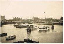
Until the mid-1960s, fishing was seen as Lowestoft's main industry,[13] although from the 1930s the percentage so employed directly and in trades associated with fishing was actually only about 10 per cent. Fleets of drifters and trawlers caught fish such as herring, cod and plaice. Catches have diminished since the 1960s[45] and although 100 boats remained by the 1980s, there are now only a few small boats operating out of Lowestoft, with no large trawlers.[44][46][47] By 2011 just three traders remained at the town's fish market, which is under threat of closure due to redevelopment of the port.[48][49] The Centre for Environment, Fisheries and Aquaculture Science (CEFAS), a large fisheries research centre that is a part of Defra, is still located in Lowestoft.[44]
Other major traditional employers included Eastern Coach Works and engineering and shipbuilding companies clustered around the harbour.[13][44] These included the Brooke Marine and Richards shipbuilding companies, which together employed over a thousand men but went out of business in the 1990s, and the Norwich-based engineering company Boulton and Paul.[13][50] Some shipbuilding and repair still goes on at the harbour.[51][52]
Modern economy

Major local employers include Birds Eye frozen foods, with 700 workers.[44][53][54] This has been located in the town for over 60 years.[55] The food-processing company Wessex Foods closed its Lowestoft plant in 2010 after a fire destroyed the factory and it failed to find alternative premises.[56]
Several other employers have shed labour in recent years. The Sanyo plant in the town closed down in 2009 with a loss of 60 jobs,[57] having once employed 800.[58] The timber company Jeld-Wen closed its factory in the town in 2010.[50]
From the mid-1960s to the late 1990s, the oil and gas industry provided significant employment in the area.[59] For many years the Shell Southern Operations base on the north shore of Lowestoft Harbour was town's largest employer.[59] A decision to close the Shell base was finally made in 2003.[60] Oil and gas is still a major industry.[61][62][63]
The town has made efforts to develop itself as a centre for renewable energy in the east of England.[64][65] The non-profit Orbis Energy centre has been set up to draw business in the green-energy sector and features solar thermal heating.[66][67][68][69] In April 2009, Associated British Ports announced that the harbour is to become the operations centre for the 500 MW Greater Gabbard wind farm, which when completed will be the world's largest offshore windfarm. The turbines will be located 15 miles (24 km) off the Suffolk coast and the Outer Harbour will be used to house the necessary operational support facilities. Other developments in the renewable energy sector include a prototype tidal energy generator being produced by local company 4NRG[70] and wave power systems developed by Trident Energy.[71]
Rainbow Saver Anglia Credit Union, a savings and loans co-operative established in 1999 and operating throughout East Anglia, is based in the town. Hoseasons, the self-catering UK Holiday specialist, is also a large employer here.[72]
Due to more opportunities to work remotely across the country, Lowestoft has become the home of many start-up tech companies.
Retailing
The town centre is the main shopping area, in Waveney district.[73] The retail chain Marks & Spencer has a store. Chadds independent department store was founded in 1907, and after nearly 100 years trading in the High Street, was taken over in 2004 by the Great Yarmouth-based Palmers group.[74][75] Specialist shopping areas, branded as The Historic High Street and the Triangle Market Place, have been developed on the northern edge of the centre. Several retail parks have appeared, the largest being North Quay Retail Park in Peto Way.
Tourism

Lowestoft is a traditional seaside resort, first developed as a bathing site in the 1760s.[12] The coast has been called the "Sunrise Coast". The town's main beaches are to the south of the harbour, where two piers, the Claremont and South piers, provide tourist facilities, and the East Point Pavilion the tourist information service.[12][76] The beach south of the Claremont Pier is a Blue Flag beach.[77] Lifeguard facilities are provided during the summer and water sports take place along the coast.[76] Tourism is a significant aspect of the town's economy.[64]
The town features two major attractions, the first being Pleasurewood Hills Theme Park, situated on the northern edge of the town,[78] while the second is the Africa Alive! wildlife park, situated in the south at Kessingland. The town maintains a holiday park at Pakefield, operated by Pontins,[61] and a small caravan site near its northern beach. The natural attractions of the Broads and the River Waveney on the west edge of the town, also attract visitors and been the site for boat trips and water sports events, with companies such as Hoseasons operating hire boats from Oulton Broad.[61]
Between 1996 and 2012, the town hosted a major air show during the summer, dubbed the Lowestoft Airshow. A major attraction, the two-day event took place in August, and featuring a wide range of aircraft including the Red Arrows, a Lancaster bomber, Spitfires and an Avro Vulcan.[79] From 2004, it was run by Lowestoft Seafront Air Festival Ltd, a non-profit company, but suffered financial difficulties. In 2010, the event made a loss of £40,000 and raised concerns over its sustainability,[80][81] whereupon further financial difficulties, coupled with bad weather and low visitor numbers, made the 2012 airshow the last before it was discontinued.[82][83][84]
Near the town centre is Lowestoft Maritime Museum, open from late April to late October, which has exhibits of maritime artefacts, an extensive collection of ship models and medals, marine art, fishing and the fishing industry, activities with the Royal Navy in WWII, and shipwrights' and coopers' tools.

Redevelopment
Lowestoft is one of the more socially deprived areas in Suffolk, with Kirkley the most deprived ward in the county, ranking 173rd most deprived in England (out of 32,486).[42] The area has attracted European Union redevelopment funding. The Waveney Sunrise Scheme invested £14.7 million in the town, funding transport improvements and tourist facilities such as fountains on Royal Plain, in an attempt to stimulate the local economy.[85][86] Regeneration company 1st East, which focused on the Lowestoft and Great Yarmouth areas, closed in 2011.[87]
Great Yarmouth and Lowestoft Enterprise Zone was announced in 2011 and launched in April 2012.[88] The zone, developed by New Anglia Local Enterprise Partnership, has six redevelopment sites across Lowestoft and Great Yarmouth. The bid for the zone in 2011 aimed to create 13,500 jobs by 2036.[89] It involved the Norfolk and Suffolk Energy Alliance and focused on developing the energy sector initially using tax incentives, simplified planning regulations and the provision of improved broadband internet services.[89] The sites in Lowestoft are Mobbs Way, Riverside Road and South Lowestoft Industrial Estate.[88]
The harbour is the focus for redevelopment proposals for Lowestoft in the form of the Lake Lothing and Outer Harbour Area Action Plan, submitted in February 2011.[90] The plan focuses on the redevelopment of brownfield sites in and around the harbour area to create jobs, particularly in the renewable energy and retailing sectors.[64][91][92]
Culture and community
The town has three theatres, the Marina Theatre, The Players Theatre (Lowestoft) and The Seagull community theatre. Operated as a charitable trust, the 800-seat Marina was substantially restored and refurbished in 2012 and its cinema upgraded to digital in 2013. A small four-screen cinema, the independently owned East Coast Cinema, underwent modest refurbishment in late 2011 to upgrade facilities and allow 3D films to be shown. The Beach radio station broadcasts to Lowestoft and the surrounding area, from studios in Norwich as does BBC Radio Suffolk, from Ipswich. The local weekly paper is the Lowestoft Journal, which is part of the Archant group. The Royal Philharmonic Orchestra has played regularly at the Marina Theatre since 2005.
Lowestoft Museum, which holds a collection of Lowestoft Porcelain, as well as artifacts describing the town's history, is in Nicholas Everett Park in Oulton Broad.[12] There are a number of small museums in Sparrow's Nest Park in the north of the town, including the Lowestoft War Memorial Museum, the Maritime Museum and the Royal Naval Patrol Service Museum. The Heritage Workshop Centre is also located in the park.[93] The Mincarlo is the last surviving sidewinder trawler of the Lowestoft fishing fleet and can be visited at Lowestoft Harbour. The East Anglia Transport Museum, which holds a collection of buses, trams and trolleybuses is located in Carlton Colville.
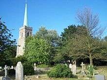
Lowestoft retains a number of narrow lanes with steps running steeply towards the sea, known locally as "scores". These were used by fishermen and smugglers in the past and are now the site of an annual race which raises money for charity.[12][94] The borough church, dedicated to St Margaret, is a Grade I listed building.[95][96] In the town centre is Our Lady Star of the Sea Church, a Grade II listed building in the Arts and Crafts style and the most easterly Catholic church in the British Isles.[97][98]
Lowestoft Library, in the centre of the town, contains a local-history section and a branch of the Suffolk Record Office.[99]
Lowestoft Hospital was closed in 2016, services are now provided by the James Paget University Hospital in Gorleston.[100] The main burial grounds for the town are Lowestoft Cemetery and Kirkley Cemetery.
The town is twinned with the French town of Plaisir in the Yvelines department in the Île-de-France to the west of Paris.
Landmarks
Lowestoft has been widely renowned for the opening of the countries tallest supermarket. Morrisons in Lowestoft measures up to approx. 562ft above sea level making it the countries tallest supermarket. Andy Peters of Blue Peter fame opened the store in 1998 and said "I am so impressed at the size of the building, it just opens up a new world of shopping. It's the tallest shop I've ever seen".Tallest Supermarket in the Country
At the most easterly point is a large compass rose, the Euroscope, set in the ground, which gives the direction and distance to various cities in Europe.[101]
Belle Vue Park is the site of the Royal Naval Patrol Service memorial. The central depot for the service was in Lowestoft when it was mobilised in August 1939, on a site known as Sparrow's Nest, adjacent to the memorial. The memorial has the names of the 2,385 members of the service who died in World War II.[18]
Morrisons
Lowestoft has been widely renowned for the opening of the countries tallest supermarket. Morrisons in Lowestoft measures up to approx. 562ft above sea level making it the countries tallest supermarket. Andy Peters of Blue Peter fame opened the store in 1998 and said "I am so impressed at the size of the building, it just opens up a new world of shopping. It's the tallest shop I've ever seen".Tallest Supermarket in the Country
Lighthouse

Lowestoft Lighthouse, located to the north of the town centre, was built in 1874 and stands 16 metres high at 37 metres above sea level. The light, which has a range of 23 nautical miles (43 km), was automated in 1975.[102] It is the most easterly lighthouse in the United Kingdom.
The first two lighthouses in Lowestoft were built in 1609 on the foreshore and candlelit, to give warning of the dangerous sandbanks around the coast. These were the first lighthouses constructed by Trinity House. The Low Light was discontinued in 1706 following sea encroachment, but re-established in 1730 in a form that could be easily moved in response to further changes to the Stamford Channel and shoreline. It was discontinued in August 1923. The High Light tower was rebuilt as the present lighthouse in 1874[103] with the intention of displaying an electric light, but when opened paraffin oil was used instead; it was not until 1936 that it was electrified. The lighthouse, along with two cottages originally used by lighthouse keepers, is a Grade II listed building.[103]
Lifeboat station
Lowestoft Lifeboat Station is located at the mouth of the outer harbour at the South Pier. The station is one of the oldest in the British Isles, founded in 1801, and is open to visitors throughout the year.[104] The lifeboat is Patsy Knight, a Shannon class lifeboat which replaced the Tyne class boat Spirit of Lowestoft in 2014. A former Lowestoft lifeboat was used during the Dunkirk evacuation of British forces from France in 1940.[104] The South Broads Lifeboat Station, an inland RNLI station, operated at Oulton Broad between 2001 and 2011.[105]
Town Hall

Lowestoft Town Hall stands on the High Street. Various forms of local government have met or been based on this site since the establishment of a Town House and Chapel here in 1570. In 1698 a new Town House was built, incorporating a 'corn cross' on the ground floor with the meeting chamber and chapel above. This in turn was replaced by the present building, designed by architect J. L. Clemence, in 1857.[106] The building houses the town clock and the curfew bell, which dates from 1644 and is rung each evening at 8 p. m.[107] The building is a Grade II listed building.[108]
In 2012, Waveney District Council announced that it planned to leave the town hall and share Suffolk County Council's offices on Riverside Road. This took place in 2015.[108]
Transport

Lowestoft railway station, originally Lowestoft Central Station, is centrally placed within the town, within walking distance of the beach and the town centre. It provides services to Ipswich on the East Suffolk Line and to Norwich on the Wherry Line.[109][110] Both lines were originally part of the Great Eastern Railway and are operated by Abellio Greater Anglia. The suburb of Oulton Broad has two stations: Oulton Broad North station lies on the line to Norwich, while Oulton Broad South is on the line to Ipswich.
Lowestoft North railway station, originally operated by the Norfolk and Suffolk Joint Railway, closed in 1970 when the Lowestoft to Great Yarmouth line closed. The site is now occupied by Beeching Drive, a residential area.
Buses in Lowestoft are mainly operated by First Norfolk & Suffolk with Lowestoft bus station as the hub for routes. Buses link the town with Norwich and Great Yarmouth and provide public transport within the town and to surrounding villages. The Excel X1 route provides a link to Peterborough and National Express Coaches stop in Lowestoft on the route from London to Great Yarmouth.
The main A12 road to London passes through Carlton Colville, Pakefield and Kirkley in the southern area of Lowestoft, ending at the town's harbour bascule bridge. It connects to the A47 road here, which runs around the centre of town, before exiting the town along Great Yarmouth Road, crossing the county border into Norfolk, towards Great Yarmouth.
A second road from the town centre, the A1044, links the town to Oulton Broad, via its second road crossing over Lake Lothing, and connects with the A146 that links Lowestoft with Beccles and Norwich.[64] Both bridges can be raised if vessels need to pass through the harbour and Lake Lothing, though this can cause congestion in the town and routes can become gridlocked.[64][111][112] A third crossing of Lowestoft Harbour is proposed,[112] but has yet to receive planning or funding; a southern relief road was built, which diverts traffic away from the seafront to help reduce congestion,[86][113] while a proposed pedestrian and cycle bridge is planned to provide an alternative crossing alongside the Bascule Bridge.[114]
Lowestoft's cycle network has routes focusing on linking areas to the town centre.[64] Around 12 per cent of residents cycle to work and the town is considered to be "ideally suited" to cycling due to its relatively small size and flat landscape.[64] Suffolk County Council is aiming to promote cycling by working with employers and schools and through funding a pedestrian and cycle bridge in the town centre.[64]
Education
Lowestoft has several primary and high schools, including four 11–16 high schools: The Benjamin Britten High School, Ormiston Denes Academy, East Point Academy and Pakefield School.[115] After a reorganisation, all eight middle schools in the town closed in 2011 and Pakefield High School opened.[116] Post-16 education is provided at Lowestoft Sixth Form College, which opened in September 2011 as part of the reorganisation, and East Coast College (Lowestoft Campus) which provides a range of academic and vocational courses.
East Coast College (Lowestoft Campus) provides a small range of higher education courses through an affiliation to University Campus Suffolk.[117] Degrees are validated by the University of East Anglia and the University of Essex.[118] The college also runs courses in boat building and some designed to support the offshore and maritime industries that are important employers in the town.[119] Other adult education courses are run by the County Council from a base at the town library.[120]
Sport and leisure
Lowestoft's sport clubs and facilities include Lowestoft Town Football Club at Crown Meadow and Kirkley & Pakefield Football Club at Walmer Road. Lowestoft Cricket Club plays at the Denes Oval sport ground.[121] Other sport clubs include Waveney Gymnastics club[122] and Rookery Park Golf Club.[123]
Lowestoft and Yarmouth rugby football club www.lyrugby.club also has its Gunton Park home based in Lowestoft. Founded in 1879, it is one of the oldest rugby union clubs in England.
The town's main leisure centre, the Waterlane Leisure Centre, was redeveloped at a cost of £8 million in 2010–2011.[124][125] Facilities include a gym and climbing wall as well as a 25-metre swimming pool with a movable floor.[124][126] Lowestoft has a number of parks and recreation grounds.[127]
The Broads national park extends to Lowestoft on Oulton Broad. Water activities and boat tours can be taken here. Powerboat racing takes place throughout the summer period, mainly on Thursday evenings.[128] Fixtures are organised by the Lowestoft and Oulton Broad Motor Boat Club and can attract up to 1500 spectators.[128][129] The Royal Norfolk and Suffolk Yacht Club has its club house in Lowestoft harbour.[130]
Notable people
- The Elizabethan pamphleteer Thomas Nashe, one of the fathers of modern journalism and a primary source for the literary milieux of William Shakespeare, was born in Lowestoft in 1567. Robert Potter, poet and translator of Greek drama, was vicar of Lowestoft until 1804. The 19th-century writer and traveller George Borrow lived at Oulton Broad for many years and wrote most of his books there. Lieutenant General Sir Edwin Alderson also lived at Oulton Broad, on a houseboat, and died in 1927 at the since-demolished Royal Hotel in Lowestoft, where he had been staying for his last month.[131]
- Admiral Sir John Ashby, who commanded HMS Victory at the Battles of Barfleur and La Hogue in 1692, grew up in Suffolk and is buried in Lowestoft. A memorial is sited in St Margaret's Church. Admiral Sir Thomas Allin, a commander at the Battle of Lowestoft on 13 June 1665 was awarded a knighthood on 24 June and appointed an Admiral of the Blue squadron. He lived in the family house in High Street until his victories enabled him to move to a grander country home, Somerleyton Hall. Vice Admiral James Dacres fought in wars against America in the 19th century and was born in the town. Claud Castleton VC of the Australian Army was born in Kirkley and Captain Thomas Crisp V.C., Royal Navy officer, was born in the town – one of the town's main roads is named after him.
- Robert William Hook, coxswain at RNLI Lowestoft from 1853 to 1883 and who has been credited with saving more than 600 lives during his career, with Lowestoft RNLI and with private companies. He was born in Lowestoft, lived and worked there all his life, and is buried in Lowestoft Cemetery.
- Sir Samuel Morton Peto, bought Somerleyton Hall in 1843, and has one of the town's main roads named after him. He was influential in developing the town's railway links and harbour. Sir Christopher Cockerell, inventor of the hovercraft, lived at Oulton Broad, and tested craft in Somerleyton at Fritton Lake. Economist Sir Dennis Holme Robertson was born in Lowestoft in 1890. He was educated on a scholarship at Eton, and read Classics and Economics at Trinity College, Cambridge before teaching at Cambridge University, working closely with Keynes.
- The philanthropist Howard Hollingsworth, co-founder of Bourne & Hollingsworth Department Store, visited Lowestoft in 1908 and later bought and renovated the burnt-out Briar Clyffe House and grounds on Gunton Cliff.[132] He became a Lowestoft benefactor, and on the death of his friend Nicholas Everitt, bought his estate at Oulton Broad and gave it to Lowestoft for a public park.[133] He was made the first Freeman of the Borough of Lowestoft in 1929.[132] Roland Aubrey Leighton, fiancé of Vera Brittain, immortalised in her WW1 autobiography Testament of Youth, lived with his family at Heather Cliff on Gunton Cliff.
- The composer Benjamin Britten was born in Lowestoft in 1913. He was "without a doubt the greatest English classical composer of the last century"[134] and "the only person of real celebrity to have emerged from darkest Lowestoft."[135] The Benjamin Britten High School and a small shopping centre in the town are named after him.
- The children's author and illustrator Michael Foreman was born in 1938 and spent his childhood years in Pakefield, where his mother kept a grocer's shop.[135] He went to Pakefield Primary School, and played on Hilly Green – stories of which are recorded in his book War Boy. The author and illustrator James Mayhew lived in the town and studied at Lowestoft School of Art. Photographer George Davison was also born in Lowestoft. Jayne-Marie Barker, author of the Inspector Allen mysteries grew up at Oulton Broad and has used Lowestoft as an inspiration for her books.[136]
- The artist Mark Burrell (born Lowestoft, 1957) has a studio in the town and frequently features Lowestoft's architectural landmarks and local people in his paintings. Burrell is also a leading member of the North Sea Magical Realists.
- Author Mark Dawson was born in the town.
- The comedian and actor Karl Theobald was born in Lowestoft, as were BBC Radio 4 newsreader and television presenter Zeb Soanes and DJ and BBC radio presenter Tim Westwood. Three founder members of The Darkness rock band were educated in Kirkley; some of their songs feature local landmarks or stories.[135] Lil' Chris featured in Channel 4's Rock School, filmed at Kirkley High School, and went on to a musical career. Leanne Mitchell, winner of the first The Voice UK series, lives in the town.[137]
- Sports people associated with Lowestoft include former England football captain Terry Butcher, who was educated in Lowestoft and Peter Wright Darts World Champion who spent his formative years in Lowestoft. . Others born there include former Ipswich Town goalkeeper Laurie Sivell, Norwich City defenders Paul Haylock and Daryl Sutch, former football player and manager Richard Money, New York Mets pitcher Les Rohr and Olympic Bronze medal-winning middleweight boxer Anthony Ogogo.
References
- City Population site. Retrieved 2 June 2020.
- Economic statistics and data – an overview of Waveney, Waveney District Council. Retrieved 2013-08-14.
- OS Explorer Map OL40: The Broads: (1:25 000) : ISBN 0 319 24086 X.
- Parfitt.S et al (2006) '700,000 years old: found in Pakefield', British Archaeology, January/February 2006. Retrieved 24 December 2008.
- Cambridge Archaeological Unit A Roman and Saxon settlement at Bloodmoor Hill, Pakefield, Lowestoft Archived 6 June 2011 at the Wayback Machine. Retrieved 2009-11-28.
- 'Human influences' Archived 19 July 2011 at the Wayback Machine, Waveney District landscape character assessment pp. 27–29, Waveney District Council, April 2008. Retrieved 18 April 2011.
- A. D. Mills (1998), A Dictionary of English Place-names, 2nd ed, Oxford: Oxford University Press, p. 227.ISBN 0-19-280074-4
- Freeman E & J (2009) Old Lowestoft, Stanlake publishing, p. 3.
- Lowestoft Archived 12 October 2012 at the Wayback Machine, Domesday Map. Retrieved 20 April 2011.
- Lowestoft, Domesday Book online. Retrieved 20 April 2011.
- Akethorpe Archived 10 August 2010 at the Wayback Machine, Domesday Map. Retrieved 21 April 2011.
- Lowestoft Archived 10 June 2011 at the Wayback Machine, Eastern Daily Press, 14 April 2010. Retrieved 11 May 2011.
- Lowestoft, Poppyland Publishing. Retrieved 21 April 2011.
- Battle of Lowestoft: notes Archived 8 October 2011 at the Wayback Machine, National Maritime Museum. Retrieved 21 April 2011.
- Port of Lowestoft Archived 22 July 2011 at the Wayback Machine, Lowestoft Maritime Museum, February 2011. Retrieved 2011-04-15.
- Prime target for bombers, Lowestoft Journal, 2008-05-27. Retrieved 2011-04-20.
- James Hoseason Obituary, The Guardian, 17 July 2009. Retrieved 20 April 2011.
- Naval War Memorial, Lowestoft, British Listed Buildings. Retrieved 24 April 2011.
- Mayor of Lowestoft Archived 27 September 2011 at the Wayback Machine, Waveney District Council. Retrieved 30 April 2011.
- "Waveney District Council (Reorganisation of Community Governance) Order 2017" (PDF). Lgbce. Retrieved 16 May 2018.
- Lowestoft ward map Archived 19 July 2011 at the Wayback Machine, Waveney District Council. Retrieved 6 May 2011.
- Changing to Whole Council Elections – Explanatory Document Archived 19 July 2011 at the Wayback Machine, Waveney District Council, 2010. Retrieved 6 May 2011.
- East Suffolk District Council elections 2019 Archived 26 March 2019 at the Wayback Machine. Accessdate=26 March 2019
- County council elections Archived 19 July 2011 at the Wayback Machine, Waveney District Council. Retrieved 6 May 2012.
- "Lowestoft Journal", 2017-05-05. Retrieved 2019-04-04
- "Lowestoft Journal", 1 August 2018. Retrieved 4 April 2019.
- 'Physical influences and ecological context' Archived 19 July 2011 at the Wayback Machine, Waveney District landscape character assessment pp. 15–21, Waveney District Council, April 2008. Retrieved 18 April 2011.
- Lowestoft north of Claremont Pier Archived 27 September 2011 at the Wayback Machine, Blue Flag. Retrieved 10 April 2011.
- Lowestoft south of Claremont Pier Archived 27 September 2011 at the Wayback Machine, Blue Flag. Retrieved 10 April 2011.
- 1953 floods – What areas were affected?, BBC Suffolk, 2003. Retrieved 21 April 2011.
- Homes under water in flash floods, Fierce storms force mass evacuations in England |BBC News Website, 15 September 2006. Retrieved 21 April 2011.
- Fierce storms force mass evacuations in England, BBC News Website. Retrieved 2014-01-30.
- Lowestoft flooded, ITV news. Retrieved 30 January 2014.
- Lowestoft 1971–2000 averages Archived 19 October 2011 at the Wayback Machine, Met Office. Retrieved 10 April 2011.
- "Lowestoft 1981–2010 averages". Met Office. Retrieved 12 February 2020.
- "Indices Data - Lowestoft Station 1843". KNMI. Retrieved 12 February 2020.
- Profiles of Ipswich, Lowestoft and Bury St Edmunds Archived 23 September 2011 at the Wayback Machine, Suffolk County Council. Retrieved 10 April 2011.
- Gunton electoral division profile Archived 8 March 2012 at the Wayback Machine, Suffolk County Council, September 2009. Retrieved 21 April 2011.
- Pakefield electoral division profile Archived 8 March 2012 at the Wayback Machine, Suffolk County Council, September 2009. Retrieved 21 April 2011.
- Oulton electoral division profile Archived 19 September 2011 at the Wayback Machine, Suffolk County Council, September 2009. Retrieved 21 April 2011.
- Lowestoft south electoral division profile Archived 8 March 2012 at the Wayback Machine, Suffolk County Council, September 2009. Retrieved 21 April 2011.
- Waveney district profile Archived 8 March 2012 at the Wayback Machine, Suffolk County Council, April 2010. Retrieved 21 April 2011.
- Gardener D, Connelly H (2005) Who are the "other" ethnic groups? Archived 28 May 2008 at the Wayback Machine, Office for National Statistics. Retrieved 22 June 2008.
- 'East Coast Inshore Fishing Fleet', Hansard, 14 October 2010. Retrieved 21 April 2011.
- Fish stocks dwindle, BBC Nation on film. Retrieved 21 April 2011.
- Fears for Suffolk fishing industry, BBC news website, 27 December 2007. Retrieved 21 April 2011.
- Madslien.J (2008) Fishermen fight for brighter future, BBC news website, 30 June 2008. Retrieved 21 April 2011.
- Fears for future of Lowestoft fish market, BBC news website, 11 March 2011. Retrieved 9 April 2011.
- End of an era beckons for Lowestoft fish market, Eastern Daily Press, 29 March 2011. Retrieved 30 April 2011.
- Timber factory closure announced, BBC news website, 3 December 2009. Retrieved 21 April 2011.
- 'Oldest' steamship gets £2m refit, BBC news website, 28 June 2008. Retrieved 2011-04-21.
- New start for grand old lady, BBC Suffolk, 2008. Retrieved 21 April 2011.
- Farmers hit as Birds Eye, Lowestoft loses peas contract, BBC news website, 4 February 2010. Retrieved 21 April 2011.
- East Anglian pea farmers sign frozen food deal, BBC news website, 5 October 2010. Retrieved 21 April 2011.
- Jobs safe at Birds Eye factory, BBC news website, 7 November 2003. Retrieved 21 April 2011.
- Staff at fire-hit burger factory in Lowestoft lose jobs, BBC news website, 29 October 2010. Retrieved 21 April 2011.
- Sanyo to shut down monitor plant, BBC news website, 1 December 2009. Retrieved 21 April 2011.
- Sanyo TV monitor factory site in Lowestoft up for sale, BBC news website, 2010-03-17. Retrieved 21 April 2011.
- Offshore industry timeline, Great Yarmouth Council. Retrieved 2011-04-21.
- Talks over Shell shutdown, BBC news website, 2003-04-03. Retrieved 14 June 2009.
- Great Yarmouth and Waveney March 2010 Archived 23 March 2012 at the Wayback Machine Shaping Norfolk's Future, March 2010. Retrieved 21 April 2011.
- International acclaim for innovation in oil and gas Archived 23 March 2012 at the Wayback Machine, Great Yarmouth marketing initiative, 2007-05-17. Retrieved 21 April 2011.
- Lowestoft delivers gas platform, associated British Ports, 11 May 2000. Retrieved 21 April 2011.
- Lowestoft transport strategy Archived 27 March 2014 at the Wayback Machine, Suffolk County Council, 29 June 2011. Retrieved 26 January 2013.
- Plan for £6m green energy centre, BBC news website, 25 March 2005. Retrieved 21 April 2011.
- Meeting on green energy in East, BBC news website, 2007-02-26. Retrieved 21 April 2011.
- Low carbon work boosted by £80m, BBC news website, 2007-12-26. Retrieved 2011-04-21.
- Orbis Energy, Suffolk works. Retrieved 30 April 2011.
- OrbisEnergy Website. Retrieved 2009-05-20.
- Suffolk firm's wave energy machine gets backing BBC news website, 2011-02-02. Retrieved 2011-04-21.
- Wave power machine tested on land, BBC news website, 2010-11-10. Retrieved 2011-04-21.
- Your Credit Union Archived 7 February 2015 at the Wayback Machine Rainbow Saver Anglia Credit Union (retrieved 6 February 2015)
- Retail and Leisure Study: Summary Archived 19 July 2011 at the Wayback Machine, Waveney District Council, 2006. Retrieved 21 April 2011.
- Lowestoft, Palmers Department Store. Retrieved 2011-04-30.
- How we're keeping our independents, Eastern Daily Press, 17 January 2007. Retrieved 30 April 2011.
- Suffolk's beaches: Lowestoft, BBC Suffolk. Retrieved 2011-04-21
- Blue Flag awards given to 55 beaches in England, BBC news website, 2013-05-22. Retrieved 2013-05-22.
- Wipeout, BBC Suffolk, 2008. Retrieved 2011-04-21.
- Lowestoft air festival, BBC Suffolk, 2009. Retrieved 2011-04-21.
- Lowestoft Air Festival sponsor appeal goes nationwide, Lowestoft Journal 2011-02-25. Retrieved 2011-04-24.
- Lowestoft air show in fund-raising drive, Norwich Evening News 2011-01-26. Retrieved 2011-04-24.
- Lowestoft Air Festival cancelled for 2013, BBC news website, 2012-07-25. Retrieved 2013-01-26.
- Lowestoft Air Show to end after cash blow, ITV Anglia, 2012-07-25. retrieved 2013-01-26.
- Lowestoft Air Festival will "definitely" not take place again, BBC news website, 2014-03-14. Retrieved 2014-03-15.
- Fountain fun, BBC Suffolk, 2005. Retrieved 2011-04-21.
- Lowestoft Sunrise Scheme Archived 8 March 2012 at the Wayback Machine, Suffolk County Council. Retrieved 21 April 2011.
- Great Yarmouth and Lowestoft regeneration firm 1st East shuts, BBC news website, 27 January 2011. Retrieved 21 April 2011.
- Dickson A (2012) Great Yarmouth and Lowestoft enterprise zone interest from around the world, Eastern Daily Press, 2012-01-12. Retrieved 2015-03-13.
- Dickson.A (2011) Great Yarmouth and Lowestoft enterprise zone given the green light Archived 13 November 2011 at the Wayback Machine, Eastern Daily Press, 17 August 2011. Retrieved 17 August 2011.
- An introduction to the Area Action Plan for Central Lowestoft Archived 19 July 2011 at the Wayback Machine, Waveney District Council. Retrieved 30 April 2011.
- What is the Area Action Plan? Archived 19 July 2011 at the Wayback Machine, Waveney District Council. Retrieved 2011-04-30.
- Mace. H (2010) Vision for future of Lowestoft harbour, Eastern Daily Press, 2010-10-14. Retrieved 2011-04-30.
- 'Memories of beach village in Lowestoft', Lowestoft Journal, 2011-02-11. Retrieved 2011-05-25.
- Lowestoft Scores Race, East Anglia's Children's Hospices, 2011-03-02. Retrieved 2011-04-21.
- St Margaret, Lowestoft, Suffolk Churches site. Retrieved 2011-04-24.
- Church of St Margaret, Lowestoft, British listed buildings. Retrieved 2011-04-24.
- Our Lady Star of the Sea, Waveney from British Listed Buildings, retrieved 20 July 2018
- Our Lady Star of the Sea, Lowestoft from SuffolkChurches.co.uk, retrieved 20 July 2018
- Suffolk Record Office, Lowestoft Branch, National Archives. Retrieved 2011-04-30.
- Retrieved 27 March 2019.
- The mess that is Ness, BBC Suffolk, 2008. Retrieved 2011-04-21.
- Lowestoft Archived 14 April 2011 at the Wayback Machine, Trinity House. Retrieved 2011-04-30.
- High Lighthouse Including North Cottage and South Cottage, Waveney, British Listed Buildings. Retrieved 2012-10-23.
- Lowestoft Lifeboat Station, Royal National Lifeboat Institution. Retrieved 2014-03-15.
- South Broads RNLI lifeboat station to close, Royal National Lifeboat Institution, 2011-11-14. Retrieved 2014-03-15.
- Town Hall, Lowestoft, British Listed Buildings. Retrieved 30 August 2015.
- Welcome to Lowestoft Town Hall Archived 12 September 2015 at the Wayback Machine, Waveney District Council. Retrieved 2015-08-30.
- The future of Lowestoft Town Hall Archived 23 June 2015 at the Wayback Machine, Waveney District Council website, April 2015. Retrieved 30 August 2015.
- East Suffolk Line Archived 26 May 2011 at the Wayback Machine. Through trains to London Liverpool Street were announced in 2016. Retrieved 9 April 2011.
- The Wherry Lines. Retrieved 2011-04-09.
- Grant could help cut congestion, BBC news website, 2007-09-12. Retrieved 2011-04-09.
- Faber Maunsell Limited (2009) A12 Lowestoft study: Lake Lothing third crossing feasibility study Archived 19 July 2011 at the Wayback Machine (online), retrieved 2011-04-09.
- Seaside town relief road opened, BBC news website, 2006-06-27. Retrieved 2013-01-26.
- Lowestoft's £6.25m for transport but no third road bridge, BBC Suffolk news website, 2011-10-13. Retrieved 2013-01-26.
- A to Z of schools by village/town, Suffolk County Council. Retrieved 2011-04-09.
- School organisation review: Lowestoft, Suffolk County Council. Retrieved 2011-04-09.
- UCS Lowestoft Archived 14 May 2011 at the Wayback Machine, University College Suffolk. Retrieved 2011-04-30.
- Validating Universities Archived 13 May 2011 at the Wayback Machine, University Campus Suffolk. Retrieved 30 April 2011.
- Colleges of Further Education Archived 22 July 2011 at the Wayback Machine, British Marine Federation. Retrieved 2011-04-30.
- An introduction to community learning and skills development, Suffolk County Council. Retrieved 2011-04-30.
- Denes Oval sport ground Archived 19 July 2011 at the Wayback Machine, Waveney District Council. Retrieved 9 April 2011.
- Waveney Gymnastics Club. Retrieved 9 April 2011.
- Rookery Park Golf Club Archived 8 November 2011 at the Wayback Machine. Retrieved 9 April 2011.
- Lowestoft leisure centre's £6.5m facelift under way, BBC news website, 27 August 2010. Retrieved 9 April 2011.
- Lowestoft leisure centre was saved from financial brink, Eastern Daily Press, 27 May 2013. Retrieved 27 May 2013.
- Waterlane leisure centre Archived 24 November 2013 at the Wayback Machine, Sentinel Leisure Trust. Retrieved 9 April 2011.
- Parks and open spaces Archived 14 March 2011 at the Wayback Machine, Waveney District Council. Retrieved 9 April 2011.
- Power Boat Racing, Report by Head of Safety Management, Broads Authority, 20 January 2012. Retrieved 21 June 2013.
- Oulton Broad speedboat engine thefts leads to race cancellation, BBC Suffolk news website, 21 June 2013. Retrieved 21 June 2013.
- Official Website Club website. Retrieved 21 June 2013.
- General's Death – Sir Edwin Alderson's Lowestoft Yachting Associations, Lowestoft Journal, 1927-12-17.
- 26 January 2006, "Howard Hollingsworth, Lowestoft's first Freeman" – by Colin Dixon, Lowestoft Archaeological and Local History Society, 26 January 2006. Retrieved 14 July 2013.
- Evidences to title to the North Cove Hall Estate, National Archives. Retrieved 14 July 2013.
- Kennedy.M (2002) Makeshift studio listed, The Guardian, 2002-10-17. Retrieved 2011-04-28.
- Foreman.M (2004) Lowestoft's Dark stars, The Guardian, 2004-02-19. Retrieved 2011-04-28.
- Oulton Broad author to make Lowestoft appearance, Lowestoft Journal, 2012-09-28. Retrieved 2014-02-25.
- Oulton Broad singer Leanne Mitchell faces final stage fight in BBC One show The Voice, Lowestoft Journal, 2012-06-01. Retrieved 2016-08-31.
External links
| Wikivoyage has a travel guide for Lowestoft. |
| Wikimedia Commons has media related to: |
- Lowestoft Town Council
- Nation on Film – the rise and fall of the fishing industry on England's east coast, BBC website.
| Boroughs or districts |
|
|---|---|
| Major settlements |
|
| Topics | |
| Authority control |
|
|---|