Loganholme, Queensland
Loganholme is a suburb in the City of Logan, Queensland, Australia.[2] In the 2016 census, Loganholme had a population of 6,303 people.[1]
| Loganholme Logan City, Queensland | |||||||||||||||
|---|---|---|---|---|---|---|---|---|---|---|---|---|---|---|---|
 Tudor Park, 2016 | |||||||||||||||
 Loganholme | |||||||||||||||
| Coordinates | 27.6830°S 153.1894°E | ||||||||||||||
| Population | 6,303 (2016 census)[1] | ||||||||||||||
| • Density | 693/km2 (1,794/sq mi) | ||||||||||||||
| Postcode(s) | 4129 | ||||||||||||||
| Area | 9.1 km2 (3.5 sq mi) | ||||||||||||||
| Time zone | AEST (UTC+10:00) | ||||||||||||||
| Location |
| ||||||||||||||
| LGA(s) | Logan City | ||||||||||||||
| State electorate(s) | |||||||||||||||
| Federal Division(s) | Forde | ||||||||||||||
| |||||||||||||||
The majority of the land is used for houses while it has range of other uses.
Geography
The suburb is bisected by the Pacific Motorway and the Logan Motorway which aligns with a small section of the northern boundary. The southern and western boundaries of the suburb follow the Logan River. Tudor Park on Clarks Road features sports facilities.[3] A small pocket of land by the Logan River is known as Alexander Clark Park. The park is well-facilitated and available for large groups and events such as weddings.[4] East of the motorway is a large commercial and industrial area, adjacent to vacant flood plains. Here the largest wastewater treatment plant in the City of Logan began an upgrade process in 2014.[5] The upgrade was needed to meet population growth in the area. In the northern tip of Loganholme, adjacent to the Logan Hyperdome is a retail district with a public hotel, Officeworks, Foodworks and Harvey Norman stores. Nearby, along Bryants Road is the Loganholme police station.
History
A cotton gin, which was converted to a sugar mill, was built at Loganholme in 1867.[6]
Loganholme State School opened on 24 May 1873. It closed on 28 Feb 1890, reoening as Loganholme Provisional School in April 1890. In 23 January 1893 it became Loganholme State School once again.[7][8]
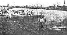
The existing ferry crossing at Loganhholme, known as the Beenleigh Ferry, established in the 1870s, was facing increased delays by the 1920s as vehicle traffic passing through the area increased dramatically. A road crossing from Loganholme to Beenleigh was opened in July 1931.[6] The bridge here was duplicated in May 1968 and rebuilt in 1999 when the Pacific Motorway was widened.
Until 1949, Loganholme was within Shire of Tingalpa.[9]
St Matthew's Catholic Primary School opened on 23 January 1984 in the tradition of Mary MacKillop.[7][10] It is now within the boundaries of the neighbouring suburb of Cornubia.[11]
In the 2016 census, Loganholme had a population of 6,303 people.[1]
Transport

A bus interchange is located adjacent to the Logan Hyperdome. A regular bus links to both Beenleigh and Logan Central. The grade separated intersection of the two motorways was originally built in 1988.
Education
Loganholme State School is a government primary (Prep-6) school for boys and girls at Wandilla Crescent (27.6863°S 153.1806°E).[12][13] In 2017, the school had an enrolment of 541 students with 37 teachers (33 full-time equivalent) and 22 non-teaching staff (14 full-time equivalent).[14] It includes a special education program.[12][15]
Demographics
In the 2011 census, Loganholme recorded a population of 6,124 people, 50.2% female and 49.8% male.[16] The median age of the Loganholme population was 31 years, 6 years below the national median of 37. 73.2% of people living in Loganholme were born in Australia. The other top responses for country of birth were New Zealand 8%, England 4.8%, South Africa 1%, Philippines 0.8%, Scotland 0.7%. 90.1% of people spoke only English at home; the next most common languages were 0.5% Vietnamese, 0.5% Mandarin, 0.4% Hindi, 0.4% Samoan, 0.3% German.[16]
References
- Australian Bureau of Statistics (27 June 2017). "Loganholme (SSC)". 2016 Census QuickStats. Retrieved 20 October 2018.

- "Loganholme - suburb in City of Logan (entry 45273)". Queensland Place Names. Queensland Government. Retrieved 26 January 2020.
- "Tudor Park". Logan City Council. Retrieved 17 December 2015.
- "Alexander Clark Park". Logan City Council. Retrieved 17 December 2015.
- "Loganholme Wastewater Treatment Plant gets a new lease on life". Logan City Council. 24 March 2014. Retrieved 17 December 2015.
- Buchanan, Robyn (1999). Logan : rich in history, young in spirit (PDF). Logan City Council. pp. 30, 64, 69. Retrieved 6 December 2015.
- Queensland Family History Society (2010), Queensland schools past and present (Version 1.01 ed.), Queensland Family History Society, ISBN 978-1-921171-26-0
- Jenkinson, Doris Katie (1973), State school Loganholme centenary 1873-1973 : souvenir booklet, Loganholme State School
- Mary Howells. "Mount Cotton - a brief history" (PDF). Redland City Council. Archived from the original (PDF) on 29 March 2011. Retrieved 26 June 2014.
- "School History". St Matthew's Catholic Primary School. Retrieved 31 March 2020.
- "Queensland Globe". State of Queensland. Retrieved 31 March 2020.
- "State and non-state school details". Queensland Government. 9 July 2018. Archived from the original on 21 November 2018. Retrieved 21 November 2018.
- "Loganholme State School". Retrieved 21 November 2018.
- "ACARA School Profile 2017". Archived from the original on 22 November 2018. Retrieved 22 November 2018.
- "Loganholme SS - Special Education Program". Retrieved 21 November 2018.
- Australian Bureau of Statistics (31 October 2012). "Loganholme (State Suburb)". 2011 Census QuickStats. Retrieved 26 June 2013.
External links
| Wikimedia Commons has media related to Loganholme, Queensland. |
- "Loganholme". Queensland Places. Centre for the Government of Queensland, University of Queensland.
- "Logan City Map" (PDF). 2008.