List of historic places in central Newfoundland
This article is a list of historic places in central Newfoundland. These properties are entered on the Canadian Register of Historic Places, whether they are federal, provincial, or municipal. The list contains entries from communities in census divisions 2, 3, 6, and 8. This grouping encompasses the central portions of the island of Newfoundland, including communities on Notre Dame Bay, the Burin Peninsula, and the southern shore between the Burin Peninsula and Cape Ray.
List of historic places
| Name | Address | Coordinates | IDF | IDP | IDM | Image | |
|---|---|---|---|---|---|---|---|
| Ashbourne Longhouse | , Twillingate, NL | 49°39′19″N 54°45′40″W | 2308 | 16265 |  More images | ||
| Ashbourne's Lower Trade General Store Municipal Heritage Site | Sellen's Cove Road, Twillingate, NL | 49°39′21″N 54°46′33″W | 18946 |  | |||
| Ashbourne Office Registered Heritage Structure | , Twillingate, NL | 49°39′19″N 54°45′40″W | 12899 | 18716 |  | ||
| Ashbourne Shop Registered Heritage Structure | , Twillingate, NL | 49°39′19″N 54°45′40″W | 12900 | | |||
| Bank of Nova Scotia | , Burin, NL | 47°04′32″N 55°08′20″W | 2016 | | |||
| Alphaeus Barbour House | , Newtown, NL | 49°12′06″N 53°30′55″W | 2108 | | |||
| Benjamin Barbour House | , New-Wes-Valley, NL | 49°12′06″N 53°30′56″W | 2201 | | |||
| Beaver Pond Municipal Heritage Site | , Harbour Breton, NL | 47°28′37″N 55°49′55″W | 11962 | | |||
| Bethany United Church | , Petites, NL | 47°37′12″N 58°37′49″W | 2318 | | |||
| Bleak House Registered Heritage Structure | , Fogo, NL | 49°43′06″N 54°17′10″W | 1891 | 10194 | | ||
| Boyd's Cove Beothuk National Historic Site of Canada | , Boyd's Cove, NL | 49°27′45″N 54°37′46″W | 10557 | 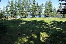 More images | |||
| Brett House and Outbuildings | , Joe Batt's Arm-Barr'd Islands-Shoal Bay, NL | 49°43′47″N 54°10′24″W | 2228 | 8144 | | ||
| John and Ann Brinson House | , Carmanville South, NL | 49°23′58″N 54°15′36″W | 2134 | | |||
| Buffett House Registered Heritage Structure | , Grand Bank, NL | 47°06′08″N 55°45′15″W | 7779 | | |||
| Cape Chapeau Rouge Municipal Heritage Site | , St. Lawrence, NL | 46°53′26″N 55°22′31″W | 3593 | | |||
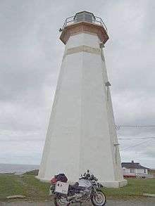
| Cape Ray Light Tower | , Cape Ray, NL | 47°37′16″N 59°18′14″W | 13113 21137 |
 | |||
| Hector Carter House, Henhouse, Fishing Shed and Property Registered Heritage Structure | , Greenspond, NL | 49°04′07″N 53°34′03″W | 10636 | | |||
| Cemetery for Priests and Religious Sisters Municipal Heritage Site | , St. Lawrence, NL | 46°55′17″N 55°22′39″W | 5452 | | |||
| Channel Head Lighttower | , Channel-Port aux Basques, NL | 47°33′58″N 59°07′26″W | 3901 |  More images | |||
| Noah Chippett Stage/Twine Loft and Wharf Municipal Heritage Site | , Leading Tickles, NL | 49°30′04″N 55°28′05″W | 7308 | | |||
| Roland Chippett Stage Municipal Heritage Building | , Leading Tickles, NL | 49°30′04″N 55°28′05″W | 7309 | | |||
| Church of England Cemetery Municipal Heritage Site | Causeway Extension, Burnt Islands, NL | 47°35′57″N 58°53′25″W | 13793 | | |||
| Cluett House Registered Heritage Structure | , Belleoram, NL | 47°31′00″N 55°25′00″W | 2089 | | |||
| Cluett House Registered Heritage Structure | Hillcrest Road, Ramea, NL | 47°31′23″N 57°23′19″W | 19793 | | |||
| Connaught Hall Masonic Lodge #9 | , Botwood, NL | 49°08′36″N 55°20′28″W | 2325 | | |||
| Deadman's Cove Municipal Heritage Site | , Harbour Breton, NL | 47°28′01″N 55°50′49″W | 15369 | | |||
| Doloman's Point Municipal Heritage Site | , Gambo, NL | 48°47′21″N 54°11′25″W | 19144 | | |||
| Dwyer House | , Tilting, NL | 49°42′20″N 54°03′31″W | 2170 | | |||
| Fidelity Lodge #5 | , Grand Bank, NL | 47°06′08″N 55°45′21″W | 1893 | 7458 | | ||
| Fishermen's Union Trading Company Cash Store Registered Heritage Structure | , Musgrave Harbour, NL | 49°26′59″N 53°56′35″W | 8145 | | |||
| Fishermen's Union Trading Company Premises Registered Heritage Structure | , Seldom-Little Seldom, NL | 49°36′36″N 54°11′06″W | 15663 | | |||
| Fleur de Lys Dorset Soapstone Quarry | Near Highway 410, locality 1, Fleur de Lys, NL | 50°07′11″N 56°07′27″W | 18943 | 4127 | | ||
| Fogo Courthouse and Public Building Municipal Heritage Site | , Fogo, NL | 49°42′54″N 54°16′52″W | 15365 | | |||
| Fogo United Church | , Fogo, NL | 49°42′53″N 54°16′56″W | 2024 | | |||
| Pearce Foley House Registered Heritage Structure | , Tilting, NL | 49°42′18″N 54°03′31″W | 2296 | | |||
| J. B. Foote House Municipal Heritage Building | , Grand Bank, NL | 47°06′09″N 55°45′31″W | 7461 | | |||
| Fortune Fishing Sheds Municipal Heritage Site | , Fortune, NL | 47°04′25″N 55°49′35″W | 5866 | | |||
| Frazer Park Municipal Heritage Site | , Grand Bank, NL | 47°06′04″N 55°45′14″W | 7459 | | |||
| Friar's Cove Municipal Heritage Site | , Harbour Breton, NL | 47°27′50″N 55°47′49″W | 15368 | | |||
| Gorman/Hynes House Municipal Heritage Site | , Harbour Breton, NL | 47°28′19″N 55°49′37″W | 13794 | | |||
| H.C. Grant Heritage Museum Registered Heritage Structure | , Springdale, NL | 49°29′48″N 56°04′13″W | 4017 | 5348 | | ||
| Martin Greene House and Outbuildings | , Tilting, NL | 49°42′08″N 54°03′50″W | 2025 | | |||
| Greenspond Courthouse | , Greenspond, NL | 49°04′07″N 53°34′05″W | 2074 | | |||
| Gun Hill Municipal Heritage Site | , Harbour Breton, NL | 47°29′20″N 55°48′40″W | 11963 | | |||
| Harbour Breton Landslide Monument Municipal Heritage Site | , Harbour Breton, NL | 47°28′44″N 55°48′22″W | 13240 | | |||
| Harding House | , Greenspond, NL | 49°04′07″N 53°34′03″W | 1887 | | |||
| Harmsworth Hall | , Grand Falls-Windsor, NL | 49°00′35″N 55°30′31″W | 2560 | 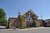 More images | |||
| George C. Harris House | , Grand Bank, NL | 47°06′03″N 55°45′14″W | 2195 | 7460 | | ||
| Hart's Cove General Cemetery Municipal Heritage Site | , Twillingate, NL | 49°39′47″N 54°45′32″W | 16267 |  | |||
| Patrick Hayden Residence | , Petit Forte, NL | 47°23′43″N 54°40′06″W | 5314 | | |||
| Hewlett House and Grounds Municipal Heritage Site | , Roberts Arm, NL | 49°29′02″N 55°50′30″W | 5966 | | |||
| Hodge Brothers Premises Registered Heritage Structure | , Twillingate, NL | 49°39′26″N 54°46′29″W | 5356 | 18909 | | ||
| Hunt's Point Municipal Heritage Site | , Harbour Breton, NL | 47°29′06″N 55°48′07″W | 12909 | | |||
| Iron Springs Mine Municipal Heritage Site | , St. Lawrence, NL | 46°59′10″N 55°25′02″W | 3594 | | |||
| Ephraim Jacobs House Municipal Heritage Site | , Twillingate, NL | 49°39′47″N 54°45′36″W | 16266 |  | |||
| Kean's General Store | , Brookfield, NL | 49°08′25″N 53°34′58″W | 1994 | | |||
| George and Mary Lake House Municipal Heritage Site | , Fortune, NL | 47°04′27″N 55°49′40″W | 5763 | | |||
| Lane House | , Tilting, NL | 49°42′29″N 54°03′55″W | 2114 | | |||
| Lighttower | , Fortune Bay, NL | 47°28′24″N 55°24′20″W | 3903 | | |||
| Lighttower | Little Denier Island, Salvage, NL | 48°41′09″N 53°35′22″W | 3977 | | |||
| Lighttower | Bacalhao Island, Bacalhao Island, NL | 49°41′20″N 54°33′42″W | 3909 | | |||
| Long Island Consumers Co-op Store Municipal Heritage Building | , Lushes Bight-Beaumont-Beaumont North, NL | 49°36′50″N 55°40′41″W | 7480 | | |||
| Long Point Light Station Dwelling Registered Heritage Structure | , Crow Head, NL | 49°41′16″N 54°48′01″W | 6407 |  | |||
| Long Point Lightstation Municipal Heritage Site | , Crow Head, NL | 49°41′16″N 54°48′01″W | 9675 20836 |
5994 | 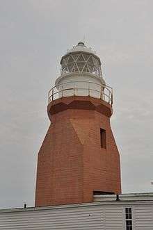 | ||
| Loveridge House | , Twillingate, NL | 49°39′00″N 54°46′13″W | 2627 | 16268 | | ||
| Lucky Strike Deckhead Municipal Heritage Structure | , Buchans, NL | 48°49′24″N 56°51′14″W | 7310 | | |||
| Man-of-War Brook Municipal Heritage Site | , Harbour Breton, NL | 47°28′30″N 55°48′52″W | 10832 | | |||
| Newman and Company Root Cellar Municipal Heritage Site | , Harbour Breton, NL | 47°28′48″N 55°48′07″W | 15367 | | |||
| Newman's Fish Store Register Heritage Structure | , Gaultois, NL | 47°36′23″N 55°54′10″W | 19609 | | |||
| Newman's Flagpole Rock Municipal Heritage Site | , Harbour Breton, NL | 47°29′N 55°48′W | 13795 | | |||
| Old Catholic Cemetery Municipal Heritage Site | , Leading Tickles, NL | 49°29′41″N 55°27′26″W | 8008 | | |||
| Old Church of England Cemetery Municipal Heritage Site | , Leading Tickes, NL | 49°30′13″N 55°27′29″W | 8006 | | |||
| Old House Cove General Cemetery Municipal Heritage Site | , Twillingate, NL | 49°38′56″N 54°46′30″W | 16269 | ||||
| Old Lumsden North (Cat Harbour) Cemetery Municipal Heritage Site | Off Lumsden North Road, Lumsden, NL | 49°18′26″N 53°36′48″W | 19794 | | |||
| Old Methodist Cemetery Municipal Heritage Site | , Leading Tickles, NL | 49°30′05″N 55°28′13″W | 8007 | | |||
| Old Schoolhouse Municipal Heritage Building | , Fogo, NL | 49°42′54″N 54°16′58″W | 10195 | | |||
| Pelley House Registered Heritage Structure | , Boyd's Cove, NL | 49°26′51″N 54°39′29″W | 19037 | | |||
| Pickersgill Premises Registered Heritage Structure | , Salvage, NL | 48°41′00″N 53°38′00″W | 2334 | | |||
| Piercey House Municipal Heritage Site | , Milltown-Head of Bay D'Espoir, NL | 47°54′54″N 55°45′03″W | 13798 | | |||
| Red Head Municipal Heritage Site | , Harbour Breton, NL | 47°27′32″N 55°49′55″W | 15366 | | |||
| Reddy Property Municipal Heritage Site | , Marystown, NL | 47°09′31″N 55°09′45″W | 5380 | | |||
| Rocky Point Light Tower Municipal Heritage Site | , Harbour Breton, NL | 47°28′44″N 55°47′38″W | 21114 | 13796 | | ||
| John Rodway Senior Residence | , Baine Harbour, NL | 47°21′37″N 54°53′19″W | 2628 | | |||
| Rose Blanche Lighthouse | , Rose Blanche, NL | 47°37′00″N 58°41′00″W | 2095 |  More images | |||
| St. Andrew's Anglican Church and Cemetery Municipal Heritage Site | , Fogo, NL | 49°42′54″N 54°16′48″W | 8143 |  More images | |||
| St. Anne's Church | , Little Fogo Island, NL | 49°48′42″N 54°07′15″W | 2092 |  More images | |||
| St. Bartholomew's Memorial Stone Municipal Heritage Site | , Harbour Breton, NL | 47°28′48″N 55°48′50″W | 13797 | | |||
| St. Cecilia Roman Catholic Cemetery Municipal Heritage Site | , St. Lawrence, NL | 46°55′33″N 55°23′32″W | 8581 | | |||
| St. Gabriel's Hall Municipal Heritage Building | , Marystown, NL | 47°09′40″N 55°09′43″W | 7277 | | |||
| St. John Lodge Society of United Fishermen No. 11 Municipal Heritage Building | , Joe Batt's Arm-Barr'd Islands-Shoal Bay, NL | 49°43′31″N 54°10′44″W | 10196 | | |||
| St. Lawrence Centennial Soccer Field | , St. Lawrence, NL | 46°55′21″N 55°23′38″W | 3554 | | |||
| St. Mark's Church | , Nippers Harbour, NL | 49°47′03″N 55°52′01″W | 2109 | | |||
| St. Matthew's Anglican Cemetery Municipal Heritage Site | , St. Lawrence, NL | 46°55′30″N 55°23′28″W | 8580 | | |||
| St. Matthew's Presbyterian Church | , Grand Falls-Windsor, NL | 48°55′52″N 55°39′34″W | 5022 |  More images | |||
| St. Peter's Anglican Cemetery Municipal Heritage Site | , Twillingate, NL | 49°39′17″N 54°46′42″W | 16270 | | |||
| St. Peter's Anglican Church | , Twillingate, NL | 49°39′22″N 54°46′33″W | 1902 | 19064 |  More images | ||
| St. Peter's Lodge SUF #12, Victoria Hall, Registered Heritage Structure | , Twillingate, NL | 49°38′59″N 54°46′20″W | 5342 | 18908 |  More images | ||
| South Side United Church Municipal Heritage Building | , Twillingate, NL | 49°39′10″N 54°45′39″W | 7279 |  More images | |||
| Stoodley Fishing Stage | , Grand Bank, NL | 47°05′58″N 55°45′10″W | 2026 | 7462 | | ||
| Sunny Cottage Registered Heritage Structure | , Harbour Breton, NL | 47°28′36″N 55°49′34″W | 1937 | 11950 | | ||
| Emma and Philip Templeman Property Registered Heritage Structure | , New-Wes-Valley, NL | 49°12′15″N 53°30′58″W | 6297 | | |||
| The Thorndyke | , Grand Bank, NL | 47°06′03″N 55°45′14″W | 2196 | 7463 | | ||
| Tilting Registered Heritage District | , Tilting, NL | 49°42′29″N 54°03′55″W | 13153 | 2731 |  | ||
| Torraville Property | , Change Islands, NL | 49°40′18″N 54°24′27″W | 2192 | | |||
| Truth Loyal Orange Lodge LOL #116 | , Herring Neck, NL | 49°38′50″N 54°45′43″W | 2203 |  More images | |||
| USS Truxtun and USS Pollux Historic Wreck Sites | , St. Lawrence, NL | 46°52′38″N 55°25′42″W | 3436 | | |||
| Twillingate Masonic Temple | , Twillingate, NL | 49°38′47″N 54°46′03″W | 2172 | 16271 |  More images | ||
| Victoria Hall Masonic Lodge #1378 Municipal Heritage Site | , Fortune, NL | 47°04′25″N 55°49′35″W | 5963 | | |||
| West Point Light Tower | West Point Lightstation, Francois, West Point, NL | 47°33′43″N 56°44′04″W | 12954 | | |||
| Jenkins House | Durrell, , | 49°40′4.8″N 54°43′43.8″W | 19412 | 19446 | Q51324585 | | |
| Lighttower | , Gull Island, NL | 49°59′54″N 55°21′33″W | 3906 | |
See also
| Wikimedia Commons has media related to Cultural heritage monuments in Newfoundland and Labrador. |
- List of historic places in Newfoundland and Labrador
- List of National Historic Sites of Canada in Newfoundland and Labrador
| National parks | |
|---|---|
| National historic sites |
|
| Provincial parks | |
| Wilderness & Ecological Reserves | |
| |
This article is issued from Wikipedia. The text is licensed under Creative Commons - Attribution - Sharealike. Additional terms may apply for the media files.