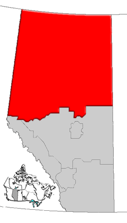
List of historic places in Northern Alberta
This article is a list of historic places in Northern Alberta entered on the Canadian Register of Historic Places, whether they are federal, provincial, or municipal.
List
| Name | Address | Coordinates | IDF | IDP | IDM | Image | |
|---|---|---|---|---|---|---|---|
| St. Paul's Anglican Church and Heritage House | 32 - 2 Avenue NE, McLennan, AB | 55°42′39″N 116°54′07″W | 2835 |  | |||
| Nativity of the Blessed Virgin Roman Catholic Church | 273 Mackenzie Ave., Fort Chipewyan, AB | 58°42′41″N 111°10′23″W | 5915 | | |||
| Building 15 | Beaverlodge Research Station, Beaverlodge, AB | 55°11′59″N 119°23′48″W | 9814 | | |||
| Reverend Forbes Homestead | 10424 - 96 Street, Grande Prairie, AB | 55°10′34″N 118°46′59″W | 3050 |  | |||
| Ronning Homestead | , Grande Prairie County No. 1, AB | 55°21′31″N 119°24′32″W | 3192 | | |||
| Bitumount Site | near Fort McMurray, Wood Buffalo Regional Municipality, AB | 57°23′11″N 111°38′46″W | 4998 | 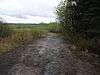 More images | |||
| Grande Prairie High School | 10209 - 99 Street, Grande Prairie, AB | 55°10′23″N 118°47′28″W | 5000 | 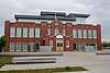 | |||
| Cochrane Farm | RR 1, Grande Prairie County No. 1, AB | 55°14′07″N 118°38′20″W | 5003 | | |||
| Athabasca United Church | 4817 - 48 Street, Athabasca, AB | 54°43′08″N 113°16′59″W | 5178 | 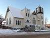 More images | |||
| Canadian Northern Railway Station | 5101 - 50 Avenue, Athabasca, AB | 54°43′17″N 113°17′14″W | 19043 | | |||
| Melsness Mercantile Building | Valhalla Centre, Grande Prairie County No. 1, AB | 55°24′13″N 119°22′59″W | 5185 | | |||
| Monkman Homestead | near Cutbank Lake, Grande Prairie County No. 1, AB | 55°15′28″N 119°07′55″W | 5186 | | |||
| Hudson's Bay Company Factor's House | Fort Vermilion, Mackenzie County, AB | 58°23′48″N 116°00′07″W | 5723 | | |||
| Obadiah Place | Amber Valley, Athabasca County, AB | 54°43′26″N 112°55′44″W | 5914 | | |||
| Sexsmith Blacksmith Shop | , Sexsmith, AB | 55°20′59″N 118°47′01″W | 6562 | 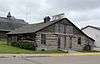 | |||
| Northern Alberta Railway Station | Main Street and Railway Avenue, Sexsmith, AB | 55°20′58″N 118°47′10″W | 6852 | 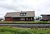 | |||
| Fort Dunvegan National Historic Site of Canada | west of Dunvegan, Fairview Municipal District No. 136, AB | 55°55′25″N 118°36′14″W | 18983 | 8769 | 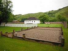 | ||
| Plavin Homestead | near North Star, Northern Lights County, AB | 56°50′23″N 117°36′58″W | 8991 | | |||
| 1880 Anglican Church of St. Paul the Apostle and the 1874 Day School | Fort Chipewyan, Wood Buffalo Regional Municipality, AB | 58°42′33″N 111°06′58″W | 9088 | | |||
| St. Bernard Mission (Church and Cemetery) | Grouard, Big Lakes County, AB | 55°32′41″N 116°09′29″W | 9089 | | |||
| McNaught Homestead | south of Beaverlodge, Grande Prairie County No. 1, AB | 55°09′07″N 119°26′13″W | 9090 | | |||
| Beaver River Quarry Archaeological Site | Near Fort MacKay, Wood Buffalo Regional Municipality, AB | 10935 | | ||||
| Quarry of the Ancestors | 6 miles northeast of Fort MacKay, Wood Buffalo Regional Municipality, AB | 57°11′53″N 111°31′56″W | 18869 | | |||
| Notre Dame des Victoires / Lac La Biche Mission National Historic Site of Canada | northwest of Lac La Biche, Lac La Biche County, AB | 54°49′22″N 112°05′38″W | 15064 21497 |
11122 | More images | ||
| Peace River N.A.R. Station | 9409 - 100 Street, Peace River, AB | 56°14′22″N 117°17′35″W | 11390 | | |||
| Trapper's Shack | 5003 River Road, Fort Vermilion, Mackenzie County, AB | 58°14′03″N 116°00′36″W | 11482 | | |||
| Eaglenest Portage Site | Near Fort MacKay, Wood Buffalo Regional Municipality, AB | 11517 | | ||||
| St. Augustine's Roman Catholic Mission | Shaftesbury Settlement, south of Peace River, Peace Municipal District No. 135, AB | 56°09′18″N 117°26′42″W | 11611 | | |||
| Bad Heart Straw Church | Teepee Creek, Grande Prairie County No. 1, AB | 55°29′06″N 118°17′17″W | 11819 | | |||
| Battle River Hospital | 300 Main Street, Manning, AB | 56°55′22″N 117°37′52″W | 11821 | | |||
| Fort Chipewyan III | Fort Chipewyan, Wood Buffalo Regional Municipality, AB | 58°42′44″N 111°08′56″W | 11935 | | |||
| Fort Vermilion National Historic Site of Canada | Southeast corner of River Road and 45th Street, Fort Vermilion, Mackenzie County, AB | 58°23′02″N 116°02′24″W | 16741 | 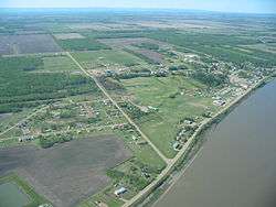 More images | |||
| Fort Fork National Historic Site of Canada | River Lot 19, Shaftesbury Settlement, south of Peace River, Peace Municipal District No. 135, AB | 56°08′11″N 117°28′01″W | 17661 | 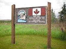 More images | |||
| Fort Chipewyan National Historic Site of Canada | Fort Chipewyan, Wood Buffalo Regional Municipality, AB | 58°38′59″N 110°36′25″W | 17705 | | |||
| Frog Lake National Historic Site of Canada | South of Frog Lake, Frog Lake, AB | 53°49′52″N 110°21′31″W | 18201 | 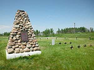 | |||
| All Saints Anglican Church | Alberta Highway 717, Cherry Point, Clear Hills County, AB | 56°11′18″N 119°56′20″W | 17901 | |
See also
References
- For references, see externally linked ID numbers.
This article is issued from Wikipedia. The text is licensed under Creative Commons - Attribution - Sharealike. Additional terms may apply for the media files.