List of earthquakes in Chile
This list of earthquakes in Chile includes every known major earthquake that was felt or with its epicenter within Chile's current boundaries.
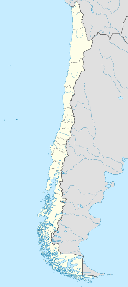
Statistics and Map
| Century | Number with M ≥ 7.0 | Average per decade |
|---|---|---|
| 1501–1600 | 3 | - |
| 1601–1700 | 6 | - |
| 1701–1800 | 4 | - |
| 1801–1900 | 19 | - |
| 1901–2000 | 76 | 7.6 |
| 2001–present | 15 | 7.5 |
| Total | 123 | - |
Statistics for earthquakes with M ≥ 7.0 in Chile are detailed on the list below.
The region, which is adjacent to the fast-moving Nazca Plate, has high tectonic activity. To keep the list manageable, only earthquakes with magnitude ≥ 7.0 will be included, or if it has other notable features like the 2010 Pichilemu earthquake. The records for earlier centuries are apparently incomplete.
Of the world's 36 known earthquakes with M ≥ 8.5 since the year 1500, one-third occurred in Chile and are shown in the map to the side. Some virtually have the same epicenters like the 1604 and 1868 (in Arica), the 1730 and 1822 (in Valparaíso), the 1751 and 1835 (in Concepción), and the 1575 and 1837 (in Valdivia).
The strongest known recorded in modern times was also in Chile, the 1960 Valdivia earthquake.
Earthquakes
| Region | Local date | Mag. | MMI | Depth (km) | Epicenter | Deaths | Notes | Sources |
|---|---|---|---|---|---|---|---|---|
| Caldera | September 1, 1420 | 9.4 MS[1][2] | Destructive tsunami in Chile, Hawaii & Japan | |||||
| Concepción | February 8, 1570 | 8.3 MS | 36.800°S 73.000°W | Destructive tsunami | ||||
| March 17, 1575 | 7.3 MS | 33.400°S 70.600°W | ||||||
| Valdivia | December 16, 1575 | 8.5 MS | 39.800°S 73.200°W | Destructive tsunami | ||||
| Offshore Arica | November 24, 1604 | 8.5 MS | 30 | 18.500°S 70.400°W | Destructive tsunami | |||
| Offshore Arica | September 16, 1615 | 7.5[3] MS | 18.500°S 70.350°W | Moderate tsunami | ||||
| Santiago | May 13, 1647 | 8.5 MS | 35.000°S 72.000°W | |||||
| March 15, 1657 | 8.0 MS | 36.830°S 73.030°W | Destructive tsunami | |||||
| March 10, 1681 | 7.3 MS | 18.500°S 70.350°W | ||||||
| July 12, 1687 | 7.3 MS | 32.750°S 70.730°W | ||||||
| Valparaíso | July 8, 1730 | 8.7 MS/9.1 MW[4] | 33.050°S 71.630°W | 5 | Destructive tsunami | |||
| Valdivia | December 24, 1737 | 7.7 MS | 39.800°S 73.200°W | Tsunami | ||||
| Concepción | May 25, 1751 | 8.5 MS | 36.830°S 73.030°W | Moderate tsunami | ||||
| March 30, 1796 | 7.7 MS | 27.350°S 70.350°W | ||||||
| April 11, 1819 | 8.3 MS | 27.350°S 70.350°W | Destructive tsunami | |||||
| Valparaíso | November 19, 1822 | 8.5 MS | 33.050°S 71.630°W | 200 | Moderate tsunami | |||
| September 26, 1829 | 7.0 MS | 33.050°S 71.630°W | ||||||
| October 8, 1831 | 7.8 MS | 18.500°S 71.000°W | ||||||
| September 18, 1833 | 7.7 MS | 60 | 18.500°S 70.400°W | |||||
| Concepción | February 20, 1835 | 8.5/8.2 MS/M? | 36.830°S 73.030°W | 500 | Destructive tsunami | |||
| Valdivia | November 7, 1837 | 8.0 MS | 39.800°S 73.200°W | Moderate tsunami | ||||
| October 8, 1847 | 7.3 MS | 31.610°S 71.180°W | ||||||
| December 17, 1849 | 7.5 MS | 29.950°S 71.370°W | Moderate tsunami | |||||
| December 6, 1850 | 7.3 MS | 33.810°S 70.220°W | ||||||
| April 2, 1851 | 7.1 MS | 33.320°S 71.420°W | ||||||
| October 5, 1859 | 7.6 MS | 27.350°S 70.350°W | Moderate tsunami | |||||
| Arica | August 13, 1868 | 9.0/8.5 M?/MS | 18.500°S 70.350°W | 25,000 | Destructive tsunami, at the time the area was part of Peru. | |||
| August 24, 1869 | 7.5 MS | 19.600°S 70.230°W | Moderate tsunami | |||||
| October 5, 1871 | 7.3 MS | 20.200°S 70.170°W | Tsunami | |||||
| Iquique | May 9, 1877 | 8.8 MS/M? | 19.600°S 70.230°W | 2,385 | Destructive tsunami | |||
| January 23, 1878 | 7.9 MS | 40 | 20.000°S 70.300°W | |||||
| February 2, 1879 | 7.3 MS | 53.000°S 70.670°W | ||||||
| August 15, 1880 | 7.7 MS | 31.620°S 71.180°W | ||||||
| Valparaíso | August 16, 1906 | 8.2 MW | 25 | 33.000°S 72.000°W | 3,882 | Moderate tsunami | ||
| June 8, 1909 | 7.6 MS | 26.500°S 70.500°W | ||||||
| October 4, 1910 | 7.3 MS | 22.000°S 69.000°W | ||||||
| September 15, 1911 | 7.3 MS | 20.000°S 72.000°W | ||||||
| January 29, 1914 | 8.2 MS | 35.000°S 73.000°W | ||||||
| February 14, 1917 | 7.0 MS | 30.000°S 73.000°W | ||||||
| May 20, 1918 | 7.9 MS | 28.500°S 71.500°W | ||||||
| December 4, 1918 | 8.2 MS | 60 | 26.000°S 71.000°W | Moderate tsunami | ||||
| March 1, 1919 | 7.2 MS | 40 | 41.000°S 73.500°W | |||||
| March 2, 1919 | 7.3 MS | 40 | 41.000°S 73.500°W | |||||
| December 10, 1920 | 7.4 MS | 39.000°S 73.000°W | ||||||
| November 7, 1922 | 7.0 MS | 28.000°S 72.000°W | ||||||
| Vallenar | November 10, 1922 | 8.5 MW | 25 | 28.500°S 70.000°W | 1,000 | Moderate tsunami | ||
| May 4, 1923 | 7.0 MS | 60 | 28.750°S 71.750°W | |||||
| May 15, 1925 | 7.1 MS | 50 | 26.000°S 71.500°W | |||||
| April 28, 1926 | 7.0 MS | 180 | 24.000°S 69.000°W | |||||
| November 21, 1927 | 7.1 MS | 44.500°S 73.000°W | Moderate tsunami | |||||
| November 20, 1928 | 7.1 MS | 25 | 22.500°S 70.500°W | |||||
| Talca | December 1, 1928 | 8.3/7.6 MS/M? | 35.000°S 72.000°W | 225 | Tsunami | |||
| October 19, 1929 | 7.5 MS | 100 | 23.000°S 69.000°W | |||||
| March 18, 1931 | 7.1 MS | 32.500°S 72.000°W | ||||||
| February 23, 1933 | 7.6 MS | 40 | 20.000°S 71.000°W | |||||
| March 1, 1936 | 7.1 MS | 120 | 40.000°S 72.500°W | |||||
| July 13, 1936 | 7.3 MS | 60 | 24.500°S 70.000°W | |||||
| Chillán | January 24, 1939 | 8.3 Mw | 60 | 36.200°S 72.200°W | 28,000 | |||
| April 18, 1939 | 7.4 MS | 100 | 27.000°S 70.500°W | |||||
| October 11, 1940 | 7.0 MS | 41.500°S 74.500°W | ||||||
| July 8, 1942 | 7.0 MS | 140 | 24.000°S 70.000°W | |||||
| March 14, 1943 | 7.2 MS | 150 | 20.000°S 69.500°W | |||||
| Ovalle | April 6, 1943 | 8.2 MW | 55 | 30.750°S 72.000°W | 25 | Tsunami | ||
| December 1, 1943 | 7.0 MS | 100 | 21.000°S 69.000°W | |||||
| July 13, 1945 | 7.1 MS | 100 | 33.250°S 70.500°W | |||||
| August 2, 1946 | 7.9 MS | 50 | 26.500°S 70.500°W | |||||
| April 19, 1949 | 7.3 MS | 70 | 38.000°S 73.500°W | |||||
| April 25, 1949 | 7.3 MS | 110 | 19.750°S 69.000°W | |||||
| May 29, 1949 | 7.0 MS | 100 | 22.000°S 69.000°W | |||||
| Tierra del Fuego | December 17, 1949 | 7.8 MS | VIII | 30 | 54.000°S 71.000°W/54°0′0″S 68°46′11″W[5] | [5] | ||
| December 17, 1949 | 7.8 MS | 54.000°S 71.000°W | ||||||
| January 29, 1950 | 7.0 MS | 53.500°S 71.500°W | ||||||
| December 9, 1950 | 8.3 MS | 100 | 23.500°S 67.500°W | |||||
| May 6, 1953 | 7.6 MS | 60 | 36.500°S 72.600°W | |||||
| December 6, 1953 | 7.4 MS | 128 | 22.100°S 68.700°W | |||||
| February 8, 1954 | 7.7 MS | 29.000°S 70.500°W | ||||||
| April 19, 1955 | 7.1 MS | 30.000°S 72.000°W | Tsunami | |||||
| January 8, 1956 | 7.1 MS | 11 | 19.000°S 70.000°W | |||||
| December 17, 1956 | 7.0 MS | 25.500°S 68.500°W | ||||||
| July 29, 1957 | 7.0 MS | 23.500°S 71.500°W | ||||||
| June 13, 1959 | 7.5 MS | 83 | 20.420°S 69.000°W | |||||
| Concepción | May 21, 1960 | 7.9/7.3 M?/MS | X | 37.500°S 73.500°W | 125 | |||
| May 22, 1960 | 7.3 MS | 37.500°S 73.000°W | ||||||
| Valdivia | May 22, 1960 | 9.5 Mw | XI | 33 | 39.500°S 74.500°W | 1,655 | Destructive tsunami, strongest earthquake in recorded history. | |
| June 19, 1960 | 7.3 MS | 38.000°S 73.500°W | ||||||
| November 1, 1960 | 7.4 MS | 55 | 38.500°S 75.100°W | |||||
| July 13, 1961 | 7.0 MS | 40 | 41.700°S 75.200°W | |||||
| February 14, 1962 | 7.3 MS | 45 | 37.800°S 72.500°W | |||||
| August 3, 1962 | 7.1 MS | 107 | 23.300°S 68.100°W | |||||
| Taltal | February 23, 1965 | 7.0 MS | 36 | 25.670°S 70.630°W | 1 | |||
| La Ligua | March 28, 1965 | 7.4 MS | 68 | 32.418°S 71.100°W | 400 | |||
| December 28, 1966 | 7.8 MS | 23 | 25.510°S 70.740°W | |||||
| March 13, 1967 | 7.3 MS | 33 | 40.120°S 74.680°W | |||||
| December 21, 1967 | 7.5 MS | 33 | 21.800°S 70.000°W | |||||
| June 17, 1971 | 7.0 MS | 76 | 25.402°S 69.058°W | |||||
| Illapel | July 8, 1971 | 7.5 MS | 40 | 32.511°S 71.207°W | 90 | Moderate tsunami | ||
| August 18, 1974 | 7.1 MS | 36 | 38.453°S 73.431°W | |||||
| May 10, 1975 | 7.7 MS | 6 | 38.183°S 73.232°W | |||||
| November 29, 1976 | 7.3 MS | 82 | 20.520°S 68.919°W | |||||
| August 3, 1979 | 7.0 MS | 49 | 26.518°S 70.664°W | |||||
| October 16, 1981 | 7.5 MS | 33 | 33.134°S 73.074°W | |||||
| October 4, 1983 | 7.3 MS | 14 | 26.535°S 70.563°W | |||||
| Algarrobo | March 3, 1985 | 8.0 Mw | VIII | 33 | 33.240°S 71.850°W | 177 | Tsunami | |
| Rapel Lake | April 8, 1985 | 7.5 MS | 37 | 34.131°S 71.618°W | 1 | |||
| Iquique | March 5, 1987 | 7.3 MS | 62 | 24.388°S 70.161°W | Tsunami | |||
| August 8, 1987 | 7.1 MS | 42 | 19.000°S 70.000°W | |||||
| Antofagasta | July 30, 1995 | 8.0 MW | 47 | 23.360°S 70.310°W | 3 | Tsunami | ||
| Punitaqui | October 15, 1997 | 7.1 MW | VIII | 56 | 30.773°S 71.315°W | 8 | ||
| Near coast of northern Chile | January 30, 1998 | 7.1 M? | VII | 42 | 23.910°S 70.200°W | 1 | Minor damage to older buildings | |
| Tarapacá | June 13, 2005 | 7.8 MW | VII | 108/117.2 | 19.895°S 69.125°W/19.934°S 69.028°W | 11 | Felt as far away as Santiago, Chile and Brasília, Brazil | |
| Aisén Fjord | April 21, 2007 | 6.2 Mw | VII | 25 | 45.27°S 72.66°W | 10 | ||
| Tocopilla | November 14, 2007 | 7.7 MW | VIII | 47.7/40 | 22.314°S 70.078°W | 2 | Felt at São Paulo, Brazil | |
| Maule, Biobío | February 27, 2010 | 8.8 MW | IX | 30/35 | 36.290°S 73.239°W | 525 | Destructive tsunami | |
| Pichilemu | March 11, 2010 | 6.9 Mw | VII | 33.1 | 34.259°S 71.929°W | 1 | [6][7] | |
| Araucanía | January 2, 2011 | 7.1 Mw | VI | 25.1 | 38.354°S 73.275°W | [8] | ||
| Talca | March 25, 2012 | 7.0 Mw | VII | 40.7 | 35.183°S 71.792°W | 1 | [9] | |
| Iquique | March 16, 2014 | 7.0 Mw | VI | 20.6 | 19.981°S 70.702°W | Tsunami | ||
| Iquique | April 1, 2014 | 8.2 Mw | VIII | 25 | 19.610°S 70.769°W | 7 | Tsunami | [10] |
| Iquique | April 1, 2014 | 7.5 Mw | VIII | 26.8 | 20.085°S 70.389°W | |||
| Iquique | April 1, 2014 | 7.0 Mw | VI | 29.7 | 19.893°S 70.945°W | |||
| Iquique | April 2, 2014 | 7.7 Mw | VIII | 22.4 | 20.571°S 70.493°W | Tsunami | ||
| Easter Island | October 8, 2014 | 7.0 Mw | I | 16.5 | 32.108°S 110.811°W | Tsunami | ||
| Illapel, Coquimbo | September 16, 2015 | 8.3 Mw | VIII | 20 | 31.57°S 71.65°W | 15 | Tsunami | |
| Quellón | December 25, 2016 | 7.6 Mw | VIII | 39 | 43.416°S 73.880°W | Tsunami | [11] | |
| Valparaíso | April 24, 2017 | 6.9 Mw | VII | 28 | 33.038°S 72.062°W | Tsunami | [12] | |
| Coquimbo | January 20, 2019 | 6.7 Mw | VIII | 63 | 30.074°S 71.423°W | 2 | ||
| Los Lagos | September 26, 2019 | 6.1 Mw | IV | 129 | 40.816°S 72.003°W | 1 | ||
| Maule | September 29, 2019 | 6.8 Mw | VI | 11 | 35.473°S 73.162°W | 1 | ||
| The inclusion criteria for adding events are based on WikiProject Earthquakes' notability guideline that was developed for stand alone articles. The principles described are also applicable to lists. In summary, only damaging, injurious, or deadly events should be recorded. | ||||||||
See also
References
- L. Guzmán: Encuentran registros de megaterremoto ocurrido hace seis siglos en el norte de Chile, El Mercurio, 2019-02-14.
- Manuel Abad, Tatiana Izquierdo, Miguel Cáceres, Enrique Bernárdez and Joaquín Rodríguez‐Vidal (2018). Coastal boulder deposit as evidence of an ocean‐wide prehistoric tsunami originated on the Atacama Desert coast (northern Chile). Sedimentology. Publication: december, 13th, 2018. https://doi.org/10.1111/sed.12570
- Kovach, Robert L. (2004). Early earthquakes of the Americas (1. publ., repr. ed.). Cambridge [u.a.]: Cambridge Univ. Press. p. 139. ISBN 978-0-521-82489-7. Retrieved 7 September 2014.
-
- Significant Earthquake, NOAA, 2019-10-03.
- Argentina's seismic prevention institute. Listado de Terremotos Históricos Archived 2012-03-16 at the Wayback Machine
- "Informe de Sismo". Sismologia.cl. 2010-03-15. Retrieved 2012-04-12.
- "Hombre fallece en Talca de un paro cardíaco en medio de fuertes réplicas | NACIONAL". latercera.com. 2010-07-31. Archived from the original on 2012-02-26. Retrieved 2012-04-12.
- "Magnitude 7.1 - ARAUCANIA, CHILE". Earthquake.usgs.gov. Archived from the original on 2011-01-05. Retrieved 2012-04-12.
- USGS, United States Geological Survey (25 March 2012). "Magnitud 7.1 MAULE, CHILE". Archived from the original on 27 March 2012. Retrieved 25 March 2012.
- "Chile earthquake: 2 dead, 3 seriously injured". Canadian Broadcasting Corporation. 2 April 2014.
- "M7.6 - 39km SSW of Puerto Quellon, Chile". USGS. December 25, 2016. Retrieved December 26, 2016.
- "M 6.9 - 40km W of Valparaiso, Chile". earthquake.usgs.gov. Retrieved 2017-08-12.
- (in Spanish) Servicio sismológico Universidad de Chile, Sismos importantes o destructivos desde 1570
- Historic World Earthquakes: Chile, United States Geological Survey