List of crossings of Rock Creek
This is a list of crossings of Rock Creek. Rock Creek runs for 31 miles from its source in Montgomery County, Maryland, to its mouth at the Potomac River, of which the final nine miles lies in Washington, D.C. The entirety of Rock Creek downstream of the Maryland border is within Rock Creek Park (except for a small portion that runs through the National Zoo). The crossings built after Rock Creek Park was established in 1890 until World War II tended to be stone-faced bridges constructed to harmonize with the rustic surroundings, while postwar bridges were more utilitarian concrete and steel structures. Of the 35 crossings, 23 are covered by a Historic American Engineering Record (HAER), and two bridges—the gargantuan Taft Bridge and the bucolic Boulder Bridge—are on the National Register of Historic Places.[1]

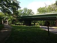
The first two crossings of Rock Creek were at the sites of the present M Street Bridge (1788) and K Street Bridge (1792), near the mouth of the creek.[2] By the early twentieth century, when the initial plans for the Rock Creek and Potomac Parkway were being made, many of the bridges along its intended path in the lower portion of the valley were utilitarian steel-truss bridges at K Street, Pennsylvania Avenue, M Street, P Street, and Calvert Street, and there was a massive earthen embankment carrying Massachusetts Avenue across the valley, with a tunnel underneath for the creek to pass through. The sole crossing of any architectural value was the monumental 1907 Taft Bridge. Construction of the parkway entailed the replacement of all of these crossings except the Taft Bridge to align with the park's intended aesthetics, and the erecting of many more.[3]
Farther upstream, at the time the upper portion of Rock Creek Park was established in 1890, the area was mainly undeveloped woodland containing small farms and mills accessed by private roads. Most crossings of the creek were fords rather than bridges, with the exception of bridges at Military Road and Peirce Mill. Much of the initial development of the park was overseen by Lansing H. Beach, after whom Beach Drive is named.[1]
Nearly all of the remaining portion of Rock Creek in Maryland is part of Rock Creek Stream Valley Park and Rock Creek Regional Park.[4] This portion of the park was established in 1902. Rock Creek in Maryland flows through densely developed suburbs and is crossed by several major highways.[5]
District of Columbia
| Image | Crossing | Carries | Built | Length | References and notes | Coordinates |
|---|---|---|---|---|---|---|
 |
Thompson Boat Center Footbridge | pedestrians | 38.900965°N 77.058274°W | |||
 |
K Street Bridge | K Street and
|
1939–41 (lower level); 1947–49 (upper level) | 497 feet | HAER DC-20. Earlier bridges on the site were built in 1792, 1869, and 1907. |
38.902531°N 77.057725°W |
 |
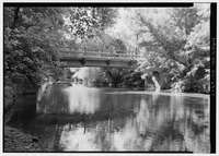
L Street Bridge | Rock Creek and Potomac Parkway | 1981–83 | HAER DC-697, pp. 92, 98, NPS Earlier bridges on the site were built ca. 1933 and ca. 1943. | 38.903978°N 77.056590°W | |
 |
Pennsylvania Avenue Bridge | Pennsylvania Avenue | 1915–16 | 276 feet | HAER DC-21.
Portions of the earlier bridge, built 1858–60, are encased inside the current bridge |
38°54′17″N 77°03′22″W |
 |
M Street Bridge | M Street | 1929–30 | 308 feet | HAER DC-37. Earlier bridges on the site were built in 1788, 1800, 1839, and 1871. |
38°54′19″N 77°03′20″W |
 |
P Street Bridge | P Street | 1933–35 | HAER DC-48. Earlier bridges on the site were built in 1855 and 1871. |
38.909588°N 77.050279°W | |
| Bridge near P Street | Rock Creek and Potomac Parkway | 1935–36 | 111 feet | HAER DC-11 | 38°54′36″N 77°03′01″W | |
 |
Dumbarton Bridge | Q Street | 1915 | 265 feet | HAER DC-38 | 38°54′39″N 77°3′4″W |
 |
Lyon's Mill Footbridge | pedestrians | 1932–34 | 88 feet | HAER DC-35 | 38°54′45″N 77°03′15″W |
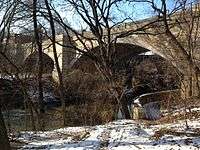
| Charles C. Glover Memorial Bridge | Massachusetts Avenue | 1939–41 | 420 feet | HAER DC-22. Earlier bridges on the site were built in 1888 and 1901. |
38°55′04″N 77°03′30″W | |
 |
Saddle Club Footbridge | pedestrians | 1934 | 110 feet | HAER DC-36 | 38°55′12″N 77°03′12″W |
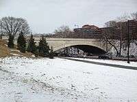
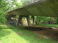
| Shoreham Hill Bridge | Rock Creek and Potomac Parkway | 1938 | 220 feet | HAER DC-10 | 38°55′12″N 77°03′10″W | |
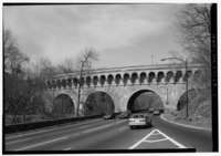
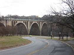 |
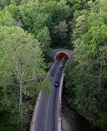
Taft Bridge | Connecticut Avenue | 1897–1907 | 901 feet | HAER DC-6.
National Register of Historic Places. Site of former Woodley Lane Bridge (HAER DC-24), built 1889. |
38°55′14″N 77°2′59″W |
 |
Edgewater Stables Bridge | Edgewater Stables driveway | 38.921752°N 77.049619°W | |||
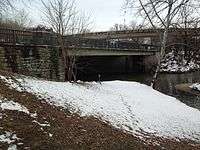
| Duke Ellington Bridge | Calvert Street | 1933–1935 | 825 feet | HAER DC-23. Earlier bridge on the site was built in 1891. |
38°55′24″N 77°02′54″W | |
 |
South Portal Bridge | Beach Drive | 1966 | HAER DC-55, p. 110 | 38.924006°N 77.048661°W | |
 |
Jewett Street Bridge | Jewett Street | Internal to National Zoological Park grounds | 38.927979°N 77.048876°W | ||
 |
Old Harvard Street Bridge | National Zoo Drive | 1900–1901 | 148 feet | HAER DC-26. Earlier bridge on the site was built in 1892. |
38°55′39″N 77°02′41″W |
 |
New Harvard Street Bridge | Harvard Street | 1965 | HAER DC-53 | 38°55′41″N 77°02′40″W | |
 |
Klingle Ford Bridge | Klingle Road | HAER DC-55, p. 35 | 38.933254°N 77.050464°W | ||
 |
Porter Street Bridge | Porter Street | 38.934189°N 77.049005°W | |||
 |
Bluffs Footbridge | pedestrians | 1934 | 90 feet | HAER DC-33 | 38°56′12″N 77°02′52″W |
 |
Footbridge near Jusserand Memorial | pedestrians | 38.938361°N 77.051966°W | |||
 |
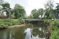
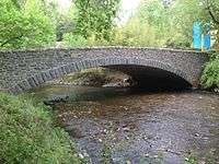
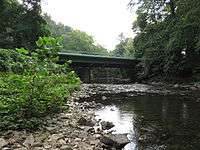
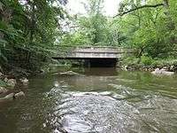
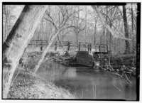
Peirce Mill Bridge | Tilden Street | 1872; additions in 1895 and 1921 | 178 feet | HAER DC-28. Earlier bridge on the site was built in the 1860s. Near Peirce Mill. |
38°56′23″N 77°03′06″W |
 |
Blagden Avenue Bridge | Beach Drive | 1956 | 107 feet | HAER DC-55, p. 10 | 38.943836°N 77.049606°W |
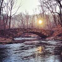 |
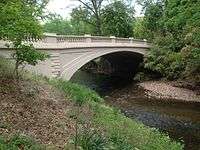
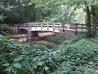
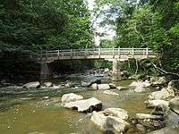
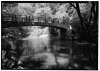
Boulder Bridge | Beach Drive | 1901–02 | 130 feet | HAER DC-12.
National Register of Historic Places |
38°56′54″N 77°02′42″W |
 |
Rapids Footbridge | pedestrians | 1934 | 110 feet | HAER DC-14 | 38°57′12″N 77°02′37″W |
 |
Joyce Road Bridge | Joyce Road | 1929 | 54 feet | HAER DC-18. Earlier bridges on the site were built in 1862 and 1905. Also called Old Military Road Bridge. |
38°57′37″N 77°02′32″W |
 |
Military Road Bridge | Military Road | 1955? | HAER DC-55, p. 146 | 38.961357°N 77.043426°W | |
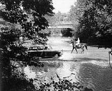
| Milkhouse Ford | Milkhouse Ford Road (abandoned) | 1904 | 74 feet | HAER DC-25. The only ford remaining in the park |
38°57′53″N 77°02′51″W | |
 |
Milkhouse Ford Bridge | Beach Drive | 1956 | HAER DC-55, p. 12
Earlier bridge on the site was built in 1926. |
38°57′55″N 77°02′51″W | |
 |
Rolling Meadow Footbridge | pedestrians | 1934 | 94 feet | HAER DC-31 | 38°58′13″N 77°02′41″W |
 |
Sherrill Drive Bridge | Sherrill Drive | 1962 | 79 feet | HAER DC-55, p. 14, 76
Earlier bridge on the site was built in 1924. |
|
 |
Riley Springs Footbridge | pedestrians | 1934–35 | 120 feet | HAER DC-32 | 38°58′41″N 77°02′36″W |
 |
Kalmia Bridge | West Beach Drive | 1958 | 68 feet | HAER DC-55, p. 13 | 38.983978°N 77.042868°W |
 |
Boundary Footbridge | pedestrians | 1934–35 | 127 feet | HAER DC-34 | 38°59′13″N 77°03′08″W |
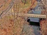
Maryland
See also


References
- Historic American Engineering Record (HAER) No. DC-55, "Rock Creek Park Road System" History and Description, pp. 3, 5–6, 22–23, 25, 36
- Ross, Amy (1992). Historic American Engineering Record (HAER) No. DC-20, "K Street Bridge" History and Description
- Davis, Timothy (1992). Historic American Engineering Record (HAER) No. DC-697, "Rock Creek and Potomac Parkway" History and Description, pp. 9, 47, 62, 91
- "Rock Creek Hiker–Biker Trail Map" (PDF). Maryland–National Capital Park and Planning Commission. Retrieved 27 April 2015.
- "Human History". Rock Creek Conservancy. Retrieved 27 April 2015.
- "The Rock Creek Trail Reopens at Rock Creek Trestle". Retrieved 6 January 2020.