List of Indiana state historical markers in Adams County
This is a list of the Indiana state historical markers in Adams County.
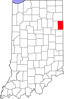
Location of Adams County in Indiana
This is intended to be a complete list of the official state historical markers placed in Adams County, Indiana, United States by the Indiana Historical Bureau. The locations of the historical markers and their latitude and longitude coordinates are included below when available, along with their names, years of placement, and topics as recorded by the Historical Bureau. There are 2 historical markers located in Adams County.[1]
Historical markers
| Marker title | Image | Year placed | Location | Topics |
|---|---|---|---|---|
| The Wayne Trace[2] | 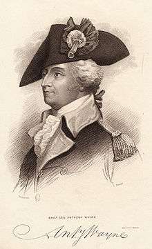 |
1977 | 6640 N. State Road 101, 0.1 miles north of the U.S. Route 224 junction and 3 miles east of Decatur, on the western side of the road 40°50′32″N 84°51′43″W |
Military, American Indian/Native American |
| Geneva Downtown Historic District[3] | 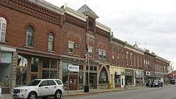 |
2006 | Line and High Streets in Geneva 40°35′32″N 84°57′29″W |
Business, Industry, and Labor, Historic District, Neighborhoods, and Towns, Buildings and Architecture |
See also
References
- "Indiana Historical Markers by County". State of Indiana. Retrieved 2012-03-15.
- The Wayne Trace, Indiana Historical Bureau, n.d. Accessed 2012-03-14.
- Geneva Downtown Historic District, Indiana Historical Bureau, n.d. Accessed 2012-03-14.
External links
Municipalities and communities of Adams County, Indiana, United States | ||
|---|---|---|
| Cities | Map of Indiana highlighting Adams County | |
| Towns | ||
| Townships | ||
| Unincorporated communities | ||
This article is issued from Wikipedia. The text is licensed under Creative Commons - Attribution - Sharealike. Additional terms may apply for the media files.