List of Category A listed buildings in Glasgow
This is a list of Category A listed buildings in Glasgow, Scotland.
In Scotland, the term listed building refers to a building or other structure officially designated as being of "special architectural or historic interest".[1] Category A structures are those considered to be "buildings of national or international importance, either architectural or historic, or fine little-altered examples of some particular period, style or building type."[2] Listing was begun by a provision in the Town and Country Planning (Scotland) Act 1947, and the current legislative basis for listing is the Planning (Listed Buildings and Conservation Areas) (Scotland) Act 1997.[3] The authority for listing rests with Historic Scotland, an executive agency of the Scottish Government, which inherited this role from the Scottish Development Department in 1991. Once listed, severe restrictions are imposed on the modifications allowed to a building's structure or its fittings. Listed building consent must be obtained from local authorities prior to any alteration to such a structure.[3] There are approximately 47,400 listed buildings in Scotland, of which around 8% (some 3,800) are Category A.[4]
Listed buildings
| Name | Location | Date Listed | Grid Ref. [note 1] | Geo-coordinates | Notes | LB Number [note 2] | Image |
|---|---|---|---|---|---|---|---|
| Trinity College | 31, 33, 35 Lynedoch Street and 92, 96 Woodside Terrace Lane | 15 December 1970 | NS5766766228 | 55°52′05″N 4°16′34″W | 32171 |  | |
| 1-12 Claremont Terrace | Claremont Terrace | 15 December 1970 | NS5757166178 | 55°52′04″N 4°16′40″W | Includes 1 Claremont Place, and gatepiers to Claremont Terrace Lane | 32185 |  |
| Great Western Road Bridge over River Kelvin | West End | 20 May 1986 | NS5746466972 | 55°52′29″N 4°16′47″W | 32197 |  | |
| St Mary's Episcopal Cathedral | 300 Great Western Road/Holyrood Crescent | 15 December 1970 | NS5776066827 | 55°52′25″N 4°16′30″W | 32198 |  | |
| 445-459 (Odd Nos) Great Western Road and 6 Caledonian Crescent, 1-8 (Inclusive Nos) Caledonian Mansions | 15 December 1970 | NS5738067001 | 55°52′30″N 4°16′52″W | 32200 |  | ||
| Lansdowne Parish Church (Church of Scotland) | 416 and 420 Great Western Road/433 North Woodside Road | 15 December 1970 | NS5756466941 | 55°52′28″N 4°16′41″W | 32205 |  | |
| Roberts Memorial | Kelvingrove Park | 15 December 1970 | NS5731766480 | 55°52′13″N 4°16′55″W | 32211 |  | |
| Stewart Memorial Fountain | Kelvingrove Park | 15 December 1970 | NS5718466234 | 55°52′05″N 4°17′02″W | 32213 |  | |
| 41-53 (Odd Nos) Oakfield Avenue and 18 Great George Street | 15 December 1970 | NS5716566914 | 55°52′27″N 4°17′04″W | 32235 | | ||
| 1-29 (Inclusive Nos) Park Circus and 9 Park Street South | Park District | 15 December 1970 | NS5754666408 | 55°52′11″N 4°16′41″W | Includes 22 Park Circus, Glasgow | 32238 | 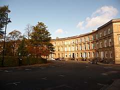 |
| 1-17 (Odd Nos) and 2-8 (Even Nos) Park Circus Place | Park District | 15 December 1970 | NS5756466296 | 55°52′07″N 4°16′40″W | 32239 | 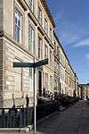 | |
| 1-6 (Inclusive Nos) Park Gardens and Park Gardens Lane | Park District | 15 December 1970 | NS5741666220 | 55°52′05″N 4°16′49″W | 32240 | _Park_Gardens_and_Park_Gardens_Lane%2C_Glasgow%2C_2018-06-27.jpg) | |
| Park Gardens, Stairway to Park Street South | Park District | 15 December 1970 | NS5740766239 | 55°52′05″N 4°16′49″W | 32241 |  | |
| 1 - 5 (Odd Nos Inclusive) and 4 Park Gate | Park District | 15 December 1970 | NS5741566393 | 55°52′10″N 4°16′49″W | 32242 |  | |
| 1-10 (Inclusive Nos) Park Quadrant | Park District | 15 December 1970 | NS5746466489 | 55°52′14″N 4°16′46″W | 32243 | 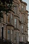 | |
| 1-21 (Inclusive Nos) Park Terrace and 18-24 (Inclusive Nos) Woodlands Terrace and 2-4 (Even Nos) Park Terrace East Lane and 3 Park Street South | Park District | 15 December 1970 | NS5746066293 | 55°52′07″N 4°16′46″W | 32245 |  | |
| Park Terrace Balustrade Railings and Gateway | Kelvingrove Park | 15 December 1970 | NS5735566447 | 55°52′12″N 4°16′52″W | 32246 |  | |
| Stairway to Clifton Street | Woodlands Terrace | 15 December 1970 | NS5748166227 | 55°52′05″N 4°16′45″W | 32267 | 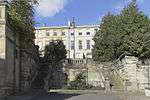 | |
| 6-19 (Inclusive No) Woodside Crescent | 15 December 1970 | NS5792766149 | 55°52′03″N 4°16′19″W | 32268 |  | ||
| 1-28 (Inclusive Nos) Woodside Place and 138, 140 Elderslie Street | 15 December 1970 | NS5786166098 | 55°52′01″N 4°16′23″W | 32270 |  | ||
| 1-22 (Inclusive Nos) Woodside Terrace, 11-63 Woodside Terrace Lane, 4 Claremount Place | 15 December 1970 | NS5774066180 | 55°52′04″N 4°16′30″W | 32271 |  | ||
| North British Engine Works | 739 South Street | 22 August 1984 | NS5341566914 | 55°52′23″N 4°20′40″W | 32280 |  | |
| Former North British Diesel Engine Engine Works, Quayside Titan Crane | 739 South Street | 14 April 1989 | NS5334166844 | 55°52′21″N 4°20′44″W | 32281 | | |
| 48 Cleveden Drive, Stoneleigh, and Gatepiers | 15 December 1970 | NS5597668019 | 55°53′01″N 4°18′15″W | 32306 | | ||
| Forth and Clyde Canal Aqueduct | Adjoining Skaethorn Road Bridge | 10 July 1989 | NS5615268980 | 55°53′33″N 4°18′06″W | 32316 | 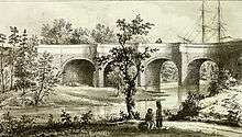 | |
| Gartnavel Royal Hospital | 1055 Great Western Road | 15 December 1970 | NS5503068034 | 55°53′01″N 4°19′09″W | 32318 |  | |
| St Mungos Academy Centenary Club | 998 Great Western Road | 15 December 1970 | NS5593868004 | 55°53′01″N 4°18′17″W | 32334 | | |
| 11 Whittinghame Drive | 5 September 1979 | NS5529068166 | 55°53′05″N 4°18′54″W | 32342 | | ||
| Ruchill Church Hall | 17 Shakespeare Street | 15 December 1970 | NS5725668308 | 55°53′12″N 4°17′02″W | 32356 |  | |
| Queen's Park Church and Hall | 20 Balvicar Drive, Balvicar Street, Camphill | 15 December 1970 | NS5786562432 | 55°50′03″N 4°16′16″W | 32359 | 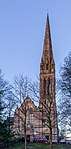 | |
| Langside Hall | 1 Langside Avenue | 15 December 1970 | NS5744562150 | 55°49′53″N 4°16′39″W | 32369 | 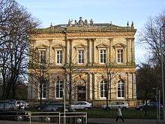 | |
| 25, 25A Mansionhouse Road | 15 December 1970 | NS5759161495 | 55°49′32″N 4°16′30″W | 32373 | 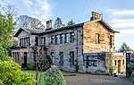 | ||
| 2, 2A-38 (Even Nos) Millbrae Crescent | 15 December 1970 | NS5752161115 | 55°49′20″N 4°16′33″W | 32384 | 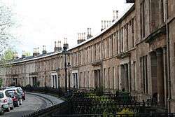 | ||
| 1-10 (Inclusive Nos) Moray Place Including 81 Nithsdale Road | 6 July 1966 | NS5771962789 | 55°50′14″N 4°16′25″W | 32386 |  | ||
| Camphill House | 799 Pollokshaws Road | 15 December 1970 | NS5759762225 | 55°49′56″N 4°16′31″W | 32401 | 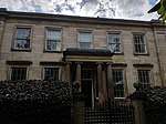 | |
| 265-289 (Odd Nos) Allison Street 19, 21, 23 Garturk Street and 34 Daisy Street | 15 December 1970 | NS5863262593 | 55°50′09″N 4°15′32″W | 32423 |  | ||
| Former Crosshill Queen's Park Church | 40 Queen's Drive | 15 December 1970 | NS5846562186 | 55°49′56″N 4°15′41″W | 32451 | 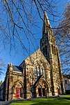 | |
| Kelvinside Academy | 20 Bellshaugh Road | 6 July 1966 | NS5655667906 | 55°52′58″N 4°17′41″W | 32476 | | |
| 15 Cleveden Gardens | 15 December 1970 | NS5625768120 | 55°53′05″N 4°17′59″W | 32486 | | ||
| 3-10 (Inclusive Nos) Crown Circus and 1, 1A and 2 Crown Terrace and 15 and 17 Crown Road North | 15 December 1970 | NS5616067157 | 55°52′34″N 4°18′03″W | 32489 | 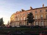 | ||
| Kibble Palace | Botanic Gardens, 730 Great Western Road | 15 December 1970 | NS5693867446 | 55°52′44″N 4°17′18″W | 32513 |  | |
| 1-11 (Inclusive Nos) Great Western Terrace, 2-34 (Even Nos) Great Western Terrace Lane, 1 and 1B Westbourne Gardens and 19 Westbourne Gardens | Great Western Road | 15 December 1970 | NS5621067704 | 55°52′51″N 4°18′01″W | 32517 |  | |
| 1-17 (Inclusive Nos) Grosvenor Terrace | Great Western Road | 6 July 1966 | NS5670967376 | 55°52′41″N 4°17′31″W | 32520 |  | |
| 21-39 (Odd Nos) Hyndland Road | 6 July 1966 | NS5599367796 | 55°52′54″N 4°18′13″W | 32530 | | ||
| Hyndland Parish Church, Church of Scotland | 79 Hyndland Road | 15 December 1970 | NS5588167507 | 55°52′45″N 4°18′19″W | 32532 | | |
| 3 Kirklee Road and 1 Redlands Road | 15 December 1970 | NS5639767727 | 55°52′52″N 4°17′50″W | 32550 | | ||
| 7-23 (Odd Nos) Kirklee Road and 2 Redlands Road | 15 December 1970 | NS5644067786 | 55°52′54″N 4°17′48″W | 32551 | | ||
| 1-14 (Inclusive Nos) Kirklee Terrace, and 1-14 Kirklee Terrace Lane (Inclusive Numbers) | Great Western Road | 6 July 1966 | NS5657567630 | 55°52′49″N 4°17′40″W | 32553 | | |
| 9 Lowther Terrace | Great Western Road | 15 December 1970 | NS5630067744 | 55°52′53″N 4°17′56″W | 32563 | .jpg) | |
| 10 Lowther Terrace | Great Western Road | 15 December 1970 | NS5628867750 | 55°52′53″N 4°17′56″W | 32564 | | |
| Notre Dame High School | 160 Observatory Road | 28 July 1987 | NS5626667407 | 55°52′42″N 4°17′57″W | Damaged by fire, 2010 | 32571 | .jpg) |
| 1 Princes Terrace | Prince Albert Road | 15 December 1970 | NS5616267256 | 55°52′37″N 4°18′03″W | 32576 | 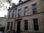 | |
| Kelvinside Hillhead Parish Church, Glasgow | 23 Saltoun Street | 15 December 1970 | NS5662967303 | 55°52′39″N 4°17′36″W | Church of Scotland. Formerly Belmont and Hillhead Parish Church | 32584 | 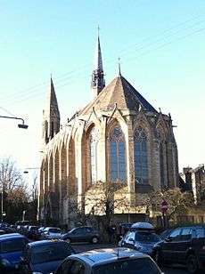 |
| Belhaven-Westbourne Church and Hall, Church of Scotland | 52 Westbourne Gardens | 15 December 1970 | NS5602167768 | 55°52′53″N 4°18′12″W | 32605 | .jpg) | |
| 145-195 (Odd Nos) Albion Street | 3 September 1974 | NS5965565265 | 55°51′36″N 4°14′38″W | 32607 | _Albion_Street%2C_Glasgow%2C_2018-06-28_angle.jpg) | ||
| Buck's Head Buildings | 63 Argyle Street | 15 December 1970 | NS5918565002 | 55°51′27″N 4°15′05″W | 32608 | .jpg) | |
| Argyle Street, Argyll Arcade (Through 98-102 Argyle Street) 3-66 (Inclusive Nos, Leading to Buchanan Street) | Argyle Street | 15 December 1970 | NS5906065089 | 55°51′30″N 4°15′12″W | 32613 |  | |
| David Sloan's Arcade Cafe | 62 Argyll Arcade/108 Argyle Street, Morrison Court | 15 December 1970 | NS5903665113 | 55°51′31″N 4°15′13″W | 32614 |  | |
| Martyrs' Public School | 15 December 1970 | NS6008165839 | 55°51′55″N 4°14′15″W | 17 Parson Street | 32619 | .jpg) | |
| 60-62 (Even Nos) Buchanan Street | Buchanan Street | 15 December 1970 | NS5901965226 | 55°51′34″N 4°15′15″W | 32635 |  | |
| 92-100 (Even Nos) Buchanan Street, known as 98 Buchanan Street | Buchanan Street | 15 December 1970 | NS5903365310 | 55°51′37″N 4°15′14″W | 32639 |  | |
| Brittania Buildings | 164A-168 (Even Nos) Buchanan Street with 10 Dundas Lane | 15 December 1970 | NS5909765542 | 55°51′45″N 4°15′11″W | 32643 | .jpg) | |
| Glasgow City Halls | Candleriggs, Merchant City | 15 December 1970 | NS5957165145 | 55°51′32″N 4°14′43″W | 32647 |  | |
| Provand's Lordship | 3 Castle Street | 6 July 1966 | NS6009665506 | 55°51′45″N 4°14′13″W | 32648 | 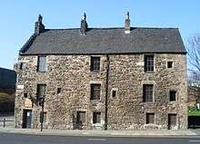 | |
| Bridge of Sighs and Superintendent's House | Cathedral Square | 15 December 1970 | NS6018265506 | 55°51′45″N 4°14′08″W | Includes gates and gatepiers | 32651 | 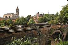 |
| Glasgow Evangelical Church; (Former Barony North Church), and Church House | 20 Cathedral Square, 14 Cathedral Square | 15 December 1970 | NS6021265399 | 55°51′41″N 4°14′06″W | 32652 |  | |
| Glasgow Cathedral and Cathedral Graveyard | 70 Cathedral Square | 15 December 1970 | NS6025565657 | 55°51′50″N 4°14′04″W | 32654 |  | |
| Statue of William III | Cathedral Square | 6 July 1966 | NS6013565441 | 55°51′42″N 4°14′11″W | 32660 | _statue_-_geograph.org.uk_-_940023.jpg) | |
| Former Our Lady and St Francis Secondary School | 72 Charlotte Street | 4 September 1989 | NS5979364539 | 55°51′13″N 4°14′29″W | 32662 | .jpg) | |
| 52 Charlotte Street | 15 December 1970 | NS5983264628 | 55°51′16″N 4°14′27″W | 32663 | 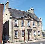 | ||
| Old Fish Market known as the Briggait | 72 Clyde Street and 135 Bridgegate | 15 October 1970 | NS5928264640 | 55°51′16″N 4°14′58″W | 32664 |  | |
| Merchants Steeple, now enclosed within The Briggait | 72 Clyde Street, Bridgegate | 6 July 1966 | NS5930564671 | 55°51′17″N 4°14′57″W | 32665 |  | |
| St Andrew's Roman Catholic Cathedral | 168 Clyde Street and Fox Lane | 15 December 1970 | NS5908064792 | 55°51′20″N 4°15′10″W | 32666 |  | |
| Albert Bridge | Clyde Street | 22 March 1977 | NS5941264443 | 55°51′09″N 4°14′50″W | 32667 |  | |
| South Portland Street Suspension Bridge | Clyde Street and South Portland Street | 6 July 1966 | NS5890764722 | 55°51′18″N 4°15′20″W | 32668 | 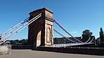 | |
| Victoria Bridge | Clyde Street | 15 December 1970 | NS5917364578 | 55°51′14″N 4°15′04″W | 32669 |  | |
| Formerly the John Street Church | 29 Cochrane Street and 18 John Street | 15 December 1970 | NS5943665275 | 55°51′36″N 4°14′51″W | 32672 |  | |
| Extension to the City Chambers | 20-40 (Even Nos) Cochrane Street, 20 John Street and 233-235 (Odd Nos) George Street | 15 December 1970 | NS5943465380 | 55°51′40″N 4°14′51″W | 32675 |  | |
| Former General Post Office | George Square | 15 December 1970 | NS5928265311 | 55°51′37″N 4°15′00″W | 32685 |  | |
| 24 George Square and 12-16 (Even Nos) Anchor Lane | George Square | 15 December 1970 | NS5916465420 | 55°51′41″N 4°15′07″W | 32688 |  | |
| The Merchants' House | 30 George Square and 7 West George Street | 15 December 1970 | NS5916965440 | 55°51′41″N 4°15′06″W | 32689 | .jpg) | |
| Glasgow City Chambers | 80 George Square | 15 December 1970 | NS5936065375 | 55°51′40″N 4°14′55″W | 32691 | 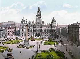 | |
| Walter Scott Memorial Column | George Square | 6 July 1966 | NS5926665396 | 55°51′40″N 4°15′01″W | 32696 | 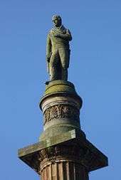 | |
| James Watt Statue | George Square | 6 July 1966 | NS5920065384 | 55°51′40″N 4°15′04″W | 32697 |  | |
| Sir John Moore Statue | George Square | 6 July 1966 | NS5931565357 | 55°51′39″N 4°14′58″W | 32698 |  | |
| Prince Albert Statue | George Square | 15 December 1970 | NS5920065384 | 55°51′40″N 4°15′04″W | 32701 | .jpg) | |
| Queen Victoria Statue | George Square | 15 December 1970 | NS5921465439 | 55°51′41″N 4°15′04″W | 32702 | 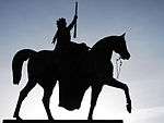 | |
| 266 George Street | 9 March 1989 | NS5940565443 | 55°51′42″N 4°14′53″W | 32709 | 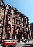 | ||
| The Trades Hall of Glasgow | 85 Glassford Street | 6 July 1966 | NS5932965183 | 55°51′33″N 4°14′57″W | 32713 |  | |
| Tolbooth Steeple | Glasgow Cross | 6 July 1966 | NS5965964900 | 55°51′24″N 4°14′37″W | 32717 |  | |
| 177 Ingram Street with 99 Glassford Street | 15 December 1970 | NS5933365224 | 55°51′35″N 4°14′56″W | 32734 |  | ||
| Lanarkshire House, Corinthian (Former Sheriff Court and Justice of Peace Court) | 191 Ingram Street | 15 December 1970 | NS5928965217 | 55°51′34″N 4°14′59″W | 32735 |  | |
| Ramshorn Theatre | 98 Ingram Street | 15 December 1970 | NS5958565228 | 55°51′35″N 4°14′42″W | Formerly St Paul's and St David's Church, Church of Scotland | 32740 |  |
| Hutchesons' Hall | 158 Ingram Street, and 2 John Street | 6 November 1966 | NS5942265249 | 55°51′36″N 4°14′51″W | 32744 | 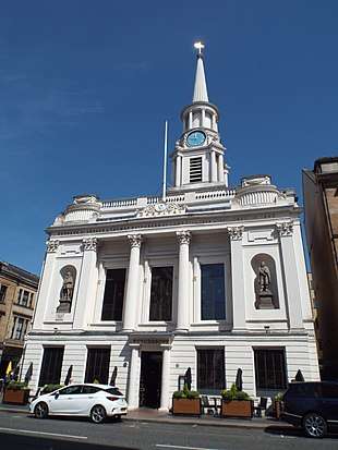 | |
| 16 McPhater Street, and return elevation to Dunblane Street (Ozalid's) | 15 December 1970 | NS5897666080 | 55°52′02″N 4°15′19″W | 32754 | 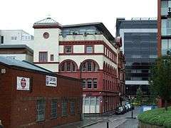 | ||
| 61-63 (Odd Nos) Miller Street | 15 December 1970 | NS5919065177 | 55°51′33″N 4°15′05″W | 32758 | | ||
| Arthur's Warehouse | 77-81 (Odd Nos) Miller Street | 6 November 1966 | NS5920065207 | 55°51′34″N 4°15′04″W | 32759 | | |
| 42 Miller Street | 15 December 1970 | NS5921265125 | 55°51′31″N 4°15′03″W | 32760 |  | ||
| Formerly Stirling's Library | 48-54 (Even Nos) Miller Street | 15 December 1970 | NS5921565142 | 55°51′32″N 4°15′03″W | 32761 | | |
| Tron Steeple | 71 Trongate | 6 July 1966 | NS5954264916 | 55°51′25″N 4°14′44″W | 32769 |  | |
| Britannia Music Hall | 109-121 (Odd Nos) Trongate and 9 New Wynd | 22 March 1977 | NS5945264917 | 55°51′25″N 4°14′49″W | 32774 |  | |
| 60-90 (Even Nos) Trongate and 19-29 (Odd Nos) Albion Street | 15 December 1970 | NS5952964955 | 55°51′26″N 4°14′45″W | 32782 |  | ||
| 190 Trongate and 2-4 (Even Nos) Glassford Street | 15 December 1970 | NS5932664999 | 55°51′27″N 4°14′56″W | 32789 | 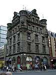 | ||
| St Andrew's-by-the-Green | 33 Turnbull Street | 6 July 1966 | NS5961964601 | 55°51′15″N 4°14′39″W | 32790 | 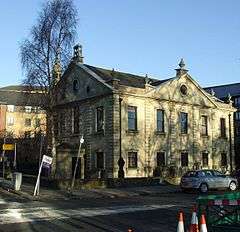 | |
| 37-47 (Odd Nos) Virginia Street | 15 December 1970 | NS5925965135 | 55°51′32″N 4°15′01″W | 32795 | _Virginia_Street%2C_Glasgow%2C_2018-06-27.jpg) | ||
| 49-53 (Odd Nos) Virginia Street | 15 December 1970 | NS5926165150 | 55°51′32″N 4°15′00″W | 32796 | | ||
| 42 Virginia Street | 15 December 1970 | NS5928465101 | 55°51′31″N 4°14′59″W | 32798 |  | ||
| Tron Theatre | 38 Parnie Street | 15 December 1970 | NS5952664880 | 55°51′24″N 4°14′45″W | Former Tron Kirk | 32812 | 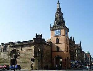 |
| Gallery of Modern Art | 111 Queen Street and 46-58 (Even Nos) Royal Exchange Square | 6 July 1966 | NS5912565288 | 55°51′36″N 4°15′09″W | Former Stirling's Library, Former Cunninghame Mansion and Former Royal Exchange | 32818 |  |
| St George's Buildings | 151-157 (Odd Nos) Queen Street | 6 July 1966 | NS5914265344 | 55°51′38″N 4°15′08″W | 32819 | _Queen_Street%2C_Glasgow%2C_2018-06-27.jpg) | |
| Queen Street station | Cathedral Street | 15 December 1970 | NS5920765545 | 55°51′45″N 4°15′04″W | 32822 | .jpg) | |
| Duke of Wellington Statue | Queen Street | 15 December 1970 | NS5914665283 | 55°51′36″N 4°15′07″W | 32823 |  | |
| Barony Hall, University of Strathclyde | Cathedral Square | 6 July 1966 | NS6008665451 | 55°51′43″N 4°14′14″W | Former Barony Church and Church Hall. Listing includes War Memorial, retaining wall, railings and gatepiers | 32824 | 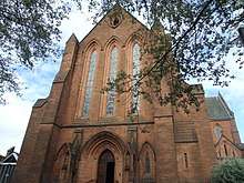 |
| 1-29 (Odd Nos) and 2-40 (Even Nos) Royal Exchange Square with 145-147 (Odd Nos) Queen Street and Archways | 15 December 1970 | NS5913965323 | 55°51′38″N 4°15′08″W | 32826 |  | ||
| Royal Bank of Scotland | Royal Exchange Square | 6 July 1966 | NS5905365305 | 55°51′37″N 4°15′13″W | 32827 |  | |
| Blochairn Parish Church (Church of Scotland) | 178 Royston Hill, Townhead | 3 September 1974 | NS6072166112 | 55°52′05″N 4°13′38″W | 32828 |  | |
| St Andrew's in the Square | St Andrews Square | 6 July 1966 | NS5970264677 | 55°51′17″N 4°14′34″W | 32830 | 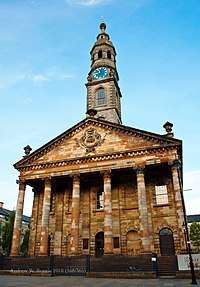 | |
| St Enoch Square Travel Centre | St Enoch Square | 15 December 1970 | NS5893765003 | 55°51′27″N 4°15′19″W | Formerly St Enoch Underground Station | 32833 | 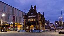 |
| Scottish Provident Institution | 17-29 (Odd Nos) St Vincent Place | 15 December 1970 | NS5910365359 | 55°51′39″N 4°15′10″W | 32836 |  | |
| 2 St Vincent Place and 2 and 4 Anchor Lane | 6 July 1966 | NS5915865407 | 55°51′40″N 4°15′07″W | 32838 |  | ||
| Anchor Building | 12-16 (Even Nos) St Vincent Place | 15 December 1970 | NS5913365415 | 55°51′41″N 4°15′08″W | 32839 |  | |
| Citizen Building | 24 St Vincent Place | 15 December 1970 | NS5911065420 | 55°51′41″N 4°15′10″W | 32840 |  | |
| 30 St Vincent Place | 15 December 1970 | NS5908065432 | 55°51′41″N 4°15′11″W | 32841 |  | ||
| Justiciary Courts | 212 Saltmarket | 15 December 1970 | NS5943664559 | 55°51′13″N 4°14′49″W | 32844 |  | |
| 1-16 (inclusive Nos) Buckingham Terrace, 2, 4 Buckingham Street, 1, 3 Ruskin Place | Great Western Road | 15 December 1970 | NS5702967267 | 55°52′38″N 4°17′13″W | 32850 | .jpg) | |
| Lilybank House | University of Glasgow, Gilmorehill Campus | 15 December 1970 | NS5679666912 | 55°52′26″N 4°17′25″W | 32853 | 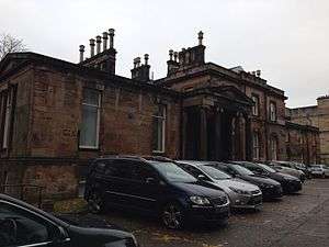 | |
| 35-51 (Odd Nos) Hamilton Drive, (1-9 Inclusive Nos) Northpark Terrace | Kelvinside | 15 December 1970 | NS5709767277 | 55°52′39″N 4°17′09″W | 32874 | | |
| Cottier Theatre Complex | 93-95 (Odd Nos) Hyndland Street | 15 December 1970 | NS5607866959 | 55°52′27″N 4°18′07″W | Former Dowanhill Church and Halls | 32879 | 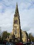 |
| Woodbank | 56 Partickhill Road | 15 December 1970 | NS5566267007 | 55°52′28″N 4°18′31″W | 32895 | | |
| 1-9 (Inclusive Nos) Ruskin Terrace, 1, 1A, 3 Hamilton Park Avenue | 15 December 1970 | NS5723167155 | 55°52′35″N 4°17′01″W | 32903 | .jpg) | ||
| Wellington Church | 76 University Avenue | 6 July 1966 | NS5700466748 | 55°52′21″N 4°17′13″W | 32912 |  | |
| Gilbert Scott Building and Memorial Chapel (with the Lion and Unicorn Staircase) | University of Glasgow, Gilmorehill Campus | 15 December 1970 | NS5687866664 | 55°52′19″N 4°17′20″W | 32913 | 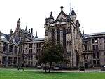 | |
| Joseph Black Building | University of Glasgow, Gilmorehill Campus | 15 January 1985 | NS5661466700 | 55°52′19″N 4°17′36″W | 32918 |  | |
| Pearce Lodge | University of Glasgow, Gilmorehill Campus | 15 December 1970 | NS5707066668 | 55°52′19″N 4°17′09″W | 32925 |  | |
| McMillan Reading Room | University of Glasgow, Gilmorehill Campus | 15 January 1985 | NS5693966755 | 55°52′22″N 4°17′17″W | 32927 |  | |
| Graham Kerr Building | University of Glasgow, Gilmorehill Campus | 15 December 1970 | NS5662566631 | 55°52′17″N 4°17′35″W | 32928 |  | |
| 2-10 (inclusive) University Gardens | University of Glasgow, Gilmorehill Campus | 15 December 1970 | NS5680766794 | 55°52′23″N 4°17′25″W | 32931 | 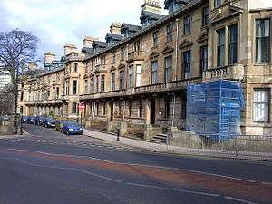 | |
| Salmon House (12 University Gardens) | University of Glasgow, Gilmorehill Campus | 15 December 1970 | NS5677966820 | 55°52′23″N 4°17′26″W | 32932 |  | |
| 14 University Gardens | University of Glasgow, Gilmorehill Campus | 15 December 1970 | NS5677366830 | 55°52′24″N 4°17′27″W | 32933 |  | |
| The Salon | 17 Vinicombe Street | 22 March 1977 | NS5679167237 | 55°52′37″N 4°17′26″W | 32934 |  | |
| Former Botanic Gardens Garage | 24 Vinicombe Street | 6 February 1989 | NS5683867267 | 55°52′38″N 4°17′24″W | 32935 |  | |
| Savings Bank of Glasgow | 752-756 (Even Nos) Argyle Street and 3, 5, 7 Shaftesbury Street | 15 December 1970 | NS5776665519 | 55°51′42″N 4°16′27″W | 32953 | .jpg) | |
| 181-199 (Odd Nos) Bath Street and Blythswood Street | 15 December 1970 | NS5847165788 | 55°51′52″N 4°15′47″W | Includes the Glasgow Art Club | 32960 | | |
| King's Theatre | 335 Bath Street and Elmbank Street | 15 December 1970 | NS5811965874 | 55°51′54″N 4°16′07″W | 32963 |  | |
| Mercantile Chambers | 39-69 (Odd Nos) Bothwell Street | 15 December 1970 | NS5858165401 | 55°51′40″N 4°15′40″W | 32980 | .jpg) | |
| 2-28 (Even Nos) Bothwell Street, 123 Hope Street | 24 July 1973 | NS5871365426 | 55°51′40″N 4°15′32″W | 32983 | | ||
| 21-31 (Odd Nos) (Known As 21) Buchanan Street and 8-28 (Even Nos) Mitchell Street | 15 December 1970 | NS5891865134 | 55°51′31″N 4°15′20″W | 32991 |  | ||
| Former Wylie and Lochead's | 45 Buchanan Street and 34-50 (Even Nos) Mitchell Street | 23 March 1977 | NS5893165178 | 55°51′33″N 4°15′19″W | 32992 |  | |
| 91 Buchanan Street | 15 December 1970 | NS5897765269 | 55°51′36″N 4°15′17″W | 32998 | .jpg) | ||
| 113-115 (Odd Nos) Buchanan Street and 4 Gordon Street | 15 December 1970 | NS5899965335 | 55°51′38″N 4°15′16″W | 33000 | _BUCHANAN_STREET_AND_4_GORDON_STREET.jpg) | ||
| Former Western Club | 147 Buchanan Street and St Vincent Street | 15 December 1970 | NS5901865433 | 55°51′41″N 4°15′15″W | 33002 |  | |
| St George's Tron Parish Church | 163 Buchanan Street | 6 July 1966 | NS5903265500 | 55°51′43″N 4°15′14″W | Church of Scotland | 33003 |  |
| Former Athenaeum Theatre | 179 Buchanan Street | 6 July 1966 | NS5903765562 | 55°51′45″N 4°15′14″W | 33004 |  | |
| No 4 Clairmont Gardens | 15 December 1970 | NS5759266077 | 55°52′00″N 4°16′38″W | 33008 | | ||
| Former Custom House | 298-306 (Even Nos) Clyde Street | 15 December 1970 | NS5884764881 | 55°51′23″N 4°15′24″W | Now Office of Procurator Fiscal | 33012 |  |
| 49 Derby Street, 22, 30 Bentinck Street | 6 July 1966 | NS5711766068 | 55°52′00″N 4°17′05″W | 33015 |  | ||
| 17-21 (Odd Nos) Drury Street | Including "The Horse Shoe Bar" | 21 July 1988 | NS5887365371 | 55°51′39″N 4°15′23″W | 33016 | | |
| 120, Elmbank Street with 71-83 (Odd Nos) Holland Street and Lodges, 59, 61 Holland Street | 15 December 1970 | NS5817865784 | 55°51′51″N 4°16′04″W | 33022 | | ||
| Central Station & Hotel | Gordon Street | 15 December 1970 | NS5872765252 | 55°51′35″N 4°15′31″W | 33029 |  | |
| 6 Gordon Street, Part of Former Commercial Bank | 6 July 1966 | NS5895965350 | 55°51′38″N 4°15′18″W | 33030 | | ||
| 20-40 (Even Nos) Gordon Street and 1, 3 West Nile Street | 15 December 1970 | NS5889765358 | 55°51′38″N 4°15′22″W | 33031 | | ||
| Grosvenor Building | 72-80 (Even Nos) Gordon Street | 15 December 1970 | NS5879365372 | 55°51′39″N 4°15′28″W | 33034 |  | |
| Mitchell Theatre | Granville Street, Berkeley Street and Kent Road | 6 July 1966 | NS5782365843 | 55°51′53″N 4°16′24″W | Formerly St Andrew's Halls | 33036 | |
| Breadalbane Terrace | 97-113B (Odd Nos) Hill Street | 15 December 1970 | NS5832466078 | 55°52′01″N 4°15′56″W | 33038 | | |
| Hill Street Synagogue | 129 Hill Street and 29 Garnet Street | 27 November 1979 | NS5819166096 | 55°52′02″N 4°16′04″W | 33040 |  | |
| Peel Terrace | 102-112 (Even Nos) Hill Street, and 37, 39 Garnethill Street | 11 May 1981 | NS5831066135 | 55°52′03″N 4°15′57″W | 33044 |  | |
| Atlantic Chambers | 43, 45, 47 Hope Street and 1A Cadogan Street | 15 December 1970 | NS5867665241 | 55°51′34″N 4°15′34″W | 33050 |  | |
| Grand Central Hotel | 91-115 (Odd Nos) Hope Street, 2-14 (Even Nos) Waterloo Street and 1-13 (Odd Nos) Bothwell Street | 15 December 1970 | NS5868565349 | 55°51′38″N 4°15′34″W | 33052 |  | |
| 157-167 (Odd Nos) Hope Street and 169-175 (Odd Nos) West George Street | 6 July 1966 | NS5874765544 | 55°51′44″N 4°15′31″W | 33053 |  | ||
| 106, 108, 110 Hope Street (Known As 108) | 15 December 1979 | NS5876165413 | 55°51′40″N 4°15′30″W | 33056 |  | ||
| Lion Chambers | 170, 172 Hope Street | 6 July 1966 | NS5882665673 | 55°51′49″N 4°15′26″W | 33059 |  | |
| Theatre Royal | 282 Hope Street, Cowcaddens | 22 March 1977 | NS5890565980 | 55°51′59″N 4°15′22″W | 33061 |  | |
| Gardner's | 36 Jamaica Street and 10 Midland Street | 6 July 1966 | NS5879865017 | 55°51′27″N 4°15′27″W | 33065 |  | |
| Atlantic Apartments | 69 James Watt Street | 15 December 1970 | NS5838365127 | 55°51′30″N 4°15′51″W | 33068 | | |
| 60 James Watt Street | 15 December 1970 | NS5840165104 | 55°51′30″N 4°15′50″W | 33069 |  | ||
| 72 James Watt Street | 15 December 1970 | NS5840165104 | 55°51′30″N 4°15′50″W | 33070 | | ||
| Kelvingrove Art Gallery and Museum | Kelvingrove Park | 15 December 1970 | NS5676266309 | 55°52′07″N 4°17′26″W | 33071 | 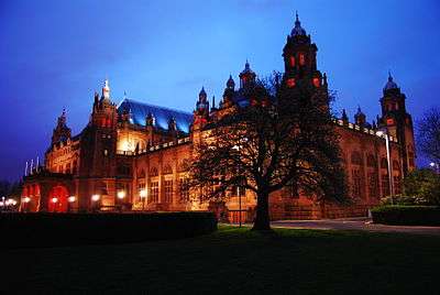 | |
| Hindu Mandir | 1 La Belle Place | 6 July 1966 | NS5746766059 | 55°52′00″N 4°16′45″W | Former Queen's Rooms | 33082 | |
| 2-5 (inclusive Nos) La Belle Place | 15 December 1970 | NS5743366058 | 55°52′00″N 4°16′47″W | 33083 | | ||
| Former Glasgow Herald Building | 60-76 (Even Nos) Mitchell Street | 15 December 1970 | NS5892465238 | 55°51′35″N 4°15′20″W | 33087 |  | |
| Glasgow Stock Exchange | 63-77 (Odd Nos) Nelson Mandela Place, West George Street with 153-159 (Odd Nos) Buchanan Street | 15 December 1970 | NS5902465464 | 55°51′42″N 4°15′15″W | 33089 |  | |
| Former Daily Record Building | 20, 26, 28 Renfield Lane and St Vincent Lane | 15 December 1970 | NS5878865410 | 55°51′40″N 4°15′28″W | 33099 |  | |
| Pavilion Theatre | 121-125 Renfield Street | 22 March 1977 | NS5893065844 | 55°51′54″N 4°15′21″W | 33103 |  | |
| Glasgow School of Art | 167 Renfrew Street and 11, 15 Dalhousie Street | 6 July 1966 | NS5843565969 | 55°51′58″N 4°15′49″W | 33105 | 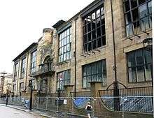 | |
| 71-75 (Odd Nos) Robertson Street and 58, 60 Robertson Lane | 15 December 1970 | NS5854265096 | 55°51′30″N 4°15′42″W | 33112 | | ||
| Clyde Navigation Trust | 16 Robertson Street | 6 July 1966 | NS5858664962 | 55°51′25″N 4°15′39″W | 33113 |  | |
| St Aloysius' Church (Roman Catholic) | 23, 25 Rose Street | 15 December 1970 | NS5855966016 | 55°51′59″N 4°15′42″W | 33115 |  | |
| Charing Cross Mansions | 2-30 (Even Nos) St George's Road, 540-546 (Even Nos) Sauchiehall Street and 357,359 Renfrew Street | 15 December 1970 | NS5801766047 | 55°52′00″N 4°16′14″W | 33127 |  | |
| 19-30 (Excluding Nos 23, 23A, 23B, 26A) St Vincent Crescent and 21 Corunna Street | 15 December 1970 | NS5720465704 | 55°51′48″N 4°17′00″W | 33128 |  | ||
| 31-70 (Excluding Nos 35A,36A,37A,39A) St Vincent Crescent and 30 Corunna Street | 15 December 1970 | NS5685865806 | 55°51′51″N 4°17′20″W | 33129 |  | ||
| 115, 117, St Vincent Street | 15 December 1970 | NS5878765434 | 55°51′41″N 4°15′28″W | 33138 |  | ||
| St Vincent Street Church | 261 St Vincent Street | 6 July 1966 | NS5831365551 | 55°51′44″N 4°15′56″W | Former United Free Church of Scotland, now Free Church | 33150 |  |
| 84-94 (Even Nos) St Vincent Street | 15 December 1970 | NS5890765456 | 55°51′42″N 4°15′21″W | 33153 | | ||
| Bank of Scotland | 110, 120 St Vincent Street and 29-37 (Odd Nos) Renfield Street and West George Lane | 15 December 1970 | NS5883665490 | 55°51′43″N 4°15′26″W | 33156 |  | |
| Royal Bank Building | 140, 142 St Vincent Street and 153, 155 Hope Street | 21 July 1988 | NS5874765494 | 55°51′43″N 4°15′31″W | 33159 |  | |
| 142A, 144 St Vincent Street | 6 July 1966 | NS5873765497 | 55°51′43″N 4°15′31″W | 33160 |  | ||
| 200 St Vincent Street | 6 July 1966 | NS5859665543 | 55°51′44″N 4°15′39″W | 33162 |  | ||
| Willow Tearooms | 217 Sauchiehall Street | 15 December 1970 | NS5859465838 | 55°51′54″N 4°15′40″W | 33173 |  | |
| 901, 903 Sauchiehall Street | 15 December 1970 | NS5712865932 | 55°51′55″N 4°17′05″W | 33184 | | ||
| 336-356 (Even Nos) Sauchiehall Street and 1 Scott Street | 15 December 1970 | NS5835265943 | 55°51′57″N 4°15′54″W | 33193 |  | ||
| Albany Chambers | 528-538 (Even Nos) Sauchiehall Street | 15 December 1970 | NS5804066017 | 55°51′59″N 4°16′12″W | 33199 |  | |
| The Egyptian Halls | 84-100 Union Street | 6 July 1966 | NS5886165263 | 55°51′35″N 4°15′24″W | 33208 |  | |
| Ca d’Oro Building | 122-136 (Even Nos) Union Street and 41-55 (Odd Nos) Gordon Street and Union Place | 15 December 1970 | NS5886465320 | 55°51′37″N 4°15′24″W | 33209 |  | |
| Former Waterloo Street Post Office, Parcels Office | 50 Waterloo Street with 81 Wellington Street | 15 December 1970 | NS5858365364 | 55°51′38″N 4°15′40″W | 33214 | | |
| Former Sun Life Building | 117, 121 West George Street and 38-42 (Even Nos) Renfield Street | 15 December 1970 | NS5889365510 | 55°51′43″N 4°15′22″W | 33223 | | |
| 4 Nelson Mandela Place | 15 December 1970 | NS5904965538 | 55°51′44″N 4°15′13″W | 33233 |  | ||
| Former Athenaeum | 8 Nelson Mandela Place | 6 July 1966 | NS5902465544 | 55°51′45″N 4°15′15″W | 33234 |  | |
| Royal Faculty of Procurators | 68 West George Street, 12 Nelson Mandela Place | 6 July 1966 | NS5899265526 | 55°51′44″N 4°15′17″W | 33235 | 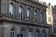 | |
| Cornhill House | 144, 146 West George Street | 15 December 1970 | NS5882965580 | 55°51′46″N 4°15′26″W | 33241 | | |
| 196, 198 West George Street and 118 Wellington Street | 15 December 1970 | NS5870265604 | 55°51′46″N 4°15′33″W | 33246 |  | ||
| Finnieston Crane | Stobcross Quay | 14 April 1989 | NS5710365150 | 55°51′30″N 4°17′04″W | 33285 | 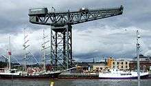 | |
| 140, 142 Balgrayhill Road, including Redclyffe | 22 March 1977 | NS6060768368 | 55°53′18″N 4°13′49″W | 33288 | | ||
| Winter Gardens | Springburn Park | 22 March 1985 | NS6081468448 | 55°53′20″N 4°13′37″W | 33298 |  | |
| Elder Cottage Hospital | 1A Drumoyne Drive and Langlands Road | 15 December 1970 | NS5440865496 | 55°51′38″N 4°19′40″W | 33300 |  | |
| Statue of Mrs John Elder | Elder Park | 15 December 1970 | NS5455265587 | 55°51′41″N 4°19′32″W | 33304 |  | |
| Elder Park Library | 228A Langlands Road and Elder Park Street | 15 December 1970 | NS5477765640 | 55°51′43″N 4°19′19″W | 33310 | | |
| Govan Graving Docks | 18 Clydebrae Street | 15 May 1987 | NS5609065462 | 55°51′39″N 4°18′03″W | 33336 | .jpg) | |
| Former British Linen Bank | 816, 818 Govan Road, 1, 3 Water Row | 15 December 1970 | NS5542865763 | 55°51′48″N 4°18′42″W | 33351 |  | |
| Pearce Institute | 840, 860 Govan Road | 6 July 1966 | NS5536265794 | 55°51′49″N 4°18′46″W | 33352 |  | |
| Govan Old Parish Church | 866, 868 Govan Road | 6 July 1966 | NS5534965916 | 55°51′53″N 4°18′47″W | 33353 | 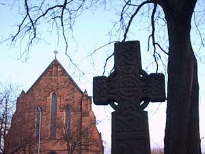 | |
| Govan Shipbuilders Ltd, General Offices | 1030, 1048 Govan Road | 15 December 1970 | NS5468866024 | 55°51′56″N 4°19′25″W | Listing excludes the 1956 extension to the west. | 33356 | |
| Govan Shipbuilders' Store, Former Engine Works of Fairfield Shipbuilding and Engineering Company | 1048 Govan Road | 15 May 1987 | NS5468866024 | 55°51′56″N 4°19′25″W | 33357 | | |
| Former Prince's Dock Hydraulic Power Station | 1 Pacific Quay | 15 December 1970 | NS5690865009 | 55°51′25″N 4°17′15″W | 33360 |  | |
| The Knowe | 301 Albert Drive | 15 December 1970 | NS5751663408 | 55°50′34″N 4°16′37″W | 33371 | | |
| Miller and Lang Building | 50 Darnley Street, Pollokshields | 22 March 1977 | NS5799763409 | 55°50′35″N 4°16′10″W | 33402 | | |
| Pollokshields Burgh Hall | 70 and 72 Glencairn Drive | 15 December 1970 | NS5685562973 | 55°50′19″N 4°17′15″W | 33411 | 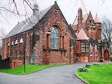 | |
| Ellisland | 200 Nithsdale Road | 15 December 1970 | NS5693863352 | 55°50′32″N 4°17′11″W | 33450 | | |
| Castlehill | 202 Nithsdale Road | 15 December 1970 | NS5689263367 | 55°50′32″N 4°17′13″W | 33451 | | |
| Pollok House | 2060 Pollokshaws Road | 6 July 1966 | NS5490761802 | 55°49′39″N 4°19′04″W | 33455 | 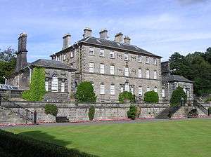 | |
| Bridge over White Cart Water at Pollok House | 2060 Pollokshaws Road | 6 July 1966 | NS5488661731 | 55°49′37″N 4°19′05″W | 33456 | 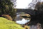 | |
| Stables of Pollok House | 2060 Pollokshaws Road | 6 July 1966 | NS5499461661 | 55°49′35″N 4°18′59″W | 33457 |  | |
| Benefrey | 124 Springkell Avenue | 15 December 1970 | NS5577763054 | 55°50′21″N 4°18′17″W | 33486 | | |
| Former Caledonia Road Church | 1 Caledonia Road | 6 July 1966 | NS5893263851 | 55°50′50″N 4°15′17″W | 33497 |  | |
| 40-61 (Inclusive) Carlton Place and 16 Nicholson Street | 15 December 1970 | NS5891664582 | 55°51′13″N 4°15′19″W | 33499 |  | ||
| Former Eglinton Engine Works | 27-117 (Odd Nos) Cook Street (Westbridge Gardens) and 181 and 183 West Street | 17 June 1986 | NS5830664278 | 55°51′03″N 4°15′54″W | 33504 | | |
| 162-170 (Even Nos) Gorbals Street | 15 December 1970 | NS5896764171 | 55°51′00″N 4°15′16″W | 33513 | 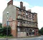 | ||
| Scotland Street School | 225 Scotland Street | 6 July 1966 | NS5775264142 | 55°50′58″N 4°16′25″W | 33534 |  | |
| Craigie Hall | 6 Rowan Road, Dumbreck | 27 April 1978 | NS5554463935 | 55°50′49″N 4°18′32″W | 33583 | .jpg) | |
| Leverndale Hospital, Towerview Unit | 510 Crookston Road | 15 December 1970 | NS5162462691 | 55°50′04″N 4°22′14″W | 33597 |  | |
| Former Springburn College | 110-136 (Even Nos) Flemington Street | 29 January 1990 | NS6056967426 | 55°52′47″N 4°13′50″W | 33612 |  | |
| Tollcross House | 591 Tollcross Road | 15 December 1970 | NS6361963607 | 55°50′47″N 4°10′47″W | 33648 | 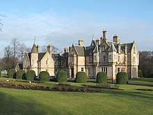 | |
| Daldowie Dovecot | Hamilton Road | 12 January 1971 | NS6677762899 | 55°50′27″N 4°07′45″W | 33668 |  | |
| Southern Necropolis Lodge | 316 Caledonia Road, Rutherglen Road | 15 December 1970 | NS5951163475 | 55°50′38″N 4°14′43″W | The main cemetery is Category B. | 33685 | 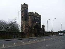 |
| St Francis Church and Presbytery | 405, 407 Cumberland Street | 15 December 1970 | NS5949363749 | 55°50′47″N 4°14′45″W | 33690 |  | |
| St Andrews Suspension Bridge | Adelphi Street/Glasgow Green | 23 March 1992 | NS5995964001 | 55°50′56″N 4°14′18″W | 33692 |  | |
| Sentinel Works | 61 Jessie Street | 13 May 1991 | NS5966662502 | 55°50′07″N 4°14′32″W | 33693 | | |
| Aikenhead House | 325 Carmunnock Road, King's Park | 15 December 1970 | NS5964060268 | 55°48′55″N 4°14′30″W | 33708 |  | |
| Ruchill Hospital, Water Tower | 520 Bilsland Drive | 6 April 1992 | NS5838568292 | 55°53′13″N 4°15′57″W | 33750 | 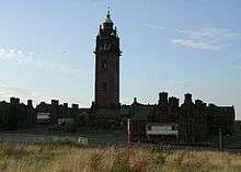 | |
| Kelvin Stevenson Memorial Church | 62 Belmont Street, 93 and 99 Garriochmill Road | 15 December 1970 | NS5753367233 | 55°52′38″N 4°16′44″W | Church of Scotland | 33753 | 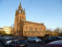 |
| Queens Cross Church and Hall | 870 Garscube Road | 6 July 1966 | NS5797667572 | 55°52′49″N 4°16′19″W | 33764 |  | |
| St Columba of Iona Roman Catholic Church and Presbytery | 74 and 76 Hopehill Road | 6 April 1992 | NS5829567132 | 55°52′35″N 4°16′00″W | 33765 |  | |
| Former St George In The Fields | 485 St George's Road | 6 July 1966 | NS5845866865 | 55°52′27″N 4°15′50″W | 33782 |  | |
| St Mary's Roman Catholic Church | 99 Abercromby Street | 16 March 1993 | NS6070064541 | 55°51′14″N 4°13′37″W | 33810 |  | |
| 105-169 (Odd Nos) Bell Street | 22 March 1977 | NS5976064987 | 55°51′27″N 4°14′31″W | 33814 |  | ||
| Shelter | Bridgeton Cross | 16 March 1993 | NS6070963997 | 55°50′56″N 4°13′35″W | 33818 |  | |
| Alexander's School | 94 Duke Street | 15 December 1970 | NS6018265190 | 55°51′34″N 4°14′08″W | Previously used as an annex by St Mungo's Academy. Currently housing small businesses. | 33827 | .jpg) |
| Doulton Fountain | Glasgow Green | 15 December 1970 | NS6010564314 | 55°51′06″N 4°14′10″W | 33836 |  | |
| Nelson Monument | Glasgow Green | 15 December 1970 | NS5982464302 | 55°51′05″N 4°14′27″W | 33837 |  | |
| People's Palace | Glasgow Green | 15 December 1970 | NS6002964265 | 55°51′04″N 4°14′15″W | 33838 |  | |
| Mercat Building | 15-23 (Odd Nos) London Road and 26 Gallowgate | 15 December 1970 | NS5969064845 | 55°51′23″N 4°14′35″W | 33851 |  | |
| Church of The Sacred Heart | 50-56 (Even Nos) Old Dalmarnock Road | 15 December 1970 | NS6089863678 | 55°50′46″N 4°13′24″W | 33855 | | |
| Templeton Carpet Factory | 62 Templeton Street | 6 July 1966 | NS6032564163 | 55°51′01″N 4°13′58″W | 33857 |  | |
| 17 Watson Street | 15 December 1970 | NS5973264909 | 55°51′25″N 4°14′33″W | 33862 | | ||
| Provan Hall | Auchinlea Park, Easterhouse | 15 December 1970 | NS6675566324 | 55°52′18″N 4°07′52″W | 33863 |  | |
| Gartloch Hospital | Gartloch Road | 14 June 1991 | NS6835967134 | 55°52′46″N 4°06′21″W | 33868 |  | |
| Walmer Crescent | Cessnock | 6 July 1966 | NS5632364465 | 55°51′07″N 4°17′48″W | 33876 | 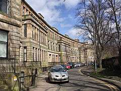 | |
| St Andrew's East Church | 681 Alexandra Parade and 6 Easter Craigs | 15 December 1970 | NS6187565529 | 55°51′47″N 4°12′31″W | 33879 | 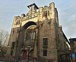 | |
| Cast-iron Fountain | Alexandra Park | 17 June 1992 | NS6190065687 | 55°51′52″N 4°12′30″W | 33880 | 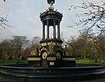 | |
| The Necropolis | Cathedral Square | 15 December 1970 | NS6048265549 | 55°51′46″N 4°13′51″W | 33890 |  | |
| Our Lady of Good Counsel Church | 73 Craigpark | 23 September 1994 | NS6101065499 | 55°51′45″N 4°13′21″W | 33891 | .jpg) | |
| 176 Duke Street, Kirkhaven | 15 December 1970 | NS6052765091 | 55°51′32″N 4°13′48″W | 33899 | | ||
| St Anne's Church and Presbytery | 17-23 (Odd Nos) Whitevale Street | 27 November 1979 | NS6139464936 | 55°51′27″N 4°12′58″W | 33912 | | |
| 52-54 (Even Nos) Langside Drive | 19 March 1991 | NS5731560342 | 55°48′55″N 4°16′43″W | 33936 | | ||
| Former Waverley Cinema | 18 Moss-Side Road | 17 June 1992 | NS5718062130 | 55°49′52″N 4°16′54″W | 33941 |  | |
| Holmwood House | 61, 63 Netherlee Road | 17 June 1967 | NS5850559695 | 55°48′35″N 4°15′34″W | 33944 | 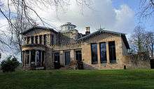 | |
| Pollokshaws Burgh Hall | 2025 Pollokshaws Road | 15 December 1970 | NS5612561514 | 55°49′31″N 4°17′54″W | 33953 | 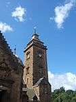 | |
| Anniesland Court | 833-861 (Odd Nos) Crow Road, Anniesland | 2 April 1996 | NS5467368865 | 55°53′27″N 4°19′31″W | 43034 | 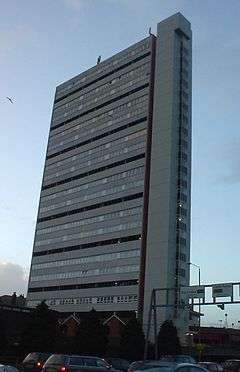 | |
| St Andrew's East Church Hall | 685 Alexandra Parade | 15 December 1970 | NS6189565518 | 55°51′47″N 4°12′30″W | Single storey building | 48569 |  |
| Scottish Ambulance Service station and St Andrew's House, St Andrew's Ambulance Association | 30 Maitland Street and 54 Milton Street | 7 February 2005 | NS5888166138 | 55°52′04″N 4°15′24″W | 50073 | 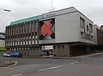 | |
| Burrell Collection | 2060 Pollokshaws Road, Pollok Country Park | 23 January 2013 | NS5548662138 | 55°49′51″N 4°18′27″W | 52002 | 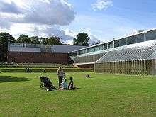 |
Notes
- Sometimes known as OSGB36, the grid reference (where provided) is based on the British national grid reference system used by the Ordnance Survey.
• "Guide to National Grid". Ordnance Survey. Retrieved 12 December 2007.
• "Get-a-map". Ordnance Survey. Retrieved 17 December 2007. - Historic Environment Scotland assign a unique alphanumeric identifier to each designated site in Scotland, for listed buildings this always begins with "LB", for example "LB12345".
References
- Guide to the Protection of Scotland's Listed Buildings (PDF). Historic Scotland. 2009. p. 4. ISBN 978-1-84917-013-0. Retrieved 5 May 2010.
- "What is Listing?". Historic Scotland. Retrieved 5 May 2010.
- Scottish Historic Environment Policy (PDF). Historic Scotland. October 2008. pp. 24–25. ISBN 978-1-84917-002-4. Retrieved 5 May 2010.
- Guide to the Protection of Scotland's Listed Buildings, p. 17.
External links
![]()
- Category A Listed Buildings in Glasgow City at British Listed Buildings